Property Record
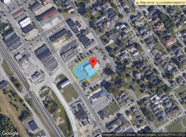
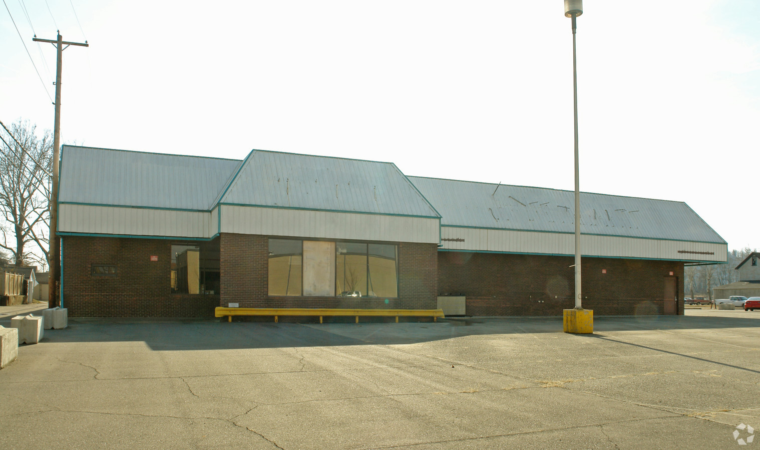
320 Jefferson St, Ironton, OH 45638

NEARBY LISTINGS FOR SALE OR LEASE
Property Detail
320 Jefferson St
Huntington-Ashland, WV-KY-OH
Ironton
34-042-0400-000
806,807,808,809 WHOLE 810,811 PT. 122 ON MADISON & VAC CEDAR ALEY LESS 7808 (WHICH IS PTS OF 810 AND 811) AND 224 SQ FT
Storebuilding
Lawrence
X
Ohio
21089C0216D
806
2023
0.98 AC
2023
Lawrence County
050300
Huntington/Ashland
13,367 SF
DEMOGRAPHICS near 320 Jefferson St
1 Mile
3 Mile
5 Mile
2024 Total Population
5,750
27,086
46,444
2029 Population
5,614
26,393
45,405
Pop Growth 2024-2029
(2.37%)
(2.56%)
(2.24%)
Average Age
42
43
42
2024 Total Households
2,547
11,203
19,290
HH Growth 2024-2029
(2.32%)
(2.48%)
(2.15%)
Median Household Inc
$36,833
$53,970
$50,318
Avg Household Size
2.10
2.30
2.30
2024 Avg HH Vehicles
1.00
2.00
2.00
Median Home Value
$101,526
$118,582
$111,137
Median Year Built
1948
1965
1967
Nearby Places
- Restaurants
- Banks
- Shops
- Fitness
- Groceries
PUBLIC TRANSPORTATION
COMMUTER RAIL
Ashland Amtrak Station (Cardinal - Amtrak)
DRIVE
WALK
Distance
Ashland Amtrak Station (Cardinal - Amtrak)
8 min
5.2 mi
AIRPORT
Tri-State/Milton J Ferguson Field
DRIVE
WALK
Distance
Tri-State/Milton J Ferguson Field
29 min
16.9 mi
Freight Ports
Port of Toledo
DRIVE
WALK
Distance
Port of Toledo
329 min
253.5 mi
Nearby Properties
Address
Land Use
TOTAL SIZE
Lot Size
Zoning
Address
Land Use
TOTAL SIZE
Lot Size
Zoning
Address
Land Use
TOTAL SIZE
Lot Size
Zoning
3,514 SF
21.96 AC
Z02
Address
Land Use
TOTAL SIZE
Lot Size
Zoning
Address
Land Use
TOTAL SIZE
Lot Size
Zoning
11.95 AC
Address
Land Use
TOTAL SIZE
Lot Size
Zoning
12.54 AC
Address
Land Use
TOTAL SIZE
Lot Size
Zoning
15 AC
Address
Land Use
TOTAL SIZE
Lot Size
Zoning
40.94 AC
Address
Land Use
TOTAL SIZE
Lot Size
Zoning
139,148 SF
Address
Land Use
TOTAL SIZE
Lot Size
Zoning
1.63 AC
COMMERCIAL
Address
Land Use
TOTAL SIZE
Lot Size
Zoning
Address
Land Use
TOTAL SIZE
Lot Size
Zoning
3.86 AC
Address
Land Use
TOTAL SIZE
Lot Size
Zoning
1,424 SF
6.46 AC
Address
Land Use
TOTAL SIZE
Lot Size
Zoning
35,014 SF
3.81 AC
Address
Land Use
TOTAL SIZE
Lot Size
Zoning
30,250 SF
8.29 AC
Address
Land Use
TOTAL SIZE
Lot Size
Zoning
75,820 SF
1.71 AC
Address
Land Use
TOTAL SIZE
Lot Size
Zoning
1,440 SF
1.38 AC
Address
Land Use
TOTAL SIZE
Lot Size
Zoning
19.91 AC
Address
Land Use
TOTAL SIZE
Lot Size
Zoning
47,557 SF
1.69 AC
Address
Land Use
TOTAL SIZE
Lot Size
Zoning
9.43 AC
Address
Land Use
TOTAL SIZE
Lot Size
Zoning
Address
Land Use
TOTAL SIZE
Lot Size
Zoning
Address
Land Use
TOTAL SIZE
Lot Size
Zoning
5,472 SF
4.94 AC
Address
Land Use
TOTAL SIZE
Lot Size
Zoning
Address
Land Use
TOTAL SIZE
Lot Size
Zoning
9.49 AC
Address
Land Use
TOTAL SIZE
Lot Size
Zoning
135,431 SF
9.19 AC
Address
Land Use
TOTAL SIZE
Lot Size
Zoning
97,299 SF
8.82 AC
Address
Land Use
TOTAL SIZE
Lot Size
Zoning
110 AC
OTHER
Address
Land Use
TOTAL SIZE
Lot Size
Zoning
9,564 SF
1.65 AC
Address
Land Use
TOTAL SIZE
Lot Size
Zoning
47,253 SF
5 AC
Address
Land Use
TOTAL SIZE
Lot Size
Zoning
5,280 SF
0.72 AC
The World's #1 Commercial Real Estate Marketplace
Connect with us
© 2025 CoStar Group
The information above has been obtained from sources believed reliable. While we do not doubt its accuracy we have not verified it and make no guarantee, warranty or representation about it. It is your responsibility to independently confirm its accuracy and completeness. Any projections, opinions, assumptions, or estimates used are for example only and do not represent the current or future performance of the property. The value of this transaction to you depends on tax and other factors which should be evaluated by your tax, financial, and legal advisors. You and your advisors should conduct a careful, independent investigation of the property to determine to your satisfaction the suitability of the property for your needs.