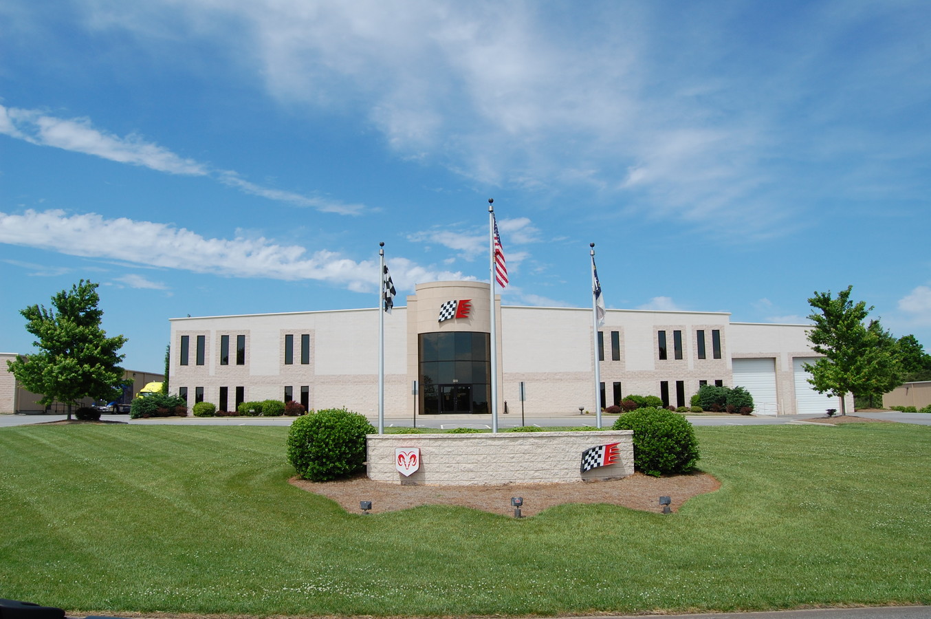
Property Record
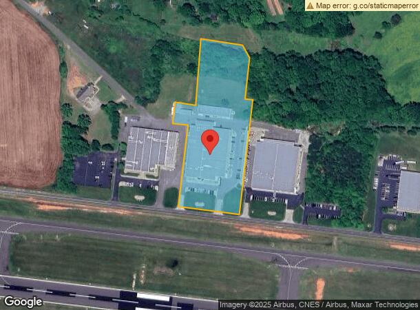
320 W Aviation Dr, Statesville, NC 28677
NEARBY LISTINGS FOR SALE OR LEASE
Property Detail
320 W Aviation Dr
Charlotte-Concord-Gastonia, NC-SC
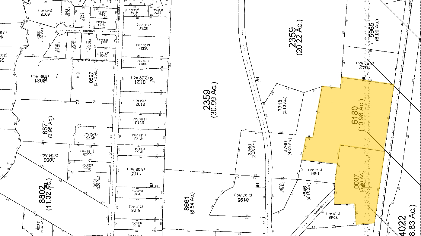
L2 GMS RACING PROPERTIES LLC PB71-24
4714-80-3220.000
Iredell
Autorepair
North Carolina
2024
2
2024
4.58 AC
061104
Iredell County
60,540 SF
Charlotte
DEMOGRAPHICS near 320 W Aviation Dr
1 Mile
3 Mile
5 Mile
2024 Total Population
914
9,182
35,677
2029 Population
1,026
10,367
40,367
Pop Growth 2024-2029
+ 12.25%
+ 12.91%
+ 13.15%
Average Age
42
42
41
2024 Total Households
361
3,655
14,216
HH Growth 2024-2029
+ 12.19%
+ 12.83%
+ 13.06%
Median Household Inc
$55,526
$55,390
$50,348
Avg Household Size
2.50
2.50
2.40
2024 Avg HH Vehicles
2.00
2.00
2.00
Median Home Value
$203,977
$174,301
$177,425
Median Year Built
1983
1983
1980
Nearby Places
- Restaurants
- Banks
- Shops
- Fitness
- Groceries
Nearby Properties
Address
Land Use
TOTAL SIZE
Lot Size
Zoning
Address
Land Use
TOTAL SIZE
Lot Size
Zoning
319,474 SF
31.55 AC
HI
Address
Land Use
TOTAL SIZE
Lot Size
Zoning
66,229 SF
21.27 AC
LI
Address
Land Use
TOTAL SIZE
Lot Size
Zoning
329,715 SF
18.23 AC
HI
Address
Land Use
TOTAL SIZE
Lot Size
Zoning
88,594 SF
RA
Address
Land Use
TOTAL SIZE
Lot Size
Zoning
43,482 SF
10 AC
CU-6 B-5
Address
Land Use
TOTAL SIZE
Lot Size
Zoning
25,815 SF
14.76 AC
R-20
Address
Land Use
TOTAL SIZE
Lot Size
Zoning
52,680 SF
7.46 AC
LI
Address
Land Use
TOTAL SIZE
Lot Size
Zoning
187,400 SF
9.98 AC
LI
Address
Land Use
TOTAL SIZE
Lot Size
Zoning
100,858 SF
9.60 AC
B-4
Address
Land Use
TOTAL SIZE
Lot Size
Zoning
162,240 SF
26.03 AC
HI
Address
Land Use
TOTAL SIZE
Lot Size
Zoning
311,284 SF
27.30 AC
LI
Address
Land Use
TOTAL SIZE
Lot Size
Zoning
57,170 SF
17.22 AC
M1
Address
Land Use
TOTAL SIZE
Lot Size
Zoning
72,092 SF
6 AC
LI
Address
Land Use
TOTAL SIZE
Lot Size
Zoning
149,196 SF
12.76 AC
LI
Address
Land Use
TOTAL SIZE
Lot Size
Zoning
97,764 SF
6.27 AC
LI
Address
Land Use
TOTAL SIZE
Lot Size
Zoning
48,930 SF
9.12 AC
LI
Address
Land Use
TOTAL SIZE
Lot Size
Zoning
35,211 SF
5.90 AC
GB
Address
Land Use
TOTAL SIZE
Lot Size
Zoning
154,562 SF
8.88 AC
LI
Address
Land Use
TOTAL SIZE
Lot Size
Zoning
61,385 SF
50.39 AC
RA
Address
Land Use
TOTAL SIZE
Lot Size
Zoning
154,600 SF
18.32 AC
LI
Address
Land Use
TOTAL SIZE
Lot Size
Zoning
118,189 SF
18.03 AC
LI
Address
Land Use
TOTAL SIZE
Lot Size
Zoning
33,800 SF
6.25 AC
R-5M
Address
Land Use
TOTAL SIZE
Lot Size
Zoning
20,998 SF
11.28 AC
M1
Address
Land Use
TOTAL SIZE
Lot Size
Zoning
145,676 SF
11.57 AC
M-1
Address
Land Use
TOTAL SIZE
Lot Size
Zoning
46,752 SF
11.50 AC
R-15
Address
Land Use
TOTAL SIZE
Lot Size
Zoning
64,500 SF
R20
Address
Land Use
TOTAL SIZE
Lot Size
Zoning
46,178 SF
5.71 AC
R-5M
Address
Land Use
TOTAL SIZE
Lot Size
Zoning
27,596 SF
22.40 AC
RA
Address
Land Use
TOTAL SIZE
Lot Size
Zoning
53,940 SF
8.75 AC
LI
The World's #1 Commercial Real Estate Marketplace
Connect with us
© 2025 CoStar Group
The information above has been obtained from sources believed reliable. While we do not doubt its accuracy we have not verified it and make no guarantee, warranty or representation about it. It is your responsibility to independently confirm its accuracy and completeness. Any projections, opinions, assumptions, or estimates used are for example only and do not represent the current or future performance of the property. The value of this transaction to you depends on tax and other factors which should be evaluated by your tax, financial, and legal advisors. You and your advisors should conduct a careful, independent investigation of the property to determine to your satisfaction the suitability of the property for your needs.