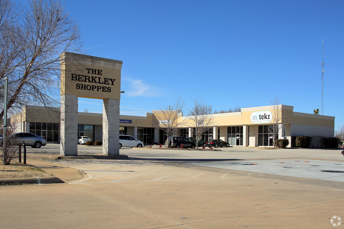
Property Record
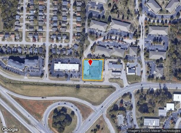
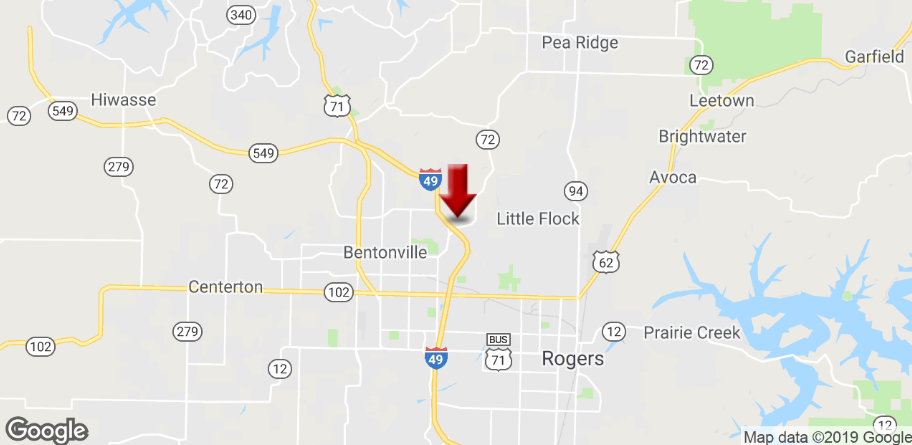
3201 Ne 11Th St, Bentonville, AR 72712
NEARBY LISTINGS FOR SALE OR LEASE
Property Detail
3201 Ne 11Th St
Fayetteville-Springdale-Rogers, AR-MO
Fast Trip Add-Bentonville
01-08091-000
REPLAT 23L-55 9/3/97 & REPLAT 12/09/2014 2014-624 & 625 FORMERLY LTS 1 & 2 BERKLEY ADD/BVILLE LESS & EXCEPT A FRACTIONAL PART OF THE FORMER LOT 1 OF FAST TRIP ADDITION TO THE CITY OF BENTONVILLE, BENTON CO
Regionalshoppingcenterormallwithanchorstore
Benton
X
Arkansas
05007C0095K
3
2024
1.05 AC
2024
Bentonville
020501
Fayetteville/Springdale/Rogers
13,060 SF
DEMOGRAPHICS near 3201 Ne 11Th St
1 Mile
3 Mile
5 Mile
2024 Total Population
3,071
32,968
94,879
2029 Population
3,584
38,713
111,457
Pop Growth 2024-2029
+ 16.70%
+ 17.43%
+ 17.47%
Average Age
37
37
37
2024 Total Households
1,086
12,956
36,334
HH Growth 2024-2029
+ 16.76%
+ 17.59%
+ 17.61%
Median Household Inc
$109,558
$76,178
$77,765
Avg Household Size
2.80
2.50
2.50
2024 Avg HH Vehicles
2.00
2.00
2.00
Median Home Value
$376,822
$288,316
$259,734
Median Year Built
2002
1994
1996
Nearby Places
- Restaurants
- Banks
- Shops
- Fitness
- Groceries
PUBLIC TRANSPORTATION
AIRPORT
Northwest Arkansas Ntl
DRIVE
WALK
Distance
Northwest Arkansas Ntl
30 min
15.2 mi
Freight Ports
Tulsa Port of Inola
DRIVE
WALK
Distance
Tulsa Port of Inola
116 min
100.5 mi
SALE & LEASE HISTORY
LISTING DATE
SALE/LEASE

May 21, 2024
For Lease
Mar 28, 2019
For Lease
Nearby Properties
Address
Land Use
TOTAL SIZE
Lot Size
Zoning
Address
Land Use
TOTAL SIZE
Lot Size
Zoning
506,457 SF
27.85 AC
Address
Land Use
TOTAL SIZE
Lot Size
Zoning
147,199 SF
16.11 AC
Address
Land Use
TOTAL SIZE
Lot Size
Zoning
675,465 SF
39.20 AC
Address
Land Use
TOTAL SIZE
Lot Size
Zoning
381,924 SF
10.23 AC
Address
Land Use
TOTAL SIZE
Lot Size
Zoning
263,788 SF
37.78 AC
Address
Land Use
TOTAL SIZE
Lot Size
Zoning
247,292 SF
1.57 AC
Address
Land Use
TOTAL SIZE
Lot Size
Zoning
746,783 SF
77.03 AC
Address
Land Use
TOTAL SIZE
Lot Size
Zoning
60,250 SF
60.17 AC
Address
Land Use
TOTAL SIZE
Lot Size
Zoning
208,865 SF
7.73 AC
Address
Land Use
TOTAL SIZE
Lot Size
Zoning
6,545 SF
29.19 AC
Address
Land Use
TOTAL SIZE
Lot Size
Zoning
418,411 SF
26.88 AC
Address
Land Use
TOTAL SIZE
Lot Size
Zoning
256,469 SF
3.18 AC
Address
Land Use
TOTAL SIZE
Lot Size
Zoning
57,288 SF
1.43 AC
Address
Land Use
TOTAL SIZE
Lot Size
Zoning
213,552 SF
20.20 AC
Address
Land Use
TOTAL SIZE
Lot Size
Zoning
118,875 SF
5.06 AC
Address
Land Use
TOTAL SIZE
Lot Size
Zoning
249,843 SF
19.21 AC
Address
Land Use
TOTAL SIZE
Lot Size
Zoning
240,065 SF
32.91 AC
Address
Land Use
TOTAL SIZE
Lot Size
Zoning
170,184 SF
10.51 AC
Address
Land Use
TOTAL SIZE
Lot Size
Zoning
161,358 SF
12.23 AC
Address
Land Use
TOTAL SIZE
Lot Size
Zoning
31.21 AC
Address
Land Use
TOTAL SIZE
Lot Size
Zoning
152,197 SF
9.99 AC
Address
Land Use
TOTAL SIZE
Lot Size
Zoning
148,317 SF
1.74 AC
Address
Land Use
TOTAL SIZE
Lot Size
Zoning
274,312 SF
12.24 AC
Address
Land Use
TOTAL SIZE
Lot Size
Zoning
175,184 SF
1.12 AC
Address
Land Use
TOTAL SIZE
Lot Size
Zoning
179,182 SF
19.21 AC
Address
Land Use
TOTAL SIZE
Lot Size
Zoning
27,874 SF
0.48 AC
Address
Land Use
TOTAL SIZE
Lot Size
Zoning
159,879 SF
20.99 AC
Address
Land Use
TOTAL SIZE
Lot Size
Zoning
228,855 SF
1.21 AC
Address
Land Use
TOTAL SIZE
Lot Size
Zoning
231,576 SF
15.18 AC
Address
Land Use
TOTAL SIZE
Lot Size
Zoning
46,851 SF
4.28 AC
The World's #1 Commercial Real Estate Marketplace
Connect with us
© 2025 CoStar Group
The information above has been obtained from sources believed reliable. While we do not doubt its accuracy we have not verified it and make no guarantee, warranty or representation about it. It is your responsibility to independently confirm its accuracy and completeness. Any projections, opinions, assumptions, or estimates used are for example only and do not represent the current or future performance of the property. The value of this transaction to you depends on tax and other factors which should be evaluated by your tax, financial, and legal advisors. You and your advisors should conduct a careful, independent investigation of the property to determine to your satisfaction the suitability of the property for your needs.