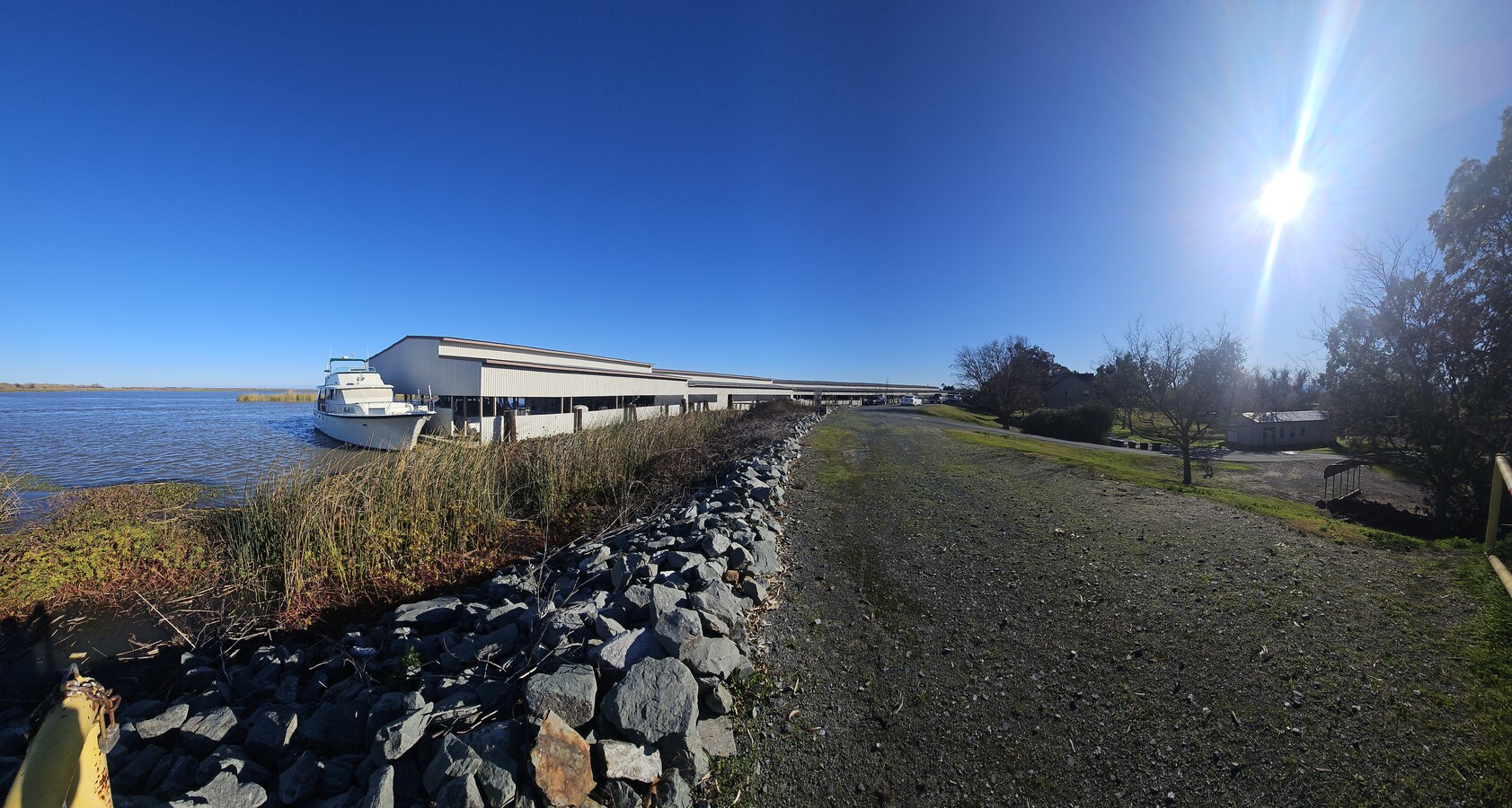
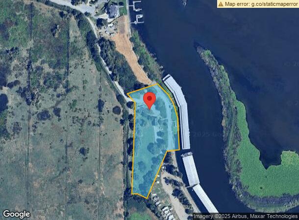
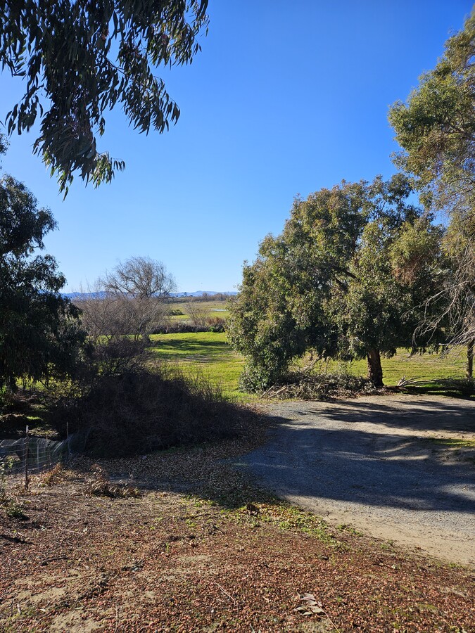
Property Record
3215 W Willow Rd, Bethel Island, CA 94511

NEARBY LISTINGS FOR SALE OR LEASE
-
-
View all Bethel Island listings for sale on LoopNet.com
Property Detail
3215 W Willow Rd
029-010-011-4
Record Of Survey Portion Of The Northwes
Portharbor
POR SW 1/4 SEC 3 T2N R3E 3.98 AC EX MR
AE
Contra Costa
06013C0170G
California
2023
3.98 AC
2024
Antioch/Pittsburg
301000
East Bay/Oakland
25,379 SF
Oakland-Hayward-Berkeley, CA
DEMOGRAPHICS near 3215 W Willow Rd
1 Mile
3 Mile
5 Mile
2024 Total Population
602
2,479
13,920
2029 Population
555
2,347
14,305
Pop Growth 2024-2029
(7.81%)
(5.32%)
+ 2.77%
Average Age
50
46
38
2024 Total Households
278
1,066
4,339
HH Growth 2024-2029
(7.91%)
(5.91%)
+ 1.45%
Median Household Inc
$68,124
$73,780
$120,517
Avg Household Size
2.10
2.20
3.20
2024 Avg HH Vehicles
2.00
2.00
3.00
Median Home Value
$686,619
$482,523
$700,366
Median Year Built
1981
1973
2003
Nearby Places
- Restaurants
- Banks
- Shops
- Fitness
- Groceries
PUBLIC TRANSPORTATION
AIRPORT
Stockton Metro
DRIVE
WALK
Distance
Stockton Metro
70 min
42.1 mi
Freight Ports
Port of Stockton
DRIVE
WALK
Distance
Port of Stockton
67 min
39.6 mi
SALE & LEASE HISTORY
LISTING DATE
SALE/LEASE

Jan 19, 2025
For Sale
Nearby Properties
Address
Land Use
TOTAL SIZE
Lot Size
Zoning
Address
Land Use
TOTAL SIZE
Lot Size
Zoning
920 SF
21.87 AC
T1
Address
Land Use
TOTAL SIZE
Lot Size
Zoning
2,636 SF
574.18 AC
A3
Address
Land Use
TOTAL SIZE
Lot Size
Zoning
4,640 SF
23.24 AC
T1
Address
Land Use
TOTAL SIZE
Lot Size
Zoning
299.33 AC
A2
Address
Land Use
TOTAL SIZE
Lot Size
Zoning
1,090 SF
7.19 AC
T1
Address
Land Use
TOTAL SIZE
Lot Size
Zoning
377.90 AC
A2
Address
Land Use
TOTAL SIZE
Lot Size
Zoning
4,928 SF
9.30 AC
RB
Address
Land Use
TOTAL SIZE
Lot Size
Zoning
0.18 AC
P1
Address
Land Use
TOTAL SIZE
Lot Size
Zoning
339.78 AC
A2
Address
Land Use
TOTAL SIZE
Lot Size
Zoning
3.85 AC
P1
Address
Land Use
TOTAL SIZE
Lot Size
Zoning
0.53 AC
RB
Address
Land Use
TOTAL SIZE
Lot Size
Zoning
6,206 SF
0.99 AC
F1
Address
Land Use
TOTAL SIZE
Lot Size
Zoning
0.16 AC
P1
Address
Land Use
TOTAL SIZE
Lot Size
Zoning
5.60 AC
A2
Address
Land Use
TOTAL SIZE
Lot Size
Zoning
0.11 AC
P1
Address
Land Use
TOTAL SIZE
Lot Size
Zoning
3,080 SF
96.71 AC
P1
Address
Land Use
TOTAL SIZE
Lot Size
Zoning
111,000 SF
8.22 AC
Address
Land Use
TOTAL SIZE
Lot Size
Zoning
203.16 AC
A2
Address
Land Use
TOTAL SIZE
Lot Size
Zoning
0.52 AC
P1
Address
Land Use
TOTAL SIZE
Lot Size
Zoning
0.14 AC
P1
Address
Land Use
TOTAL SIZE
Lot Size
Zoning
4,400 SF
1.46 AC
RB
Address
Land Use
TOTAL SIZE
Lot Size
Zoning
0.18 AC
P1
Address
Land Use
TOTAL SIZE
Lot Size
Zoning
0.12 AC
P1
Address
Land Use
TOTAL SIZE
Lot Size
Zoning
2,593 SF
14.11 AC
A2
Address
Land Use
TOTAL SIZE
Lot Size
Zoning
1,008 SF
128.78 AC
A2
Address
Land Use
TOTAL SIZE
Lot Size
Zoning
98,178 SF
11 AC
F1
Address
Land Use
TOTAL SIZE
Lot Size
Zoning
0.11 AC
P1
Address
Land Use
TOTAL SIZE
Lot Size
Zoning
627.39 AC
A3
Address
Land Use
TOTAL SIZE
Lot Size
Zoning
0.11 AC
P1
Address
Land Use
TOTAL SIZE
Lot Size
Zoning
3,860 SF
12.12 AC
A2
The World's #1 Commercial Real Estate Marketplace
Connect with us
© 2025 CoStar Group
The information above has been obtained from sources believed reliable. While we do not doubt its accuracy we have not verified it and make no guarantee, warranty or representation about it. It is your responsibility to independently confirm its accuracy and completeness. Any projections, opinions, assumptions, or estimates used are for example only and do not represent the current or future performance of the property. The value of this transaction to you depends on tax and other factors which should be evaluated by your tax, financial, and legal advisors. You and your advisors should conduct a careful, independent investigation of the property to determine to your satisfaction the suitability of the property for your needs.