Property Record
3219 Carey Rd, Kinston, NC 28504
NEARBY LISTINGS FOR SALE OR LEASE
-
-
View all Kinston listings for sale on LoopNet.com
Property Detail
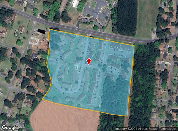
3219 Carey Rd
451610454482
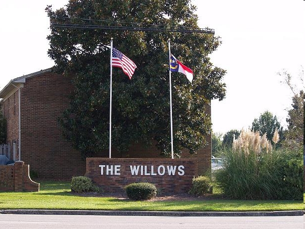
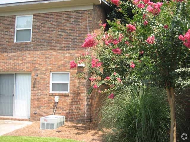
THE WILLOWS APTS TOTAL 187 UNITS
Multifamilydwelling
Lenoir
X
North Carolina
3720451600K
505.60 AC
2024
North Carolina Southeast Area
2024
Other Market Areas
010800
Kinston, NC
7,700 SF
DEMOGRAPHICS near 3219 Carey Rd
1 Mile
3 Mile
5 Mile
2024 Total Population
3,736
18,151
29,375
2029 Population
3,627
17,917
29,184
Pop Growth 2024-2029
(2.92%)
(1.29%)
(0.65%)
Average Age
45
44
43
2024 Total Households
1,563
7,713
12,551
HH Growth 2024-2029
(3.07%)
(1.31%)
(0.65%)
Median Household Inc
$50,891
$39,112
$37,852
Avg Household Size
2.10
2.20
2.20
2024 Avg HH Vehicles
2.00
2.00
2.00
Median Home Value
$149,365
$108,725
$106,699
Median Year Built
1974
1969
1973
Nearby Places
- Restaurants
- Banks
- Shops
- Fitness
- Groceries
PUBLIC TRANSPORTATION
AIRPORT
Pitt-Greenville
DRIVE
WALK
Distance
Pitt-Greenville
47 min
36.8 mi
Freight Ports
Port of Morehead City
DRIVE
WALK
Distance
Port of Morehead City
119 min
80.2 mi
Nearby Properties
Address
Land Use
TOTAL SIZE
Lot Size
Zoning
Address
Land Use
TOTAL SIZE
Lot Size
Zoning
598,078 SF
278.06 AC
RA20
Address
Land Use
TOTAL SIZE
Lot Size
Zoning
357,454 SF
54.92 AC
OI
Address
Land Use
TOTAL SIZE
Lot Size
Zoning
185,613 SF
12.24 AC
SC
Address
Land Use
TOTAL SIZE
Lot Size
Zoning
150,941 SF
20 AC
I1
Address
Land Use
TOTAL SIZE
Lot Size
Zoning
207,102 SF
64.24 AC
RA6
Address
Land Use
TOTAL SIZE
Lot Size
Zoning
5.78 AC
RA6
Address
Land Use
TOTAL SIZE
Lot Size
Zoning
20,000 SF
1,912.62 AC
RA12
Address
Land Use
TOTAL SIZE
Lot Size
Zoning
65,151 SF
24 AC
I1
Address
Land Use
TOTAL SIZE
Lot Size
Zoning
117,763 SF
54.75 AC
I1
Address
Land Use
TOTAL SIZE
Lot Size
Zoning
85,993 SF
33.29 AC
I1
Address
Land Use
TOTAL SIZE
Lot Size
Zoning
150,570 SF
63.12 AC
I1
Address
Land Use
TOTAL SIZE
Lot Size
Zoning
750.08 AC
RA6
Address
Land Use
TOTAL SIZE
Lot Size
Zoning
100,800 SF
51.94 AC
I1
Address
Land Use
TOTAL SIZE
Lot Size
Zoning
70,578 SF
33.22 AC
B1
Address
Land Use
TOTAL SIZE
Lot Size
Zoning
61,370 SF
20.71 AC
SC
Address
Land Use
TOTAL SIZE
Lot Size
Zoning
278,576 SF
36.10 AC
I1
Address
Land Use
TOTAL SIZE
Lot Size
Zoning
122,274 SF
1.86 AC
B2
Address
Land Use
TOTAL SIZE
Lot Size
Zoning
100,000 SF
30.89 AC
Address
Land Use
TOTAL SIZE
Lot Size
Zoning
96,800 SF
16.62 AC
I1
Address
Land Use
TOTAL SIZE
Lot Size
Zoning
69,696 SF
0.32 AC
B2
Address
Land Use
TOTAL SIZE
Lot Size
Zoning
234.71 AC
I1
Address
Land Use
TOTAL SIZE
Lot Size
Zoning
25,163 SF
159.12 AC
OI
Address
Land Use
TOTAL SIZE
Lot Size
Zoning
55,387 SF
11.34 AC
SC
Address
Land Use
TOTAL SIZE
Lot Size
Zoning
72,572 SF
76.38 AC
I1
Address
Land Use
TOTAL SIZE
Lot Size
Zoning
407.13 AC
RA6
Address
Land Use
TOTAL SIZE
Lot Size
Zoning
8.99 AC
I1
Address
Land Use
TOTAL SIZE
Lot Size
Zoning
4.20 AC
Address
Land Use
TOTAL SIZE
Lot Size
Zoning
83,088 SF
1.19 AC
B2
Address
Land Use
TOTAL SIZE
Lot Size
Zoning
197,870 SF
32.52 AC
I1
The World's #1 Commercial Real Estate Marketplace
Connect with us
© 2025 CoStar Group
The information above has been obtained from sources believed reliable. While we do not doubt its accuracy we have not verified it and make no guarantee, warranty or representation about it. It is your responsibility to independently confirm its accuracy and completeness. Any projections, opinions, assumptions, or estimates used are for example only and do not represent the current or future performance of the property. The value of this transaction to you depends on tax and other factors which should be evaluated by your tax, financial, and legal advisors. You and your advisors should conduct a careful, independent investigation of the property to determine to your satisfaction the suitability of the property for your needs.