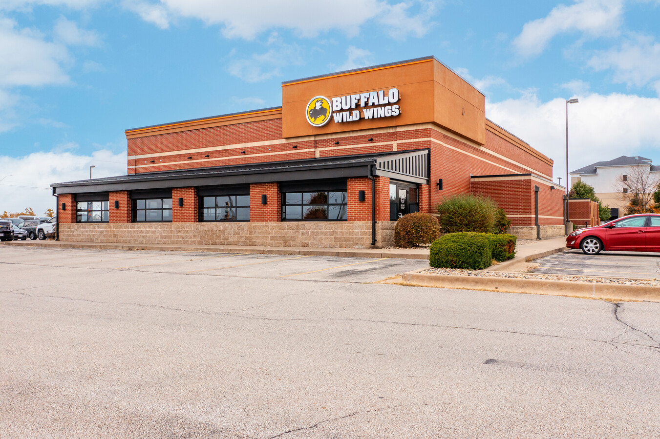
Property Record
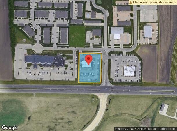
3220 E Empire St, Bloomington, IL 61704

NEARBY LISTINGS FOR SALE OR LEASE
Property Detail
3220 E Empire St
Bloomington, IL
Airport Park Subdivision, 8Th Addition
15-31-453-005
AIRPORT PARK SUB 8TH ADD LT 141
Commercialnec
Mclean
X
Illinois
17113C0510E
141
2022
1.57 AC
2022
Bloomington/Normal
005104
Other Market Areas
22,890 SF
DEMOGRAPHICS near 3220 E Empire St
1 Mile
3 Mile
5 Mile
2024 Total Population
4,919
42,679
102,685
2029 Population
4,917
42,508
102,783
Pop Growth 2024-2029
(0.04%)
(0.40%)
+ 0.10%
Average Age
36
39
37
2024 Total Households
1,949
17,452
41,715
HH Growth 2024-2029
+ 0.05%
(0.38%)
+ 0.12%
Median Household Inc
$90,102
$94,789
$69,093
Avg Household Size
2.50
2.40
2.20
2024 Avg HH Vehicles
2.00
2.00
2.00
Median Home Value
$232,616
$234,776
$193,490
Median Year Built
2001
1990
1980
Nearby Places
- Restaurants
- Banks
- Shops
- Fitness
- Groceries
PUBLIC TRANSPORTATION
COMMUTER RAIL
Bloomington-Normal (Lincoln Service - Amtrak, Lincoln Service Missouri River Runner - Amtrak, Texas Eagle - Amtrak)
DRIVE
WALK
Distance
Bloomington-Normal (Lincoln Service - Amtrak, Lincoln Service Missouri River Runner - Amtrak, Texas Eagle - Amtrak)
12 min
5.5 mi
AIRPORT
Central Il Regional/Bloomington-Normal
DRIVE
WALK
Distance
Central Il Regional/Bloomington-Normal
6 min
1.4 mi
Freight Ports
Port Milwaukee
DRIVE
WALK
Distance
Port Milwaukee
243 min
205.3 mi
SALE & LEASE HISTORY
LISTING DATE
SALE/LEASE

Oct 18, 2022
For Sale
Oct 04, 2023
For Sale
Nearby Properties
Address
Land Use
TOTAL SIZE
Lot Size
Zoning
Address
Land Use
TOTAL SIZE
Lot Size
Zoning
1,867,780 SF
48.61 AC
Address
Land Use
TOTAL SIZE
Lot Size
Zoning
562,852 SF
48.94 AC
Address
Land Use
TOTAL SIZE
Lot Size
Zoning
1,624,618 SF
54.32 AC
Address
Land Use
TOTAL SIZE
Lot Size
Zoning
454,529 SF
19.25 AC
Address
Land Use
TOTAL SIZE
Lot Size
Zoning
445,676 SF
20.86 AC
Address
Land Use
TOTAL SIZE
Lot Size
Zoning
426,806 SF
20.93 AC
Address
Land Use
TOTAL SIZE
Lot Size
Zoning
333,419 SF
35.07 AC
Address
Land Use
TOTAL SIZE
Lot Size
Zoning
95,242 SF
7.52 AC
Address
Land Use
TOTAL SIZE
Lot Size
Zoning
414,270 SF
13.50 AC
Address
Land Use
TOTAL SIZE
Lot Size
Zoning
177,365 SF
11.75 AC
Address
Land Use
TOTAL SIZE
Lot Size
Zoning
123,016 SF
18.52 AC
C-2
Address
Land Use
TOTAL SIZE
Lot Size
Zoning
423,526 SF
25.35 AC
B-1
Address
Land Use
TOTAL SIZE
Lot Size
Zoning
136,382 SF
9.53 AC
Address
Land Use
TOTAL SIZE
Lot Size
Zoning
362,086 SF
15.40 AC
Address
Land Use
TOTAL SIZE
Lot Size
Zoning
388,851 SF
4.40 AC
Address
Land Use
TOTAL SIZE
Lot Size
Zoning
276,695 SF
12.68 AC
Address
Land Use
TOTAL SIZE
Lot Size
Zoning
122,112 SF
7.16 AC
Address
Land Use
TOTAL SIZE
Lot Size
Zoning
208,876 SF
20.87 AC
B-1
Address
Land Use
TOTAL SIZE
Lot Size
Zoning
231,077 SF
15.49 AC
Address
Land Use
TOTAL SIZE
Lot Size
Zoning
295,802 SF
14.99 AC
Address
Land Use
TOTAL SIZE
Lot Size
Zoning
141,694 SF
5.75 AC
Address
Land Use
TOTAL SIZE
Lot Size
Zoning
223,726 SF
10.15 AC
Address
Land Use
TOTAL SIZE
Lot Size
Zoning
123,174 SF
8.95 AC
Address
Land Use
TOTAL SIZE
Lot Size
Zoning
105,746 SF
8.17 AC
B-1
Address
Land Use
TOTAL SIZE
Lot Size
Zoning
197,766 SF
13.86 AC
Address
Land Use
TOTAL SIZE
Lot Size
Zoning
104,805 SF
3.77 AC
Address
Land Use
TOTAL SIZE
Lot Size
Zoning
85,785 SF
9 AC
B1
Address
Land Use
TOTAL SIZE
Lot Size
Zoning
51,422 SF
3.97 AC
Address
Land Use
TOTAL SIZE
Lot Size
Zoning
166,922 SF
7.42 AC
Address
Land Use
TOTAL SIZE
Lot Size
Zoning
119,299 SF
8.91 AC
The World's #1 Commercial Real Estate Marketplace
Connect with us
© 2025 CoStar Group
The information above has been obtained from sources believed reliable. While we do not doubt its accuracy we have not verified it and make no guarantee, warranty or representation about it. It is your responsibility to independently confirm its accuracy and completeness. Any projections, opinions, assumptions, or estimates used are for example only and do not represent the current or future performance of the property. The value of this transaction to you depends on tax and other factors which should be evaluated by your tax, financial, and legal advisors. You and your advisors should conduct a careful, independent investigation of the property to determine to your satisfaction the suitability of the property for your needs.