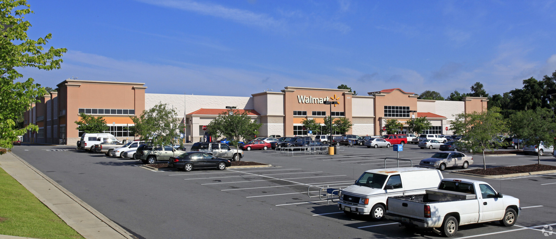
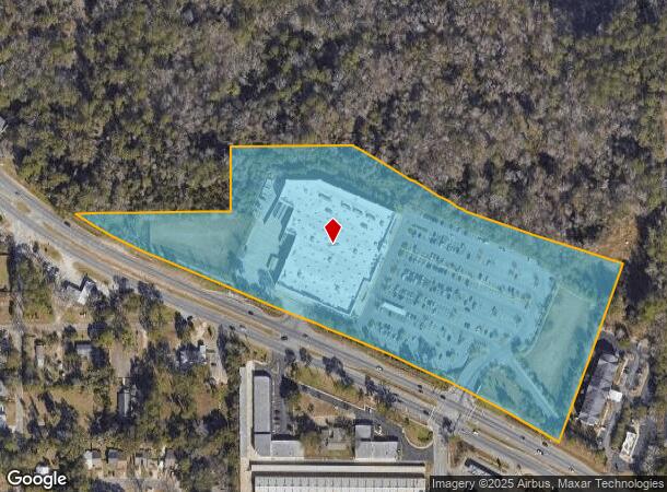
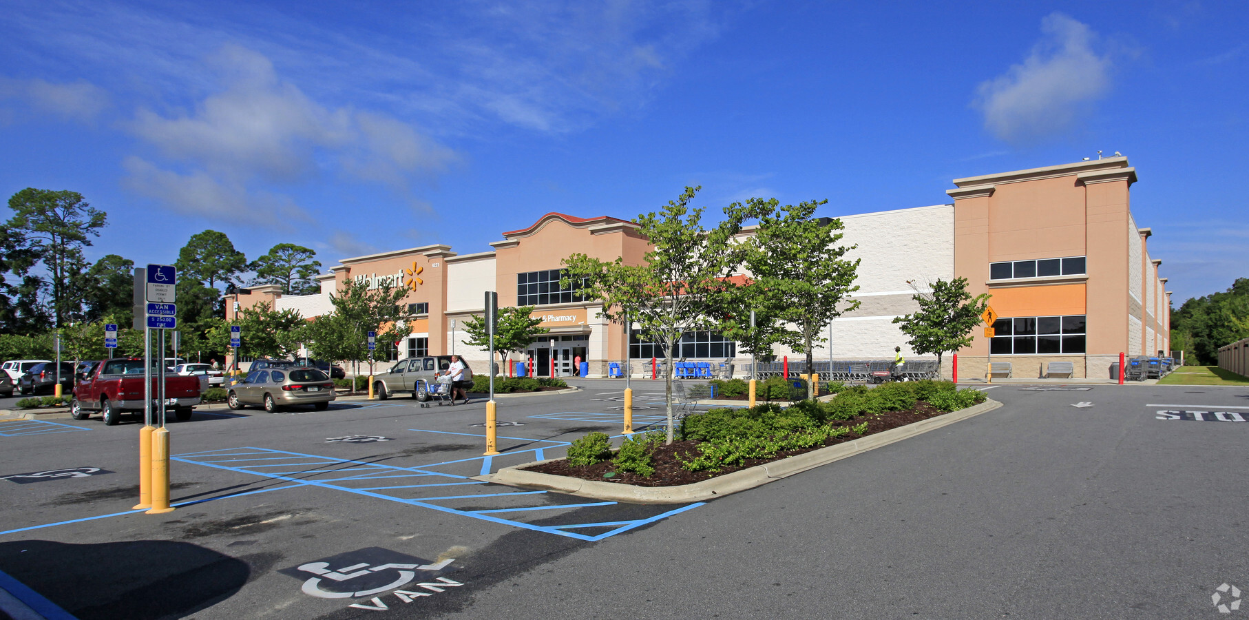
Property Record
3221 N Monroe St, Tallahassee, FL 32303
NEARBY LISTINGS FOR SALE OR LEASE
Property Detail
3221 N Monroe St
Tallahassee, FL
Super Saver
21-15-15-000-000.1
SUPER SAVER UNREC 15 1N 1W 15.608 A PART OF VARIOUS PECAN PLANTATION LOTS OR 1200/350 353 356 1274/1815 OR 1049/823 1175/1626 1629 1631
Storemultistory
Leon
X
Florida
12073C0277F
000-1
2024
15.61 AC
2024
Northwest Leon County
002207
Tallahassee
102,584 SF
DEMOGRAPHICS near 3221 N Monroe St
1 Mile
3 Mile
5 Mile
2024 Total Population
5,534
68,742
134,747
2029 Population
5,872
72,072
140,983
Pop Growth 2024-2029
+ 6.11%
+ 4.84%
+ 4.63%
Average Age
36
33
34
2024 Total Households
2,382
28,425
57,674
HH Growth 2024-2029
+ 6.30%
+ 5.11%
+ 4.81%
Median Household Inc
$55,777
$45,768
$44,183
Avg Household Size
2.20
2.20
2.10
2024 Avg HH Vehicles
2.00
2.00
2.00
Median Home Value
$159,148
$187,358
$214,007
Median Year Built
1979
1985
1983
Nearby Places
- Restaurants
- Banks
- Shops
- Fitness
- Groceries
PUBLIC TRANSPORTATION
AIRPORT
Tallahassee International
DRIVE
WALK
Distance
Tallahassee International
17 min
10.0 mi
Freight Ports
Port of Panama City
DRIVE
WALK
Distance
Port of Panama City
138 min
103.1 mi
Nearby Properties
Address
Land Use
TOTAL SIZE
Lot Size
Zoning
Address
Land Use
TOTAL SIZE
Lot Size
Zoning
369,383 SF
4.50 AC
UT
Address
Land Use
TOTAL SIZE
Lot Size
Zoning
859,666 SF
20.17 AC
MR1
Address
Land Use
TOTAL SIZE
Lot Size
Zoning
556,751 SF
20.60 AC
CP
Address
Land Use
TOTAL SIZE
Lot Size
Zoning
309,750 SF
11.04 AC
Address
Land Use
TOTAL SIZE
Lot Size
Zoning
421,095 SF
28.06 AC
MR1
Address
Land Use
TOTAL SIZE
Lot Size
Zoning
459,568 SF
10.10 AC
CU45
Address
Land Use
TOTAL SIZE
Lot Size
Zoning
883,293 SF
35.97 AC
R4
Address
Land Use
TOTAL SIZE
Lot Size
Zoning
738,711 SF
20.04 AC
MR1
Address
Land Use
TOTAL SIZE
Lot Size
Zoning
607,000 SF
37.55 AC
PUD
Address
Land Use
TOTAL SIZE
Lot Size
Zoning
1,241,812 SF
44.71 AC
MR1
Address
Land Use
TOTAL SIZE
Lot Size
Zoning
660,721 SF
30.95 AC
Address
Land Use
TOTAL SIZE
Lot Size
Zoning
423,131 SF
8.36 AC
CU45
Address
Land Use
TOTAL SIZE
Lot Size
Zoning
1,048,414 SF
5.88 AC
UT
Address
Land Use
TOTAL SIZE
Lot Size
Zoning
489,720 SF
2.07 AC
UPUD
Address
Land Use
TOTAL SIZE
Lot Size
Zoning
358,501 SF
1.98 AC
UT
Address
Land Use
TOTAL SIZE
Lot Size
Zoning
445,330 SF
2.44 AC
UPUD
Address
Land Use
TOTAL SIZE
Lot Size
Zoning
498,076 SF
22.49 AC
MR1
Address
Land Use
TOTAL SIZE
Lot Size
Zoning
711,296 SF
17.86 AC
PUD
Address
Land Use
TOTAL SIZE
Lot Size
Zoning
127,486 SF
8.23 AC
M1
Address
Land Use
TOTAL SIZE
Lot Size
Zoning
196,915 SF
3.33 AC
UT
Address
Land Use
TOTAL SIZE
Lot Size
Zoning
588,955 SF
36.20 AC
R3
Address
Land Use
TOTAL SIZE
Lot Size
Zoning
236,679 SF
32.60 AC
MR1
Address
Land Use
TOTAL SIZE
Lot Size
Zoning
123,020 SF
9.45 AC
M1
Address
Land Use
TOTAL SIZE
Lot Size
Zoning
352,637 SF
14.68 AC
MR1
Address
Land Use
TOTAL SIZE
Lot Size
Zoning
240,852 SF
8.21 AC
MR1
Address
Land Use
TOTAL SIZE
Lot Size
Zoning
551,527 SF
15.30 AC
MR1
Address
Land Use
TOTAL SIZE
Lot Size
Zoning
509,100 SF
14.92 AC
OR3
Address
Land Use
TOTAL SIZE
Lot Size
Zoning
364,760 SF
12.05 AC
MR1
Address
Land Use
TOTAL SIZE
Lot Size
Zoning
140,364 SF
15.29 AC
UT
Address
Land Use
TOTAL SIZE
Lot Size
Zoning
365,297 SF
9.50 AC
MR1
The World's #1 Commercial Real Estate Marketplace
Connect with us
© 2025 CoStar Group
The information above has been obtained from sources believed reliable. While we do not doubt its accuracy we have not verified it and make no guarantee, warranty or representation about it. It is your responsibility to independently confirm its accuracy and completeness. Any projections, opinions, assumptions, or estimates used are for example only and do not represent the current or future performance of the property. The value of this transaction to you depends on tax and other factors which should be evaluated by your tax, financial, and legal advisors. You and your advisors should conduct a careful, independent investigation of the property to determine to your satisfaction the suitability of the property for your needs.