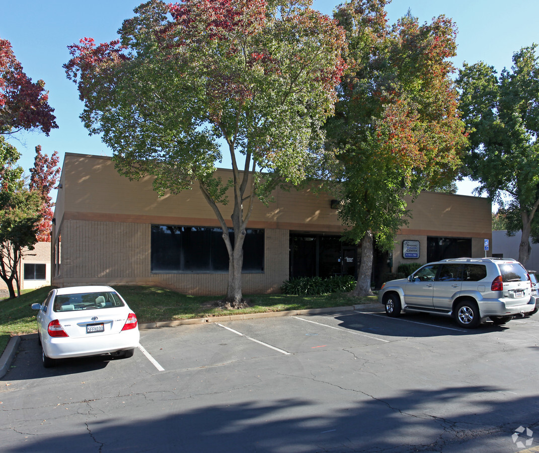
Property Record
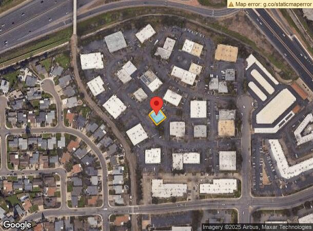
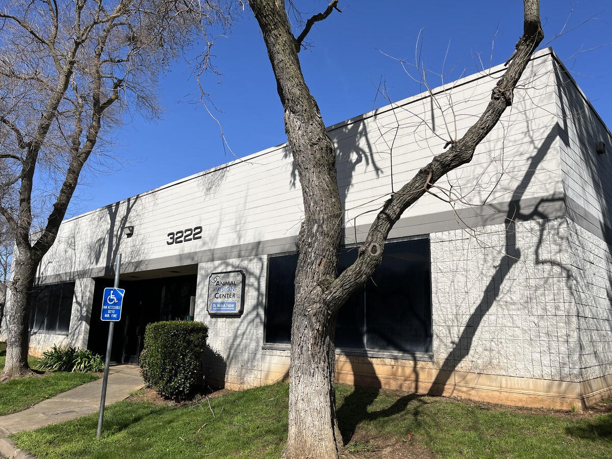
3222 Ramos Cir, Sacramento, CA 95827

Current Lease Availabilities
NEARBY LISTINGS FOR SALE OR LEASE
Property Detail
3222 Ramos Cir
Sacramento--Roseville--Arden-Arcade, CA
Pioneer Fifty Business Center
077-0350-019
PCL 19, PM 66-29, TOGETHER WITH POR LOT B DESC IN LOT LN ADJ86-SRC-1637 PER BK 870330, PG 1745. CONTG 5,378 SQ FT M/L.
Officebuilding
Sacramento
X
California
06067C0208H
b
2023
0.12 AC
2024
Highway 50 Corridor
009007
Sacramento
5,239 SF
DEMOGRAPHICS near 3222 Ramos Cir
1 Mile
3 Mile
5 Mile
2024 Total Population
21,915
89,804
216,106
2029 Population
22,048
90,292
217,331
Pop Growth 2024-2029
+ 0.61%
+ 0.54%
+ 0.57%
Average Age
36
39
41
2024 Total Households
8,051
32,797
82,738
HH Growth 2024-2029
+ 0.66%
+ 0.55%
+ 0.52%
Median Household Inc
$63,343
$83,200
$85,741
Avg Household Size
2.60
2.70
2.50
2024 Avg HH Vehicles
2.00
2.00
2.00
Median Home Value
$333,907
$434,163
$476,067
Median Year Built
1977
1975
1973
Nearby Places
- Restaurants
- Banks
- Shops
- Fitness
- Groceries
PUBLIC TRANSPORTATION
TRANSIT/SUBWAY
Mather Field/Mills (Gold Line - Sacramento Regional Transit District Light Rail (The RT))
DRIVE
WALK
Distance
Mather Field/Mills (Gold Line - Sacramento Regional Transit District Light Rail (The RT))
4 min
20 min
1.1 mi
AIRPORT
Sacramento International
DRIVE
WALK
Distance
Sacramento International
32 min
24.3 mi
Freight Ports
Port of Stockton
DRIVE
WALK
Distance
Port of Stockton
68 min
51.4 mi
Nearby Properties
Address
Land Use
TOTAL SIZE
Lot Size
Zoning
Address
Land Use
TOTAL SIZE
Lot Size
Zoning
266,841 SF
47.29 AC
RD-5
Address
Land Use
TOTAL SIZE
Lot Size
Zoning
251,024 SF
5.19 AC
SPA (CVSPA
Address
Land Use
TOTAL SIZE
Lot Size
Zoning
223,046 SF
10.99 AC
RD 20
Address
Land Use
TOTAL SIZE
Lot Size
Zoning
109,805 SF
20.04 AC
OPMU
Address
Land Use
TOTAL SIZE
Lot Size
Zoning
181,573 SF
12.10 AC
SPA (MFSPA
Address
Land Use
TOTAL SIZE
Lot Size
Zoning
192,500 SF
11.78 AC
OPMU
Address
Land Use
TOTAL SIZE
Lot Size
Zoning
323,088 SF
19.69 AC
OPMU
Address
Land Use
TOTAL SIZE
Lot Size
Zoning
162,023 SF
8.96 AC
OIMU
Address
Land Use
TOTAL SIZE
Lot Size
Zoning
0.21 AC
RD-5
Address
Land Use
TOTAL SIZE
Lot Size
Zoning
139,500 SF
5.21 AC
MP
Address
Land Use
TOTAL SIZE
Lot Size
Zoning
221,337 SF
12.19 AC
RD 25
Address
Land Use
TOTAL SIZE
Lot Size
Zoning
132,149 SF
8.29 AC
OPMU
Address
Land Use
TOTAL SIZE
Lot Size
Zoning
95,174 SF
5.29 AC
SPA (MFSPA
Address
Land Use
TOTAL SIZE
Lot Size
Zoning
156,032 SF
9.31 AC
OPMU
Address
Land Use
TOTAL SIZE
Lot Size
Zoning
218,216 SF
14.22 AC
OPMU
Address
Land Use
TOTAL SIZE
Lot Size
Zoning
169,618 SF
10.44 AC
RD-4
Address
Land Use
TOTAL SIZE
Lot Size
Zoning
110,960 SF
6.62 AC
SPA (MFSPA
Address
Land Use
TOTAL SIZE
Lot Size
Zoning
104,042 SF
7.40 AC
OIMU
Address
Land Use
TOTAL SIZE
Lot Size
Zoning
198,413 SF
9.24 AC
RD 30
Address
Land Use
TOTAL SIZE
Lot Size
Zoning
135,197 SF
11.38 AC
SPA (CVSPA
Address
Land Use
TOTAL SIZE
Lot Size
Zoning
137,306 SF
15.91 AC
GC
Address
Land Use
TOTAL SIZE
Lot Size
Zoning
148,650 SF
10.23 AC
OPMU
Address
Land Use
TOTAL SIZE
Lot Size
Zoning
12.47 AC
RD 30
Address
Land Use
TOTAL SIZE
Lot Size
Zoning
457,088 SF
12.50 AC
RD 30
Address
Land Use
TOTAL SIZE
Lot Size
Zoning
98,767 SF
6.43 AC
BP (ZSPA)
Address
Land Use
TOTAL SIZE
Lot Size
Zoning
89,098 SF
4.93 AC
RD-40
Address
Land Use
TOTAL SIZE
Lot Size
Zoning
302,966 SF
15.94 AC
RD 30
Address
Land Use
TOTAL SIZE
Lot Size
Zoning
258,819 SF
13.47 AC
RD 30
Address
Land Use
TOTAL SIZE
Lot Size
Zoning
90,972 SF
2.36 AC
RD-40
Address
Land Use
TOTAL SIZE
Lot Size
Zoning
8,724 SF
101.84 AC
M-2 (SM)
The World's #1 Commercial Real Estate Marketplace
Connect with us
© 2025 CoStar Group
The information above has been obtained from sources believed reliable. While we do not doubt its accuracy we have not verified it and make no guarantee, warranty or representation about it. It is your responsibility to independently confirm its accuracy and completeness. Any projections, opinions, assumptions, or estimates used are for example only and do not represent the current or future performance of the property. The value of this transaction to you depends on tax and other factors which should be evaluated by your tax, financial, and legal advisors. You and your advisors should conduct a careful, independent investigation of the property to determine to your satisfaction the suitability of the property for your needs.