Property Record
3220 Springs Rd Ne, Hickory, NC 28601

NEARBY LISTINGS FOR SALE OR LEASE
Property Detail
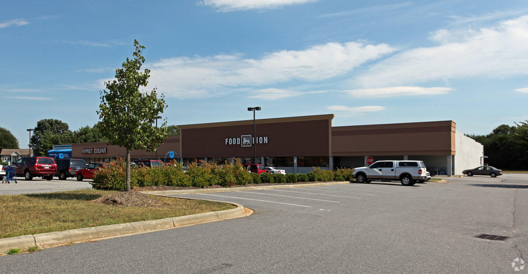
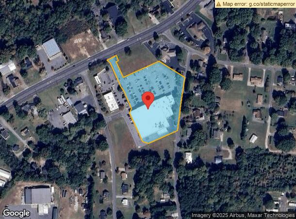
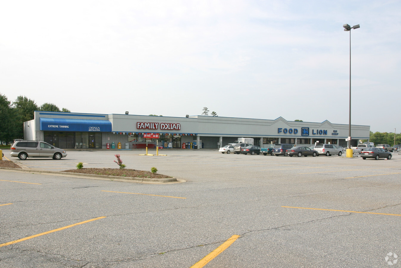
3220 Springs Rd Ne
3723075883070000
ACCT# 159767741 MAP 165H -04-027- -0 SPRINGS CROSSING/FOOD LION; OSAKA; SMART DOLLAR; EXTREME TANNING FAMILY EXTENDED
Stripcommercialcenter
Catawba
X
North Carolina
3710372300J
3.65 AC
2024
Catawba County
2024
Charlotte
010303
Hickory-Lenoir-Morganton, NC
47,626 SF
DEMOGRAPHICS near 3220 Springs Rd Ne
1 Mile
3 Mile
5 Mile
2024 Total Population
3,852
31,720
70,191
2029 Population
4,002
33,143
73,203
Pop Growth 2024-2029
+ 3.89%
+ 4.49%
+ 4.29%
Average Age
40
40
41
2024 Total Households
1,501
12,996
28,767
HH Growth 2024-2029
+ 3.93%
+ 4.47%
+ 4.26%
Median Household Inc
$55,000
$52,428
$57,068
Avg Household Size
2.50
2.40
2.30
2024 Avg HH Vehicles
2.00
2.00
2.00
Median Home Value
$164,106
$174,813
$198,141
Median Year Built
1977
1983
1982
Nearby Places
- Restaurants
- Banks
- Shops
- Fitness
- Groceries
SALE & LEASE HISTORY
LISTING DATE
SALE/LEASE

Sep 25, 2016
For Lease
Sep 05, 2018
For Lease
Nearby Properties
Address
Land Use
TOTAL SIZE
Lot Size
Zoning
Address
Land Use
TOTAL SIZE
Lot Size
Zoning
8,492 SF
15.83 AC
R-4
Address
Land Use
TOTAL SIZE
Lot Size
Zoning
94,152 SF
14.46 AC
IND
Address
Land Use
TOTAL SIZE
Lot Size
Zoning
8,436 SF
13.28 AC
R-4
Address
Land Use
TOTAL SIZE
Lot Size
Zoning
57,658 SF
10.64 AC
OI
Address
Land Use
TOTAL SIZE
Lot Size
Zoning
1,726 SF
15.93 AC
PD
Address
Land Use
TOTAL SIZE
Lot Size
Zoning
8,992 SF
11.66 AC
R-4
Address
Land Use
TOTAL SIZE
Lot Size
Zoning
42.11 AC
R-20
Address
Land Use
TOTAL SIZE
Lot Size
Zoning
8,960 SF
14.07 AC
R-4
Address
Land Use
TOTAL SIZE
Lot Size
Zoning
60,130 SF
4.02 AC
IND
Address
Land Use
TOTAL SIZE
Lot Size
Zoning
27,426 SF
7.99 AC
PD
Address
Land Use
TOTAL SIZE
Lot Size
Zoning
6,144 SF
11.37 AC
R-4
Address
Land Use
TOTAL SIZE
Lot Size
Zoning
27,008 SF
12.02 AC
R-3
Address
Land Use
TOTAL SIZE
Lot Size
Zoning
7,742 SF
10.93 AC
PD
Address
Land Use
TOTAL SIZE
Lot Size
Zoning
22.99 AC
PD
Address
Land Use
TOTAL SIZE
Lot Size
Zoning
44,116 SF
6.33 AC
OI
Address
Land Use
TOTAL SIZE
Lot Size
Zoning
20.34 AC
R-20
Address
Land Use
TOTAL SIZE
Lot Size
Zoning
72,388 SF
7.57 AC
R-2
Address
Land Use
TOTAL SIZE
Lot Size
Zoning
31.22 AC
R-1
Address
Land Use
TOTAL SIZE
Lot Size
Zoning
132,633 SF
24.64 AC
IND
Address
Land Use
TOTAL SIZE
Lot Size
Zoning
55,384 SF
3.88 AC
IND
Address
Land Use
TOTAL SIZE
Lot Size
Zoning
28.97 AC
R-20
Address
Land Use
TOTAL SIZE
Lot Size
Zoning
4,160 SF
8.95 AC
R-4
Address
Land Use
TOTAL SIZE
Lot Size
Zoning
165,121 SF
13.25 AC
IND
Address
Land Use
TOTAL SIZE
Lot Size
Zoning
18.81 AC
R-1
Address
Land Use
TOTAL SIZE
Lot Size
Zoning
34.80 AC
R-20
Address
Land Use
TOTAL SIZE
Lot Size
Zoning
123,678 SF
8.01 AC
IND
Address
Land Use
TOTAL SIZE
Lot Size
Zoning
226,680 SF
16.05 AC
IND
Address
Land Use
TOTAL SIZE
Lot Size
Zoning
5,842 SF
9.72 AC
PD
Address
Land Use
TOTAL SIZE
Lot Size
Zoning
3,652 SF
14.02 AC
R-4
Address
Land Use
TOTAL SIZE
Lot Size
Zoning
50,472 SF
5.63 AC
IND
The World's #1 Commercial Real Estate Marketplace
Connect with us
© 2025 CoStar Group
The information above has been obtained from sources believed reliable. While we do not doubt its accuracy we have not verified it and make no guarantee, warranty or representation about it. It is your responsibility to independently confirm its accuracy and completeness. Any projections, opinions, assumptions, or estimates used are for example only and do not represent the current or future performance of the property. The value of this transaction to you depends on tax and other factors which should be evaluated by your tax, financial, and legal advisors. You and your advisors should conduct a careful, independent investigation of the property to determine to your satisfaction the suitability of the property for your needs.