Property Record
3256 Medlock Bridge Rd, Peachtree Corners, GA 30092


NEARBY LISTINGS FOR SALE OR LEASE
-
-
View all Peachtree Corners listings for sale on LoopNet.com
Property Detail
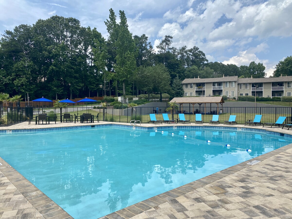
3256 Medlock Bridge Rd
Atlanta-Sandy Springs-Roswell, GA
Medlock
6-271-003
MEDLOCK BR RD
Apartment
Gwinnett
X
Georgia
13135C0067G
i
2024
22.93 AC
2023
Peachtree Corners
050324
Atlanta
232,142 SF
DEMOGRAPHICS near 3256 Medlock Bridge Rd
1 Mile
3 Mile
5 Mile
2024 Total Population
7,792
75,402
232,646
2029 Population
8,053
78,351
240,027
Pop Growth 2024-2029
+ 3.35%
+ 3.91%
+ 3.17%
Average Age
38
38
37
2024 Total Households
3,289
27,588
85,071
HH Growth 2024-2029
+ 3.22%
+ 3.85%
+ 3.17%
Median Household Inc
$74,279
$70,464
$62,590
Avg Household Size
2.40
2.70
2.70
2024 Avg HH Vehicles
2.00
2.00
2.00
Median Home Value
$423,625
$394,169
$373,366
Median Year Built
1994
1988
1988
Nearby Places
- Restaurants
- Banks
- Shops
- Fitness
- Groceries
PUBLIC TRANSPORTATION
AIRPORT
Hartsfield - Jackson Atlanta International
DRIVE
WALK
Distance
Hartsfield - Jackson Atlanta International
45 min
31.5 mi
Freight Ports
Georgia Ports - Savannah
DRIVE
WALK
Distance
Georgia Ports - Savannah
300 min
266.7 mi
Nearby Properties
Address
Land Use
TOTAL SIZE
Lot Size
Zoning
Address
Land Use
TOTAL SIZE
Lot Size
Zoning
652,108 SF
78.64 AC
PUD
Address
Land Use
TOTAL SIZE
Lot Size
Zoning
420,327 SF
37.47 AC
MUD
Address
Land Use
TOTAL SIZE
Lot Size
Zoning
631,710 SF
65.19 AC
RM13
Address
Land Use
TOTAL SIZE
Lot Size
Zoning
429,696 SF
39.03 AC
RM13
Address
Land Use
TOTAL SIZE
Lot Size
Zoning
300,735 SF
21.95 AC
PUD
Address
Land Use
TOTAL SIZE
Lot Size
Zoning
500,746 SF
53.40 AC
RM8
Address
Land Use
TOTAL SIZE
Lot Size
Zoning
286,481 SF
20.06 AC
M1
Address
Land Use
TOTAL SIZE
Lot Size
Zoning
450,830 SF
5.37 AC
NX
Address
Land Use
TOTAL SIZE
Lot Size
Zoning
196,201 SF
12.88 AC
RM13
Address
Land Use
TOTAL SIZE
Lot Size
Zoning
781,705 SF
60.29 AC
M1
Address
Land Use
TOTAL SIZE
Lot Size
Zoning
416,142 SF
51.98 AC
OI
Address
Land Use
TOTAL SIZE
Lot Size
Zoning
340,962 SF
34.50 AC
PRD
Address
Land Use
TOTAL SIZE
Lot Size
Zoning
524,000 SF
44.93 AC
RM
Address
Land Use
TOTAL SIZE
Lot Size
Zoning
230,144 SF
23.46 AC
RM13
Address
Land Use
TOTAL SIZE
Lot Size
Zoning
336,694 SF
32.05 AC
RM10
Address
Land Use
TOTAL SIZE
Lot Size
Zoning
72,700 SF
2.38 AC
AB3
Address
Land Use
TOTAL SIZE
Lot Size
Zoning
428,933 SF
50.01 AC
PRD
Address
Land Use
TOTAL SIZE
Lot Size
Zoning
266,440 SF
30.27 AC
RM10
Address
Land Use
TOTAL SIZE
Lot Size
Zoning
210,598 SF
21.08 AC
RM13
Address
Land Use
TOTAL SIZE
Lot Size
Zoning
13,920 SF
20.13 AC
RM-MULTI-F
Address
Land Use
TOTAL SIZE
Lot Size
Zoning
254,048 SF
28.59 AC
RM
Address
Land Use
TOTAL SIZE
Lot Size
Zoning
201,795 SF
22.03 AC
RM
Address
Land Use
TOTAL SIZE
Lot Size
Zoning
342,442 SF
27.24 AC
RM
Address
Land Use
TOTAL SIZE
Lot Size
Zoning
326,258 SF
24.05 AC
PRC
Address
Land Use
TOTAL SIZE
Lot Size
Zoning
189,618 SF
39.43 AC
RM10
Address
Land Use
TOTAL SIZE
Lot Size
Zoning
190,416 SF
24.63 AC
RM10
Address
Land Use
TOTAL SIZE
Lot Size
Zoning
251,998 SF
9.44 AC
PUD
Address
Land Use
TOTAL SIZE
Lot Size
Zoning
420,576 SF
27.06 AC
M2
Address
Land Use
TOTAL SIZE
Lot Size
Zoning
185,492 SF
12.60 AC
M1
The World's #1 Commercial Real Estate Marketplace
Connect with us
© 2025 CoStar Group
The information above has been obtained from sources believed reliable. While we do not doubt its accuracy we have not verified it and make no guarantee, warranty or representation about it. It is your responsibility to independently confirm its accuracy and completeness. Any projections, opinions, assumptions, or estimates used are for example only and do not represent the current or future performance of the property. The value of this transaction to you depends on tax and other factors which should be evaluated by your tax, financial, and legal advisors. You and your advisors should conduct a careful, independent investigation of the property to determine to your satisfaction the suitability of the property for your needs.