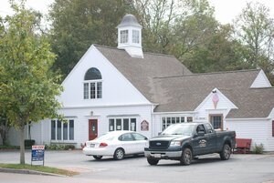
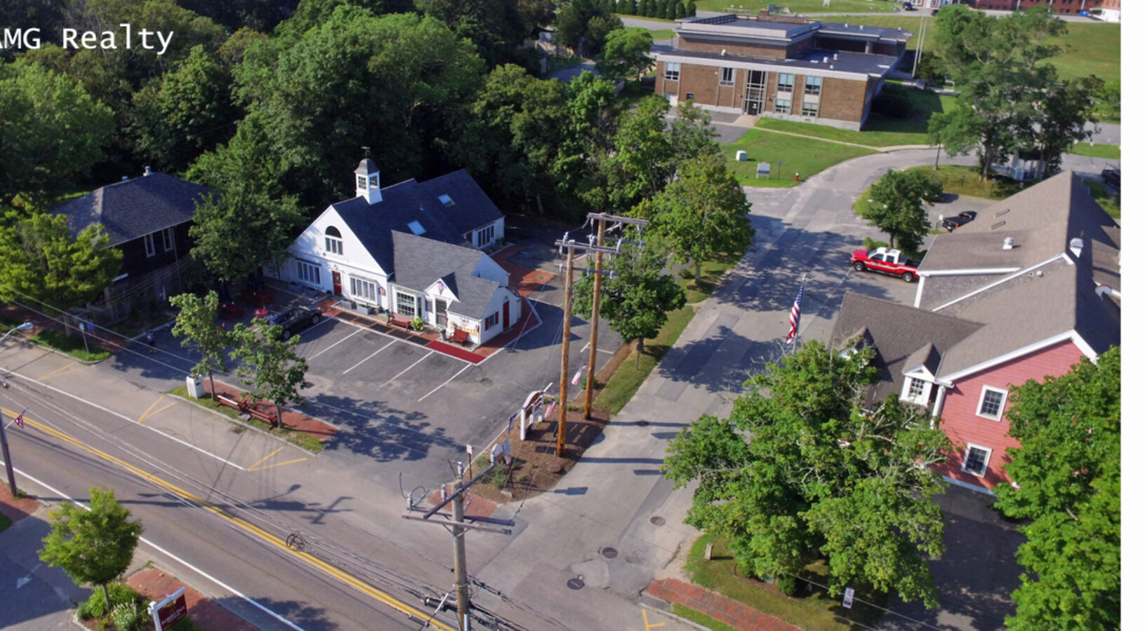
Property Record
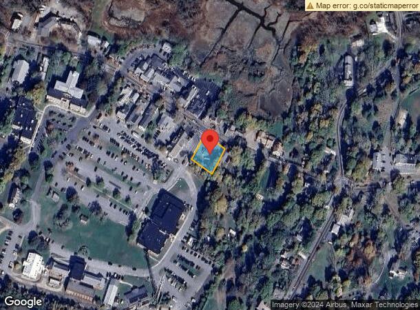
3261 Main St, Barnstable, MA 02630
NEARBY LISTINGS FOR SALE OR LEASE
Property Detail
3261 Main St
BARN-000299-000000-000018
Barnstable
Storebuilding
Massachusetts
X
18
25001C0558J
0.29 AC
2024
Cape Cod
2024
Other Market Areas
012200
Barnstable Town, MA
3,291 SF
DEMOGRAPHICS near 3261 Main St
1 Mile
3 Mile
5 Mile
2024 Total Population
1,280
10,359
44,820
2029 Population
1,216
10,343
45,557
Pop Growth 2024-2029
(5.00%)
(0.15%)
+ 1.64%
Average Age
52
45
47
2024 Total Households
571
4,219
19,046
HH Growth 2024-2029
(5.60%)
(0.50%)
+ 1.50%
Median Household Inc
$127,744
$80,813
$76,227
Avg Household Size
2.20
2.30
2.20
2024 Avg HH Vehicles
2.00
2.00
2.00
Median Home Value
$668,539
$467,883
$452,498
Median Year Built
1981
1978
1975
Nearby Places
- Restaurants
- Banks
- Shops
- Fitness
- Groceries
PUBLIC TRANSPORTATION
COMMUTER RAIL
Hyannis (CapeFLYER - Cape Cod Regional Transit Authority)
Drive
Walk
Distance
Hyannis (CapeFLYER - Cape Cod Regional Transit Authority)
8 min
4.2 mi
AIRPORT
Martha's Vineyard
Drive
Walk
Distance
Martha's Vineyard
106 min
39.3 mi
Freight Ports
Port of New Bedford Harbor
Drive
Walk
Distance
Port of New Bedford Harbor
66 min
45.6 mi
SALE & LEASE HISTORY
LISTING DATE
SALE/LEASE

May 15, 2019
For Lease
Mar 26, 2019
For Lease
Dec 10, 2020
For Sale
Aug 01, 2019
For Sale
Nearby Properties
Address
Land Use
TOTAL SIZE
Lot Size
Zoning
Address
Land Use
TOTAL SIZE
Lot Size
Zoning
44 AC
RG;RF
Address
Land Use
TOTAL SIZE
Lot Size
Zoning
298,272 SF
9.34 AC
IN
Address
Land Use
TOTAL SIZE
Lot Size
Zoning
17.95 AC
VB-A;R
Address
Land Use
TOTAL SIZE
Lot Size
Zoning
25.88 AC
HB;B
Address
Land Use
TOTAL SIZE
Lot Size
Zoning
1,114.30 AC
Address
Land Use
TOTAL SIZE
Lot Size
Zoning
10.68 AC
Address
Land Use
TOTAL SIZE
Lot Size
Zoning
14.34 AC
B;IND
Address
Land Use
TOTAL SIZE
Lot Size
Zoning
30,000 SF
8.48 AC
HB;RF-
Address
Land Use
TOTAL SIZE
Lot Size
Zoning
82.38 AC
RC-1;R
Address
Land Use
TOTAL SIZE
Lot Size
Zoning
253,562 SF
12.54 AC
RC-1;H
Address
Land Use
TOTAL SIZE
Lot Size
Zoning
12.82 AC
B;HB
Address
Land Use
TOTAL SIZE
Lot Size
Zoning
43.50 AC
IN
Address
Land Use
TOTAL SIZE
Lot Size
Zoning
54,172 SF
17.97 AC
IND;B;
Address
Land Use
TOTAL SIZE
Lot Size
Zoning
67,000 SF
9.15 AC
HB;B
Address
Land Use
TOTAL SIZE
Lot Size
Zoning
117,584 SF
9.68 AC
IND;B
Address
Land Use
TOTAL SIZE
Lot Size
Zoning
32.95 AC
IN
Address
Land Use
TOTAL SIZE
Lot Size
Zoning
106,197 SF
8.13 AC
Address
Land Use
TOTAL SIZE
Lot Size
Zoning
167,800 SF
9.73 AC
IN
Address
Land Use
TOTAL SIZE
Lot Size
Zoning
37,169 SF
8.71 AC
RC-1;H
Address
Land Use
TOTAL SIZE
Lot Size
Zoning
90,837 SF
11.66 AC
IN
Address
Land Use
TOTAL SIZE
Lot Size
Zoning
13.46 AC
IN
Address
Land Use
TOTAL SIZE
Lot Size
Zoning
118,274 SF
7.42 AC
Address
Land Use
TOTAL SIZE
Lot Size
Zoning
99,248 SF
4.73 AC
HB;B
Address
Land Use
TOTAL SIZE
Lot Size
Zoning
54,688 SF
10.02 AC
B;RG;R
Address
Land Use
TOTAL SIZE
Lot Size
Zoning
36,536 SF
36.91 AC
RG;RF-
Address
Land Use
TOTAL SIZE
Lot Size
Zoning
16.63 AC
IN
Address
Land Use
TOTAL SIZE
Lot Size
Zoning
10.21 AC
IN
Address
Land Use
TOTAL SIZE
Lot Size
Zoning
8.09 AC
Address
Land Use
TOTAL SIZE
Lot Size
Zoning
74,841 SF
6.45 AC
HB;B
Address
Land Use
TOTAL SIZE
Lot Size
Zoning
80,464 SF
3.50 AC
HB;B
Start a new search to find other properties for sale or lease
Connect with us
© 2024 CoStar Group
The information above has been obtained from sources believed reliable. While we do not doubt its accuracy we have not verified it and make no guarantee, warranty or representation about it. It is your responsibility to independently confirm its accuracy and completeness. Any projections, opinions, assumptions, or estimates used are for example only and do not represent the current or future performance of the property. The value of this transaction to you depends on tax and other factors which should be evaluated by your tax, financial, and legal advisors. You and your advisors should conduct a careful, independent investigation of the property to determine to your satisfaction the suitability of the property for your needs.