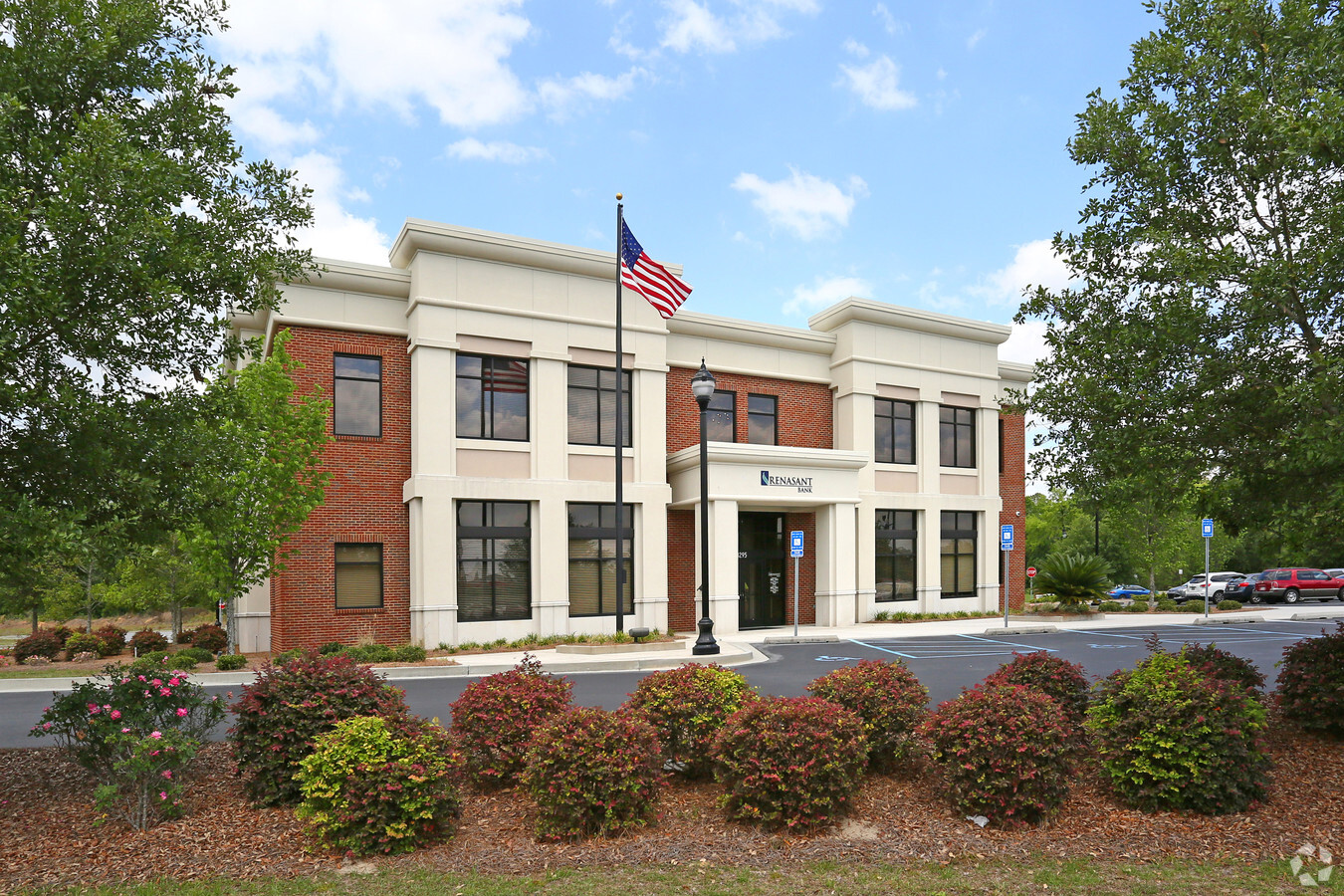
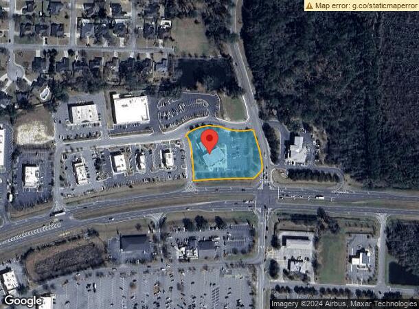
Property Record
3295 Inner Perimeter Rd, Valdosta, GA 31602
NEARBY LISTINGS FOR SALE OR LEASE
Property Detail
3295 Inner Perimeter Rd
Valdosta, GA
Perimeter West Of Bemiss
0109B-147E
PRT LT 6 STATEN OFFICE PARK ADD 1
Financialbuilding
Lowndes
X
Georgia
13185C0120E
6
2023
1.85 AC
2023
Valdosta/Lake Park
010301
Other Market Areas
11,232 SF
DEMOGRAPHICS near 3295 Inner Perimeter Rd
1 Mile
3 Mile
5 Mile
2024 Total Population
7,279
44,080
76,616
2029 Population
7,505
45,602
79,520
Pop Growth 2024-2029
+ 3.10%
+ 3.45%
+ 3.79%
Average Age
36
35
35
2024 Total Households
3,316
17,343
29,616
HH Growth 2024-2029
+ 3.23%
+ 3.60%
+ 3.97%
Median Household Inc
$37,716
$39,850
$40,043
Avg Household Size
2.10
2.40
2.40
2024 Avg HH Vehicles
2.00
2.00
2.00
Median Home Value
$231,967
$171,048
$170,975
Median Year Built
1992
1987
1990
Nearby Places
- Restaurants
- Banks
- Shops
- Fitness
- Groceries
PUBLIC TRANSPORTATION
AIRPORT
Valdosta Regional
Drive
Walk
Distance
Valdosta Regional
14 min
7.6 mi
Freight Ports
Georgia Ports - Brunswick
Drive
Walk
Distance
Georgia Ports - Brunswick
155 min
117.5 mi
Nearby Properties
Address
Land Use
TOTAL SIZE
Lot Size
Zoning
Address
Land Use
TOTAL SIZE
Lot Size
Zoning
15.75 AC
R-P
Address
Land Use
TOTAL SIZE
Lot Size
Zoning
4878
14.83 AC
R-P
Address
Land Use
TOTAL SIZE
Lot Size
Zoning
142140
24.29 AC
DR-10
Address
Land Use
TOTAL SIZE
Lot Size
Zoning
1728
24.30 AC
R-P, C-C
Address
Land Use
TOTAL SIZE
Lot Size
Zoning
39024
18.04 AC
P-D
Address
Land Use
TOTAL SIZE
Lot Size
Zoning
93036
2.80 AC
C-H
Address
Land Use
TOTAL SIZE
Lot Size
Zoning
185727
20.33 AC
C-H
Address
Land Use
TOTAL SIZE
Lot Size
Zoning
78048
9.18 AC
R-P
Address
Land Use
TOTAL SIZE
Lot Size
Zoning
110646
9.76 AC
R-P
Address
Land Use
TOTAL SIZE
Lot Size
Zoning
48000
9.06 AC
C-C
Address
Land Use
TOTAL SIZE
Lot Size
Zoning
18312
16.93 AC
R-M
Address
Land Use
TOTAL SIZE
Lot Size
Zoning
202062
7.12 AC
R-15
Address
Land Use
TOTAL SIZE
Lot Size
Zoning
2574
12 AC
R-P
Address
Land Use
TOTAL SIZE
Lot Size
Zoning
339
23.53 AC
E-R
Address
Land Use
TOTAL SIZE
Lot Size
Zoning
49546
10.45 AC
R-P
Address
Land Use
TOTAL SIZE
Lot Size
Zoning
45241
13.16 AC
R-1
Address
Land Use
TOTAL SIZE
Lot Size
Zoning
20636
8.21 AC
C-H
Address
Land Use
TOTAL SIZE
Lot Size
Zoning
53880
8.01 AC
C-H,C-C
Address
Land Use
TOTAL SIZE
Lot Size
Zoning
11376
0.25 AC
LARD2
Address
Land Use
TOTAL SIZE
Lot Size
Zoning
40343
49.11 AC
R-6
Address
Land Use
TOTAL SIZE
Lot Size
Zoning
105558
11.38 AC
C-C
Address
Land Use
TOTAL SIZE
Lot Size
Zoning
574
7.28 AC
PPD
Address
Land Use
TOTAL SIZE
Lot Size
Zoning
90710
33.43 AC
PRD-10
Address
Land Use
TOTAL SIZE
Lot Size
Zoning
60950
5.81 AC
R-P
Address
Land Use
TOTAL SIZE
Lot Size
Zoning
25.69 AC
C-H
Address
Land Use
TOTAL SIZE
Lot Size
Zoning
9180
4.86 AC
C-H
Address
Land Use
TOTAL SIZE
Lot Size
Zoning
40800
5.83 AC
R-P
Address
Land Use
TOTAL SIZE
Lot Size
Zoning
24928
10 AC
R-M
Address
Land Use
TOTAL SIZE
Lot Size
Zoning
57408
4.18 AC
C-C
Address
Land Use
TOTAL SIZE
Lot Size
Zoning
67044
3.79 AC
C-C
Start a new search to find other properties for sale or lease
Connect with us
© 2024 CoStar Group
The information above has been obtained from sources believed reliable. While we do not doubt its accuracy we have not verified it and make no guarantee, warranty or representation about it. It is your responsibility to independently confirm its accuracy and completeness. Any projections, opinions, assumptions, or estimates used are for example only and do not represent the current or future performance of the property. The value of this transaction to you depends on tax and other factors which should be evaluated by your tax, financial, and legal advisors. You and your advisors should conduct a careful, independent investigation of the property to determine to your satisfaction the suitability of the property for your needs.