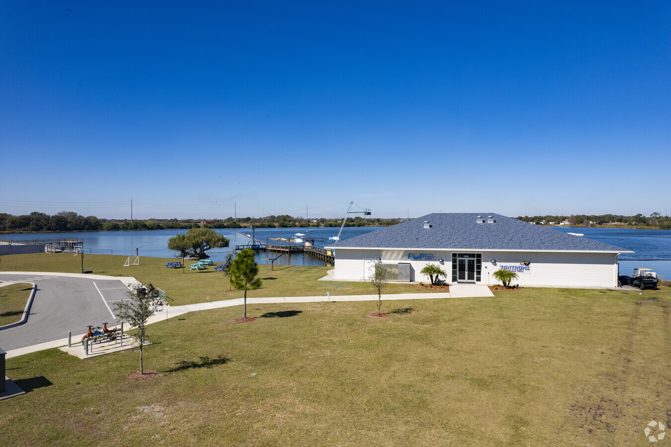
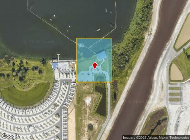
Property Record
330 Denton Ave, Auburndale, FL 33823


NEARBY LISTINGS FOR SALE OR LEASE
-
-
View all Auburndale listings for sale on LoopNet.com
Property Detail
330 Denton Ave
25-27-32-000000-022040
Alameda Heights
Storebuilding
COMM SE COR OF SEC RUN S89-53-16W 1024.97 FT TO NE COR OF SEC 5 T28S R25E RUN S89-49-32W 46.58 FT TO PT ON W R/W OF MYRTLE RD (NOW DENTON AVE) AS PER OR 3544 PG 2154 CONT S89-49-32W 219.26 FT TO PT LYING 30 FT E OF W LINE OF SE1/4 OF SE1/4 OF SEC N00
AE
Polk
12105C0330G
Florida
2023
4.26 AC
2023
Polk County
011604
Tampa/St Petersburg
3,804 SF
Lakeland-Winter Haven, FL
DEMOGRAPHICS near 330 Denton Ave
1 Mile
3 Mile
5 Mile
2024 Total Population
2,952
25,598
56,776
2029 Population
3,580
30,882
68,543
Pop Growth 2024-2029
+ 21.27%
+ 20.64%
+ 20.73%
Average Age
43
42
42
2024 Total Households
1,118
9,750
21,519
HH Growth 2024-2029
+ 21.20%
+ 20.55%
+ 20.71%
Median Household Inc
$76,984
$64,493
$58,741
Avg Household Size
2.60
2.60
2.60
2024 Avg HH Vehicles
2.00
2.00
2.00
Median Home Value
$261,705
$212,708
$196,859
Median Year Built
1993
1992
1990
Nearby Places
- Restaurants
- Banks
- Shops
- Fitness
- Groceries
SALE & LEASE HISTORY
LISTING DATE
SALE/LEASE

Jan 16, 2024
For Sale
Aug 13, 2020
For Sale
Nearby Properties
Address
Land Use
TOTAL SIZE
Lot Size
Zoning
Address
Land Use
TOTAL SIZE
Lot Size
Zoning
831,600 SF
51.22 AC
Address
Land Use
TOTAL SIZE
Lot Size
Zoning
811,392 SF
47.70 AC
Address
Land Use
TOTAL SIZE
Lot Size
Zoning
275,220 SF
94.52 AC
Address
Land Use
TOTAL SIZE
Lot Size
Zoning
422,812 SF
38.60 AC
Address
Land Use
TOTAL SIZE
Lot Size
Zoning
238,721 SF
11.66 AC
GI
Address
Land Use
TOTAL SIZE
Lot Size
Zoning
136,724 SF
4.62 AC
GI
Address
Land Use
TOTAL SIZE
Lot Size
Zoning
108,360 SF
4.23 AC
GI
Address
Land Use
TOTAL SIZE
Lot Size
Zoning
178,899 SF
10.09 AC
GI
Address
Land Use
TOTAL SIZE
Lot Size
Zoning
188,353 SF
29.12 AC
Address
Land Use
TOTAL SIZE
Lot Size
Zoning
291,428 SF
59.34 AC
Address
Land Use
TOTAL SIZE
Lot Size
Zoning
91,962 SF
19.46 AC
R4
Address
Land Use
TOTAL SIZE
Lot Size
Zoning
135,247 SF
22.49 AC
C4
Address
Land Use
TOTAL SIZE
Lot Size
Zoning
191,975 SF
14.28 AC
HI
Address
Land Use
TOTAL SIZE
Lot Size
Zoning
126,384 SF
4.67 AC
CH
Address
Land Use
TOTAL SIZE
Lot Size
Zoning
42,400 SF
121.06 AC
RC
Address
Land Use
TOTAL SIZE
Lot Size
Zoning
30,568 SF
60.79 AC
RC
Address
Land Use
TOTAL SIZE
Lot Size
Zoning
30,898 SF
7.27 AC
Address
Land Use
TOTAL SIZE
Lot Size
Zoning
113,410 SF
19.78 AC
C4
Address
Land Use
TOTAL SIZE
Lot Size
Zoning
23,800 SF
2.94 AC
Address
Land Use
TOTAL SIZE
Lot Size
Zoning
58,918 SF
2.44 AC
LI
Address
Land Use
TOTAL SIZE
Lot Size
Zoning
151,567 SF
6.34 AC
GI
Address
Land Use
TOTAL SIZE
Lot Size
Zoning
80,100 SF
4.68 AC
GI
Address
Land Use
TOTAL SIZE
Lot Size
Zoning
77,279 SF
12.12 AC
Address
Land Use
TOTAL SIZE
Lot Size
Zoning
Address
Land Use
TOTAL SIZE
Lot Size
Zoning
17,688 SF
3.16 AC
C3
Address
Land Use
TOTAL SIZE
Lot Size
Zoning
54,204 SF
9.09 AC
Address
Land Use
TOTAL SIZE
Lot Size
Zoning
178,950 SF
26.20 AC
PUD
Address
Land Use
TOTAL SIZE
Lot Size
Zoning
6,032 SF
2.26 AC
Address
Land Use
TOTAL SIZE
Lot Size
Zoning
35,397 SF
1.90 AC
Address
Land Use
TOTAL SIZE
Lot Size
Zoning
17,760 SF
2.62 AC
The World's #1 Commercial Real Estate Marketplace
Connect with us
© 2025 CoStar Group
The information above has been obtained from sources believed reliable. While we do not doubt its accuracy we have not verified it and make no guarantee, warranty or representation about it. It is your responsibility to independently confirm its accuracy and completeness. Any projections, opinions, assumptions, or estimates used are for example only and do not represent the current or future performance of the property. The value of this transaction to you depends on tax and other factors which should be evaluated by your tax, financial, and legal advisors. You and your advisors should conduct a careful, independent investigation of the property to determine to your satisfaction the suitability of the property for your needs.