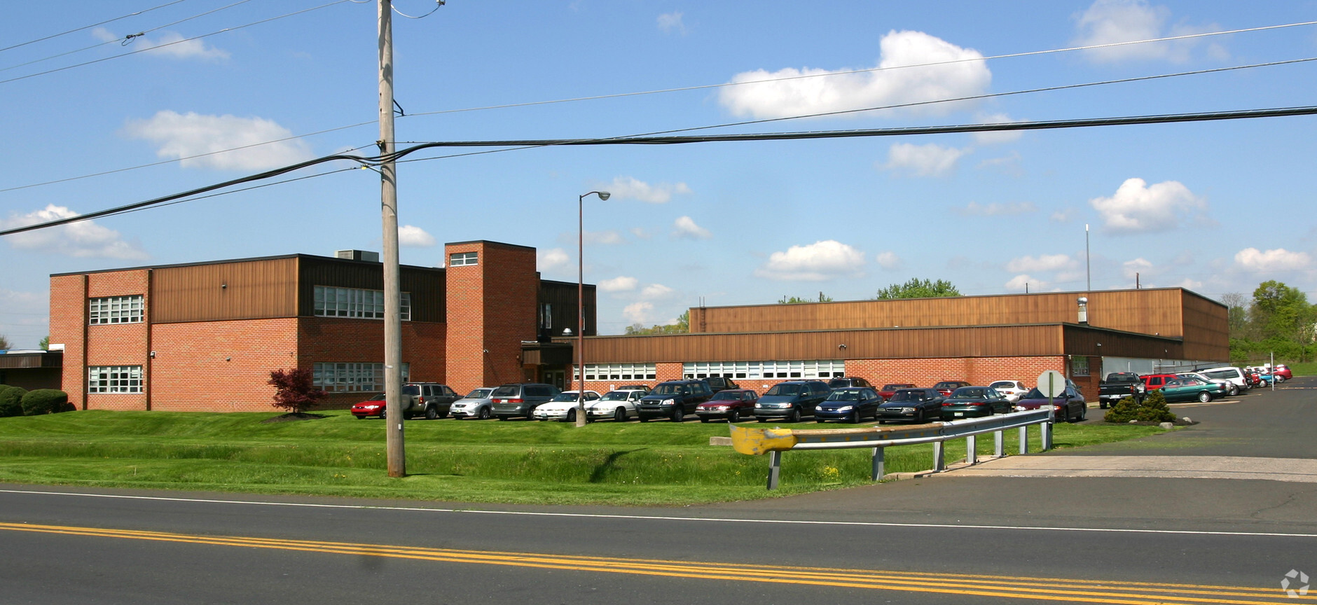
Property Record
330 Jacksonville Rd, Warminster, PA 18974
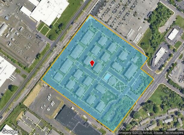
NEARBY LISTINGS FOR SALE OR LEASE
Property Detail
330 Jacksonville Rd
Philadelphia-Camden-Wilmington, PA-NJ-DE-MD
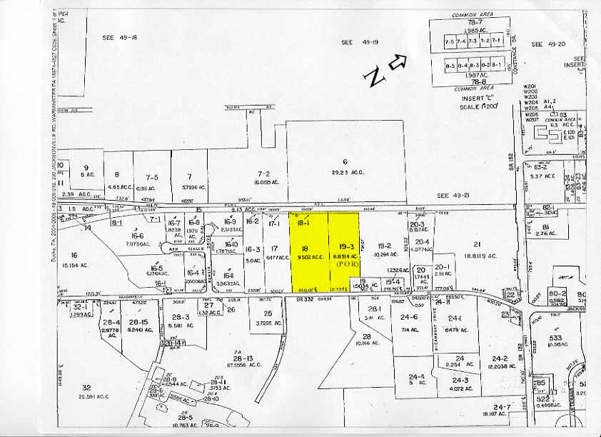
Alta/Acsm Land Title Surv
49-009-018
15.961AC WS SR332 882 N OF BONAIR DR 668 ON JACKSONVILLE RD
Apartment
Bucks
X
Pennsylvania
42017C0404J
9
2024
15.96 AC
2024
Bucks
101605
Philadelphia
29,308 SF
DEMOGRAPHICS near 330 Jacksonville Rd
1 Mile
3 Mile
5 Mile
2024 Total Population
16,877
89,343
186,405
2029 Population
17,365
90,601
188,457
Pop Growth 2024-2029
+ 2.89%
+ 1.41%
+ 1.10%
Average Age
41
44
43
2024 Total Households
7,068
36,496
71,221
HH Growth 2024-2029
+ 3.11%
+ 1.50%
+ 1.20%
Median Household Inc
$75,230
$85,331
$100,263
Avg Household Size
2.30
2.40
2.50
2024 Avg HH Vehicles
2.00
2.00
2.00
Median Home Value
$306,860
$348,813
$375,758
Median Year Built
1969
1969
1970
Nearby Places
- Restaurants
- Banks
- Shops
- Fitness
- Groceries
PUBLIC TRANSPORTATION
COMMUTER RAIL
Warminster (R2 - Southeastern Pennsylvania Transportation Authority Regional Rail (SEPTA Regional Rail))
DRIVE
WALK
Distance
Warminster (R2 - Southeastern Pennsylvania Transportation Authority Regional Rail (SEPTA Regional Rail))
3 min
10 min
0.5 mi
Hatboro (R2 - Southeastern Pennsylvania Transportation Authority Regional Rail (SEPTA Regional Rail))
DRIVE
WALK
Distance
Hatboro (R2 - Southeastern Pennsylvania Transportation Authority Regional Rail (SEPTA Regional Rail))
4 min
1.5 mi
AIRPORT
Trenton Mercer
DRIVE
WALK
Distance
Trenton Mercer
36 min
20.0 mi
Philadelphia International
DRIVE
WALK
Distance
Philadelphia International
55 min
32.2 mi
Freight Ports
Port of Philadelphia
DRIVE
WALK
Distance
Port of Philadelphia
33 min
18.0 mi
Nearby Properties
Address
Land Use
TOTAL SIZE
Lot Size
Zoning
Address
Land Use
TOTAL SIZE
Lot Size
Zoning
377,044 SF
58.73 AC
INST
Address
Land Use
TOTAL SIZE
Lot Size
Zoning
571,213 SF
67.31 AC
M
Address
Land Use
TOTAL SIZE
Lot Size
Zoning
251,655 SF
48.95 AC
SC
Address
Land Use
TOTAL SIZE
Lot Size
Zoning
257,010 SF
34.12 AC
INST
Address
Land Use
TOTAL SIZE
Lot Size
Zoning
195,534 SF
14.23 AC
I1
Address
Land Use
TOTAL SIZE
Lot Size
Zoning
256,679 SF
14 AC
MI
Address
Land Use
TOTAL SIZE
Lot Size
Zoning
420,736 SF
29.47 AC
LI
Address
Land Use
TOTAL SIZE
Lot Size
Zoning
344,636 SF
25.02 AC
R7
Address
Land Use
TOTAL SIZE
Lot Size
Zoning
110,198 SF
12.18 AC
R2
Address
Land Use
TOTAL SIZE
Lot Size
Zoning
273,531 SF
11.11 AC
INST
Address
Land Use
TOTAL SIZE
Lot Size
Zoning
94,059 SF
19.22 AC
R4
Address
Land Use
TOTAL SIZE
Lot Size
Zoning
120,549 SF
10 AC
C2
Address
Land Use
TOTAL SIZE
Lot Size
Zoning
91,814 SF
38.63 AC
RC
Address
Land Use
TOTAL SIZE
Lot Size
Zoning
71,680 SF
8.12 AC
C1
Address
Land Use
TOTAL SIZE
Lot Size
Zoning
126,660 SF
17.26 AC
C2
Address
Land Use
TOTAL SIZE
Lot Size
Zoning
69,060 SF
18.68 AC
R1
Address
Land Use
TOTAL SIZE
Lot Size
Zoning
213,350 SF
11.78 AC
R7
Address
Land Use
TOTAL SIZE
Lot Size
Zoning
182,364 SF
21.06 AC
M
Address
Land Use
TOTAL SIZE
Lot Size
Zoning
141,532 SF
21.43 AC
R6
Address
Land Use
TOTAL SIZE
Lot Size
Zoning
148,942 SF
34.95 AC
R4
Address
Land Use
TOTAL SIZE
Lot Size
Zoning
157,870 SF
13.20 AC
I1
Address
Land Use
TOTAL SIZE
Lot Size
Zoning
240,682 SF
4.81 AC
HI
Address
Land Use
TOTAL SIZE
Lot Size
Zoning
96,823 SF
9.77 AC
INST
Address
Land Use
TOTAL SIZE
Lot Size
Zoning
60,945 SF
74.12 AC
Address
Land Use
TOTAL SIZE
Lot Size
Zoning
318,625 SF
19.01 AC
I
Address
Land Use
TOTAL SIZE
Lot Size
Zoning
125,387 SF
4.10 AC
RC2
Address
Land Use
TOTAL SIZE
Lot Size
Zoning
114,156 SF
10.38 AC
I1
Address
Land Use
TOTAL SIZE
Lot Size
Zoning
72,032 SF
4.47 AC
C2
Address
Land Use
TOTAL SIZE
Lot Size
Zoning
82,880 SF
8.86 AC
I
Address
Land Use
TOTAL SIZE
Lot Size
Zoning
220,338 SF
16.76 AC
M
The World's #1 Commercial Real Estate Marketplace
Connect with us
© 2025 CoStar Group
The information above has been obtained from sources believed reliable. While we do not doubt its accuracy we have not verified it and make no guarantee, warranty or representation about it. It is your responsibility to independently confirm its accuracy and completeness. Any projections, opinions, assumptions, or estimates used are for example only and do not represent the current or future performance of the property. The value of this transaction to you depends on tax and other factors which should be evaluated by your tax, financial, and legal advisors. You and your advisors should conduct a careful, independent investigation of the property to determine to your satisfaction the suitability of the property for your needs.