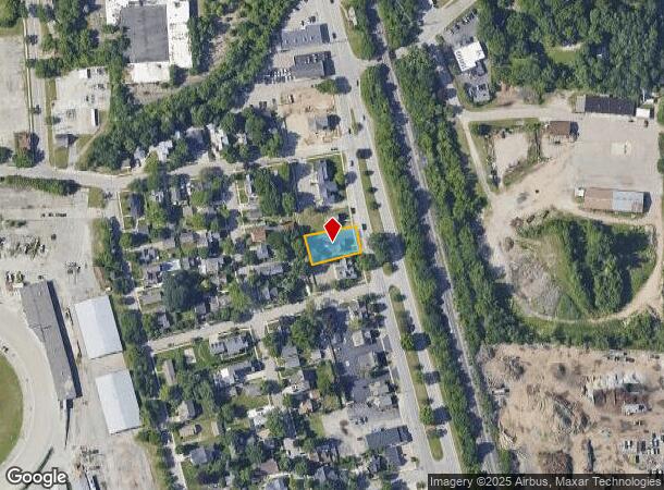
Property Record
330 S Main St, Northville, MI 48167


NEARBY LISTINGS FOR SALE OR LEASE
Property Detail
330 S Main St
Detroit-Warren-Dearborn, MI
Assrs Northville
48-004-02-0100-302
03N101A LOT 101 AND A PT OF LOT 100 ASSESSORS NORTHVILLE PLAT NO 1 DESC AS BEG AT THE SE COR OF LOT 101 FOR A POB; TH S 75DEG 06M 00S W 132.00 FT; TH N 14DEG 55M 18S W 81.32 FT; TH N 80DEG 13M 09S E 132.48 FT; TH S 14DEG 57M 57S E 69.50 FT TO THE POB
Commercialnec
Wayne
X
Michigan
26163C0036E
100-101
2025
0.22 AC
2025
Southern I-275 Corridor
560100
Detroit
2,834 SF
DEMOGRAPHICS near 330 S Main St
1 Mile
3 Mile
5 Mile
2024 Total Population
8,807
60,045
151,934
2029 Population
8,551
58,481
147,753
Pop Growth 2024-2029
(2.91%)
(2.60%)
(2.75%)
Average Age
44
43
42
2024 Total Households
4,297
24,108
62,127
HH Growth 2024-2029
(2.93%)
(2.54%)
(2.76%)
Median Household Inc
$92,248
$120,511
$112,137
Avg Household Size
2.00
2.40
2.40
2024 Avg HH Vehicles
2.00
2.00
2.00
Median Home Value
$342,051
$413,335
$371,618
Median Year Built
1976
1984
1982
Nearby Places
Map Layers
Map Styles
 Street
 Aerial
- Restaurants
- Banks
- Shops
- Fitness
- Groceries
PUBLIC TRANSPORTATION
AIRPORT
Detroit Metro Wayne County
DRIVE
WALK
Distance
Detroit Metro Wayne County
30 min
23.6 mi
Windsor International
DRIVE
WALK
Distance
Windsor International
57 min
36.7 mi
Freight Ports
Port of Toledo
DRIVE
WALK
Distance
Port of Toledo
80 min
65.2 mi
Nearby Properties
Address
Land Use
TOTAL SIZE
Lot Size
Zoning
Address
Land Use
TOTAL SIZE
Lot Size
Zoning
57.28 AC
RM-1
Address
Land Use
TOTAL SIZE
Lot Size
Zoning
250,699 SF
16.89 AC
SH
Address
Land Use
TOTAL SIZE
Lot Size
Zoning
182,121 SF
10.85 AC
HPUD
Address
Land Use
TOTAL SIZE
Lot Size
Zoning
42.06 AC
RM-1
Address
Land Use
TOTAL SIZE
Lot Size
Zoning
38 AC
RM-1
Address
Land Use
TOTAL SIZE
Lot Size
Zoning
102,878 SF
10.48 AC
CJ
Address
Land Use
TOTAL SIZE
Lot Size
Zoning
289,722 SF
7.34 AC
C-2
Address
Land Use
TOTAL SIZE
Lot Size
Zoning
334,346 SF
55.65 AC
TAR
Address
Land Use
TOTAL SIZE
Lot Size
Zoning
30.32 AC
RM-1
Address
Land Use
TOTAL SIZE
Lot Size
Zoning
5,339 SF
20.10 AC
R-3
Address
Land Use
TOTAL SIZE
Lot Size
Zoning
206,496 SF
12.72 AC
PO
Address
Land Use
TOTAL SIZE
Lot Size
Zoning
80,574 SF
19.95 AC
7MIPUD
Address
Land Use
TOTAL SIZE
Lot Size
Zoning
9,706 SF
40.41 AC
RM-1
Address
Land Use
TOTAL SIZE
Lot Size
Zoning
99,826 SF
ORT
Address
Land Use
TOTAL SIZE
Lot Size
Zoning
129,448 SF
9.37 AC
OSC
Address
Land Use
TOTAL SIZE
Lot Size
Zoning
110,220 SF
0.78 AC
CBD
Address
Land Use
TOTAL SIZE
Lot Size
Zoning
46.60 AC
R-3
Address
Land Use
TOTAL SIZE
Lot Size
Zoning
78,164 SF
5.51 AC
PUD
Address
Land Use
TOTAL SIZE
Lot Size
Zoning
510.78 AC
R-2
Address
Land Use
TOTAL SIZE
Lot Size
Zoning
66,109 SF
35.02 AC
PO
Address
Land Use
TOTAL SIZE
Lot Size
Zoning
976 SF
26.85 AC
RM-1
Address
Land Use
TOTAL SIZE
Lot Size
Zoning
152,414 SF
13.91 AC
RM-1
Address
Land Use
TOTAL SIZE
Lot Size
Zoning
103,075 SF
8.15 AC
PUD
Address
Land Use
TOTAL SIZE
Lot Size
Zoning
16.54 AC
RM-1
Address
Land Use
TOTAL SIZE
Lot Size
Zoning
237,049 SF
27.23 AC
B-3
Address
Land Use
TOTAL SIZE
Lot Size
Zoning
25.57 AC
RM-1
Address
Land Use
TOTAL SIZE
Lot Size
Zoning
19.68 AC
RM-1
Address
Land Use
TOTAL SIZE
Lot Size
Zoning
113,994 SF
6.32 AC
SH
Address
Land Use
TOTAL SIZE
Lot Size
Zoning
135,586 SF
8.08 AC
IND
Address
Land Use
TOTAL SIZE
Lot Size
Zoning
191,759 SF
26.11 AC
ORT
The World's #1 Commercial Real Estate Marketplace
Connect with us
© 2025 CoStar Group
The information above has been obtained from sources believed reliable. While we do not doubt its accuracy we have not verified it and make no guarantee, warranty or representation about it. It is your responsibility to independently confirm its accuracy and completeness. Any projections, opinions, assumptions, or estimates used are for example only and do not represent the current or future performance of the property. The value of this transaction to you depends on tax and other factors which should be evaluated by your tax, financial, and legal advisors. You and your advisors should conduct a careful, independent investigation of the property to determine to your satisfaction the suitability of the property for your needs.