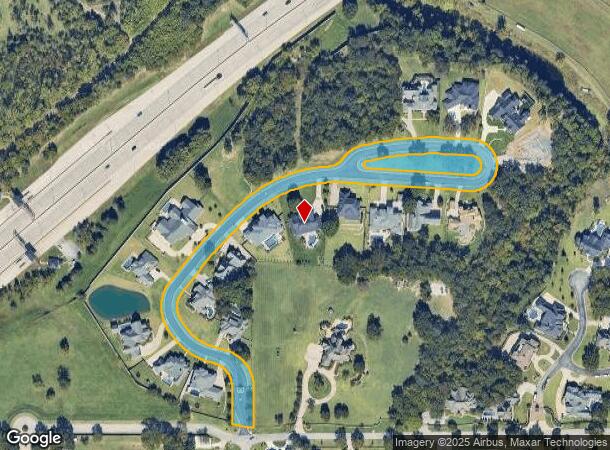
Property Record
10535 S Koa St, Jenks, OK 74037


NEARBY LISTINGS FOR SALE OR LEASE
Property Detail
10535 S Koa St
Tulsa, OK
Fountain Ridge
60696-82-25-68420
RESERVE A
Residentialacreage
Tulsa
X
Oklahoma
40143C0363L
a
2023
2.66 AC
2024
Tulsa CBD
006710
Tulsa
DEMOGRAPHICS near 10535 S Koa St
1 Mile
3 Mile
5 Mile
2024 Total Population
10,764
75,625
164,065
2029 Population
11,478
79,194
171,200
Pop Growth 2024-2029
+ 6.63%
+ 4.72%
+ 4.35%
Average Age
40
38
39
2024 Total Households
5,183
32,539
70,504
HH Growth 2024-2029
+ 7.76%
+ 5.07%
+ 4.50%
Median Household Inc
$49,015
$46,932
$48,331
Avg Household Size
1.60
2.10
2.20
2024 Avg HH Vehicles
1.00
2.00
2.00
Median Home Value
$163,301
$178,742
$151,003
Median Year Built
1962
1954
1955
Nearby Places
- Restaurants
- Banks
- Shops
- Fitness
- Groceries
PUBLIC TRANSPORTATION
AIRPORT
Tulsa International
DRIVE
WALK
Distance
Tulsa International
32 min
22.4 mi
Freight Ports
Tulsa Port Of Catoosa
DRIVE
WALK
Distance
Tulsa Port Of Catoosa
36 min
27.4 mi
Nearby Properties
Address
Land Use
TOTAL SIZE
Lot Size
Zoning
Address
Land Use
TOTAL SIZE
Lot Size
Zoning
1,648,051 SF
84.41 AC
AG
Address
Land Use
TOTAL SIZE
Lot Size
Zoning
815,416 SF
149.86 AC
RS3
Address
Land Use
TOTAL SIZE
Lot Size
Zoning
325 SF
44.06 AC
RM2
Address
Land Use
TOTAL SIZE
Lot Size
Zoning
415.28 AC
IL
Address
Land Use
TOTAL SIZE
Lot Size
Zoning
58,907 SF
5 AC
CG
Address
Land Use
TOTAL SIZE
Lot Size
Zoning
301,267 SF
25.06 AC
IL
Address
Land Use
TOTAL SIZE
Lot Size
Zoning
6,338 SF
104.15 AC
AG
Address
Land Use
TOTAL SIZE
Lot Size
Zoning
107,538 SF
19.74 AC
OM
Address
Land Use
TOTAL SIZE
Lot Size
Zoning
58,977 SF
15.85 AC
CS
Address
Land Use
TOTAL SIZE
Lot Size
Zoning
2,178,542 SF
46.63 AC
OM
Address
Land Use
TOTAL SIZE
Lot Size
Zoning
30,418 SF
7.86 AC
CM
Address
Land Use
TOTAL SIZE
Lot Size
Zoning
1 SF
11.34 AC
CS
Address
Land Use
TOTAL SIZE
Lot Size
Zoning
365,433 SF
18.39 AC
CO
Address
Land Use
TOTAL SIZE
Lot Size
Zoning
81,732 SF
26.20 AC
AG
Address
Land Use
TOTAL SIZE
Lot Size
Zoning
49,025 SF
10.75 AC
AG
Address
Land Use
TOTAL SIZE
Lot Size
Zoning
20,286 SF
21.68 AC
AG
Address
Land Use
TOTAL SIZE
Lot Size
Zoning
13,691 SF
2.66 AC
CO
Address
Land Use
TOTAL SIZE
Lot Size
Zoning
240 SF
17.07 AC
OM
Address
Land Use
TOTAL SIZE
Lot Size
Zoning
72,746 SF
3.93 AC
AG
Address
Land Use
TOTAL SIZE
Lot Size
Zoning
87,304 SF
3.29 AC
CN
Address
Land Use
TOTAL SIZE
Lot Size
Zoning
137,364 SF
14.64 AC
RS3
Address
Land Use
TOTAL SIZE
Lot Size
Zoning
14,496 SF
100.21 AC
AG
Address
Land Use
TOTAL SIZE
Lot Size
Zoning
300,577 SF
13.74 AC
RM1
Address
Land Use
TOTAL SIZE
Lot Size
Zoning
8.09 AC
CS
Address
Land Use
TOTAL SIZE
Lot Size
Zoning
15,636 SF
4.91 AC
AG
Address
Land Use
TOTAL SIZE
Lot Size
Zoning
186,012 SF
9.31 AC
RS3
Address
Land Use
TOTAL SIZE
Lot Size
Zoning
1 SF
25.77 AC
AG
Address
Land Use
TOTAL SIZE
Lot Size
Zoning
25,555 SF
17.31 AC
CN
Address
Land Use
TOTAL SIZE
Lot Size
Zoning
23,474 SF
0.32 AC
CH
Address
Land Use
TOTAL SIZE
Lot Size
Zoning
331,125 SF
17.64 AC
CG
The World's #1 Commercial Real Estate Marketplace
Connect with us
© 2025 CoStar Group
The information above has been obtained from sources believed reliable. While we do not doubt its accuracy we have not verified it and make no guarantee, warranty or representation about it. It is your responsibility to independently confirm its accuracy and completeness. Any projections, opinions, assumptions, or estimates used are for example only and do not represent the current or future performance of the property. The value of this transaction to you depends on tax and other factors which should be evaluated by your tax, financial, and legal advisors. You and your advisors should conduct a careful, independent investigation of the property to determine to your satisfaction the suitability of the property for your needs.