Property Record
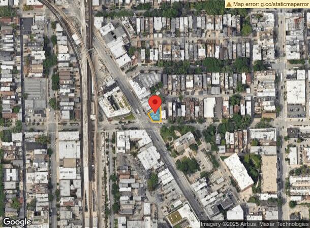
3301 N Clark St, Chicago, IL 60657
NEARBY LISTINGS FOR SALE OR LEASE
Property Detail
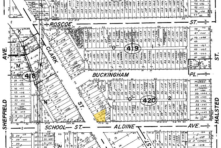
3301 N Clark St
Chicago-Naperville-Elgin, IL-IN-WI
Buckinghams Sub
14-20-420-053-0000
(BUCKINGHAMS) SUB OF LT4 OF CIRCUIT COURT PARTN OF N3 /4 OF EH SE SEC 20-40-14
Commercialnec
Cook
X
Illinois
17031C0409K
4
2022
0.08 AC
2024
Lakeview
062100
Chicago
8,874 SF
DEMOGRAPHICS near 3301 N Clark St
1 Mile
3 Mile
5 Mile
2024 Total Population
106,758
437,411
1,014,879
2029 Population
103,997
424,646
981,889
Pop Growth 2024-2029
(2.59%)
(2.92%)
(3.25%)
Average Age
35
37
37
2024 Total Households
60,500
227,756
493,718
HH Growth 2024-2029
(2.81%)
(3.08%)
(3.16%)
Median Household Inc
$95,199
$97,563
$90,972
Avg Household Size
1.70
1.90
2.00
2024 Avg HH Vehicles
1.00
1.00
1.00
Median Home Value
$475,439
$512,945
$454,002
Median Year Built
1962
1959
1959
Nearby Places
- Restaurants
- Banks
- Shops
- Fitness
- Groceries
PUBLIC TRANSPORTATION
TRANSIT/SUBWAY
Belmont Station (Brown, Purple, Red Lines) (Brown Line - Chicago Transit Authority "L" Trains (The "L"), Purple Line - Chicago Transit Authority "L" Trains (The "L"), Red Line - Chicago Transit Authority "L" Trains (The "L"))
DRIVE
WALK
Distance
Belmont Station (Brown, Purple, Red Lines) (Brown Line - Chicago Transit Authority "L" Trains (The "L"), Purple Line - Chicago Transit Authority "L" Trains (The "L"), Red Line - Chicago Transit Authority "L" Trains (The "L"))
1 min
5 min
0.3 mi
Addison Station (Red Line) (Red Line - Chicago Transit Authority "L" Trains (The "L"))
DRIVE
WALK
Distance
Addison Station (Red Line) (Red Line - Chicago Transit Authority "L" Trains (The "L"))
1 min
8 min
0.4 mi
Wellington Station (Brown Line - Chicago Transit Authority "L" Trains (The "L"), Purple Line - Chicago Transit Authority "L" Trains (The "L"))
DRIVE
WALK
Distance
Wellington Station (Brown Line - Chicago Transit Authority "L" Trains (The "L"), Purple Line - Chicago Transit Authority "L" Trains (The "L"))
2 min
9 min
0.5 mi
Southport Station (Brown Line - Chicago Transit Authority "L" Trains (The "L"))
DRIVE
WALK
Distance
Southport Station (Brown Line - Chicago Transit Authority "L" Trains (The "L"))
2 min
13 min
0.7 mi
Diversey Station (Brown Line - Chicago Transit Authority "L" Trains (The "L"), Purple Line - Chicago Transit Authority "L" Trains (The "L"))
DRIVE
WALK
Distance
Diversey Station (Brown Line - Chicago Transit Authority "L" Trains (The "L"), Purple Line - Chicago Transit Authority "L" Trains (The "L"))
2 min
15 min
0.8 mi
COMMUTER RAIL
Ravenswood Station (Union Pacific North Line - Northeast Illinois Regional Commuter Railroad (Metra))
DRIVE
WALK
Distance
Ravenswood Station (Union Pacific North Line - Northeast Illinois Regional Commuter Railroad (Metra))
6 min
2.4 mi
Clybourn Station (Union Pacific North Line - Northeast Illinois Regional Commuter Railroad (Metra), Union Pacific Northwest Line - Northeast Illinois Regional Commuter Railroad (Metra))
DRIVE
WALK
Distance
Clybourn Station (Union Pacific North Line - Northeast Illinois Regional Commuter Railroad (Metra), Union Pacific Northwest Line - Northeast Illinois Regional Commuter Railroad (Metra))
6 min
2.8 mi
AIRPORT
Chicago Midway International
DRIVE
WALK
Distance
Chicago Midway International
26 min
14.6 mi
Chicago O'Hare International
DRIVE
WALK
Distance
Chicago O'Hare International
24 min
14.7 mi
Freight Ports
Port Milwaukee
DRIVE
WALK
Distance
Port Milwaukee
102 min
82.9 mi
SALE & LEASE HISTORY
LISTING DATE
SALE/LEASE

Oct 07, 2024
For Sale
Nov 08, 2021
For Sale
Jan 04, 2024
For Lease
Feb 19, 2024
For Lease
Nearby Properties
Address
Land Use
TOTAL SIZE
Lot Size
Zoning
Address
Land Use
TOTAL SIZE
Lot Size
Zoning
1.09 AC
B1-3
Address
Land Use
TOTAL SIZE
Lot Size
Zoning
228,018 SF
8.72 AC
PD 958
Address
Land Use
TOTAL SIZE
Lot Size
Zoning
134,668 SF
0.28 AC
PD 1291
Address
Land Use
TOTAL SIZE
Lot Size
Zoning
266,248 SF
Address
Land Use
TOTAL SIZE
Lot Size
Zoning
602,197 SF
Address
Land Use
TOTAL SIZE
Lot Size
Zoning
623,912 SF
Address
Land Use
TOTAL SIZE
Lot Size
Zoning
222,240 SF
2.45 AC
PD 1439
Address
Land Use
TOTAL SIZE
Lot Size
Zoning
0.96 AC
PD 958
Address
Land Use
TOTAL SIZE
Lot Size
Zoning
652,620 SF
Address
Land Use
TOTAL SIZE
Lot Size
Zoning
61,300 SF
0.30 AC
B3-5
Address
Land Use
TOTAL SIZE
Lot Size
Zoning
1,426,524 SF
2.15 AC
RM-6.5
Address
Land Use
TOTAL SIZE
Lot Size
Zoning
24,296 SF
0.25 AC
RM-5
Address
Land Use
TOTAL SIZE
Lot Size
Zoning
434,320 SF
1.16 AC
C3-5
Address
Land Use
TOTAL SIZE
Lot Size
Zoning
311,612 SF
2.40 AC
PD 1096
Address
Land Use
TOTAL SIZE
Lot Size
Zoning
73,338 SF
0.19 AC
B3-5
Address
Land Use
TOTAL SIZE
Lot Size
Zoning
376,302 SF
PD 1019
Address
Land Use
TOTAL SIZE
Lot Size
Zoning
16.93 AC
POS-1,PD 1
Address
Land Use
TOTAL SIZE
Lot Size
Zoning
268,778 SF
0.59 AC
RM-6.5
Address
Land Use
TOTAL SIZE
Lot Size
Zoning
19,500 SF
12.06 AC
PD 367
Address
Land Use
TOTAL SIZE
Lot Size
Zoning
1.32 AC
PD 1398
Address
Land Use
TOTAL SIZE
Lot Size
Zoning
0.21 AC
B1-3
Address
Land Use
TOTAL SIZE
Lot Size
Zoning
1.06 AC
PD 157
Address
Land Use
TOTAL SIZE
Lot Size
Zoning
141,105 SF
3.49 AC
PD 667
Address
Land Use
TOTAL SIZE
Lot Size
Zoning
82,000 SF
9.68 AC
PD 437
Address
Land Use
TOTAL SIZE
Lot Size
Zoning
255,926 SF
0.73 AC
RM-6.5
Address
Land Use
TOTAL SIZE
Lot Size
Zoning
301,100 SF
2.20 AC
PD 37
Address
Land Use
TOTAL SIZE
Lot Size
Zoning
0.64 AC
PD 158
Address
Land Use
TOTAL SIZE
Lot Size
Zoning
0.81 AC
PD 158
Address
Land Use
TOTAL SIZE
Lot Size
Zoning
170,538 SF
0.76 AC
PD 112
Address
Land Use
TOTAL SIZE
Lot Size
Zoning
164,719 SF
0.20 AC
RM-6.5
The World's #1 Commercial Real Estate Marketplace
Connect with us
© 2025 CoStar Group
The information above has been obtained from sources believed reliable. While we do not doubt its accuracy we have not verified it and make no guarantee, warranty or representation about it. It is your responsibility to independently confirm its accuracy and completeness. Any projections, opinions, assumptions, or estimates used are for example only and do not represent the current or future performance of the property. The value of this transaction to you depends on tax and other factors which should be evaluated by your tax, financial, and legal advisors. You and your advisors should conduct a careful, independent investigation of the property to determine to your satisfaction the suitability of the property for your needs.