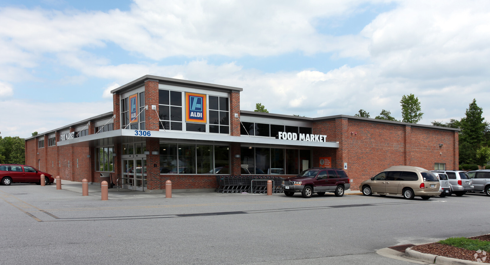
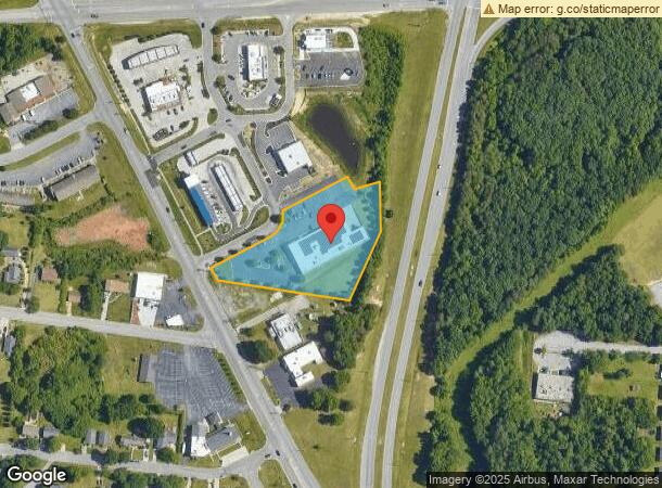
Property Record
3306 N Main St, High Point, NC 27265
NEARBY LISTINGS FOR SALE OR LEASE
Property Detail
3306 N Main St
Greensboro-High Point, NC
N Main
0198460
ALDI/N MAIN/171-15
Commercialnec
Guilford
X
North Carolina
3710689200K
5
2023
2.33 AC
2023
High Point/SW Guilford Cty
014407
Greensboro/Winston-Salem
18,782 SF
DEMOGRAPHICS near 3306 N Main St
1 Mile
3 Mile
5 Mile
2024 Total Population
6,114
42,338
105,564
2029 Population
6,172
42,608
106,734
Pop Growth 2024-2029
+ 0.95%
+ 0.64%
+ 1.11%
Average Age
40
40
40
2024 Total Households
2,647
16,481
40,984
HH Growth 2024-2029
+ 0.76%
+ 0.62%
+ 1.11%
Median Household Inc
$53,442
$62,001
$57,964
Avg Household Size
2.30
2.30
2.40
2024 Avg HH Vehicles
2.00
2.00
2.00
Median Home Value
$177,247
$197,105
$205,167
Median Year Built
1988
1979
1983
Nearby Places
- Restaurants
- Banks
- Shops
- Fitness
- Groceries
PUBLIC TRANSPORTATION
AIRPORT
Piedmont Triad International
DRIVE
WALK
Distance
Piedmont Triad International
24 min
12.2 mi
Nearby Properties
Address
Land Use
TOTAL SIZE
Lot Size
Zoning
Address
Land Use
TOTAL SIZE
Lot Size
Zoning
256,051 SF
37.69 AC
CU-LI
Address
Land Use
TOTAL SIZE
Lot Size
Zoning
236,597 SF
13.83 AC
CU-PI
Address
Land Use
TOTAL SIZE
Lot Size
Zoning
806,200 SF
114.96 AC
CZ-LI-HP
Address
Land Use
TOTAL SIZE
Lot Size
Zoning
35,604 SF
40.16 AC
PDH
Address
Land Use
TOTAL SIZE
Lot Size
Zoning
136,202 SF
30.02 AC
CZ-I
Address
Land Use
TOTAL SIZE
Lot Size
Zoning
240,936 SF
12.02 AC
PDM
Address
Land Use
TOTAL SIZE
Lot Size
Zoning
215,222 SF
15.14 AC
CU-SC
Address
Land Use
TOTAL SIZE
Lot Size
Zoning
185,320 SF
15.08 AC
PI
Address
Land Use
TOTAL SIZE
Lot Size
Zoning
170,183 SF
13.94 AC
RM-16
Address
Land Use
TOTAL SIZE
Lot Size
Zoning
166,196 SF
19.99 AC
RM-16
Address
Land Use
TOTAL SIZE
Lot Size
Zoning
164,027 SF
12.52 AC
RM-16
Address
Land Use
TOTAL SIZE
Lot Size
Zoning
56,029 SF
9.36 AC
CU-GB
Address
Land Use
TOTAL SIZE
Lot Size
Zoning
250,573 SF
48.53 AC
R-5
Address
Land Use
TOTAL SIZE
Lot Size
Zoning
181,106 SF
16.23 AC
RM-16
Address
Land Use
TOTAL SIZE
Lot Size
Zoning
161,377 SF
16.36 AC
CU-SC
Address
Land Use
TOTAL SIZE
Lot Size
Zoning
132,924 SF
12.99 AC
RM-16
Address
Land Use
TOTAL SIZE
Lot Size
Zoning
244,197 SF
14.76 AC
RM-26
Address
Land Use
TOTAL SIZE
Lot Size
Zoning
133,710 SF
8.70 AC
PI
Address
Land Use
TOTAL SIZE
Lot Size
Zoning
291,142 SF
11.01 AC
RC
Address
Land Use
TOTAL SIZE
Lot Size
Zoning
184,724 SF
15.71 AC
RM-16
Address
Land Use
TOTAL SIZE
Lot Size
Zoning
131,187 SF
13.89 AC
CU-GO-M
Address
Land Use
TOTAL SIZE
Lot Size
Zoning
65,520 SF
3.88 AC
GB
Address
Land Use
TOTAL SIZE
Lot Size
Zoning
11,116 SF
2.60 AC
MS
Address
Land Use
TOTAL SIZE
Lot Size
Zoning
101,625 SF
4.97 AC
CZ-I
Address
Land Use
TOTAL SIZE
Lot Size
Zoning
111,193 SF
11.36 AC
CU-SC
Address
Land Use
TOTAL SIZE
Lot Size
Zoning
74,786 SF
10.61 AC
CU-HB
Address
Land Use
TOTAL SIZE
Lot Size
Zoning
666,462 SF
44.09 AC
CU-RC
Address
Land Use
TOTAL SIZE
Lot Size
Zoning
67,497 SF
5.95 AC
CU-SC
Address
Land Use
TOTAL SIZE
Lot Size
Zoning
49,030 SF
5.03 AC
CU-GO-M
Address
Land Use
TOTAL SIZE
Lot Size
Zoning
146,216 SF
12.79 AC
RM-16
The World's #1 Commercial Real Estate Marketplace
Connect with us
© 2025 CoStar Group
The information above has been obtained from sources believed reliable. While we do not doubt its accuracy we have not verified it and make no guarantee, warranty or representation about it. It is your responsibility to independently confirm its accuracy and completeness. Any projections, opinions, assumptions, or estimates used are for example only and do not represent the current or future performance of the property. The value of this transaction to you depends on tax and other factors which should be evaluated by your tax, financial, and legal advisors. You and your advisors should conduct a careful, independent investigation of the property to determine to your satisfaction the suitability of the property for your needs.