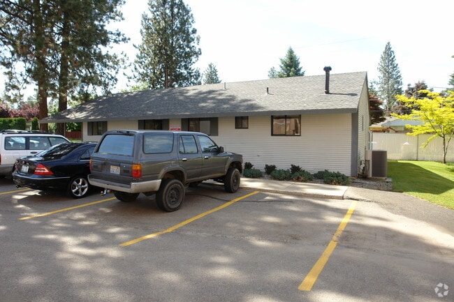
Property Record
3321 W Indian Trail Rd, Spokane, WA 99208


NEARBY LISTINGS FOR SALE OR LEASE
Property Detail
3321 W Indian Trail Rd
Spokane-Spokane Valley, WA
Pacific Heights
26264.1912
PACIFIC HEIGHTS 1ST AMENDED PLAT PTN OF LT 1 BLK 8 LYG SLY OF FOLLOWING DESC LN; BEG AT MOST WLY COR OF SD BLK 8, TH SELY ALG MOST WLY LN 127FT TO POB OF SD LN, TH N 49DEG 37MIN 00SDS E 279.86FT TO MOST ELY LN OF SD BLK 8 & TERM OF SD LN
Storebuilding
Spokane
X
Washington
53063C0529D
1
2025
3.23 AC
2025
NW North Metro
000800
Spokane
39,530 SF
DEMOGRAPHICS near 3321 W Indian Trail Rd
1 Mile
3 Mile
5 Mile
2024 Total Population
14,026
85,724
185,398
2029 Population
14,853
90,897
196,985
Pop Growth 2024-2029
+ 5.90%
+ 6.03%
+ 6.25%
Average Age
40
39
39
2024 Total Households
5,385
33,641
75,414
HH Growth 2024-2029
+ 6.05%
+ 6.18%
+ 6.56%
Median Household Inc
$73,747
$67,943
$56,579
Avg Household Size
2.50
2.40
2.30
2024 Avg HH Vehicles
2.00
2.00
2.00
Median Home Value
$312,417
$318,122
$297,756
Median Year Built
1959
1964
1964
Nearby Places
Map Layers
Map Styles
 Street
 Aerial
- Restaurants
- Banks
- Shops
- Fitness
- Groceries
PUBLIC TRANSPORTATION
COMMUTER RAIL
Spokane (Empire Builder - Amtrak)
DRIVE
WALK
Distance
Spokane (Empire Builder - Amtrak)
15 min
5.8 mi
AIRPORT
Spokane International
DRIVE
WALK
Distance
Spokane International
22 min
10.5 mi
Freight Ports
Port of Everett
DRIVE
WALK
Distance
Port of Everett
350 min
306.1 mi
Nearby Properties
Address
Land Use
TOTAL SIZE
Lot Size
Zoning
Address
Land Use
TOTAL SIZE
Lot Size
Zoning
831,429 SF
119.79 AC
Address
Land Use
TOTAL SIZE
Lot Size
Zoning
531,295 SF
17.11 AC
CC2
Address
Land Use
TOTAL SIZE
Lot Size
Zoning
171,479 SF
67.30 AC
RSF
Address
Land Use
TOTAL SIZE
Lot Size
Zoning
188,040 SF
68.10 AC
UR
Address
Land Use
TOTAL SIZE
Lot Size
Zoning
139,485 SF
16.74 AC
RSF
Address
Land Use
TOTAL SIZE
Lot Size
Zoning
1,555,116 SF
23.12 AC
GC
Address
Land Use
TOTAL SIZE
Lot Size
Zoning
228,981 SF
5.32 AC
RHD
Address
Land Use
TOTAL SIZE
Lot Size
Zoning
56,600 SF
4.98 AC
GC
Address
Land Use
TOTAL SIZE
Lot Size
Zoning
159,508 SF
18.52 AC
RSF
Address
Land Use
TOTAL SIZE
Lot Size
Zoning
241,400 SF
11.57 AC
RMF
Address
Land Use
TOTAL SIZE
Lot Size
Zoning
158,348 SF
6.60 AC
RMF
Address
Land Use
TOTAL SIZE
Lot Size
Zoning
101,372 SF
5.48 AC
RMF
Address
Land Use
TOTAL SIZE
Lot Size
Zoning
76,559 SF
7.11 AC
LDR
Address
Land Use
TOTAL SIZE
Lot Size
Zoning
108 AC
RSF
Address
Land Use
TOTAL SIZE
Lot Size
Zoning
99,984 SF
4.45 AC
O
Address
Land Use
TOTAL SIZE
Lot Size
Zoning
172,140 SF
70.04 AC
RHD
Address
Land Use
TOTAL SIZE
Lot Size
Zoning
113,638 SF
34.05 AC
RSF
Address
Land Use
TOTAL SIZE
Lot Size
Zoning
114,377 SF
2.51 AC
RSF
Address
Land Use
TOTAL SIZE
Lot Size
Zoning
154,455 SF
11.29 AC
CC2
Address
Land Use
TOTAL SIZE
Lot Size
Zoning
28,400 SF
58.11 AC
RSF
Address
Land Use
TOTAL SIZE
Lot Size
Zoning
123,142 SF
2.22 AC
RHD
Address
Land Use
TOTAL SIZE
Lot Size
Zoning
103,755 SF
7.64 AC
CC2
Address
Land Use
TOTAL SIZE
Lot Size
Zoning
125,849 SF
6.78 AC
RMF
Address
Land Use
TOTAL SIZE
Lot Size
Zoning
79,576 SF
12.71 AC
GC
Address
Land Use
TOTAL SIZE
Lot Size
Zoning
120,573 SF
13.20 AC
GC
Address
Land Use
TOTAL SIZE
Lot Size
Zoning
61,261 SF
5.65 AC
RSF
Address
Land Use
TOTAL SIZE
Lot Size
Zoning
68,670 SF
19.71 AC
UR
Address
Land Use
TOTAL SIZE
Lot Size
Zoning
68,676 SF
7.08 AC
RSF
Address
Land Use
TOTAL SIZE
Lot Size
Zoning
88,824 SF
3.77 AC
RHD
Address
Land Use
TOTAL SIZE
Lot Size
Zoning
74,804 SF
2.87 AC
RHD
The World's #1 Commercial Real Estate Marketplace
Connect with us
© 2025 CoStar Group
The information above has been obtained from sources believed reliable. While we do not doubt its accuracy we have not verified it and make no guarantee, warranty or representation about it. It is your responsibility to independently confirm its accuracy and completeness. Any projections, opinions, assumptions, or estimates used are for example only and do not represent the current or future performance of the property. The value of this transaction to you depends on tax and other factors which should be evaluated by your tax, financial, and legal advisors. You and your advisors should conduct a careful, independent investigation of the property to determine to your satisfaction the suitability of the property for your needs.