Property Record
3323 Ridge Rd, Lansing, IL 60438
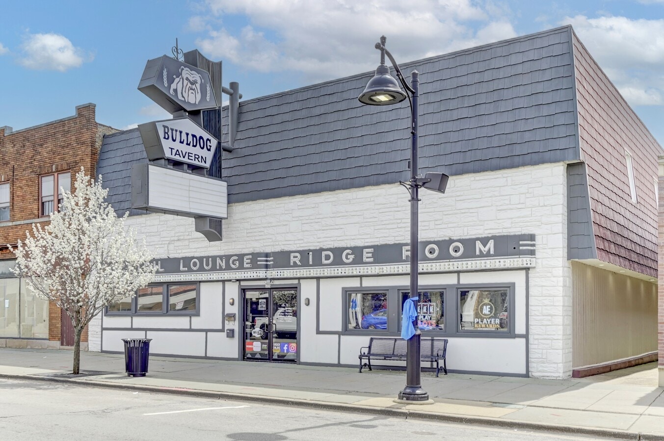
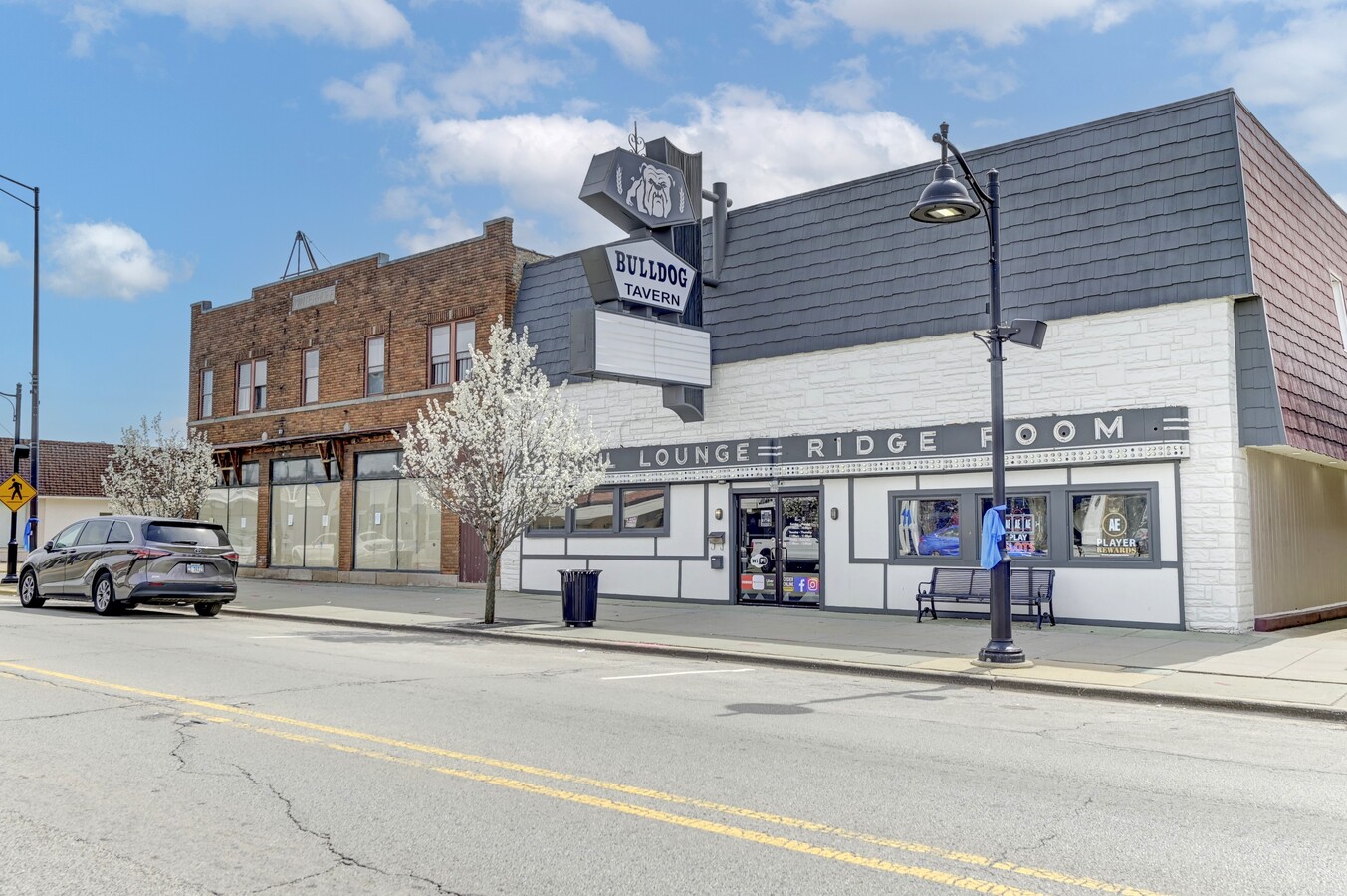
This Property Is For Sale
NEARBY LISTINGS FOR SALE OR LEASE
-
-
-
-
-
-
No Photo
-
-
-
-
-
-
-
-
-
-
View all Lansing listings for sale on LoopNet.com
Property Detail
3323 Ridge Rd
Chicago-Naperville-Elgin, IL-IN-WI
Lansing Central
30-32-302-005-0000
(LANSING)(CENTRAL) SUB EX N 147.5 FT OF E 147.5 FT TH EREOF OF NW SW SEC 32-36-15
Miscresidentialimprovement
Cook
X
Illinois
17031C0758J
2
2022
0.18 AC
2024
Near South Cook
828000
Chicago
3,536 SF
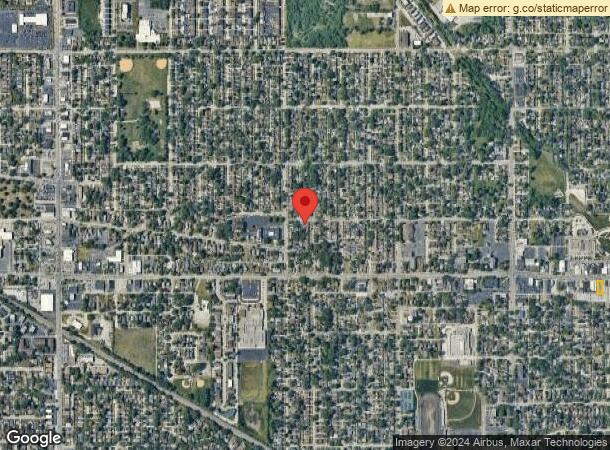
DEMOGRAPHICS near 3323 Ridge Rd
1 Mile
3 Mile
5 Mile
2024 Total Population
17,140
88,672
230,897
2029 Population
16,711
87,144
227,093
Pop Growth 2024-2029
(2.50%)
(1.72%)
(1.65%)
Average Age
40
41
40
2024 Total Households
6,630
34,108
88,407
HH Growth 2024-2029
(2.75%)
(1.89%)
(1.85%)
Median Household Inc
$65,594
$63,663
$61,260
Avg Household Size
2.50
2.50
2.50
2024 Avg HH Vehicles
2.00
2.00
2.00
Median Home Value
$162,072
$173,076
$164,649
Median Year Built
1961
1962
1964
Nearby Places
- Restaurants
- Banks
- Shops
- Fitness
- Groceries
PUBLIC TRANSPORTATION
COMMUTER RAIL
Dyer Amtrak (Cardinal - Amtrak)
DRIVE
WALK
Distance
Dyer Amtrak (Cardinal - Amtrak)
11 min
5.8 mi
AIRPORT
Chicago Midway International
DRIVE
WALK
Distance
Chicago Midway International
37 min
24.5 mi
Freight Ports
Port Milwaukee
DRIVE
WALK
Distance
Port Milwaukee
141 min
111.1 mi
Nearby Properties
Address
Land Use
TOTAL SIZE
Lot Size
Zoning
Address
Land Use
TOTAL SIZE
Lot Size
Zoning
879,191 SF
13.93 AC
Address
Land Use
TOTAL SIZE
Lot Size
Zoning
308,022 SF
31.98 AC
R33
Address
Land Use
TOTAL SIZE
Lot Size
Zoning
296,588 SF
36.83 AC
R33
Address
Land Use
TOTAL SIZE
Lot Size
Zoning
125,938 SF
12.86 AC
Address
Land Use
TOTAL SIZE
Lot Size
Zoning
350,110 SF
24.01 AC
R33
Address
Land Use
TOTAL SIZE
Lot Size
Zoning
454,750 SF
21.15 AC
Address
Land Use
TOTAL SIZE
Lot Size
Zoning
668,326 SF
28.87 AC
Address
Land Use
TOTAL SIZE
Lot Size
Zoning
24.56 AC
Address
Land Use
TOTAL SIZE
Lot Size
Zoning
97,046 SF
3.36 AC
Address
Land Use
TOTAL SIZE
Lot Size
Zoning
197,080 SF
R33
Address
Land Use
TOTAL SIZE
Lot Size
Zoning
140,360 SF
15 AC
R33
Address
Land Use
TOTAL SIZE
Lot Size
Zoning
135,617 SF
7.80 AC
Address
Land Use
TOTAL SIZE
Lot Size
Zoning
251,700 SF
19.86 AC
Address
Land Use
TOTAL SIZE
Lot Size
Zoning
82,272 SF
12.55 AC
R3
Address
Land Use
TOTAL SIZE
Lot Size
Zoning
87,166 SF
7.82 AC
Address
Land Use
TOTAL SIZE
Lot Size
Zoning
52,731 SF
2.24 AC
R33
Address
Land Use
TOTAL SIZE
Lot Size
Zoning
94,500 SF
2.68 AC
Address
Land Use
TOTAL SIZE
Lot Size
Zoning
68,178 SF
0.64 AC
Address
Land Use
TOTAL SIZE
Lot Size
Zoning
100,720 SF
Address
Land Use
TOTAL SIZE
Lot Size
Zoning
244,310 SF
9.32 AC
Address
Land Use
TOTAL SIZE
Lot Size
Zoning
106,840 SF
6.62 AC
R33
Address
Land Use
TOTAL SIZE
Lot Size
Zoning
36,704 SF
3.12 AC
Address
Land Use
TOTAL SIZE
Lot Size
Zoning
61,214 SF
2.06 AC
Address
Land Use
TOTAL SIZE
Lot Size
Zoning
63,711 SF
6.98 AC
Address
Land Use
TOTAL SIZE
Lot Size
Zoning
117,855 SF
8.51 AC
Address
Land Use
TOTAL SIZE
Lot Size
Zoning
37,450 SF
1.78 AC
Address
Land Use
TOTAL SIZE
Lot Size
Zoning
35,920 SF
3.93 AC
Address
Land Use
TOTAL SIZE
Lot Size
Zoning
149,623 SF
4.93 AC
Address
Land Use
TOTAL SIZE
Lot Size
Zoning
122,628 SF
9.40 AC
Address
Land Use
TOTAL SIZE
Lot Size
Zoning
615,006 SF
61.84 AC
The World's #1 Commercial Real Estate Marketplace
Connect with us
© 2025 CoStar Group
The information above has been obtained from sources believed reliable. While we do not doubt its accuracy we have not verified it and make no guarantee, warranty or representation about it. It is your responsibility to independently confirm its accuracy and completeness. Any projections, opinions, assumptions, or estimates used are for example only and do not represent the current or future performance of the property. The value of this transaction to you depends on tax and other factors which should be evaluated by your tax, financial, and legal advisors. You and your advisors should conduct a careful, independent investigation of the property to determine to your satisfaction the suitability of the property for your needs.