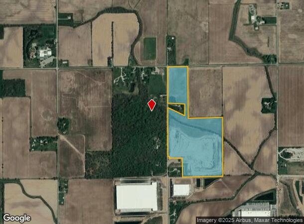
Property Record
3325 S 450 E, Whitestown, IN 46075


NEARBY LISTINGS FOR SALE OR LEASE
Property Detail
3325 S 450 E
Indianapolis-Carmel-Anderson, IN
Harman Minor Sub
06-07-23-000-001.002-018
HARMAN MINOR PLAT LOT 3 (49.20A)
Residentialacreage
Boone
AE
Indiana
18011C0307E
3
2023
49.20 AC
2024
Boone County
810601
Indianapolis
DEMOGRAPHICS near 3325 S 450 E
1 Mile
3 Mile
5 Mile
2024 Total Population
162
9,359
24,961
2029 Population
188
10,773
28,313
Pop Growth 2024-2029
+ 16.05%
+ 15.11%
+ 13.43%
Average Age
37
36
36
2024 Total Households
65
3,583
8,719
HH Growth 2024-2029
+ 15.38%
+ 15.46%
+ 13.83%
Median Household Inc
$104,605
$106,250
$116,599
Avg Household Size
2.50
2.60
2.90
2024 Avg HH Vehicles
2.00
2.00
2.00
Median Home Value
$251,785
$264,876
$345,710
Median Year Built
2010
2010
2009
Nearby Places
- Restaurants
- Banks
- Shops
- Fitness
- Groceries
PUBLIC TRANSPORTATION
AIRPORT
Indianapolis International
DRIVE
WALK
Distance
Indianapolis International
44 min
27.6 mi
Freight Ports
Port of Toledo
DRIVE
WALK
Distance
Port of Toledo
281 min
236.2 mi
SALE & LEASE HISTORY
LISTING DATE
SALE/LEASE

Mar 30, 2017
For Sale
Jun 03, 2019
For Sale
Nearby Properties
Address
Land Use
TOTAL SIZE
Lot Size
Zoning
Address
Land Use
TOTAL SIZE
Lot Size
Zoning
336 SF
52.76 AC
ZO01
Address
Land Use
TOTAL SIZE
Lot Size
Zoning
518 SF
95.61 AC
ZO01
Address
Land Use
TOTAL SIZE
Lot Size
Zoning
632,788 SF
59.27 AC
ZO01
Address
Land Use
TOTAL SIZE
Lot Size
Zoning
62.07 AC
ZO01
Address
Land Use
TOTAL SIZE
Lot Size
Zoning
44.11 AC
ZO01
Address
Land Use
TOTAL SIZE
Lot Size
Zoning
846,720 SF
58.21 AC
ZO01
Address
Land Use
TOTAL SIZE
Lot Size
Zoning
736,560 SF
55.22 AC
ZO01
Address
Land Use
TOTAL SIZE
Lot Size
Zoning
705,024 SF
39.27 AC
ZO01
Address
Land Use
TOTAL SIZE
Lot Size
Zoning
1,338 SF
51.66 AC
ZO01
Address
Land Use
TOTAL SIZE
Lot Size
Zoning
400,145 SF
31.94 AC
ZO01
Address
Land Use
TOTAL SIZE
Lot Size
Zoning
628,206 SF
31.89 AC
ZO01
Address
Land Use
TOTAL SIZE
Lot Size
Zoning
529,200 SF
19.46 AC
ZO01
Address
Land Use
TOTAL SIZE
Lot Size
Zoning
600,672 SF
33.21 AC
ZO01
Address
Land Use
TOTAL SIZE
Lot Size
Zoning
570,344 SF
33.79 AC
ZO01
Address
Land Use
TOTAL SIZE
Lot Size
Zoning
565,560 SF
35.19 AC
ZO01
Address
Land Use
TOTAL SIZE
Lot Size
Zoning
3,913 SF
13.09 AC
ZO01
Address
Land Use
TOTAL SIZE
Lot Size
Zoning
604,200 SF
42.93 AC
ZO01
Address
Land Use
TOTAL SIZE
Lot Size
Zoning
532,380 SF
28.26 AC
ZO01
Address
Land Use
TOTAL SIZE
Lot Size
Zoning
460,177 SF
27.85 AC
ZO01
Address
Land Use
TOTAL SIZE
Lot Size
Zoning
400,576 SF
39.22 AC
ZO01
Address
Land Use
TOTAL SIZE
Lot Size
Zoning
505,728 SF
33.61 AC
ZO01
Address
Land Use
TOTAL SIZE
Lot Size
Zoning
4,876 SF
10.60 AC
ZO01
Address
Land Use
TOTAL SIZE
Lot Size
Zoning
501,120 SF
27.32 AC
ZO01
Address
Land Use
TOTAL SIZE
Lot Size
Zoning
442,154 SF
41.17 AC
ZO01
Address
Land Use
TOTAL SIZE
Lot Size
Zoning
498,750 SF
23.97 AC
ZO01
Address
Land Use
TOTAL SIZE
Lot Size
Zoning
120 SF
29.31 AC
ZO01
Address
Land Use
TOTAL SIZE
Lot Size
Zoning
280,000 SF
16.88 AC
ZO01
Address
Land Use
TOTAL SIZE
Lot Size
Zoning
457,704 SF
28.48 AC
ZO01
Address
Land Use
TOTAL SIZE
Lot Size
Zoning
420,848 SF
22.51 AC
ZO01
Address
Land Use
TOTAL SIZE
Lot Size
Zoning
68,481 SF
6.47 AC
ZO01
The World's #1 Commercial Real Estate Marketplace
Connect with us
© 2025 CoStar Group
The information above has been obtained from sources believed reliable. While we do not doubt its accuracy we have not verified it and make no guarantee, warranty or representation about it. It is your responsibility to independently confirm its accuracy and completeness. Any projections, opinions, assumptions, or estimates used are for example only and do not represent the current or future performance of the property. The value of this transaction to you depends on tax and other factors which should be evaluated by your tax, financial, and legal advisors. You and your advisors should conduct a careful, independent investigation of the property to determine to your satisfaction the suitability of the property for your needs.