Property Record
333 Boyd Blvd, La Porte, IN 46350
NEARBY LISTINGS FOR SALE OR LEASE
Property Detail
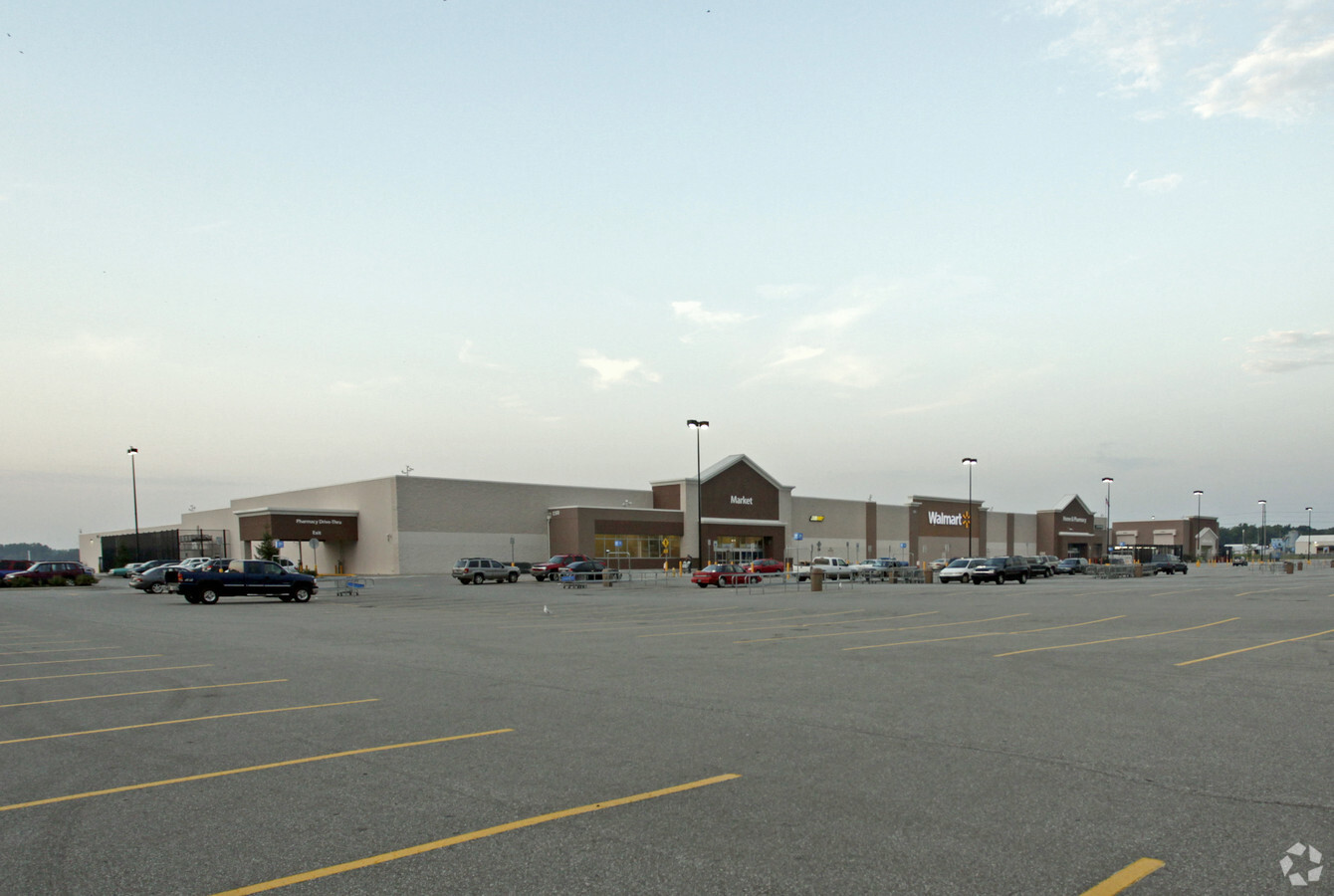
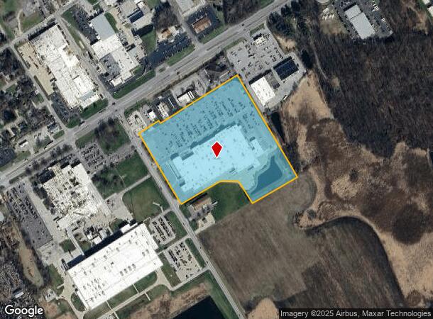
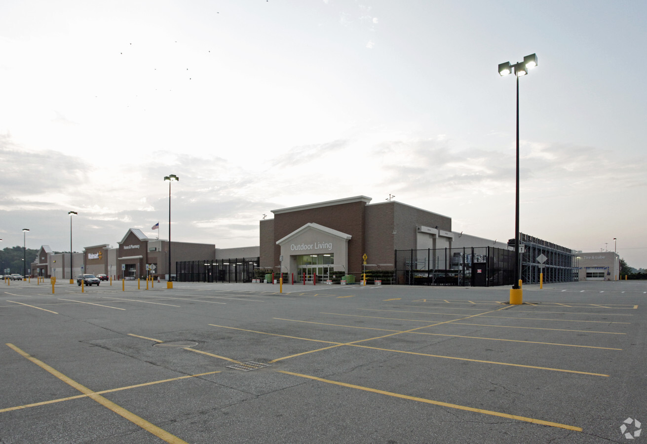
333 Boyd Blvd
46-07-30-377-004.000-053
Meander Land
Departmentstore
33-07-30-377-004 MEANDER LAND MID POINT S1/2 S30 T37 R2 17.50 AC (PER DEED)
X
La Porte
18091C0280D
Indiana
2023
17.50 AC
2024
Other Market Areas
042100
Michigan City-La Porte, IN
194,458 SF
DEMOGRAPHICS near 333 Boyd Blvd
1 Mile
3 Mile
5 Mile
2024 Total Population
2,784
22,623
32,004
2029 Population
2,753
22,375
31,584
Pop Growth 2024-2029
(1.11%)
(1.10%)
(1.31%)
Average Age
38
40
40
2024 Total Households
1,089
9,055
12,638
HH Growth 2024-2029
(1.29%)
(1.29%)
(1.50%)
Median Household Inc
$46,739
$52,951
$61,836
Avg Household Size
2.50
2.40
2.40
2024 Avg HH Vehicles
2.00
2.00
2.00
Median Home Value
$113,622
$144,723
$171,795
Median Year Built
1952
1954
1960
Nearby Places
- Restaurants
- Banks
- Shops
- Fitness
- Groceries
PUBLIC TRANSPORTATION
AIRPORT
South Bend International
DRIVE
WALK
Distance
South Bend International
42 min
24.3 mi
Freight Ports
Port Milwaukee
DRIVE
WALK
Distance
Port Milwaukee
194 min
155.8 mi
Nearby Properties
Address
Land Use
TOTAL SIZE
Lot Size
Zoning
Address
Land Use
TOTAL SIZE
Lot Size
Zoning
222,443 SF
5.25 AC
Address
Land Use
TOTAL SIZE
Lot Size
Zoning
225,592 SF
3.72 AC
Address
Land Use
TOTAL SIZE
Lot Size
Zoning
482,301 SF
49.97 AC
Address
Land Use
TOTAL SIZE
Lot Size
Zoning
511,980 SF
45.42 AC
Address
Land Use
TOTAL SIZE
Lot Size
Zoning
294,600 SF
22.86 AC
Address
Land Use
TOTAL SIZE
Lot Size
Zoning
289,954 SF
15.78 AC
Address
Land Use
TOTAL SIZE
Lot Size
Zoning
47,659 SF
22.32 AC
Address
Land Use
TOTAL SIZE
Lot Size
Zoning
603,796 SF
18.96 AC
Address
Land Use
TOTAL SIZE
Lot Size
Zoning
221,703 SF
16.87 AC
Address
Land Use
TOTAL SIZE
Lot Size
Zoning
18,620 SF
6.87 AC
Address
Land Use
TOTAL SIZE
Lot Size
Zoning
150,364 SF
14.26 AC
Address
Land Use
TOTAL SIZE
Lot Size
Zoning
185,774 SF
4.89 AC
Address
Land Use
TOTAL SIZE
Lot Size
Zoning
56,034 SF
3.04 AC
Address
Land Use
TOTAL SIZE
Lot Size
Zoning
50,562 SF
11.99 AC
Address
Land Use
TOTAL SIZE
Lot Size
Zoning
28,154 SF
2.68 AC
Address
Land Use
TOTAL SIZE
Lot Size
Zoning
84,600 SF
52.12 AC
Address
Land Use
TOTAL SIZE
Lot Size
Zoning
36,179 SF
6.15 AC
Address
Land Use
TOTAL SIZE
Lot Size
Zoning
52,830 SF
0.32 AC
Address
Land Use
TOTAL SIZE
Lot Size
Zoning
30,505 SF
1.59 AC
Address
Land Use
TOTAL SIZE
Lot Size
Zoning
19,230 SF
2.32 AC
Address
Land Use
TOTAL SIZE
Lot Size
Zoning
54,262 SF
6.43 AC
Address
Land Use
TOTAL SIZE
Lot Size
Zoning
120,354 SF
11.46 AC
Address
Land Use
TOTAL SIZE
Lot Size
Zoning
130,620 SF
12.68 AC
Address
Land Use
TOTAL SIZE
Lot Size
Zoning
414,159 SF
54.34 AC
Address
Land Use
TOTAL SIZE
Lot Size
Zoning
7,217 SF
0.40 AC
LBCCN
Address
Land Use
TOTAL SIZE
Lot Size
Zoning
31,483 SF
0.78 AC
Address
Land Use
TOTAL SIZE
Lot Size
Zoning
64,084 SF
4.54 AC
Address
Land Use
TOTAL SIZE
Lot Size
Zoning
67,862 SF
3.77 AC
Address
Land Use
TOTAL SIZE
Lot Size
Zoning
39,424 SF
1.28 AC
The World's #1 Commercial Real Estate Marketplace
Connect with us
© 2025 CoStar Group
The information above has been obtained from sources believed reliable. While we do not doubt its accuracy we have not verified it and make no guarantee, warranty or representation about it. It is your responsibility to independently confirm its accuracy and completeness. Any projections, opinions, assumptions, or estimates used are for example only and do not represent the current or future performance of the property. The value of this transaction to you depends on tax and other factors which should be evaluated by your tax, financial, and legal advisors. You and your advisors should conduct a careful, independent investigation of the property to determine to your satisfaction the suitability of the property for your needs.