Property Record
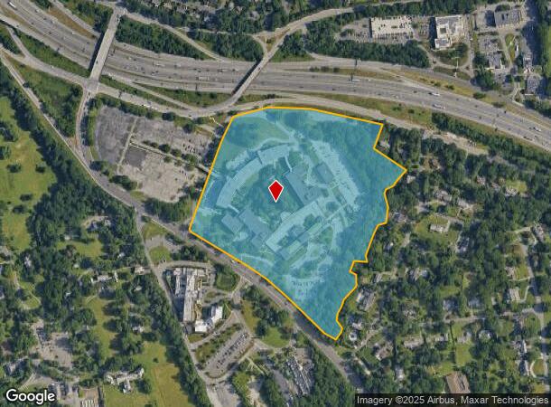
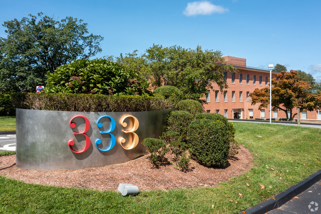
333 Westchester Ave, West Harrison, NY 10604

Current Lease Availabilities
NEARBY LISTINGS FOR SALE OR LEASE
Property Detail
333 Westchester Ave
1700-126-018-00002-000-0001
Westchester
Officebuilding
New York
X
1.000
36119C0288F
29 AC
2023
East I-287 Corridor
2023
Westchester/So Connecticut
009702
New York-Jersey City-White Plains, NY-NJ
623,000 SF
DEMOGRAPHICS near 333 Westchester Ave
1 Mile
3 Mile
5 Mile
2024 Total Population
18,153
102,978
239,361
2029 Population
17,925
101,850
234,677
Pop Growth 2024-2029
(1.26%)
(1.10%)
(1.96%)
Average Age
43
42
42
2024 Total Households
8,033
40,016
87,499
HH Growth 2024-2029
(1.28%)
(1.08%)
(1.96%)
Median Household Inc
$93,451
$124,699
$137,687
Avg Household Size
2.20
2.40
2.60
2024 Avg HH Vehicles
1.00
2.00
2.00
Median Home Value
$466,071
$664,425
$737,153
Median Year Built
1958
1961
1958
Nearby Places
- Restaurants
- Banks
- Shops
- Fitness
- Groceries
PUBLIC TRANSPORTATION
COMMUTER RAIL
White Plains Station (Harlem Line - Metro-North Commuter Railroad Company (Metro-North))
DRIVE
WALK
Distance
White Plains Station (Harlem Line - Metro-North Commuter Railroad Company (Metro-North))
6 min
2.3 mi
North White Plains Station (Harlem Line - Metro-North Commuter Railroad Company (Metro-North))
DRIVE
WALK
Distance
North White Plains Station (Harlem Line - Metro-North Commuter Railroad Company (Metro-North))
6 min
3.5 mi
AIRPORT
Westchester County
DRIVE
WALK
Distance
Westchester County
12 min
6.9 mi
Laguardia
DRIVE
WALK
Distance
Laguardia
42 min
24.7 mi
John F Kennedy International
DRIVE
WALK
Distance
John F Kennedy International
48 min
32.3 mi
Freight Ports
NY - Red Hook Container Terminal
DRIVE
WALK
Distance
NY - Red Hook Container Terminal
56 min
35.2 mi
Nearby Properties
Address
Land Use
TOTAL SIZE
Lot Size
Zoning
Address
Land Use
TOTAL SIZE
Lot Size
Zoning
237,313 SF
22.67 AC
A1
Address
Land Use
TOTAL SIZE
Lot Size
Zoning
1,975 SF
13.80 AC
CA
Address
Land Use
TOTAL SIZE
Lot Size
Zoning
477.23 AC
Address
Land Use
TOTAL SIZE
Lot Size
Zoning
7.98 AC
M-14
Address
Land Use
TOTAL SIZE
Lot Size
Zoning
48,267 SF
11.04 AC
A2 A
Address
Land Use
TOTAL SIZE
Lot Size
Zoning
7.98 AC
CA
Address
Land Use
TOTAL SIZE
Lot Size
Zoning
5.57 AC
AA1
Address
Land Use
TOTAL SIZE
Lot Size
Zoning
1,630 SF
2.64 AC
LOB
Address
Land Use
TOTAL SIZE
Lot Size
Zoning
1,348 SF
5.67 AC
CA
Address
Land Use
TOTAL SIZE
Lot Size
Zoning
9.73 AC
OB-1
Address
Land Use
TOTAL SIZE
Lot Size
Zoning
1.21 AC
B
Address
Land Use
TOTAL SIZE
Lot Size
Zoning
21,524 SF
11.06 AC
A2 A
Address
Land Use
TOTAL SIZE
Lot Size
Zoning
5.37 AC
R-20
Address
Land Use
TOTAL SIZE
Lot Size
Zoning
8.36 AC
Address
Land Use
TOTAL SIZE
Lot Size
Zoning
8 AC
M-10
Address
Land Use
TOTAL SIZE
Lot Size
Zoning
49,865 SF
3 AC
A3
Address
Land Use
TOTAL SIZE
Lot Size
Zoning
1,338 SF
51.60 AC
R-20
Address
Land Use
TOTAL SIZE
Lot Size
Zoning
0.59 AC
M-174
Address
Land Use
TOTAL SIZE
Lot Size
Zoning
2,365 SF
3.02 AC
CA
Address
Land Use
TOTAL SIZE
Lot Size
Zoning
6.09 AC
DS
Address
Land Use
TOTAL SIZE
Lot Size
Zoning
17,240 SF
0.68 AC
A3
Address
Land Use
TOTAL SIZE
Lot Size
Zoning
1.12 AC
UR
Address
Land Use
TOTAL SIZE
Lot Size
Zoning
0.91 AC
CA
Address
Land Use
TOTAL SIZE
Lot Size
Zoning
5.99 AC
Address
Land Use
TOTAL SIZE
Lot Size
Zoning
19,456 SF
10.78 AC
OB-1 OFFC
Address
Land Use
TOTAL SIZE
Lot Size
Zoning
Address
Land Use
TOTAL SIZE
Lot Size
Zoning
25,152 SF
0.31 AC
A3
Address
Land Use
TOTAL SIZE
Lot Size
Zoning
1,312 SF
2.89 AC
CA
Address
Land Use
TOTAL SIZE
Lot Size
Zoning
4.50 AC
CA
Address
Land Use
TOTAL SIZE
Lot Size
Zoning
2.61 AC
UR
The World's #1 Commercial Real Estate Marketplace
Connect with us
© 2025 CoStar Group
The information above has been obtained from sources believed reliable. While we do not doubt its accuracy we have not verified it and make no guarantee, warranty or representation about it. It is your responsibility to independently confirm its accuracy and completeness. Any projections, opinions, assumptions, or estimates used are for example only and do not represent the current or future performance of the property. The value of this transaction to you depends on tax and other factors which should be evaluated by your tax, financial, and legal advisors. You and your advisors should conduct a careful, independent investigation of the property to determine to your satisfaction the suitability of the property for your needs.