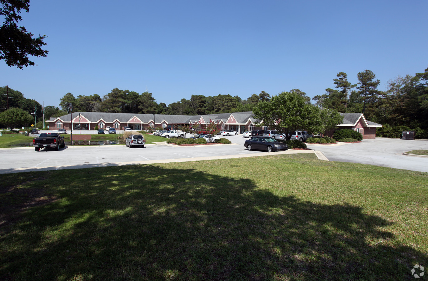
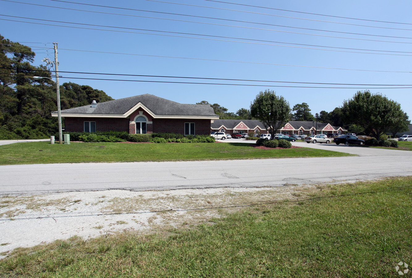
Property Record
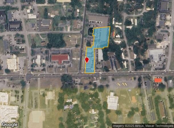
3332 Bridges St, Morehead City, NC 28557
NEARBY LISTINGS FOR SALE OR LEASE
Property Detail
3332 Bridges St
6376.15.53.6664000
AC MAPLE & BRIDGES ST
Officebuilding
Carteret
X
North Carolina
3720637600J
1.68 AC
2023
Coastal Carolina
2024
Other Market Areas
970401
Morehead City, NC
9,230 SF
DEMOGRAPHICS near 3332 Bridges St
1 Mile
3 Mile
5 Mile
2024 Total Population
4,070
14,584
20,952
2029 Population
4,149
15,349
22,206
Pop Growth 2024-2029
+ 1.94%
+ 5.25%
+ 5.99%
Average Age
46
47
48
2024 Total Households
2,030
7,005
10,000
HH Growth 2024-2029
+ 1.63%
+ 5.35%
+ 6.07%
Median Household Inc
$44,208
$56,764
$63,342
Avg Household Size
1.90
2.00
2.00
2024 Avg HH Vehicles
2.00
2.00
2.00
Median Home Value
$212,086
$320,043
$331,004
Median Year Built
1986
1984
1985
Nearby Places
- Restaurants
- Banks
- Shops
- Fitness
- Groceries
PUBLIC TRANSPORTATION
AIRPORT
Coastal Carolina Regional
DRIVE
WALK
Distance
Coastal Carolina Regional
55 min
35.6 mi
Freight Ports
Port of Morehead City
DRIVE
WALK
Distance
Port of Morehead City
6 min
2.9 mi
SALE & LEASE HISTORY
LISTING DATE
SALE/LEASE

Dec 05, 2016
For Lease
Nearby Properties
Address
Land Use
TOTAL SIZE
Lot Size
Zoning
Address
Land Use
TOTAL SIZE
Lot Size
Zoning
11,040 SF
14.25 AC
Address
Land Use
TOTAL SIZE
Lot Size
Zoning
4,744 SF
24.01 AC
Address
Land Use
TOTAL SIZE
Lot Size
Zoning
20,886 SF
8.01 AC
Address
Land Use
TOTAL SIZE
Lot Size
Zoning
41,661 SF
14.90 AC
Address
Land Use
TOTAL SIZE
Lot Size
Zoning
99,630 SF
17.63 AC
Address
Land Use
TOTAL SIZE
Lot Size
Zoning
161,597 SF
13.30 AC
Address
Land Use
TOTAL SIZE
Lot Size
Zoning
117,000 SF
30.58 AC
Address
Land Use
TOTAL SIZE
Lot Size
Zoning
77,856 SF
49.10 AC
Address
Land Use
TOTAL SIZE
Lot Size
Zoning
72,380 SF
8.22 AC
Address
Land Use
TOTAL SIZE
Lot Size
Zoning
24,100 SF
15.16 AC
Address
Land Use
TOTAL SIZE
Lot Size
Zoning
24,068 SF
4.76 AC
Address
Land Use
TOTAL SIZE
Lot Size
Zoning
17,873 SF
5.45 AC
Address
Land Use
TOTAL SIZE
Lot Size
Zoning
23,717 SF
7.58 AC
Address
Land Use
TOTAL SIZE
Lot Size
Zoning
53,819 SF
7 AC
Address
Land Use
TOTAL SIZE
Lot Size
Zoning
15,324 SF
2.71 AC
Address
Land Use
TOTAL SIZE
Lot Size
Zoning
52,962 SF
5.02 AC
Address
Land Use
TOTAL SIZE
Lot Size
Zoning
13,000 SF
2.27 AC
Address
Land Use
TOTAL SIZE
Lot Size
Zoning
14,868 SF
4.80 AC
Address
Land Use
TOTAL SIZE
Lot Size
Zoning
56,694 SF
7.29 AC
Address
Land Use
TOTAL SIZE
Lot Size
Zoning
17,896 SF
3.10 AC
Address
Land Use
TOTAL SIZE
Lot Size
Zoning
21,945 SF
3.53 AC
Address
Land Use
TOTAL SIZE
Lot Size
Zoning
9,668 SF
156.38 AC
Address
Land Use
TOTAL SIZE
Lot Size
Zoning
10,773 SF
10.01 AC
Address
Land Use
TOTAL SIZE
Lot Size
Zoning
1,980 SF
16.76 AC
Address
Land Use
TOTAL SIZE
Lot Size
Zoning
9,611 SF
3.93 AC
Address
Land Use
TOTAL SIZE
Lot Size
Zoning
15,001 SF
1.70 AC
Address
Land Use
TOTAL SIZE
Lot Size
Zoning
5,068 SF
2.13 AC
Address
Land Use
TOTAL SIZE
Lot Size
Zoning
15,434 SF
1.25 AC
The World's #1 Commercial Real Estate Marketplace
Connect with us
© 2025 CoStar Group
The information above has been obtained from sources believed reliable. While we do not doubt its accuracy we have not verified it and make no guarantee, warranty or representation about it. It is your responsibility to independently confirm its accuracy and completeness. Any projections, opinions, assumptions, or estimates used are for example only and do not represent the current or future performance of the property. The value of this transaction to you depends on tax and other factors which should be evaluated by your tax, financial, and legal advisors. You and your advisors should conduct a careful, independent investigation of the property to determine to your satisfaction the suitability of the property for your needs.