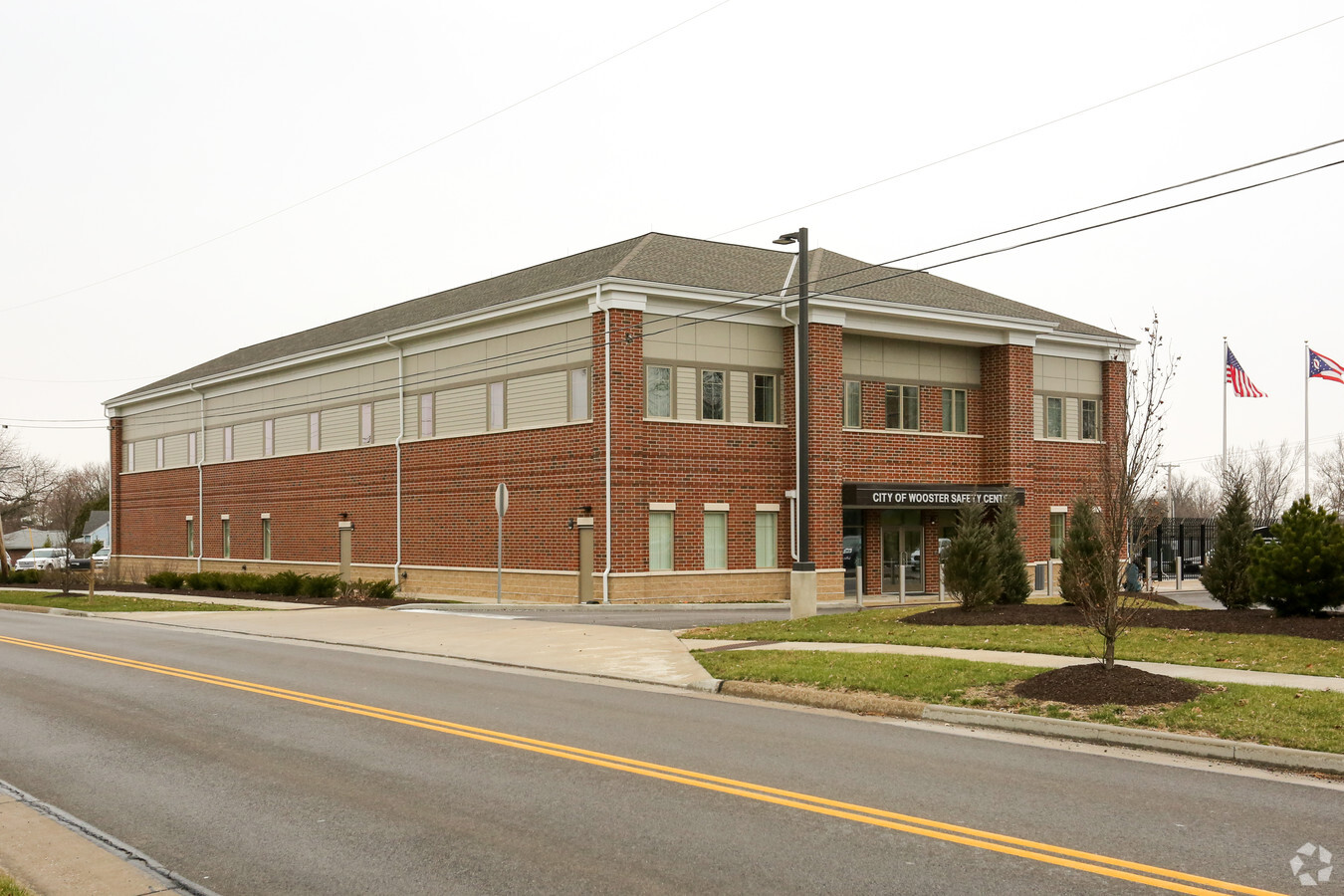
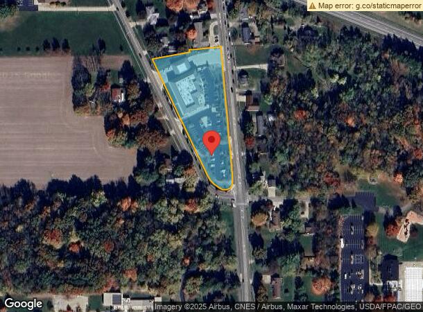
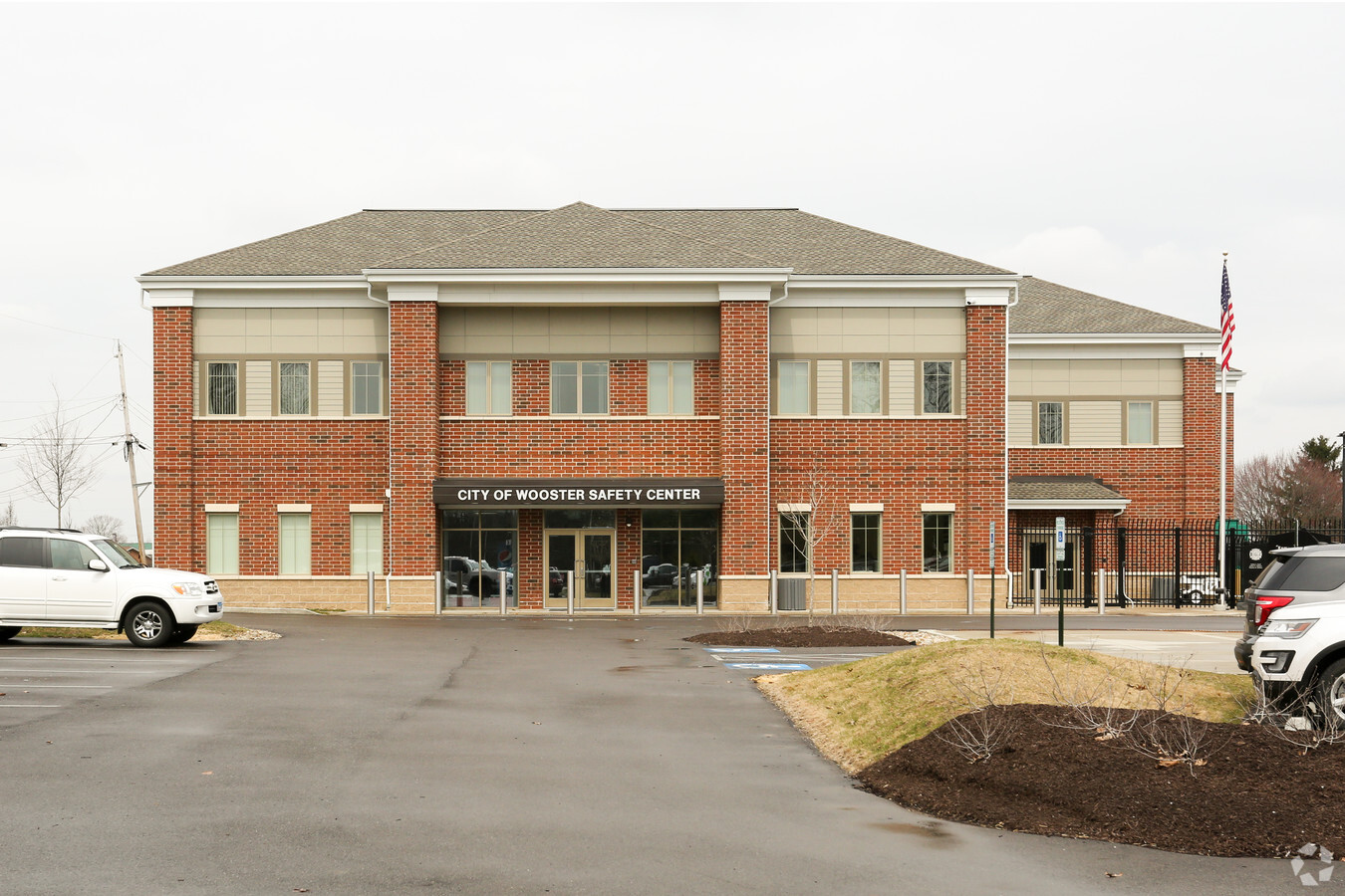
Property Record
3333 Burbank Rd, Wooster, OH 44691
NEARBY LISTINGS FOR SALE OR LEASE
Property Detail
3333 Burbank Rd
67-01663-000
LOT 9721 SAFETY CENTER PLAT 1293.19 2.683A MP 182
Commercialnec
Wayne
X
Ohio
39169C0204E
9721
2024
2.68 AC
2023
Ohio North Area
000700
Other Market Areas
36,220 SF
Wooster, OH
DEMOGRAPHICS near 3333 Burbank Rd
1 Mile
3 Mile
5 Mile
2024 Total Population
4,198
29,043
39,040
2029 Population
4,238
29,319
39,341
Pop Growth 2024-2029
+ 0.95%
+ 0.95%
+ 0.77%
Average Age
46
42
41
2024 Total Households
1,849
11,985
15,758
HH Growth 2024-2029
+ 0.76%
+ 0.85%
+ 0.70%
Median Household Inc
$65,817
$56,255
$56,690
Avg Household Size
2.20
2.20
2.20
2024 Avg HH Vehicles
2.00
2.00
2.00
Median Home Value
$180,562
$180,506
$182,312
Median Year Built
1978
1977
1975
Nearby Places
- Restaurants
- Banks
- Shops
- Fitness
- Groceries
PUBLIC TRANSPORTATION
AIRPORT
Akron-Canton Regional
DRIVE
WALK
Distance
Akron-Canton Regional
55 min
45.0 mi
Freight Ports
Port of Toledo
DRIVE
WALK
Distance
Port of Toledo
166 min
120.7 mi
Nearby Properties
Address
Land Use
TOTAL SIZE
Lot Size
Zoning
Address
Land Use
TOTAL SIZE
Lot Size
Zoning
537,309 SF
43.72 AC
CF
Address
Land Use
TOTAL SIZE
Lot Size
Zoning
333,469 SF
9 AC
CF
Address
Land Use
TOTAL SIZE
Lot Size
Zoning
431,926 SF
74.14 AC
CF
Address
Land Use
TOTAL SIZE
Lot Size
Zoning
316,857 SF
41.43 AC
CF
Address
Land Use
TOTAL SIZE
Lot Size
Zoning
608,111 SF
44 AC
Address
Land Use
TOTAL SIZE
Lot Size
Zoning
59.44 AC
Address
Land Use
TOTAL SIZE
Lot Size
Zoning
51.79 AC
M2
Address
Land Use
TOTAL SIZE
Lot Size
Zoning
198,900 SF
17.94 AC
Address
Land Use
TOTAL SIZE
Lot Size
Zoning
85,724 SF
1.67 AC
C4
Address
Land Use
TOTAL SIZE
Lot Size
Zoning
109.56 AC
M2
Address
Land Use
TOTAL SIZE
Lot Size
Zoning
128,014 SF
38.46 AC
Address
Land Use
TOTAL SIZE
Lot Size
Zoning
227,500 SF
58.38 AC
Address
Land Use
TOTAL SIZE
Lot Size
Zoning
79,408 SF
11.24 AC
C5
Address
Land Use
TOTAL SIZE
Lot Size
Zoning
160,158 SF
14.21 AC
Address
Land Use
TOTAL SIZE
Lot Size
Zoning
47,160 SF
3.22 AC
C4
Address
Land Use
TOTAL SIZE
Lot Size
Zoning
188,041 SF
17.20 AC
C5
Address
Land Use
TOTAL SIZE
Lot Size
Zoning
27,981 SF
12.42 AC
CF
Address
Land Use
TOTAL SIZE
Lot Size
Zoning
84,678 SF
5.57 AC
CF
Address
Land Use
TOTAL SIZE
Lot Size
Zoning
29,606 SF
16.79 AC
R4
Address
Land Use
TOTAL SIZE
Lot Size
Zoning
85,910 SF
4.33 AC
Address
Land Use
TOTAL SIZE
Lot Size
Zoning
118,144 SF
19.26 AC
CF
Address
Land Use
TOTAL SIZE
Lot Size
Zoning
223,592 SF
25.29 AC
M2
Address
Land Use
TOTAL SIZE
Lot Size
Zoning
108,423 SF
10.46 AC
CF
Address
Land Use
TOTAL SIZE
Lot Size
Zoning
302,400 SF
24.51 AC
M2
Address
Land Use
TOTAL SIZE
Lot Size
Zoning
50,049 SF
17.88 AC
M1
Address
Land Use
TOTAL SIZE
Lot Size
Zoning
60,146 SF
6.30 AC
CF
Address
Land Use
TOTAL SIZE
Lot Size
Zoning
64,102 SF
19.59 AC
CF
Address
Land Use
TOTAL SIZE
Lot Size
Zoning
98,041 SF
9.53 AC
CF
Address
Land Use
TOTAL SIZE
Lot Size
Zoning
120,420 SF
11.77 AC
Address
Land Use
TOTAL SIZE
Lot Size
Zoning
45,487 SF
6.77 AC
The World's #1 Commercial Real Estate Marketplace
Connect with us
© 2025 CoStar Group
The information above has been obtained from sources believed reliable. While we do not doubt its accuracy we have not verified it and make no guarantee, warranty or representation about it. It is your responsibility to independently confirm its accuracy and completeness. Any projections, opinions, assumptions, or estimates used are for example only and do not represent the current or future performance of the property. The value of this transaction to you depends on tax and other factors which should be evaluated by your tax, financial, and legal advisors. You and your advisors should conduct a careful, independent investigation of the property to determine to your satisfaction the suitability of the property for your needs.