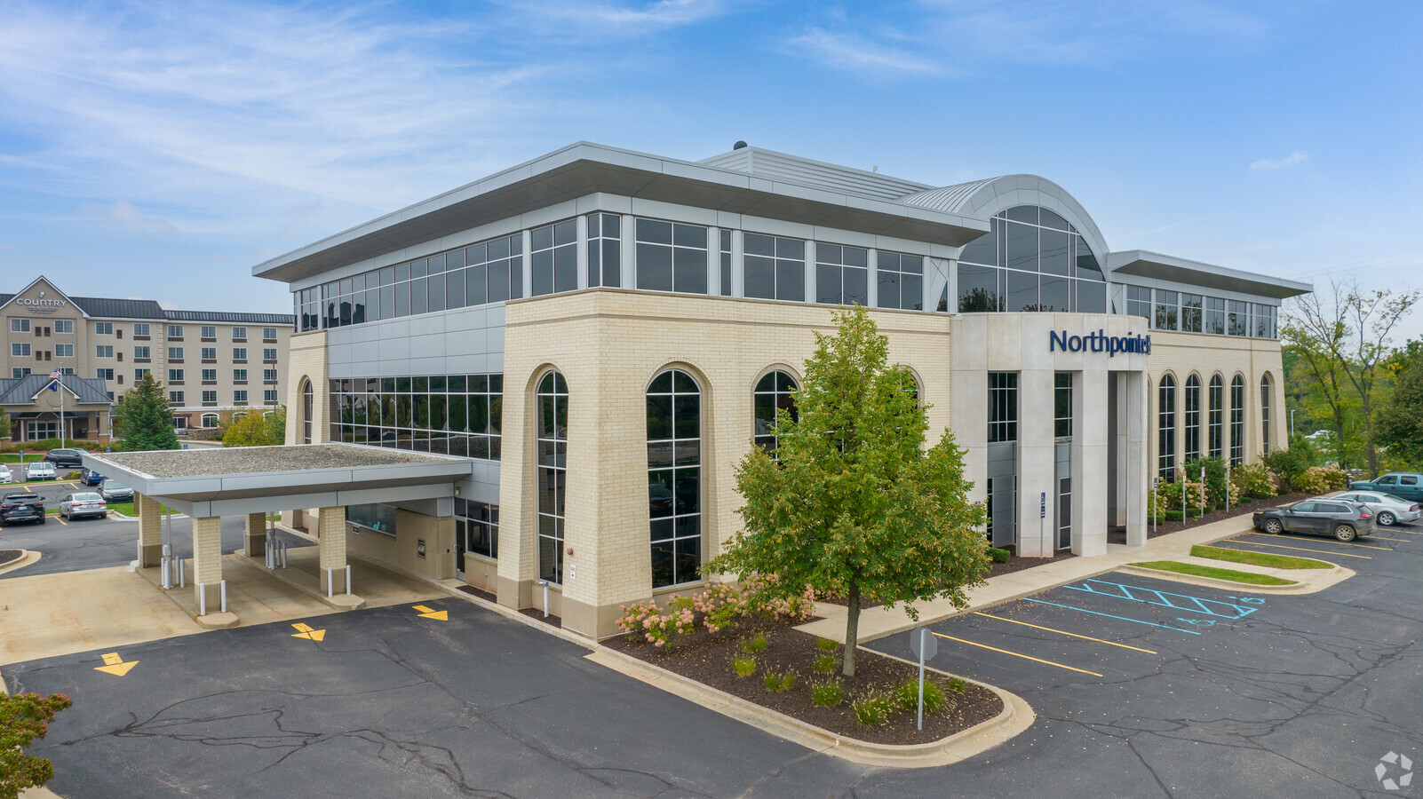
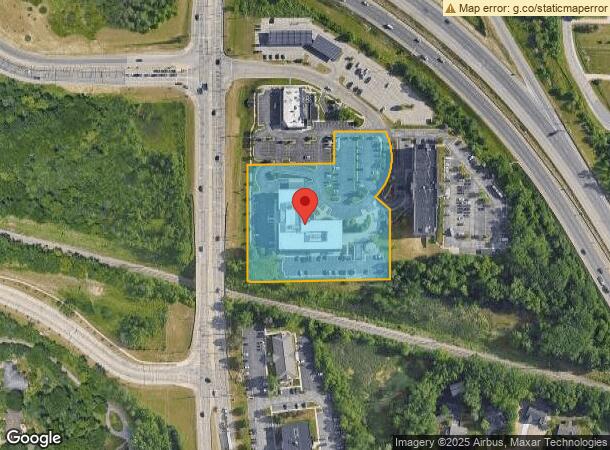
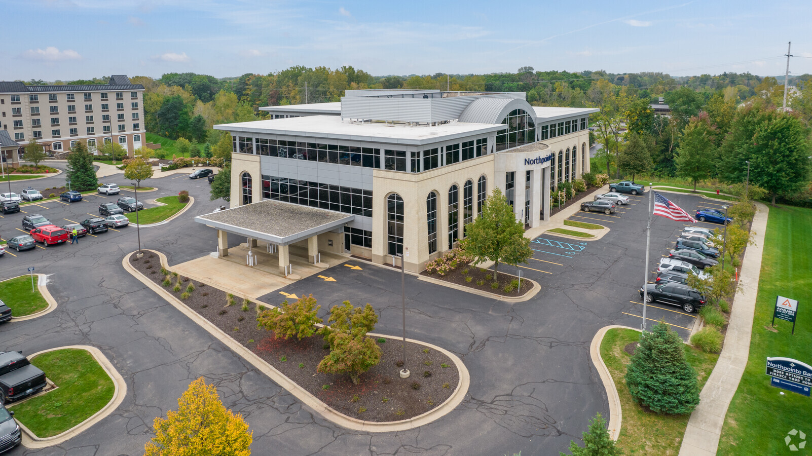
Property Record
3333 Deposit Dr Ne, Grand Rapids, MI 49546
Current Lease Availabilities
NEARBY LISTINGS FOR SALE OR LEASE
Property Detail
3333 Deposit Dr Ne
Grand Rapids-Wyoming, MI
Sunset Park
41-14-23-352-009
411423352009 PART OF SW 1/4 COM 439.55 FT N 0D 11M 18S W ALONG W SEC LINE & 99.25 FT S 89D 30M 18S E ALONG C/L OF MICHIGAN ST
Financialbuilding
Kent
2023
Michigan
2024
3.13 AC
011803
Ada/Lowell
59,811 SF
West Michigan
DEMOGRAPHICS near 3333 Deposit Dr Ne
1 Mile
3 Mile
5 Mile
2024 Total Population
3,452
62,771
204,915
2029 Population
3,488
63,118
206,278
Pop Growth 2024-2029
+ 1.04%
+ 0.55%
+ 0.67%
Average Age
42
38
37
2024 Total Households
1,240
23,528
82,278
HH Growth 2024-2029
+ 1.29%
+ 0.51%
+ 0.71%
Median Household Inc
$113,308
$91,405
$70,200
Avg Household Size
2.40
2.40
2.40
2024 Avg HH Vehicles
2.00
2.00
2.00
Median Home Value
$397,798
$315,726
$256,670
Median Year Built
1978
1964
1961
Nearby Places
- Restaurants
- Banks
- Shops
- Fitness
- Groceries
PUBLIC TRANSPORTATION
COMMUTER RAIL
Grand Rapids Vernon J. Ehlers Station (Pere Marquette - Amtrak)
DRIVE
WALK
Distance
Grand Rapids Vernon J. Ehlers Station (Pere Marquette - Amtrak)
9 min
6.5 mi
AIRPORT
Gerald R Ford International
DRIVE
WALK
Distance
Gerald R Ford International
18 min
10.8 mi
Freight Ports
Port Milwaukee
DRIVE
WALK
Distance
Port Milwaukee
311 min
267.8 mi
Nearby Properties
Address
Land Use
TOTAL SIZE
Lot Size
Zoning
Address
Land Use
TOTAL SIZE
Lot Size
Zoning
333,281 SF
13.99 AC
SD-PRD
Address
Land Use
TOTAL SIZE
Lot Size
Zoning
126,805 SF
9.36 AC
C4
Address
Land Use
TOTAL SIZE
Lot Size
Zoning
709,488 SF
106.95 AC
LI
Address
Land Use
TOTAL SIZE
Lot Size
Zoning
151,708 SF
7.22 AC
C4
Address
Land Use
TOTAL SIZE
Lot Size
Zoning
250,170 SF
16.13 AC
R-1
Address
Land Use
TOTAL SIZE
Lot Size
Zoning
211,760 SF
TN-CC
Address
Land Use
TOTAL SIZE
Lot Size
Zoning
Address
Land Use
TOTAL SIZE
Lot Size
Zoning
257,381 SF
7.08 AC
SD-PRD
Address
Land Use
TOTAL SIZE
Lot Size
Zoning
194,153 SF
15.84 AC
MCN-C
Address
Land Use
TOTAL SIZE
Lot Size
Zoning
112,764 SF
17.29 AC
SD-PRD
Address
Land Use
TOTAL SIZE
Lot Size
Zoning
18.07 AC
MON-LDR
Address
Land Use
TOTAL SIZE
Lot Size
Zoning
226,877 SF
22.40 AC
R2
Address
Land Use
TOTAL SIZE
Lot Size
Zoning
47,370 SF
8.18 AC
MON-LDR
Address
Land Use
TOTAL SIZE
Lot Size
Zoning
91,907 SF
11.25 AC
R-1
Address
Land Use
TOTAL SIZE
Lot Size
Zoning
138,278 SF
35.63 AC
R-1
Address
Land Use
TOTAL SIZE
Lot Size
Zoning
24.96 AC
MCN-MDR
Address
Land Use
TOTAL SIZE
Lot Size
Zoning
32,366 SF
34.78 AC
R-1
Address
Land Use
TOTAL SIZE
Lot Size
Zoning
96,528 SF
9.88 AC
SD-NOS
Address
Land Use
TOTAL SIZE
Lot Size
Zoning
247,954 SF
40.84 AC
SD-PRD
Address
Land Use
TOTAL SIZE
Lot Size
Zoning
154,643 SF
10.96 AC
O-PUD
Address
Land Use
TOTAL SIZE
Lot Size
Zoning
158,883 SF
16.53 AC
MCN-LDR
Address
Land Use
TOTAL SIZE
Lot Size
Zoning
183,583 SF
9.12 AC
R-1
Address
Land Use
TOTAL SIZE
Lot Size
Zoning
159,721 SF
5.51 AC
C-1
Address
Land Use
TOTAL SIZE
Lot Size
Zoning
21.10 AC
MON-MDR
Address
Land Use
TOTAL SIZE
Lot Size
Zoning
145,127 SF
18.52 AC
SD-PRD
Address
Land Use
TOTAL SIZE
Lot Size
Zoning
105,029 SF
5.65 AC
C
Address
Land Use
TOTAL SIZE
Lot Size
Zoning
417,625 SF
29.60 AC
SD-IT
Address
Land Use
TOTAL SIZE
Lot Size
Zoning
22.63 AC
MCN-MDR
Address
Land Use
TOTAL SIZE
Lot Size
Zoning
11.01 AC
MCN-LDR
Address
Land Use
TOTAL SIZE
Lot Size
Zoning
56,095 SF
3.30 AC
SD-PRD
The World's #1 Commercial Real Estate Marketplace
Connect with us
© 2025 CoStar Group
The information above has been obtained from sources believed reliable. While we do not doubt its accuracy we have not verified it and make no guarantee, warranty or representation about it. It is your responsibility to independently confirm its accuracy and completeness. Any projections, opinions, assumptions, or estimates used are for example only and do not represent the current or future performance of the property. The value of this transaction to you depends on tax and other factors which should be evaluated by your tax, financial, and legal advisors. You and your advisors should conduct a careful, independent investigation of the property to determine to your satisfaction the suitability of the property for your needs.