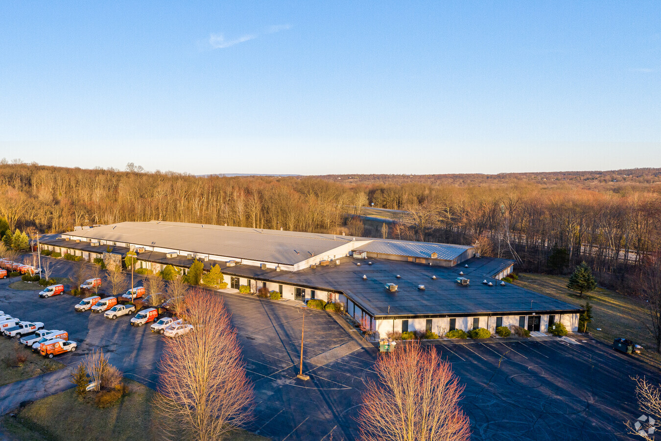
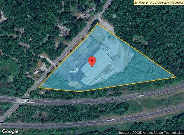
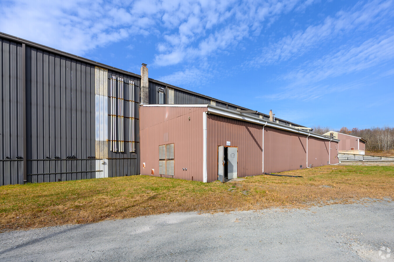
Property Record
334 Co Rt 49, Wawayanda, NY 10973
Current Lease Availabilities
NEARBY LISTINGS FOR SALE OR LEASE
Property Detail
334 Co Rt 49
335600-014-000-0001-092.100-0000
Orange
Industrialgeneral
New York
X
92.10
36071C0265E
10 AC
2024
Orange County
2023
Northern New Jersey
011801
New York-Jersey City-White Plains, NY-NJ
104,070 SF
DEMOGRAPHICS near 334 Co Rt 49
1 Mile
3 Mile
5 Mile
2024 Total Population
611
13,208
47,750
2029 Population
616
13,496
48,539
Pop Growth 2024-2029
+ 0.82%
+ 2.18%
+ 1.65%
Average Age
40
40
39
2024 Total Households
211
5,131
17,214
HH Growth 2024-2029
+ 0.95%
+ 2.46%
+ 1.82%
Median Household Inc
$99,999
$77,522
$78,610
Avg Household Size
2.80
2.50
2.70
2024 Avg HH Vehicles
2.00
2.00
2.00
Median Home Value
$328,750
$286,555
$271,755
Median Year Built
1978
1989
1970
Nearby Places
- Restaurants
- Banks
- Shops
- Fitness
- Groceries
PUBLIC TRANSPORTATION
COMMUTER RAIL
Middletown New York (Bergen County/Port Jervis Line - NJ Transit Commuter Rail (NJ Transit), Main/Port Jervis Line - NJ Transit Commuter Rail (NJ Transit))
DRIVE
WALK
Distance
Middletown New York (Bergen County/Port Jervis Line - NJ Transit Commuter Rail (NJ Transit), Main/Port Jervis Line - NJ Transit Commuter Rail (NJ Transit))
18 min
7.3 mi
AIRPORT
New York Stewart International
DRIVE
WALK
Distance
New York Stewart International
36 min
24.1 mi
Freight Ports
Port Newark Container Terminal
DRIVE
WALK
Distance
Port Newark Container Terminal
100 min
72.7 mi
Nearby Properties
Address
Land Use
TOTAL SIZE
Lot Size
Zoning
Address
Land Use
TOTAL SIZE
Lot Size
Zoning
72.50 AC
MC 1
Address
Land Use
TOTAL SIZE
Lot Size
Zoning
499,762 SF
67.30 AC
SR-MC1
Address
Land Use
TOTAL SIZE
Lot Size
Zoning
129.70 AC
AR
Address
Land Use
TOTAL SIZE
Lot Size
Zoning
40.40 AC
I-2
Address
Land Use
TOTAL SIZE
Lot Size
Zoning
240,800 SF
29.50 AC
MC 1
Address
Land Use
TOTAL SIZE
Lot Size
Zoning
29,950 SF
3 AC
TC-1
Address
Land Use
TOTAL SIZE
Lot Size
Zoning
26,659 SF
15.80 AC
MC 2
Address
Land Use
TOTAL SIZE
Lot Size
Zoning
2,576 SF
146.70 AC
AR
Address
Land Use
TOTAL SIZE
Lot Size
Zoning
50,700 SF
7.70 AC
TC-1
Address
Land Use
TOTAL SIZE
Lot Size
Zoning
26,156 SF
0.01 AC
TC-1
Address
Land Use
TOTAL SIZE
Lot Size
Zoning
5,832 SF
2.30 AC
TC-1
Address
Land Use
TOTAL SIZE
Lot Size
Zoning
4 AC
TC2
Address
Land Use
TOTAL SIZE
Lot Size
Zoning
7 AC
C-3
Address
Land Use
TOTAL SIZE
Lot Size
Zoning
60,321 SF
10.70 AC
TC2
Address
Land Use
TOTAL SIZE
Lot Size
Zoning
41,728 SF
5 AC
TC-1
Address
Land Use
TOTAL SIZE
Lot Size
Zoning
726 SF
40.30 AC
C-3
Address
Land Use
TOTAL SIZE
Lot Size
Zoning
62.90 AC
AR
Address
Land Use
TOTAL SIZE
Lot Size
Zoning
11.50 AC
SR-3B
Address
Land Use
TOTAL SIZE
Lot Size
Zoning
24.70 AC
MC 1
Address
Land Use
TOTAL SIZE
Lot Size
Zoning
22,144 SF
5.60 AC
MC 2
Address
Land Use
TOTAL SIZE
Lot Size
Zoning
19.20 AC
C-3
Address
Land Use
TOTAL SIZE
Lot Size
Zoning
27,662 SF
85.50 AC
R1
Address
Land Use
TOTAL SIZE
Lot Size
Zoning
19,555 SF
10.10 AC
MC 1
Address
Land Use
TOTAL SIZE
Lot Size
Zoning
21.20 AC
Address
Land Use
TOTAL SIZE
Lot Size
Zoning
21,134 SF
4.70 AC
TC-1
Address
Land Use
TOTAL SIZE
Lot Size
Zoning
26,800 SF
3.50 AC
Address
Land Use
TOTAL SIZE
Lot Size
Zoning
12,152 SF
3.60 AC
TC-1
Address
Land Use
TOTAL SIZE
Lot Size
Zoning
25,200 SF
3.40 AC
TC-1
Address
Land Use
TOTAL SIZE
Lot Size
Zoning
4,615 SF
4.30 AC
TC-1
The World's #1 Commercial Real Estate Marketplace
Connect with us
© 2025 CoStar Group
The information above has been obtained from sources believed reliable. While we do not doubt its accuracy we have not verified it and make no guarantee, warranty or representation about it. It is your responsibility to independently confirm its accuracy and completeness. Any projections, opinions, assumptions, or estimates used are for example only and do not represent the current or future performance of the property. The value of this transaction to you depends on tax and other factors which should be evaluated by your tax, financial, and legal advisors. You and your advisors should conduct a careful, independent investigation of the property to determine to your satisfaction the suitability of the property for your needs.