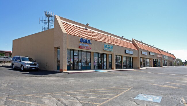
Property Record
3355 N Yarbrough Dr, El Paso, TX 79925


NEARBY LISTINGS FOR SALE OR LEASE
Property Detail
3355 N Yarbrough Dr
El Paso, TX
Tsp 1 Sec 1 T & P Surv
X580-999-2380-5125
80 TSP 2 SEC 38 T & P SURV 2-F-7-C (3.358 AC) & 2-F-7-A-1 (0.391 AC) (3.749 AC)
Commercialnec
El Paso
2024
Texas
2025
3.75 AC
004311
East
31,575 SF
El Paso
DEMOGRAPHICS near 3355 N Yarbrough Dr
1 Mile
3 Mile
5 Mile
2024 Total Population
17,168
96,049
226,960
2029 Population
17,310
96,697
228,529
Pop Growth 2024-2029
+ 0.83%
+ 0.67%
+ 0.69%
Average Age
39
39
38
2024 Total Households
6,328
36,109
79,507
HH Growth 2024-2029
+ 0.82%
+ 0.70%
+ 0.69%
Median Household Inc
$56,169
$55,838
$51,494
Avg Household Size
2.60
2.60
2.80
2024 Avg HH Vehicles
2.00
2.00
2.00
Median Home Value
$149,583
$160,109
$150,476
Median Year Built
1975
1977
1982
Nearby Places
Map Layers
Map Styles
 Street
 Aerial
- Restaurants
- Banks
- Shops
- Fitness
- Groceries
PUBLIC TRANSPORTATION
AIRPORT
El Paso International
DRIVE
WALK
Distance
El Paso International
13 min
4.6 mi
Freight Ports
Port of Corpus Christi
DRIVE
WALK
Distance
Port of Corpus Christi
674 min
688.7 mi
SALE & LEASE HISTORY
LISTING DATE
SALE/LEASE

Sep 25, 2016
For Lease
Jun 02, 2017
For Lease
Nearby Properties
Address
Land Use
TOTAL SIZE
Lot Size
Zoning
Address
Land Use
TOTAL SIZE
Lot Size
Zoning
1,527,480 SF
201.94 AC
Address
Land Use
TOTAL SIZE
Lot Size
Zoning
1,122,782 SF
55.24 AC
C4
Address
Land Use
TOTAL SIZE
Lot Size
Zoning
380,811 SF
22.75 AC
M1
Address
Land Use
TOTAL SIZE
Lot Size
Zoning
259,926 SF
250.23 AC
M1
Address
Land Use
TOTAL SIZE
Lot Size
Zoning
289.07 AC
Address
Land Use
TOTAL SIZE
Lot Size
Zoning
135,639 SF
211.63 AC
C4
Address
Land Use
TOTAL SIZE
Lot Size
Zoning
273.45 AC
M1
Address
Land Use
TOTAL SIZE
Lot Size
Zoning
377,168 SF
8.40 AC
C1
Address
Land Use
TOTAL SIZE
Lot Size
Zoning
195,101 SF
15.45 AC
C1
Address
Land Use
TOTAL SIZE
Lot Size
Zoning
201.94 AC
Address
Land Use
TOTAL SIZE
Lot Size
Zoning
125,896 SF
8.67 AC
R3
Address
Land Use
TOTAL SIZE
Lot Size
Zoning
106,261 SF
3 AC
R3
Address
Land Use
TOTAL SIZE
Lot Size
Zoning
206,726 SF
24.42 AC
M1S
Address
Land Use
TOTAL SIZE
Lot Size
Zoning
435.51 AC
Address
Land Use
TOTAL SIZE
Lot Size
Zoning
154,016 SF
8.05 AC
A2
Address
Land Use
TOTAL SIZE
Lot Size
Zoning
272,601 SF
14.97 AC
AO
Address
Land Use
TOTAL SIZE
Lot Size
Zoning
259,968 SF
10.54 AC
AO
Address
Land Use
TOTAL SIZE
Lot Size
Zoning
235,213 SF
11.98 AC
A3O
Address
Land Use
TOTAL SIZE
Lot Size
Zoning
170,528 SF
9.05 AC
C3S
Address
Land Use
TOTAL SIZE
Lot Size
Zoning
186,950 SF
14.30 AC
C1
Address
Land Use
TOTAL SIZE
Lot Size
Zoning
189,234 SF
10.01 AC
AO
Address
Land Use
TOTAL SIZE
Lot Size
Zoning
54,062 SF
4.92 AC
R4
Address
Land Use
TOTAL SIZE
Lot Size
Zoning
163,540 SF
18.75 AC
C3
Address
Land Use
TOTAL SIZE
Lot Size
Zoning
45,364 SF
30 AC
R3
Address
Land Use
TOTAL SIZE
Lot Size
Zoning
23,760 SF
124.65 AC
Address
Land Use
TOTAL SIZE
Lot Size
Zoning
107,215 SF
4.05 AC
GM
Address
Land Use
TOTAL SIZE
Lot Size
Zoning
226,736 SF
12 AC
A2
Address
Land Use
TOTAL SIZE
Lot Size
Zoning
139,470 SF
11.33 AC
C3
Address
Land Use
TOTAL SIZE
Lot Size
Zoning
153,159 SF
11.86 AC
C1
Address
Land Use
TOTAL SIZE
Lot Size
Zoning
136,526 SF
10.97 AC
C3
The World's #1 Commercial Real Estate Marketplace
Connect with us
© 2026 CoStar Group
The information above has been obtained from sources believed reliable. While we do not doubt its accuracy we have not verified it and make no guarantee, warranty or representation about it. It is your responsibility to independently confirm its accuracy and completeness. Any projections, opinions, assumptions, or estimates used are for example only and do not represent the current or future performance of the property. The value of this transaction to you depends on tax and other factors which should be evaluated by your tax, financial, and legal advisors. You and your advisors should conduct a careful, independent investigation of the property to determine to your satisfaction the suitability of the property for your needs.