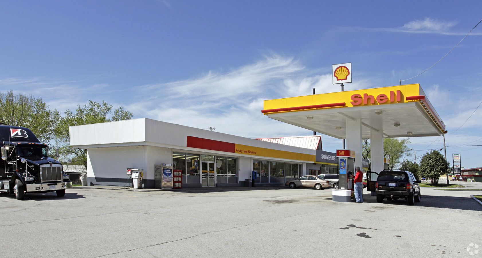
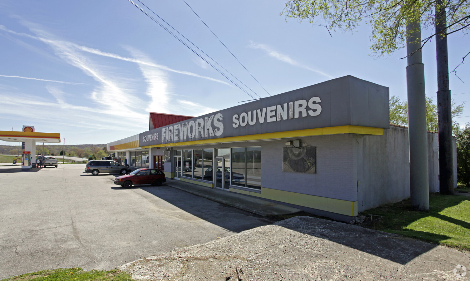
Property Record
3358 Westel Rd, Rockwood, TN 37854
NEARBY LISTINGS FOR SALE OR LEASE
-
-
View all Rockwood listings for sale on LoopNet.com
Property Detail
3358 Westel Rd
144-079.01
DISTRICT: 06, COUNTY AREA: R01
Commercialnec
Cumberland
X
Tennessee
47035C0400D
1.77 AC
2023
Tennessee East Area
2024
Other Market Areas
030500
Crossville, TN
6,707 SF
DEMOGRAPHICS near 3358 Westel Rd
1 Mile
3 Mile
5 Mile
2024 Total Population
205
1,873
9,355
2029 Population
226
2,046
10,169
Pop Growth 2024-2029
+ 10.24%
+ 9.24%
+ 8.70%
Average Age
45
44
44
2024 Total Households
86
801
3,930
HH Growth 2024-2029
+ 9.30%
+ 9.11%
+ 8.68%
Median Household Inc
$55,833
$44,749
$45,775
Avg Household Size
2.40
2.30
2.30
2024 Avg HH Vehicles
2.00
2.00
2.00
Median Home Value
$139,655
$114,674
$125,380
Median Year Built
1986
1976
1971
Nearby Places
- Restaurants
- Banks
- Shops
- Fitness
- Groceries
Nearby Properties
Address
Land Use
TOTAL SIZE
Lot Size
Zoning
Address
Land Use
TOTAL SIZE
Lot Size
Zoning
Address
Land Use
TOTAL SIZE
Lot Size
Zoning
190,022 SF
25.83 AC
Address
Land Use
TOTAL SIZE
Lot Size
Zoning
9.20 AC
Address
Land Use
TOTAL SIZE
Lot Size
Zoning
17,991 SF
10.80 AC
Address
Land Use
TOTAL SIZE
Lot Size
Zoning
7,778 SF
18.40 AC
Address
Land Use
TOTAL SIZE
Lot Size
Zoning
Address
Land Use
TOTAL SIZE
Lot Size
Zoning
1,067.90 AC
Address
Land Use
TOTAL SIZE
Lot Size
Zoning
10,208 SF
17.34 AC
Address
Land Use
TOTAL SIZE
Lot Size
Zoning
546 AC
Address
Land Use
TOTAL SIZE
Lot Size
Zoning
87,970 SF
3.70 AC
Address
Land Use
TOTAL SIZE
Lot Size
Zoning
19,240 SF
18.25 AC
Address
Land Use
TOTAL SIZE
Lot Size
Zoning
10,598 SF
24.20 AC
Address
Land Use
TOTAL SIZE
Lot Size
Zoning
4,856 SF
3.95 AC
Address
Land Use
TOTAL SIZE
Lot Size
Zoning
51,088 SF
7.90 AC
Address
Land Use
TOTAL SIZE
Lot Size
Zoning
6,536 SF
111.90 AC
Address
Land Use
TOTAL SIZE
Lot Size
Zoning
4,126.39 AC
Address
Land Use
TOTAL SIZE
Lot Size
Zoning
248,439 SF
9.26 AC
M1
Address
Land Use
TOTAL SIZE
Lot Size
Zoning
12,602 SF
83.48 AC
Address
Land Use
TOTAL SIZE
Lot Size
Zoning
Address
Land Use
TOTAL SIZE
Lot Size
Zoning
1,320 AC
Address
Land Use
TOTAL SIZE
Lot Size
Zoning
44.60 AC
Address
Land Use
TOTAL SIZE
Lot Size
Zoning
210 AC
Address
Land Use
TOTAL SIZE
Lot Size
Zoning
136.80 AC
Address
Land Use
TOTAL SIZE
Lot Size
Zoning
77,469 SF
11.31 AC
Address
Land Use
TOTAL SIZE
Lot Size
Zoning
1,237 AC
Address
Land Use
TOTAL SIZE
Lot Size
Zoning
Address
Land Use
TOTAL SIZE
Lot Size
Zoning
8,368 SF
4.14 AC
Address
Land Use
TOTAL SIZE
Lot Size
Zoning
8,041 SF
0.34 AC
Address
Land Use
TOTAL SIZE
Lot Size
Zoning
21,076 SF
2.29 AC
Address
Land Use
TOTAL SIZE
Lot Size
Zoning
The World's #1 Commercial Real Estate Marketplace
Connect with us
© 2025 CoStar Group
The information above has been obtained from sources believed reliable. While we do not doubt its accuracy we have not verified it and make no guarantee, warranty or representation about it. It is your responsibility to independently confirm its accuracy and completeness. Any projections, opinions, assumptions, or estimates used are for example only and do not represent the current or future performance of the property. The value of this transaction to you depends on tax and other factors which should be evaluated by your tax, financial, and legal advisors. You and your advisors should conduct a careful, independent investigation of the property to determine to your satisfaction the suitability of the property for your needs.