Property Record
338 Roanoke Ave, Roanoke Rapids, NC 27870
NEARBY LISTINGS FOR SALE OR LEASE
-
-
View all Roanoke Rapids listings for sale on LoopNet.com
Property Detail
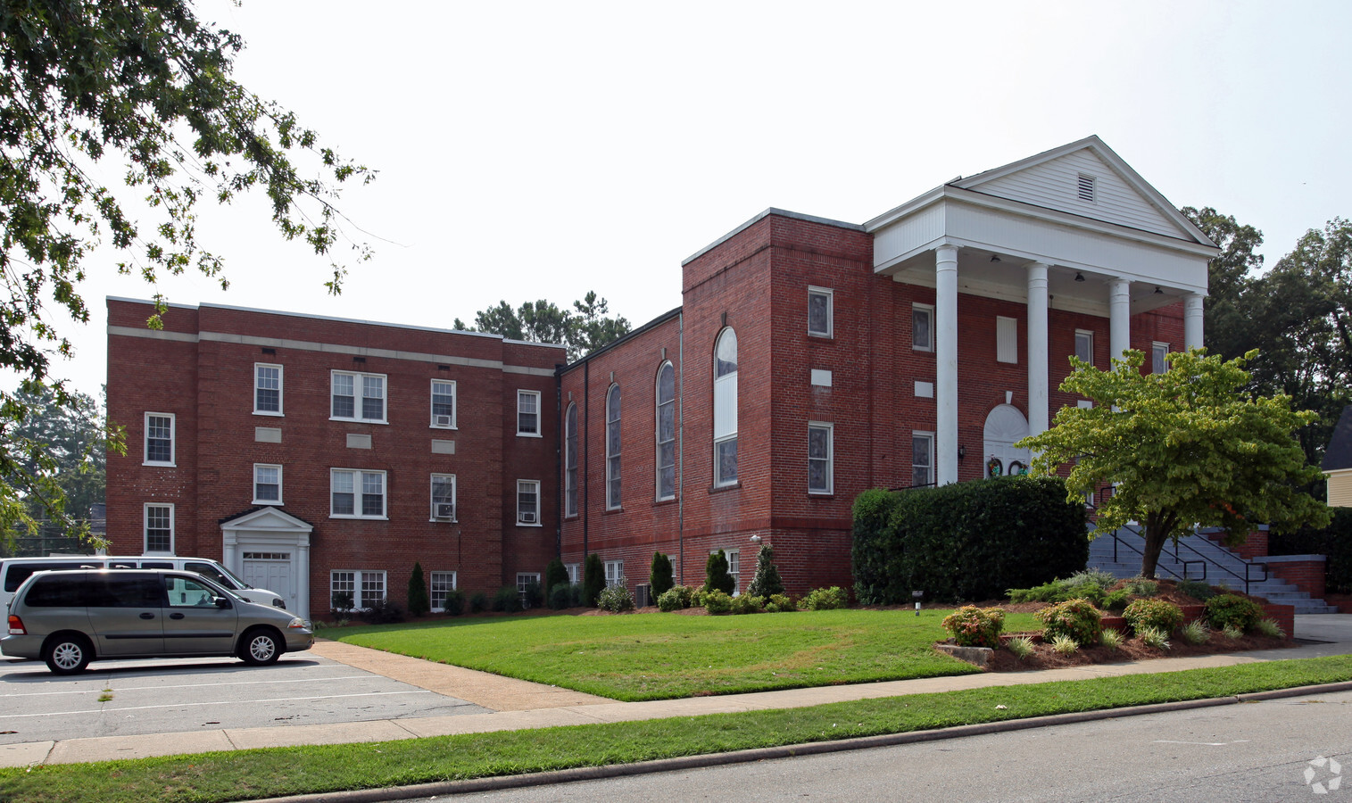
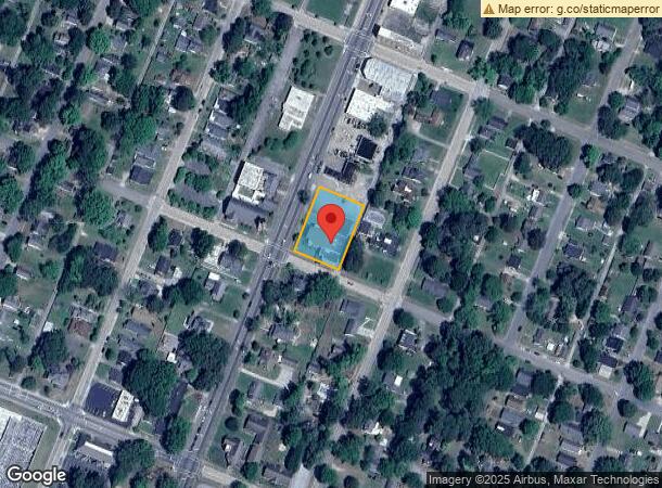
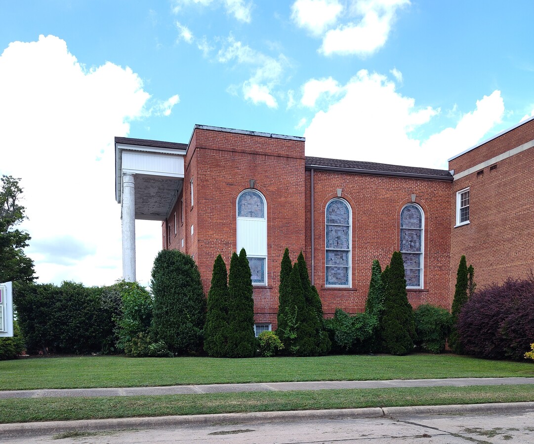
338 Roanoke Ave
09-09193
LOTS#332 334 336 338 340 342 344 346 &CHURCHROA AV
Religious
Halifax
X
North Carolina
3720399900K
0.64 AC
0
North Carolina Northeast Area
2024
Other Market Areas
930200
Roanoke Rapids, NC
24,780 SF
DEMOGRAPHICS near 338 Roanoke Ave
1 Mile
3 Mile
5 Mile
2024 Total Population
6,365
19,578
26,997
2029 Population
6,211
18,996
26,196
Pop Growth 2024-2029
(2.42%)
(2.97%)
(2.97%)
Average Age
40
41
42
2024 Total Households
2,527
8,360
11,550
HH Growth 2024-2029
(2.37%)
(2.95%)
(2.96%)
Median Household Inc
$54,917
$41,378
$38,268
Avg Household Size
2.40
2.30
2.30
2024 Avg HH Vehicles
2.00
2.00
2.00
Median Home Value
$142,607
$125,015
$113,498
Median Year Built
1959
1974
1976
Nearby Places
- Restaurants
- Banks
- Shops
- Fitness
- Groceries
Nearby Properties
Address
Land Use
TOTAL SIZE
Lot Size
Zoning
Address
Land Use
TOTAL SIZE
Lot Size
Zoning
239,194 SF
48.24 AC
RRB5
Address
Land Use
TOTAL SIZE
Lot Size
Zoning
50,336 SF
113.40 AC
WELI1
Address
Land Use
TOTAL SIZE
Lot Size
Zoning
97,735 SF
21.37 AC
RRR8
Address
Land Use
TOTAL SIZE
Lot Size
Zoning
94,328 SF
26.40 AC
RRR8
Address
Land Use
TOTAL SIZE
Lot Size
Zoning
203,628 SF
17.91 AC
RRB4
Address
Land Use
TOTAL SIZE
Lot Size
Zoning
26,530 SF
196.49 AC
RRI2
Address
Land Use
TOTAL SIZE
Lot Size
Zoning
46,948 SF
2.31 AC
RRB4
Address
Land Use
TOTAL SIZE
Lot Size
Zoning
110,678 SF
11.34 AC
RRB4
Address
Land Use
TOTAL SIZE
Lot Size
Zoning
66,609 SF
2.60 AC
RRB4
Address
Land Use
TOTAL SIZE
Lot Size
Zoning
13,794 SF
11.34 AC
RRR
Address
Land Use
TOTAL SIZE
Lot Size
Zoning
28,316 SF
10.19 AC
RRB4
Address
Land Use
TOTAL SIZE
Lot Size
Zoning
87,165 SF
8.77 AC
RRB4
Address
Land Use
TOTAL SIZE
Lot Size
Zoning
8,200 SF
5.96 AC
RRB4
Address
Land Use
TOTAL SIZE
Lot Size
Zoning
14,000 SF
13.66 AC
RRB4
Address
Land Use
TOTAL SIZE
Lot Size
Zoning
75,392 SF
4.22 AC
RRR
Address
Land Use
TOTAL SIZE
Lot Size
Zoning
60,043 SF
1.58 AC
RRR6
Address
Land Use
TOTAL SIZE
Lot Size
Zoning
69,793 SF
23.96 AC
Address
Land Use
TOTAL SIZE
Lot Size
Zoning
6,655 SF
10.02 AC
Address
Land Use
TOTAL SIZE
Lot Size
Zoning
14,300 SF
10 AC
RRB4
Address
Land Use
TOTAL SIZE
Lot Size
Zoning
38,176 SF
6.20 AC
RRR6
Address
Land Use
TOTAL SIZE
Lot Size
Zoning
75,353 SF
10 AC
RRR6
Address
Land Use
TOTAL SIZE
Lot Size
Zoning
14,400 SF
4.83 AC
RRI2
Address
Land Use
TOTAL SIZE
Lot Size
Zoning
57,708 SF
2.55 AC
RRB4
Address
Land Use
TOTAL SIZE
Lot Size
Zoning
10,114 SF
4.45 AC
RRR6
Address
Land Use
TOTAL SIZE
Lot Size
Zoning
35,336 SF
10.21 AC
RRB4
Address
Land Use
TOTAL SIZE
Lot Size
Zoning
132,851 SF
35.37 AC
Address
Land Use
TOTAL SIZE
Lot Size
Zoning
47,641 SF
2.15 AC
RRB4
Address
Land Use
TOTAL SIZE
Lot Size
Zoning
10,436 SF
4.92 AC
RRR6
Address
Land Use
TOTAL SIZE
Lot Size
Zoning
23,652 SF
5 AC
RRR
Address
Land Use
TOTAL SIZE
Lot Size
Zoning
6,840 SF
1.82 AC
RRR20
The World's #1 Commercial Real Estate Marketplace
Connect with us
© 2025 CoStar Group
The information above has been obtained from sources believed reliable. While we do not doubt its accuracy we have not verified it and make no guarantee, warranty or representation about it. It is your responsibility to independently confirm its accuracy and completeness. Any projections, opinions, assumptions, or estimates used are for example only and do not represent the current or future performance of the property. The value of this transaction to you depends on tax and other factors which should be evaluated by your tax, financial, and legal advisors. You and your advisors should conduct a careful, independent investigation of the property to determine to your satisfaction the suitability of the property for your needs.