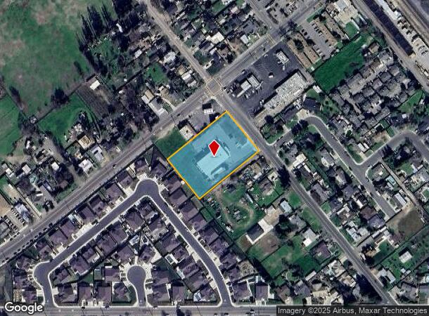
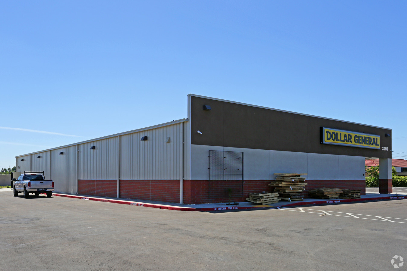
Property Record
3401 Fresno St, Denair, CA 95316
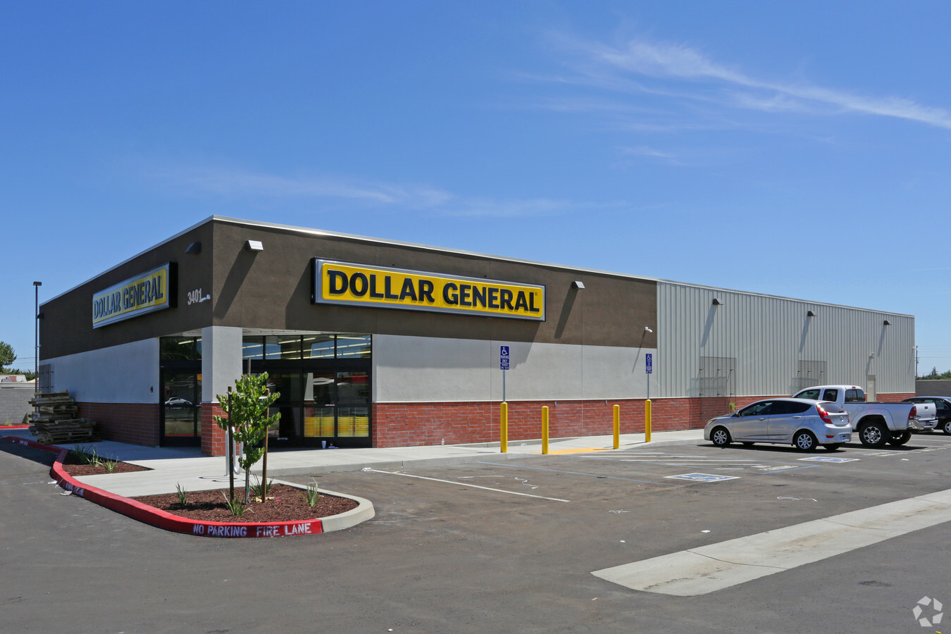

This Property Is For Sale
NEARBY LISTINGS FOR SALE OR LEASE
Property Detail
3401 Fresno St
Modesto, CA
J D
024-32-17
J D SUB LOT 66,67
Storemultistory
Stanislaus
X
California
06099C0600E
66&67
2024
1.69 AC
2024
Hughson/Oakdale/Waterford
003607
Stockton/Modesto
9,002 SF
DEMOGRAPHICS near 3401 Fresno St
1 Mile
3 Mile
5 Mile
2024 Total Population
5,320
38,070
84,782
2029 Population
5,302
38,146
84,895
Pop Growth 2024-2029
(0.34%)
+ 0.20%
+ 0.13%
Average Age
38
39
37
2024 Total Households
1,732
13,305
28,180
HH Growth 2024-2029
(0.40%)
+ 0.25%
+ 0.18%
Median Household Inc
$108,108
$83,941
$74,977
Avg Household Size
3.00
2.80
2.90
2024 Avg HH Vehicles
2.00
2.00
2.00
Median Home Value
$456,538
$455,878
$415,916
Median Year Built
1978
1978
1982
Nearby Places
- Restaurants
- Banks
- Shops
- Fitness
- Groceries
PUBLIC TRANSPORTATION
COMMUTER RAIL
Turlock-Denair (San Joaquins - Amtrak)
DRIVE
WALK
Distance
Turlock-Denair (San Joaquins - Amtrak)
1 min
8 min
0.4 mi
Freight Ports
Port of Stockton
DRIVE
WALK
Distance
Port of Stockton
63 min
48.5 mi
Nearby Properties
Address
Land Use
TOTAL SIZE
Lot Size
Zoning
Address
Land Use
TOTAL SIZE
Lot Size
Zoning
231,258 SF
17.84 AC
Address
Land Use
TOTAL SIZE
Lot Size
Zoning
142,720 SF
12.04 AC
Address
Land Use
TOTAL SIZE
Lot Size
Zoning
108,998 SF
10.10 AC
Address
Land Use
TOTAL SIZE
Lot Size
Zoning
149,310 SF
8.45 AC
Address
Land Use
TOTAL SIZE
Lot Size
Zoning
103,011 SF
7.90 AC
Address
Land Use
TOTAL SIZE
Lot Size
Zoning
55,242 SF
4.45 AC
CO
Address
Land Use
TOTAL SIZE
Lot Size
Zoning
44,860 SF
2.93 AC
Address
Land Use
TOTAL SIZE
Lot Size
Zoning
113,026 SF
9.39 AC
Address
Land Use
TOTAL SIZE
Lot Size
Zoning
105,464 SF
6.60 AC
Address
Land Use
TOTAL SIZE
Lot Size
Zoning
100,911 SF
14.88 AC
Address
Land Use
TOTAL SIZE
Lot Size
Zoning
49,250 SF
2.77 AC
Address
Land Use
TOTAL SIZE
Lot Size
Zoning
42,096 SF
3.17 AC
Address
Land Use
TOTAL SIZE
Lot Size
Zoning
57,674 SF
4 AC
Address
Land Use
TOTAL SIZE
Lot Size
Zoning
47,856 SF
2.53 AC
Address
Land Use
TOTAL SIZE
Lot Size
Zoning
92,584 SF
4.77 AC
Address
Land Use
TOTAL SIZE
Lot Size
Zoning
177,727 SF
9.14 AC
Address
Land Use
TOTAL SIZE
Lot Size
Zoning
30,306 SF
6.25 AC
Address
Land Use
TOTAL SIZE
Lot Size
Zoning
19,727 SF
2.06 AC
TURCC
Address
Land Use
TOTAL SIZE
Lot Size
Zoning
28,888 SF
2.07 AC
Address
Land Use
TOTAL SIZE
Lot Size
Zoning
1,448 SF
155 AC
A240
Address
Land Use
TOTAL SIZE
Lot Size
Zoning
21,480 SF
1.53 AC
Address
Land Use
TOTAL SIZE
Lot Size
Zoning
2,525 SF
123.24 AC
Address
Land Use
TOTAL SIZE
Lot Size
Zoning
2,535 SF
326.36 AC
A240
Address
Land Use
TOTAL SIZE
Lot Size
Zoning
41,268 SF
2.80 AC
Address
Land Use
TOTAL SIZE
Lot Size
Zoning
1,372 SF
24.45 AC
A240
Address
Land Use
TOTAL SIZE
Lot Size
Zoning
50,640 SF
4.23 AC
Address
Land Use
TOTAL SIZE
Lot Size
Zoning
17,526 SF
1.62 AC
C2
Address
Land Use
TOTAL SIZE
Lot Size
Zoning
41,026 SF
2.82 AC
Address
Land Use
TOTAL SIZE
Lot Size
Zoning
29,448 SF
1.54 AC
TURRH
Address
Land Use
TOTAL SIZE
Lot Size
Zoning
3,682 SF
18.61 AC
The World's #1 Commercial Real Estate Marketplace
Connect with us
© 2025 CoStar Group
The information above has been obtained from sources believed reliable. While we do not doubt its accuracy we have not verified it and make no guarantee, warranty or representation about it. It is your responsibility to independently confirm its accuracy and completeness. Any projections, opinions, assumptions, or estimates used are for example only and do not represent the current or future performance of the property. The value of this transaction to you depends on tax and other factors which should be evaluated by your tax, financial, and legal advisors. You and your advisors should conduct a careful, independent investigation of the property to determine to your satisfaction the suitability of the property for your needs.