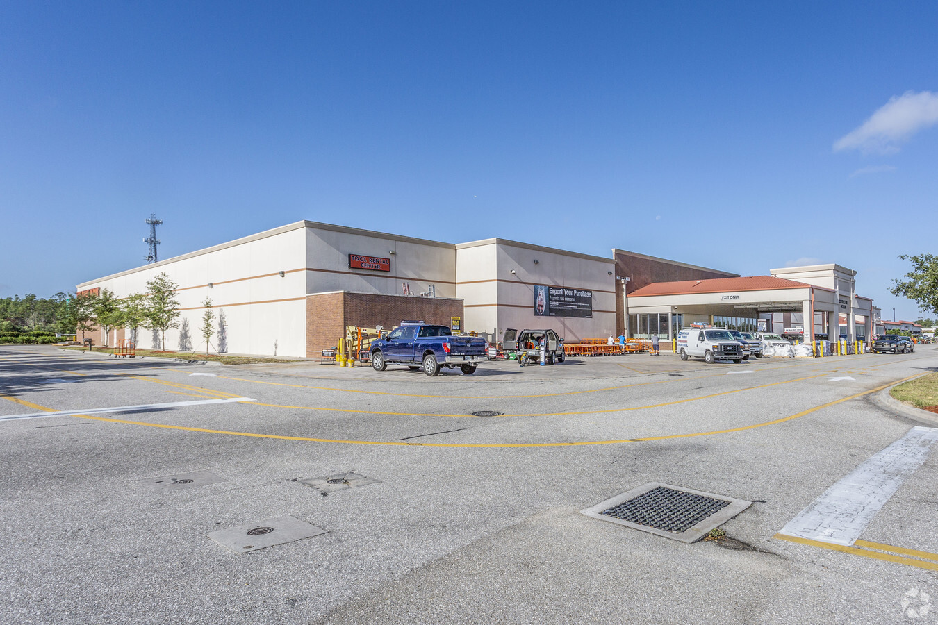
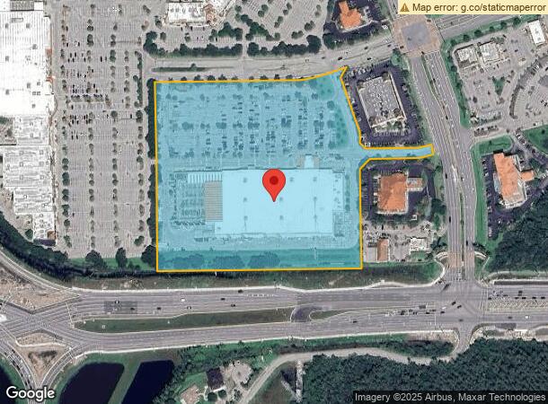
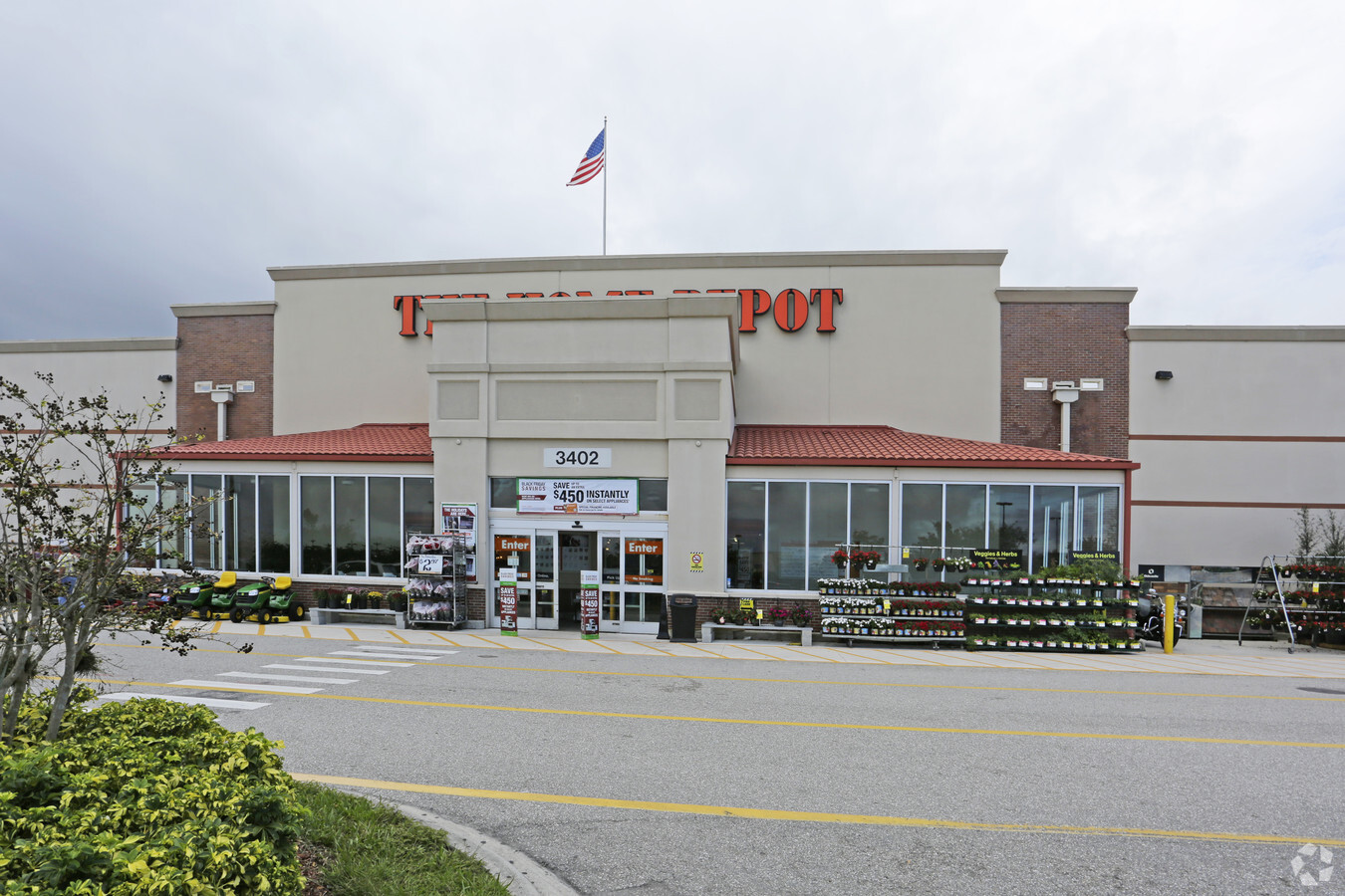
Property Record
3402 Forum Blvd, Fort Myers, FL 33905
NEARBY LISTINGS FOR SALE OR LEASE
Property Detail
3402 Forum Blvd
Cape Coral-Fort Myers, FL
Colonial - Sr 82 E Of I-75 Bbb
27-44-25-P3-0050A.0000
HOME DEPOT AT THE FORUM PB 77 PGS 100 + 101 TRACT A
Storemultistory
Lee
X
Florida
12071C0431G
tr22
2023
13.63 AC
2024
City of Ft Myers
040110
Southwest Florida
167,017 SF
DEMOGRAPHICS near 3402 Forum Blvd
1 Mile
3 Mile
5 Mile
2024 Total Population
6,189
44,908
138,028
2029 Population
7,560
54,105
164,340
Pop Growth 2024-2029
+ 22.15%
+ 20.48%
+ 19.06%
Average Age
43
44
42
2024 Total Households
2,206
18,699
54,165
HH Growth 2024-2029
+ 23.89%
+ 20.65%
+ 19.03%
Median Household Inc
$70,392
$69,088
$60,281
Avg Household Size
2.20
2.20
2.40
2024 Avg HH Vehicles
1.00
2.00
2.00
Median Home Value
$317,453
$313,211
$287,756
Median Year Built
2010
2008
2002
Nearby Places
- Restaurants
- Banks
- Shops
- Fitness
- Groceries
PUBLIC TRANSPORTATION
AIRPORT
Southwest Florida International
DRIVE
WALK
Distance
Southwest Florida International
16 min
8.9 mi
Punta Gorda
DRIVE
WALK
Distance
Punta Gorda
34 min
27.4 mi
Freight Ports
Port Manatee
DRIVE
WALK
Distance
Port Manatee
114 min
99.1 mi
Nearby Properties
Address
Land Use
TOTAL SIZE
Lot Size
Zoning
Address
Land Use
TOTAL SIZE
Lot Size
Zoning
608,522 SF
38.57 AC
CG
Address
Land Use
TOTAL SIZE
Lot Size
Zoning
438,839 SF
66.95 AC
MU
Address
Land Use
TOTAL SIZE
Lot Size
Zoning
362,391 SF
12.80 AC
SDA
Address
Land Use
TOTAL SIZE
Lot Size
Zoning
475,045 SF
30.22 AC
PUD
Address
Land Use
TOTAL SIZE
Lot Size
Zoning
429,703 SF
16.24 AC
PUD
Address
Land Use
TOTAL SIZE
Lot Size
Zoning
432,890 SF
18.88 AC
SDA
Address
Land Use
TOTAL SIZE
Lot Size
Zoning
77.79 AC
PUD
Address
Land Use
TOTAL SIZE
Lot Size
Zoning
425,658 SF
25.61 AC
CG
Address
Land Use
TOTAL SIZE
Lot Size
Zoning
364,206 SF
106.76 AC
PUD
Address
Land Use
TOTAL SIZE
Lot Size
Zoning
305,224 SF
17.11 AC
CG
Address
Land Use
TOTAL SIZE
Lot Size
Zoning
368,722 SF
18.09 AC
CG
Address
Land Use
TOTAL SIZE
Lot Size
Zoning
16.13 AC
Address
Land Use
TOTAL SIZE
Lot Size
Zoning
286,629 SF
13.01 AC
SDA
Address
Land Use
TOTAL SIZE
Lot Size
Zoning
304,258 SF
12.20 AC
CG
Address
Land Use
TOTAL SIZE
Lot Size
Zoning
260,320 SF
8.81 AC
SDA
Address
Land Use
TOTAL SIZE
Lot Size
Zoning
261,340 SF
9.07 AC
CG
Address
Land Use
TOTAL SIZE
Lot Size
Zoning
250,169 SF
10.67 AC
CI
Address
Land Use
TOTAL SIZE
Lot Size
Zoning
580,121 SF
61.83 AC
IL
Address
Land Use
TOTAL SIZE
Lot Size
Zoning
324,346 SF
20 AC
C1
Address
Land Use
TOTAL SIZE
Lot Size
Zoning
333,614 SF
294.30 AC
AG-2
Address
Land Use
TOTAL SIZE
Lot Size
Zoning
13.71 AC
Address
Land Use
TOTAL SIZE
Lot Size
Zoning
319,765 SF
47.40 AC
RS7
Address
Land Use
TOTAL SIZE
Lot Size
Zoning
154,653 SF
11.77 AC
SDA
Address
Land Use
TOTAL SIZE
Lot Size
Zoning
288,358 SF
23.15 AC
CG
Address
Land Use
TOTAL SIZE
Lot Size
Zoning
482,282 SF
20 AC
CG
Address
Land Use
TOTAL SIZE
Lot Size
Zoning
231,360 SF
17.08 AC
PUD
Address
Land Use
TOTAL SIZE
Lot Size
Zoning
174,647 SF
21.56 AC
CG
Address
Land Use
TOTAL SIZE
Lot Size
Zoning
45,040 SF
14.03 AC
CG
Address
Land Use
TOTAL SIZE
Lot Size
Zoning
128,803 SF
9.80 AC
CPD
Address
Land Use
TOTAL SIZE
Lot Size
Zoning
52.12 AC
PUD
The World's #1 Commercial Real Estate Marketplace
Connect with us
© 2025 CoStar Group
The information above has been obtained from sources believed reliable. While we do not doubt its accuracy we have not verified it and make no guarantee, warranty or representation about it. It is your responsibility to independently confirm its accuracy and completeness. Any projections, opinions, assumptions, or estimates used are for example only and do not represent the current or future performance of the property. The value of this transaction to you depends on tax and other factors which should be evaluated by your tax, financial, and legal advisors. You and your advisors should conduct a careful, independent investigation of the property to determine to your satisfaction the suitability of the property for your needs.