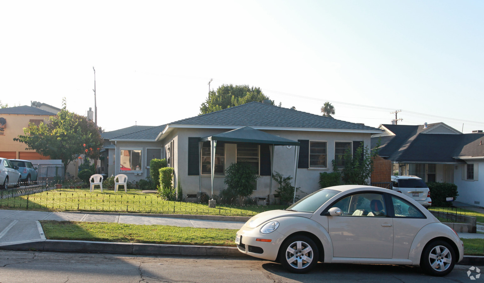
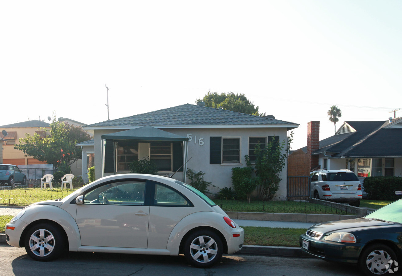
Property Record
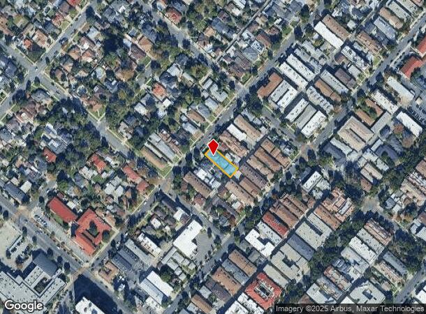
516 E Harvard Rd, Burbank, CA 91501

NEARBY LISTINGS FOR SALE OR LEASE
Property Detail
516 E Harvard Rd
Los Angeles-Long Beach-Glendale, CA
5829
2459-040-054
TR=5829 EX OF ALLEY LOT 27
Multifamilydwelling
Los Angeles
X
California
06037C1335F
27
2024
0.18 AC
2024
Burbank
310701
Los Angeles
3,957 SF
DEMOGRAPHICS near 516 E Harvard Rd
1 Mile
3 Mile
5 Mile
2024 Total Population
31,790
133,883
450,371
2029 Population
30,746
129,249
436,255
Pop Growth 2024-2029
(3.28%)
(3.46%)
(3.13%)
Average Age
42
42
41
2024 Total Households
13,142
51,793
176,251
HH Growth 2024-2029
(3.54%)
(3.72%)
(3.35%)
Median Household Inc
$71,777
$84,821
$75,907
Avg Household Size
2.40
2.50
2.50
2024 Avg HH Vehicles
2.00
2.00
2.00
Median Home Value
$880,293
$876,222
$857,017
Median Year Built
1972
1957
1964
Nearby Places
- Restaurants
- Banks
- Shops
- Fitness
- Groceries
PUBLIC TRANSPORTATION
COMMUTER RAIL
Downtown Burbank (Antelope Valley Line - Southern California Regional Rail Authority (Metrolink), Ventura County Line - Southern California Regional Rail Authority (Metrolink))
DRIVE
WALK
Distance
Downtown Burbank (Antelope Valley Line - Southern California Regional Rail Authority (Metrolink), Ventura County Line - Southern California Regional Rail Authority (Metrolink))
3 min
1.5 mi
Burbank-Bob Hope Airport (Ventura County Line - Southern California Regional Rail Authority (Metrolink))
DRIVE
WALK
Distance
Burbank-Bob Hope Airport (Ventura County Line - Southern California Regional Rail Authority (Metrolink))
6 min
2.7 mi
AIRPORT
Bob Hope
DRIVE
WALK
Distance
Bob Hope
10 min
5.3 mi
Los Angeles International
DRIVE
WALK
Distance
Los Angeles International
41 min
20.7 mi
Long Beach (Daugherty Field)
DRIVE
WALK
Distance
Long Beach (Daugherty Field)
45 min
32.8 mi
Freight Ports
Port of Long Beach
DRIVE
WALK
Distance
Port of Long Beach
47 min
35.6 mi
Nearby Properties
Address
Land Use
TOTAL SIZE
Lot Size
Zoning
Address
Land Use
TOTAL SIZE
Lot Size
Zoning
735,900 SF
34.87 AC
BUPD*
Address
Land Use
TOTAL SIZE
Lot Size
Zoning
207,766 SF
42.81 AC
BUM1*
Address
Land Use
TOTAL SIZE
Lot Size
Zoning
359,197 SF
13.48 AC
GLENDALE M
Address
Land Use
TOTAL SIZE
Lot Size
Zoning
849,801 SF
59.25 AC
BUM2
Address
Land Use
TOTAL SIZE
Lot Size
Zoning
616,662 SF
19.66 AC
BUM1*
Address
Land Use
TOTAL SIZE
Lot Size
Zoning
397,477 SF
2.75 AC
BUR4
Address
Land Use
TOTAL SIZE
Lot Size
Zoning
979,623 SF
13.36 AC
GLM2
Address
Land Use
TOTAL SIZE
Lot Size
Zoning
489,466 SF
2.90 AC
BUM1
Address
Land Use
TOTAL SIZE
Lot Size
Zoning
452,048 SF
21.58 AC
BCCM
Address
Land Use
TOTAL SIZE
Lot Size
Zoning
43,558 SF
30.11 AC
BUMI-C2*
Address
Land Use
TOTAL SIZE
Lot Size
Zoning
1,328,547 SF
39.36 AC
BUPD
Address
Land Use
TOTAL SIZE
Lot Size
Zoning
432,232 SF
7.17 AC
BUM2
Address
Land Use
TOTAL SIZE
Lot Size
Zoning
219,607 SF
1.50 AC
BUR4
Address
Land Use
TOTAL SIZE
Lot Size
Zoning
380,017 SF
Address
Land Use
TOTAL SIZE
Lot Size
Zoning
440,774 SF
2.20 AC
BUR4*
Address
Land Use
TOTAL SIZE
Lot Size
Zoning
362,863 SF
1.82 AC
BUMZ
Address
Land Use
TOTAL SIZE
Lot Size
Zoning
346,186 SF
11.72 AC
BUM2*
Address
Land Use
TOTAL SIZE
Lot Size
Zoning
558,532 SF
5.20 AC
BUC4*
Address
Land Use
TOTAL SIZE
Lot Size
Zoning
660,463 SF
6.88 AC
BUR4*
Address
Land Use
TOTAL SIZE
Lot Size
Zoning
612,976 SF
3.53 AC
BUC2*
Address
Land Use
TOTAL SIZE
Lot Size
Zoning
151,704 SF
1 AC
BUC4*
Address
Land Use
TOTAL SIZE
Lot Size
Zoning
488,658 SF
3.85 AC
BUMDCZ*
Address
Land Use
TOTAL SIZE
Lot Size
Zoning
279,574 SF
4 AC
BUM2*
Address
Land Use
TOTAL SIZE
Lot Size
Zoning
299,864 SF
1.29 AC
BUC3
Address
Land Use
TOTAL SIZE
Lot Size
Zoning
252,974 SF
2.86 AC
BUC4
Address
Land Use
TOTAL SIZE
Lot Size
Zoning
255,800 SF
1.51 AC
BUC2*
Address
Land Use
TOTAL SIZE
Lot Size
Zoning
126,652 SF
0.93 AC
BUC3
Address
Land Use
TOTAL SIZE
Lot Size
Zoning
106,988 SF
1.45 AC
BUM2*
Address
Land Use
TOTAL SIZE
Lot Size
Zoning
203,175 SF
1.15 AC
BUC4*
Address
Land Use
TOTAL SIZE
Lot Size
Zoning
108,649 SF
3.33 AC
BUPD
The World's #1 Commercial Real Estate Marketplace
Connect with us
© 2025 CoStar Group
The information above has been obtained from sources believed reliable. While we do not doubt its accuracy we have not verified it and make no guarantee, warranty or representation about it. It is your responsibility to independently confirm its accuracy and completeness. Any projections, opinions, assumptions, or estimates used are for example only and do not represent the current or future performance of the property. The value of this transaction to you depends on tax and other factors which should be evaluated by your tax, financial, and legal advisors. You and your advisors should conduct a careful, independent investigation of the property to determine to your satisfaction the suitability of the property for your needs.