Property Record
342 2Nd St, Portsmouth, OH 45662
NEARBY LISTINGS FOR SALE OR LEASE
-
-
View all Portsmouth listings for sale on LoopNet.com
Property Detail
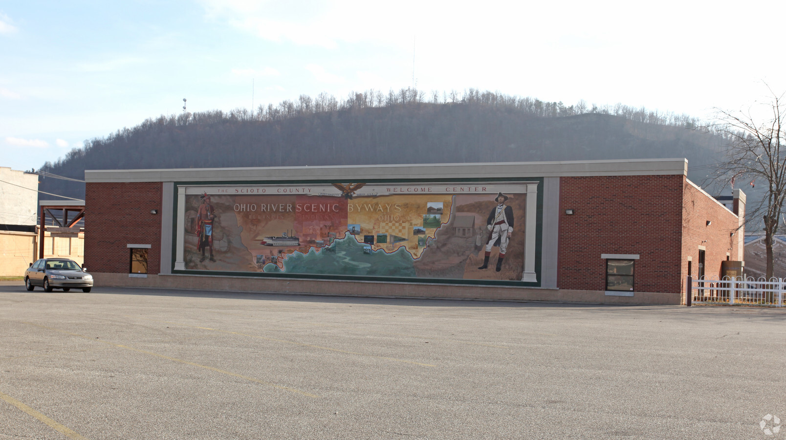
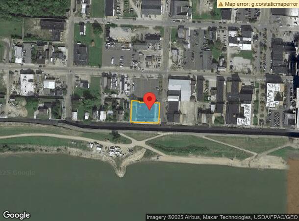
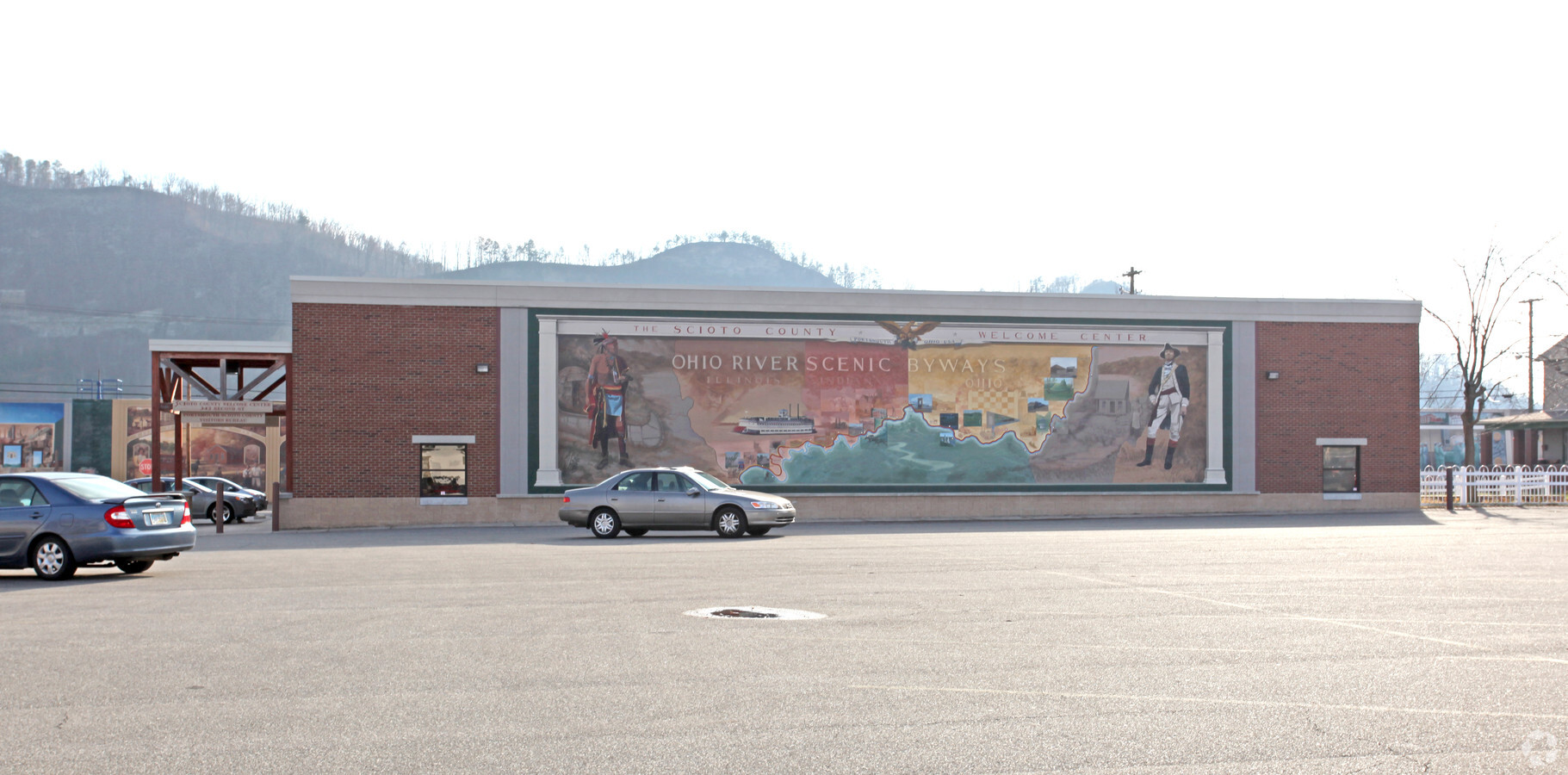
342 2Nd St
Portsmouth, OH
CITY WH LOT 189+202 + VAC ALLEY 123 X 123 & 49 X 132 MAP 3-1
29-0375.000
Scioto
Storebuilding
Ohio
X
189
39145C0382F
0.50 AC
2024
Ohio South Area
2024
Other Market Areas
003600
DEMOGRAPHICS near 342 2Nd St
1 Mile
3 Mile
5 Mile
2024 Total Population
2,244
20,189
29,490
2029 Population
2,217
19,775
28,828
Pop Growth 2024-2029
(1.20%)
(2.05%)
(2.24%)
Average Age
39
40
41
2024 Total Households
899
8,483
12,416
HH Growth 2024-2029
(0.56%)
(2.02%)
(2.24%)
Median Household Inc
$17,331
$29,246
$30,849
Avg Household Size
1.60
2.20
2.20
2024 Avg HH Vehicles
1.00
2.00
2.00
Median Home Value
$150,000
$79,006
$82,284
Median Year Built
1947
1953
1956
Nearby Places
- Restaurants
- Banks
- Shops
- Fitness
- Groceries
PUBLIC TRANSPORTATION
COMMUTER RAIL
South Portsmouth Amtrak (Cardinal - Amtrak)
DRIVE
WALK
Distance
South Portsmouth Amtrak (Cardinal - Amtrak)
4 min
3.2 mi
Freight Ports
Port of Toledo
DRIVE
WALK
Distance
Port of Toledo
307 min
228.2 mi
Nearby Properties
Address
Land Use
TOTAL SIZE
Lot Size
Zoning
Address
Land Use
TOTAL SIZE
Lot Size
Zoning
15.67 AC
Address
Land Use
TOTAL SIZE
Lot Size
Zoning
3.57 AC
Address
Land Use
TOTAL SIZE
Lot Size
Zoning
Address
Land Use
TOTAL SIZE
Lot Size
Zoning
2.47 AC
Address
Land Use
TOTAL SIZE
Lot Size
Zoning
9.09 AC
Address
Land Use
TOTAL SIZE
Lot Size
Zoning
4.17 AC
Address
Land Use
TOTAL SIZE
Lot Size
Zoning
11.26 AC
Address
Land Use
TOTAL SIZE
Lot Size
Zoning
Address
Land Use
TOTAL SIZE
Lot Size
Zoning
2.70 AC
Address
Land Use
TOTAL SIZE
Lot Size
Zoning
0.91 AC
Address
Land Use
TOTAL SIZE
Lot Size
Zoning
16.98 AC
Address
Land Use
TOTAL SIZE
Lot Size
Zoning
1.18 AC
Address
Land Use
TOTAL SIZE
Lot Size
Zoning
17,946 SF
2.33 AC
Address
Land Use
TOTAL SIZE
Lot Size
Zoning
1.58 AC
Address
Land Use
TOTAL SIZE
Lot Size
Zoning
Address
Land Use
TOTAL SIZE
Lot Size
Zoning
0.12 AC
Address
Land Use
TOTAL SIZE
Lot Size
Zoning
1.56 AC
Address
Land Use
TOTAL SIZE
Lot Size
Zoning
3.08 AC
Address
Land Use
TOTAL SIZE
Lot Size
Zoning
2.80 AC
Address
Land Use
TOTAL SIZE
Lot Size
Zoning
8.04 AC
Address
Land Use
TOTAL SIZE
Lot Size
Zoning
6.37 AC
Address
Land Use
TOTAL SIZE
Lot Size
Zoning
1.82 AC
Address
Land Use
TOTAL SIZE
Lot Size
Zoning
1.91 AC
Address
Land Use
TOTAL SIZE
Lot Size
Zoning
1.52 AC
Address
Land Use
TOTAL SIZE
Lot Size
Zoning
16.45 AC
Address
Land Use
TOTAL SIZE
Lot Size
Zoning
0.88 AC
Address
Land Use
TOTAL SIZE
Lot Size
Zoning
0.85 AC
Address
Land Use
TOTAL SIZE
Lot Size
Zoning
1.17 AC
Address
Land Use
TOTAL SIZE
Lot Size
Zoning
15.53 AC
Address
Land Use
TOTAL SIZE
Lot Size
Zoning
0.88 AC
The World's #1 Commercial Real Estate Marketplace
Connect with us
© 2025 CoStar Group
The information above has been obtained from sources believed reliable. While we do not doubt its accuracy we have not verified it and make no guarantee, warranty or representation about it. It is your responsibility to independently confirm its accuracy and completeness. Any projections, opinions, assumptions, or estimates used are for example only and do not represent the current or future performance of the property. The value of this transaction to you depends on tax and other factors which should be evaluated by your tax, financial, and legal advisors. You and your advisors should conduct a careful, independent investigation of the property to determine to your satisfaction the suitability of the property for your needs.