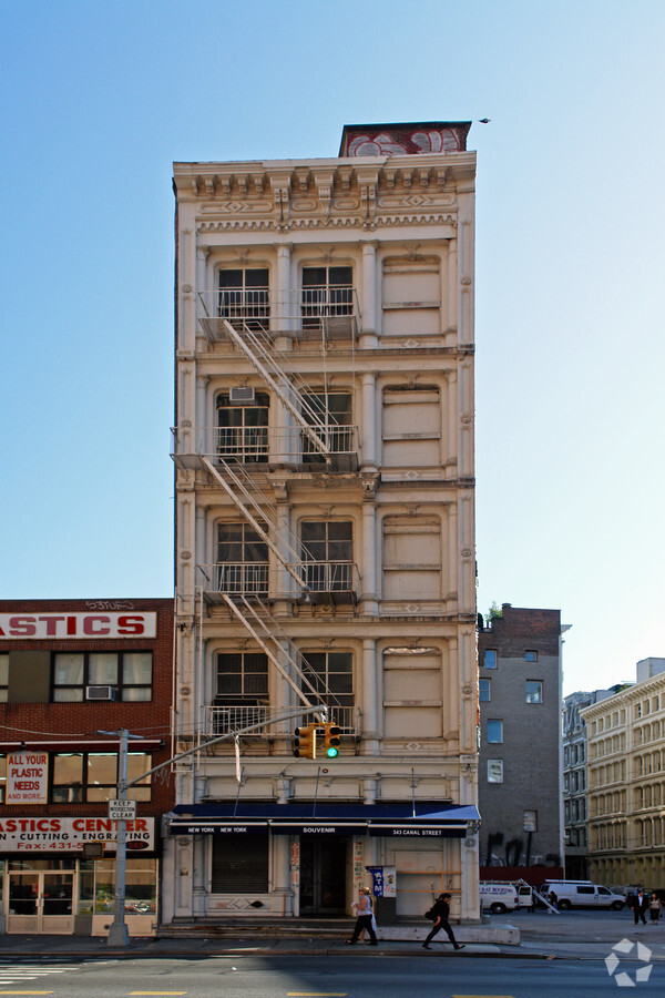
Property Record
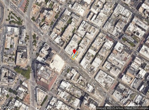
343 Canal St, New York, NY 10013
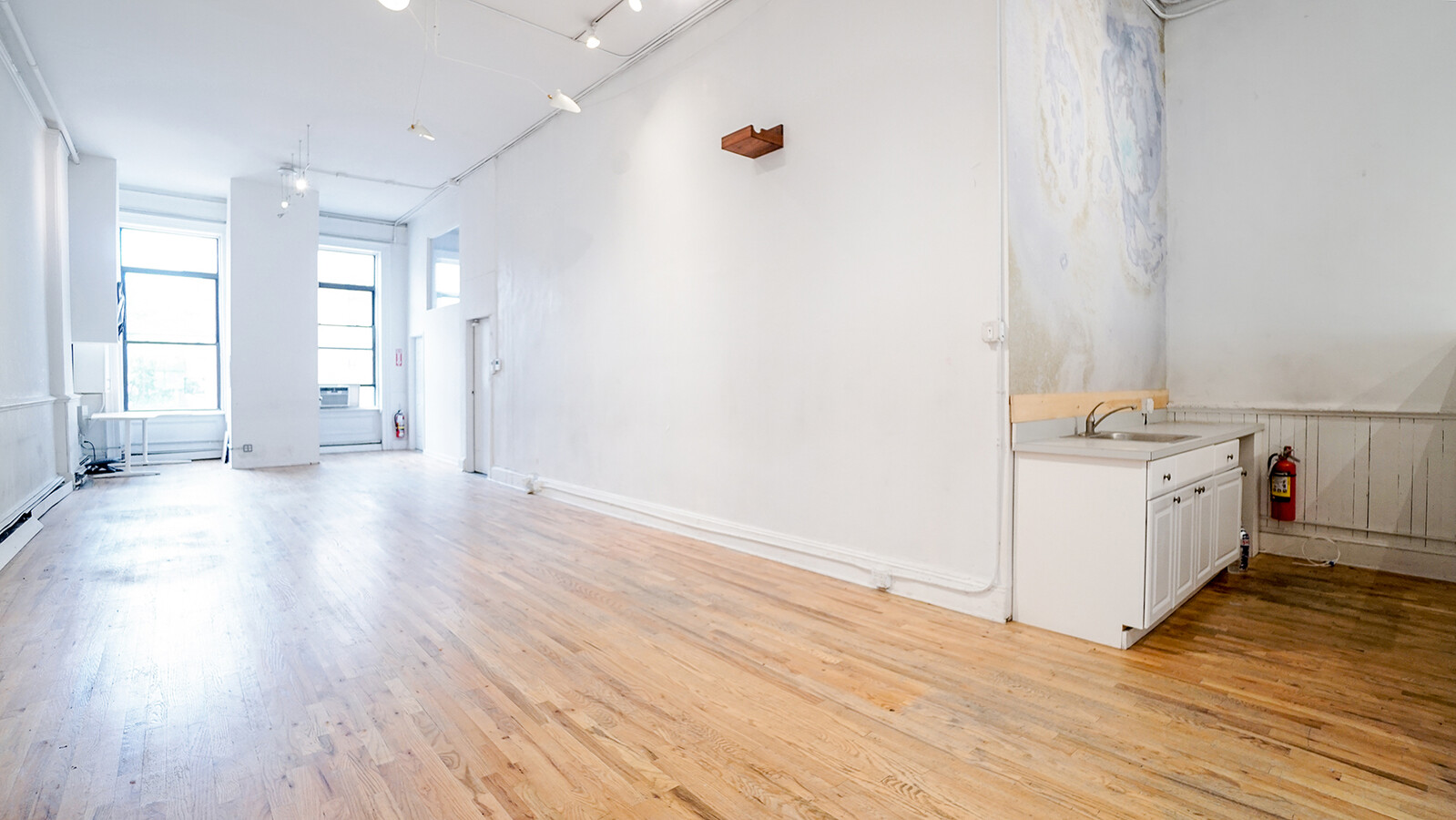
Current Lease Availabilities
NEARBY LISTINGS FOR SALE OR LEASE
Property Detail
343 Canal St
0229-0003
Manhattan
Officebuilding
New York
X
3
3604970182F
0.05 AC
2024
Soho
2024
New York City
004700
New York-Jersey City-White Plains, NY-NJ
10,900 SF
DEMOGRAPHICS near 343 Canal St
1 Mile
3 Mile
5 Mile
2024 Total Population
190,465
1,075,758
2,460,925
2029 Population
177,254
1,021,314
2,327,735
Pop Growth 2024-2029
(6.94%)
(5.06%)
(5.41%)
Average Age
41
38
39
2024 Total Households
93,382
517,720
1,121,316
HH Growth 2024-2029
(7.08%)
(5.45%)
(5.83%)
Median Household Inc
$101,687
$113,337
$99,176
Avg Household Size
1.90
2.00
2.10
2024 Avg HH Vehicles
.00
.00
.00
Median Home Value
$1,036,265
$926,334
$931,038
Median Year Built
1948
1960
1955
Nearby Places
- Restaurants
- Banks
- Shops
- Fitness
- Groceries
PUBLIC TRANSPORTATION
TRANSIT/SUBWAY
Canal Street (N,Q,R Line) (N - New York MTA Subway (The Subway), Q - New York MTA Subway (The Subway), R - New York MTA Subway (The Subway))
DRIVE
WALK
Distance
Canal Street (N,Q,R Line) (N - New York MTA Subway (The Subway), Q - New York MTA Subway (The Subway), R - New York MTA Subway (The Subway))
0 min
2 min
0.1 mi
Canal Street (A,C,E Line) (A - New York MTA Subway (The Subway), C - New York MTA Subway (The Subway), E - New York MTA Subway (The Subway))
DRIVE
WALK
Distance
Canal Street (A,C,E Line) (A - New York MTA Subway (The Subway), C - New York MTA Subway (The Subway), E - New York MTA Subway (The Subway))
1 min
2 min
0.1 mi
Canal Street (1,2 Line) (1 - New York MTA Subway (The Subway), 2 - New York MTA Subway (The Subway))
DRIVE
WALK
Distance
Canal Street (1,2 Line) (1 - New York MTA Subway (The Subway), 2 - New York MTA Subway (The Subway))
0 min
4 min
0.2 mi
Canal Street (4,5,6 Line) (4 - New York MTA Subway (The Subway), 6 - New York MTA Subway (The Subway), J - New York MTA Subway (The Subway), M - New York MTA Subway (The Subway), N - New York MTA Subway (The Subway), Q - New York MTA Subway (The Subway), R - New York MTA Subway (The Subway), Z - New York MTA Subway (The Subway))
DRIVE
WALK
Distance
Canal Street (4,5,6 Line) (4 - New York MTA Subway (The Subway), 6 - New York MTA Subway (The Subway), J - New York MTA Subway (The Subway), M - New York MTA Subway (The Subway), N - New York MTA Subway (The Subway), Q - New York MTA Subway (The Subway), R - New York MTA Subway (The Subway), Z - New York MTA Subway (The Subway))
1 min
4 min
0.2 mi
Franklin Street (1 - New York MTA Subway (The Subway), 2 - New York MTA Subway (The Subway))
DRIVE
WALK
Distance
Franklin Street (1 - New York MTA Subway (The Subway), 2 - New York MTA Subway (The Subway))
1 min
5 min
0.3 mi
COMMUTER RAIL
Christopher St (Hoboken-33rd Street - Port Authority Trans-Hudson (PATH), Journal Square-33rd Street - Port Authority Trans-Hudson (PATH))
DRIVE
WALK
Distance
Christopher St (Hoboken-33rd Street - Port Authority Trans-Hudson (PATH), Journal Square-33rd Street - Port Authority Trans-Hudson (PATH))
3 min
18 min
1.0 mi
9 St (Path) (Hoboken-33rd Street - Port Authority Trans-Hudson (PATH), Journal Square-33rd Street - Port Authority Trans-Hudson (PATH))
DRIVE
WALK
Distance
9 St (Path) (Hoboken-33rd Street - Port Authority Trans-Hudson (PATH), Journal Square-33rd Street - Port Authority Trans-Hudson (PATH))
3 min
20 min
1.0 mi
AIRPORT
Laguardia
DRIVE
WALK
Distance
Laguardia
21 min
10.0 mi
Newark Liberty International
DRIVE
WALK
Distance
Newark Liberty International
18 min
11.9 mi
John F Kennedy International
DRIVE
WALK
Distance
John F Kennedy International
31 min
18.2 mi
Freight Ports
NY - Red Hook Container Terminal
DRIVE
WALK
Distance
NY - Red Hook Container Terminal
9 min
3.6 mi
Nearby Properties
Address
Land Use
TOTAL SIZE
Lot Size
Zoning
Address
Land Use
TOTAL SIZE
Lot Size
Zoning
8,966,500 SF
19.14 AC
C6-4
Address
Land Use
TOTAL SIZE
Lot Size
Zoning
4,060,596 SF
22.09 AC
M2-3
Address
Land Use
TOTAL SIZE
Lot Size
Zoning
2,245,112 SF
2.02 AC
C6-6
Address
Land Use
TOTAL SIZE
Lot Size
Zoning
2,521,850 SF
1.59 AC
C6-4
Address
Land Use
TOTAL SIZE
Lot Size
Zoning
2,221,336 SF
1.55 AC
C6-4
Address
Land Use
TOTAL SIZE
Lot Size
Zoning
2,161,994 SF
3.79 AC
M1-5
Address
Land Use
TOTAL SIZE
Lot Size
Zoning
2,636,182 SF
2.35 AC
C65.5
Address
Land Use
TOTAL SIZE
Lot Size
Zoning
2,354,289 SF
3.96 AC
C6-4
Address
Land Use
TOTAL SIZE
Lot Size
Zoning
1,678,135 SF
1.01 AC
C5-3
Address
Land Use
TOTAL SIZE
Lot Size
Zoning
2,734,038 SF
4.24 AC
C52.5
Address
Land Use
TOTAL SIZE
Lot Size
Zoning
2,812,739 SF
2.10 AC
C5-3
Address
Land Use
TOTAL SIZE
Lot Size
Zoning
1,586,876 SF
1.87 AC
C5-3
Address
Land Use
TOTAL SIZE
Lot Size
Zoning
1,048,620 SF
5.67 AC
C6-4
Address
Land Use
TOTAL SIZE
Lot Size
Zoning
1,962,900 SF
1.89 AC
C66.5
Address
Land Use
TOTAL SIZE
Lot Size
Zoning
1,178,640 SF
0.92 AC
C6-4
Address
Land Use
TOTAL SIZE
Lot Size
Zoning
2,535,958 SF
2.94 AC
C6-4
Address
Land Use
TOTAL SIZE
Lot Size
Zoning
1,751,641 SF
1.84 AC
C6-4
Address
Land Use
TOTAL SIZE
Lot Size
Zoning
6,877 SF
27.74 AC
R-1E
Address
Land Use
TOTAL SIZE
Lot Size
Zoning
Address
Land Use
TOTAL SIZE
Lot Size
Zoning
1,642,675 SF
1.05 AC
C6-7
Address
Land Use
TOTAL SIZE
Lot Size
Zoning
2.38 AC
Address
Land Use
TOTAL SIZE
Lot Size
Zoning
1.75 AC
Address
Land Use
TOTAL SIZE
Lot Size
Zoning
1,805,894 SF
1.42 AC
C6-4
Address
Land Use
TOTAL SIZE
Lot Size
Zoning
2,157,862 SF
2.23 AC
BPC
Address
Land Use
TOTAL SIZE
Lot Size
Zoning
1,649,604 SF
1.51 AC
C67T
Address
Land Use
TOTAL SIZE
Lot Size
Zoning
1,448,897 SF
1.56 AC
C6-6
Address
Land Use
TOTAL SIZE
Lot Size
Zoning
2,255,659 SF
4.58 AC
BPC
Address
Land Use
TOTAL SIZE
Lot Size
Zoning
2,400,000 SF
15.14 AC
C5-2
Address
Land Use
TOTAL SIZE
Lot Size
Zoning
2,124,441 SF
17.29 AC
R8
Address
Land Use
TOTAL SIZE
Lot Size
Zoning
1.68 AC
The World's #1 Commercial Real Estate Marketplace
Connect with us
© 2025 CoStar Group
The information above has been obtained from sources believed reliable. While we do not doubt its accuracy we have not verified it and make no guarantee, warranty or representation about it. It is your responsibility to independently confirm its accuracy and completeness. Any projections, opinions, assumptions, or estimates used are for example only and do not represent the current or future performance of the property. The value of this transaction to you depends on tax and other factors which should be evaluated by your tax, financial, and legal advisors. You and your advisors should conduct a careful, independent investigation of the property to determine to your satisfaction the suitability of the property for your needs.