Property Record
3446 Snelling Ave, Minneapolis, MN 55406
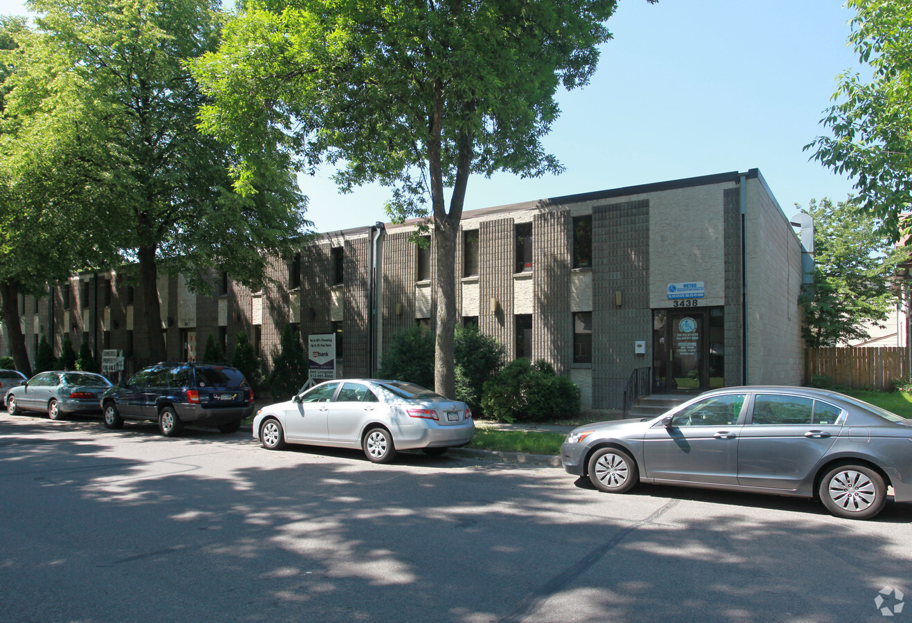
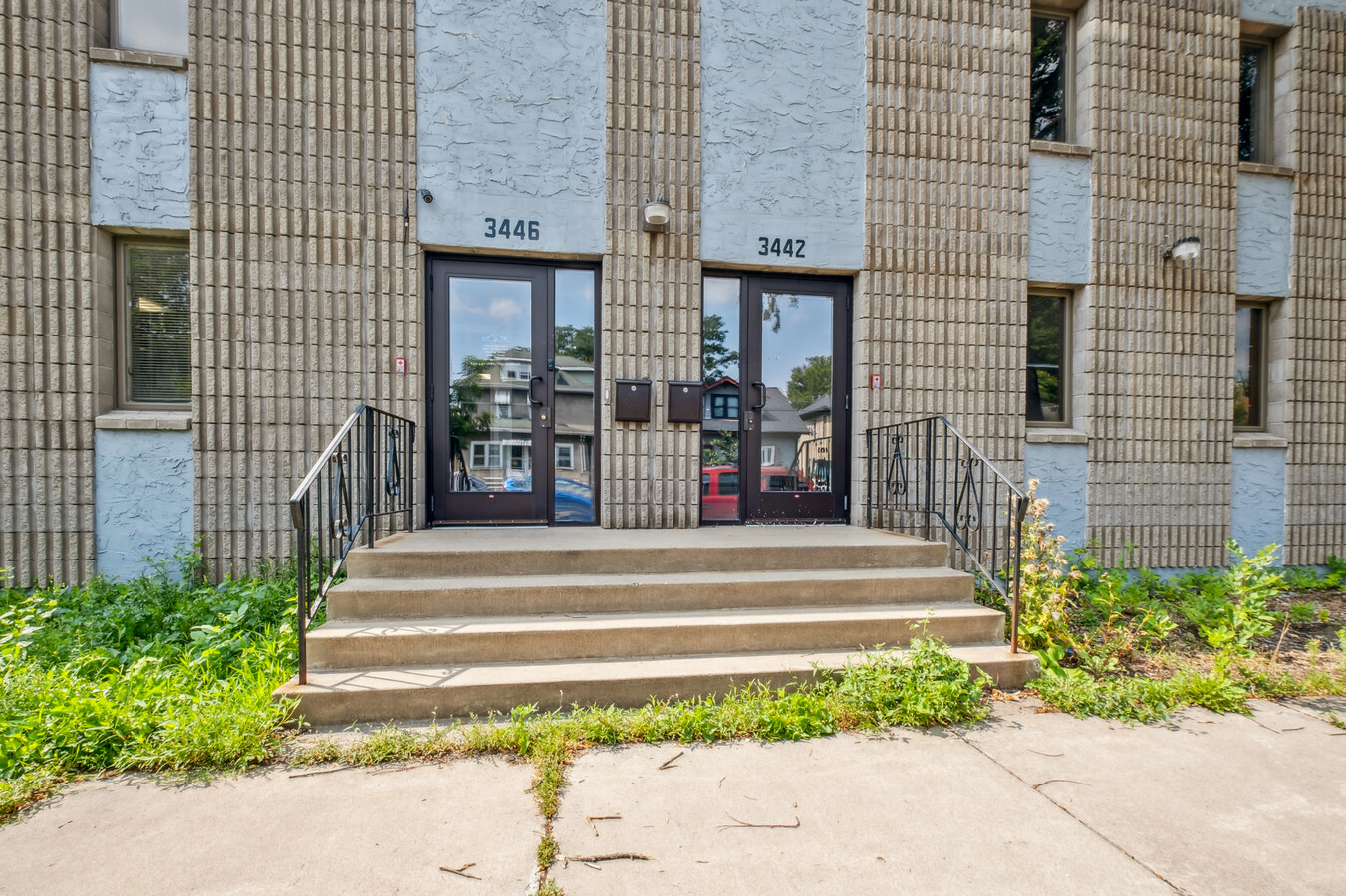
This Property Is For Sale
NEARBY LISTINGS FOR SALE OR LEASE
Property Detail
3446 Snelling Ave
Minneapolis-St. Paul-Bloomington, MN-WI
Palmers Addn To Mpls
01-028-24-41-0144
LOT 013 BLOCK 002 A PALMERS ADDN TO MPLS 40.00 X 150.00
Industrialgeneral
Hennepin
X
Minnesota
27053C0378F
13
2024
0.14 AC
2023
Minneapolis
1088002005
Minneapolis/St Paul
5,920 SF
DEMOGRAPHICS near 3446 Snelling Ave
1 Mile
3 Mile
5 Mile
2024 Total Population
24,213
229,319
481,966
2029 Population
23,755
225,686
473,800
Pop Growth 2024-2029
(1.89%)
(1.58%)
(1.69%)
Average Age
39
36
37
2024 Total Households
10,355
97,020
216,308
HH Growth 2024-2029
(2.07%)
(1.64%)
(1.68%)
Median Household Inc
$72,713
$65,074
$72,298
Avg Household Size
2.20
2.10
2.10
2024 Avg HH Vehicles
2.00
1.00
1.00
Median Home Value
$278,816
$332,658
$352,454
Median Year Built
1946
1949
1954
Nearby Places
- Restaurants
- Banks
- Shops
- Fitness
- Groceries
PUBLIC TRANSPORTATION
TRANSIT/SUBWAY
38Th Street Station (Hiawatha Line - Minneapolis-Saint Paul Metro Transit Light Rail)
DRIVE
WALK
Distance
38Th Street Station (Hiawatha Line - Minneapolis-Saint Paul Metro Transit Light Rail)
2 min
9 min
0.5 mi
Lake Street/Midtown Station (Hiawatha Line - Minneapolis-Saint Paul Metro Transit Light Rail)
DRIVE
WALK
Distance
Lake Street/Midtown Station (Hiawatha Line - Minneapolis-Saint Paul Metro Transit Light Rail)
3 min
15 min
0.8 mi
COMMUTER RAIL
Target Field Station (Northstar Corridor - Northstar Commuter Rail)
DRIVE
WALK
Distance
Target Field Station (Northstar Corridor - Northstar Commuter Rail)
11 min
4.2 mi
St. Paul-Minneapolis (Empire Builder - Amtrak)
DRIVE
WALK
Distance
St. Paul-Minneapolis (Empire Builder - Amtrak)
18 min
8.4 mi
AIRPORT
Minneapolis-St Paul International/Wold-Chamberlain
DRIVE
WALK
Distance
Minneapolis-St Paul International/Wold-Chamberlain
15 min
7.5 mi
Freight Ports
Port Milwaukee
DRIVE
WALK
Distance
Port Milwaukee
377 min
336.7 mi
Nearby Properties
Address
Land Use
TOTAL SIZE
Lot Size
Zoning
Address
Land Use
TOTAL SIZE
Lot Size
Zoning
141,277 SF
44.78 AC
Address
Land Use
TOTAL SIZE
Lot Size
Zoning
504,049 SF
75.43 AC
Address
Land Use
TOTAL SIZE
Lot Size
Zoning
Address
Land Use
TOTAL SIZE
Lot Size
Zoning
1,261,574 SF
2.52 AC
B4-2
Address
Land Use
TOTAL SIZE
Lot Size
Zoning
695,624 SF
3.67 AC
C2
Address
Land Use
TOTAL SIZE
Lot Size
Zoning
618,841 SF
1.54 AC
B4S-2
Address
Land Use
TOTAL SIZE
Lot Size
Zoning
618,841 SF
1.53 AC
B4N
Address
Land Use
TOTAL SIZE
Lot Size
Zoning
176,108 SF
27.45 AC
Address
Land Use
TOTAL SIZE
Lot Size
Zoning
577,656 SF
2.92 AC
C3A
Address
Land Use
TOTAL SIZE
Lot Size
Zoning
398,356 SF
1.14 AC
B4N
Address
Land Use
TOTAL SIZE
Lot Size
Zoning
546,882 SF
2.64 AC
R6
Address
Land Use
TOTAL SIZE
Lot Size
Zoning
2.65 AC
Address
Land Use
TOTAL SIZE
Lot Size
Zoning
401,175 SF
0.75 AC
B4N
Address
Land Use
TOTAL SIZE
Lot Size
Zoning
420,485 SF
1.18 AC
OR3
Address
Land Use
TOTAL SIZE
Lot Size
Zoning
364,104 SF
2.51 AC
B4S-2
Address
Land Use
TOTAL SIZE
Lot Size
Zoning
267,530 SF
28.60 AC
Address
Land Use
TOTAL SIZE
Lot Size
Zoning
321,828 SF
0.77 AC
I1
Address
Land Use
TOTAL SIZE
Lot Size
Zoning
344,458 SF
1.64 AC
C3A
Address
Land Use
TOTAL SIZE
Lot Size
Zoning
429,720 SF
6.02 AC
Address
Land Use
TOTAL SIZE
Lot Size
Zoning
423,037 SF
0.28 AC
C3A
Address
Land Use
TOTAL SIZE
Lot Size
Zoning
282,086 SF
2.51 AC
B4N
Address
Land Use
TOTAL SIZE
Lot Size
Zoning
3,200 SF
0.14 AC
Address
Land Use
TOTAL SIZE
Lot Size
Zoning
518,750 SF
3.58 AC
Address
Land Use
TOTAL SIZE
Lot Size
Zoning
244,186 SF
0.72 AC
C3A
Address
Land Use
TOTAL SIZE
Lot Size
Zoning
200,892 SF
3.60 AC
Address
Land Use
TOTAL SIZE
Lot Size
Zoning
291,264 SF
1.61 AC
C3A
Address
Land Use
TOTAL SIZE
Lot Size
Zoning
386,583 SF
1.79 AC
OR2
Address
Land Use
TOTAL SIZE
Lot Size
Zoning
372,142 SF
2.11 AC
C3A
Address
Land Use
TOTAL SIZE
Lot Size
Zoning
313,892 SF
2.03 AC
R5
Address
Land Use
TOTAL SIZE
Lot Size
Zoning
251,619 SF
1.20 AC
The World's #1 Commercial Real Estate Marketplace
Connect with us
© 2025 CoStar Group
The information above has been obtained from sources believed reliable. While we do not doubt its accuracy we have not verified it and make no guarantee, warranty or representation about it. It is your responsibility to independently confirm its accuracy and completeness. Any projections, opinions, assumptions, or estimates used are for example only and do not represent the current or future performance of the property. The value of this transaction to you depends on tax and other factors which should be evaluated by your tax, financial, and legal advisors. You and your advisors should conduct a careful, independent investigation of the property to determine to your satisfaction the suitability of the property for your needs.