Property Record
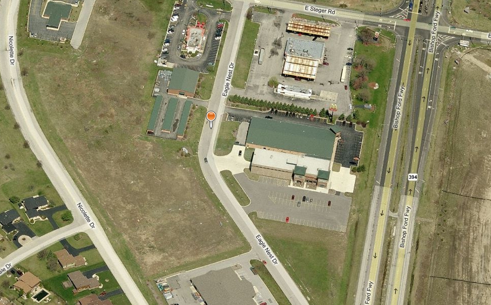
3440 Eagle Nest Dr, Crete, IL 60417
NEARBY LISTINGS FOR SALE OR LEASE
-
-
-
-
-
No Photo
-
-
View all Crete listings for sale on LoopNet.com
Property Detail
3440 Eagle Nest Dr
15-02-208-001
Crete Park Of Commerce
Commercialnec
TRACT 3: THAT PRT OF THE NE 1/4 OF SEC 2, T34N R14E DAF: COMM AT THE NW COR OF SD NE 1/4 OF SEC 2, THC S 89 DEG 59'47" E ON
X
Will
17197C0379G
Illinois
2023
2.49 AC
2023
Far South
8838102001
Chicago
15,983 SF
Chicago-Naperville-Elgin, IL-IN-WI
DEMOGRAPHICS near 3440 Eagle Nest Dr
1 Mile
3 Mile
5 Mile
2024 Total Population
3,077
25,496
97,780
2029 Population
3,049
25,249
97,283
Pop Growth 2024-2029
(0.91%)
(0.97%)
(0.51%)
Average Age
43
40
40
2024 Total Households
1,090
9,006
35,643
HH Growth 2024-2029
(1.01%)
(1.14%)
(0.72%)
Median Household Inc
$78,634
$63,719
$66,885
Avg Household Size
2.60
2.70
2.70
2024 Avg HH Vehicles
2.00
2.00
2.00
Median Home Value
$169,295
$159,488
$185,315
Median Year Built
1980
1975
1975
Nearby Places
- Restaurants
- Banks
- Shops
- Fitness
- Groceries
PUBLIC TRANSPORTATION
COMMUTER RAIL
Dyer Amtrak (Cardinal - Amtrak)
DRIVE
WALK
Distance
Dyer Amtrak (Cardinal - Amtrak)
12 min
6.0 mi
211Th Street (Lincoln Highway) Station (Metra Electric Line - Northeast Illinois Regional Commuter Railroad (Metra))
DRIVE
WALK
Distance
211Th Street (Lincoln Highway) Station (Metra Electric Line - Northeast Illinois Regional Commuter Railroad (Metra))
18 min
9.2 mi
AIRPORT
Chicago Midway International
DRIVE
WALK
Distance
Chicago Midway International
44 min
29.9 mi
Freight Ports
Port Milwaukee
DRIVE
WALK
Distance
Port Milwaukee
147 min
116.2 mi
Nearby Properties
Address
Land Use
TOTAL SIZE
Lot Size
Zoning
Address
Land Use
TOTAL SIZE
Lot Size
Zoning
90,526 SF
22.99 AC
R33
Address
Land Use
TOTAL SIZE
Lot Size
Zoning
49,866 SF
5.57 AC
Address
Land Use
TOTAL SIZE
Lot Size
Zoning
304,256 SF
21.50 AC
Address
Land Use
TOTAL SIZE
Lot Size
Zoning
87,105 SF
7.74 AC
Address
Land Use
TOTAL SIZE
Lot Size
Zoning
2,845,012 SF
133.73 AC
Address
Land Use
TOTAL SIZE
Lot Size
Zoning
64,295 SF
2.23 AC
Address
Land Use
TOTAL SIZE
Lot Size
Zoning
26.61 AC
Address
Land Use
TOTAL SIZE
Lot Size
Zoning
628 SF
4.91 AC
Address
Land Use
TOTAL SIZE
Lot Size
Zoning
91,341 SF
2.66 AC
Address
Land Use
TOTAL SIZE
Lot Size
Zoning
36.48 AC
Address
Land Use
TOTAL SIZE
Lot Size
Zoning
562,369 SF
50 AC
Address
Land Use
TOTAL SIZE
Lot Size
Zoning
Address
Land Use
TOTAL SIZE
Lot Size
Zoning
35.43 AC
Address
Land Use
TOTAL SIZE
Lot Size
Zoning
Address
Land Use
TOTAL SIZE
Lot Size
Zoning
4,528 SF
43.65 AC
Address
Land Use
TOTAL SIZE
Lot Size
Zoning
269,840 SF
16.04 AC
Address
Land Use
TOTAL SIZE
Lot Size
Zoning
119,200 SF
11.12 AC
Address
Land Use
TOTAL SIZE
Lot Size
Zoning
68,315 SF
5.31 AC
Address
Land Use
TOTAL SIZE
Lot Size
Zoning
377,200 SF
18.90 AC
Address
Land Use
TOTAL SIZE
Lot Size
Zoning
17,931 SF
32.75 AC
Address
Land Use
TOTAL SIZE
Lot Size
Zoning
11.87 AC
Address
Land Use
TOTAL SIZE
Lot Size
Zoning
221,842 SF
30.94 AC
Address
Land Use
TOTAL SIZE
Lot Size
Zoning
118,135 SF
9.42 AC
Address
Land Use
TOTAL SIZE
Lot Size
Zoning
40 AC
Address
Land Use
TOTAL SIZE
Lot Size
Zoning
155,690 SF
17.59 AC
Address
Land Use
TOTAL SIZE
Lot Size
Zoning
5,724 SF
3.31 AC
Address
Land Use
TOTAL SIZE
Lot Size
Zoning
Address
Land Use
TOTAL SIZE
Lot Size
Zoning
4,597 SF
5.18 AC
Address
Land Use
TOTAL SIZE
Lot Size
Zoning
3,795 SF
6 AC
Address
Land Use
TOTAL SIZE
Lot Size
Zoning
34.26 AC
The World's #1 Commercial Real Estate Marketplace
Connect with us
© 2025 CoStar Group
The information above has been obtained from sources believed reliable. While we do not doubt its accuracy we have not verified it and make no guarantee, warranty or representation about it. It is your responsibility to independently confirm its accuracy and completeness. Any projections, opinions, assumptions, or estimates used are for example only and do not represent the current or future performance of the property. The value of this transaction to you depends on tax and other factors which should be evaluated by your tax, financial, and legal advisors. You and your advisors should conduct a careful, independent investigation of the property to determine to your satisfaction the suitability of the property for your needs.