Property Record
347 Hiatt Dr, Palm Beach Gardens, FL 33418
NEARBY LISTINGS FOR SALE OR LEASE
-
-
View all Palm Beach Gardens listings for sale on LoopNet.com
Property Detail
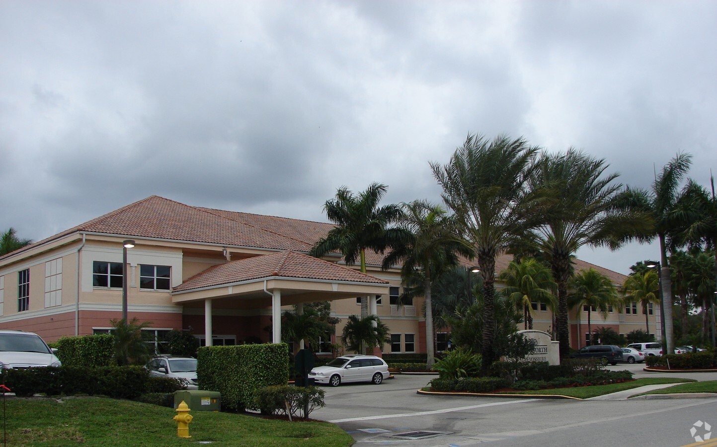
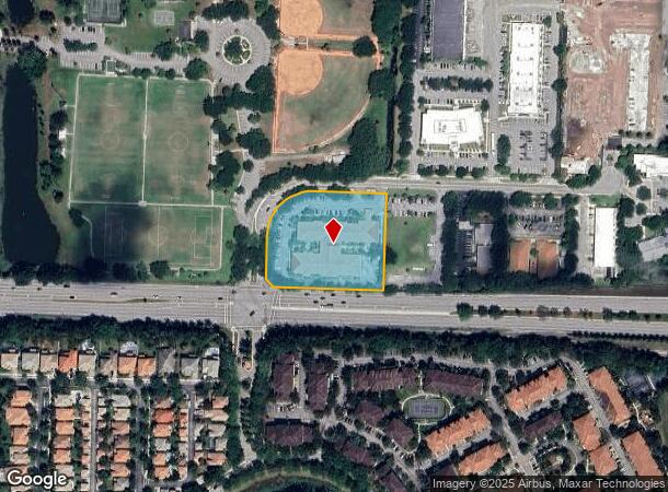
347 Hiatt Dr
West Palm Beach-Boca Raton-Delray Beach, FL
Pga Natl Commerce Park
52-42-42-15-15-000-0010
PGA NATL COMMERCE PARK LT 1
Hospitalprivate
Palm Beach
X
Florida
12099C0367F
1
2023
2.55 AC
2023
Palm Bch Cty Outlying
007831
South Florida
64,444 SF
DEMOGRAPHICS near 347 Hiatt Dr
1 Mile
3 Mile
5 Mile
2024 Total Population
5,856
43,503
137,342
2029 Population
6,030
45,040
143,224
Pop Growth 2024-2029
+ 2.97%
+ 3.53%
+ 4.28%
Average Age
53
46
43
2024 Total Households
2,784
18,286
55,583
HH Growth 2024-2029
+ 2.26%
+ 2.97%
+ 3.70%
Median Household Inc
$106,465
$89,738
$76,694
Avg Household Size
2.00
2.30
2.30
2024 Avg HH Vehicles
2.00
2.00
2.00
Median Home Value
$452,439
$401,392
$373,493
Median Year Built
1990
1989
1990
Nearby Places
- Restaurants
- Banks
- Shops
- Fitness
- Groceries
PUBLIC TRANSPORTATION
COMMUTER RAIL
Mangonia Park (Tri-County Commuter - South Florida Regional Transportation Authority (Tri-Rail))
DRIVE
WALK
Distance
Mangonia Park (Tri-County Commuter - South Florida Regional Transportation Authority (Tri-Rail))
14 min
6.9 mi
AIRPORT
Palm Beach International
DRIVE
WALK
Distance
Palm Beach International
23 min
12.9 mi
Freight Ports
Port of Palm Beach
DRIVE
WALK
Distance
Port of Palm Beach
16 min
7.4 mi
Nearby Properties
Address
Land Use
TOTAL SIZE
Lot Size
Zoning
Address
Land Use
TOTAL SIZE
Lot Size
Zoning
1,778,741 SF
69.19 AC
CF
Address
Land Use
TOTAL SIZE
Lot Size
Zoning
386,667 SF
26.42 AC
PCD
Address
Land Use
TOTAL SIZE
Lot Size
Zoning
650,167 SF
27.64 AC
PCD
Address
Land Use
TOTAL SIZE
Lot Size
Zoning
770,163 SF
571.53 AC
CS
Address
Land Use
TOTAL SIZE
Lot Size
Zoning
390,568 SF
38.79 AC
NZ
Address
Land Use
TOTAL SIZE
Lot Size
Zoning
697,820 SF
19.21 AC
PCD
Address
Land Use
TOTAL SIZE
Lot Size
Zoning
416,171 SF
19.24 AC
R-PUD
Address
Land Use
TOTAL SIZE
Lot Size
Zoning
406,434 SF
40.60 AC
P/I
Address
Land Use
TOTAL SIZE
Lot Size
Zoning
180,563 SF
54.46 AC
P/I
Address
Land Use
TOTAL SIZE
Lot Size
Zoning
150,123 SF
25.97 AC
PCD
Address
Land Use
TOTAL SIZE
Lot Size
Zoning
118,736 SF
6.21 AC
PCD
Address
Land Use
TOTAL SIZE
Lot Size
Zoning
97,179 SF
10.64 AC
MXD
Address
Land Use
TOTAL SIZE
Lot Size
Zoning
116,383 SF
7.52 AC
PCD
Address
Land Use
TOTAL SIZE
Lot Size
Zoning
87,936 SF
8.46 AC
PCD
Address
Land Use
TOTAL SIZE
Lot Size
Zoning
198,571 SF
6.58 AC
CG1
Address
Land Use
TOTAL SIZE
Lot Size
Zoning
225,343 SF
55.05 AC
P/I
Address
Land Use
TOTAL SIZE
Lot Size
Zoning
6,132 SF
355.72 AC
PO
Address
Land Use
TOTAL SIZE
Lot Size
Zoning
251,720 SF
12.95 AC
IL
Address
Land Use
TOTAL SIZE
Lot Size
Zoning
90,414 SF
13.18 AC
CG1
Address
Land Use
TOTAL SIZE
Lot Size
Zoning
116,484 SF
11.52 AC
CG1
Address
Land Use
TOTAL SIZE
Lot Size
Zoning
87,936 SF
3.45 AC
PCD
Address
Land Use
TOTAL SIZE
Lot Size
Zoning
182,208 SF
8.03 AC
CG1
Address
Land Use
TOTAL SIZE
Lot Size
Zoning
153,818 SF
17.57 AC
CG1
Address
Land Use
TOTAL SIZE
Lot Size
Zoning
104,964 SF
12.13 AC
PCD
Address
Land Use
TOTAL SIZE
Lot Size
Zoning
155,328 SF
1.08 AC
CG1
Address
Land Use
TOTAL SIZE
Lot Size
Zoning
66,810 SF
7.02 AC
PCD
Address
Land Use
TOTAL SIZE
Lot Size
Zoning
138,081 SF
17.27 AC
CG1
Address
Land Use
TOTAL SIZE
Lot Size
Zoning
124,645 SF
10.30 AC
PCD
Address
Land Use
TOTAL SIZE
Lot Size
Zoning
98,550 SF
1.61 AC
M1A
Address
Land Use
TOTAL SIZE
Lot Size
Zoning
328,474 SF
21.38 AC
R-PUD
The World's #1 Commercial Real Estate Marketplace
Connect with us
© 2025 CoStar Group
The information above has been obtained from sources believed reliable. While we do not doubt its accuracy we have not verified it and make no guarantee, warranty or representation about it. It is your responsibility to independently confirm its accuracy and completeness. Any projections, opinions, assumptions, or estimates used are for example only and do not represent the current or future performance of the property. The value of this transaction to you depends on tax and other factors which should be evaluated by your tax, financial, and legal advisors. You and your advisors should conduct a careful, independent investigation of the property to determine to your satisfaction the suitability of the property for your needs.