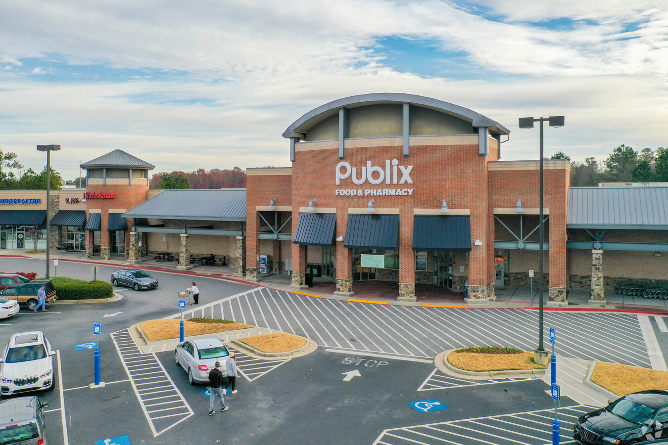
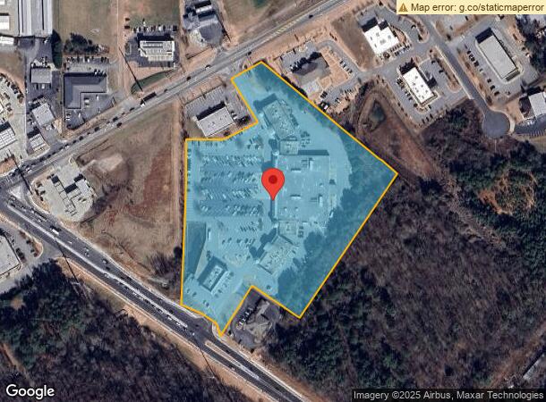
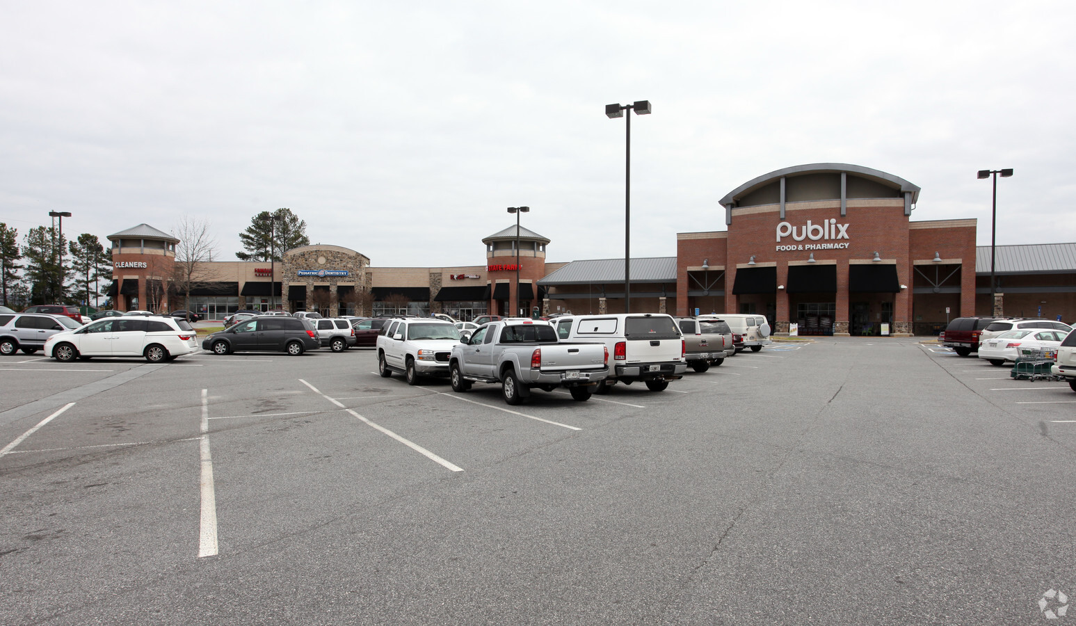
Property Record
3480 Keith Bridge Rd, Cumming, GA 30041

NEARBY LISTINGS FOR SALE OR LEASE
Property Detail
3480 Keith Bridge Rd
Atlanta-Sandy Springs-Roswell, GA
Hammond Crossing
238-023
14-1 345-346
Commercialnec
Forsyth
A
Georgia
13117C0064G
345
2023
9.92 AC
2024
Cumming/Forsyth Cnty
130105
Atlanta
74,796 SF
DEMOGRAPHICS near 3480 Keith Bridge Rd
1 Mile
3 Mile
5 Mile
2024 Total Population
1,107
22,683
57,170
2029 Population
1,285
26,406
66,721
Pop Growth 2024-2029
+ 16.08%
+ 16.41%
+ 16.71%
Average Age
40
39
40
2024 Total Households
386
8,024
19,994
HH Growth 2024-2029
+ 16.32%
+ 16.49%
+ 16.80%
Median Household Inc
$89,285
$93,593
$101,344
Avg Household Size
2.70
2.80
2.80
2024 Avg HH Vehicles
2.00
2.00
2.00
Median Home Value
$394,736
$370,278
$388,386
Median Year Built
2000
2001
2000
Nearby Places
- Restaurants
- Banks
- Shops
- Fitness
- Groceries
SALE & LEASE HISTORY
LISTING DATE
SALE/LEASE

Oct 17, 2024
For Lease
Nearby Properties
Address
Land Use
TOTAL SIZE
Lot Size
Zoning
Address
Land Use
TOTAL SIZE
Lot Size
Zoning
305,332 SF
23.75 AC
CBD
Address
Land Use
TOTAL SIZE
Lot Size
Zoning
34.02 AC
MP
Address
Land Use
TOTAL SIZE
Lot Size
Zoning
413,484 SF
127.99 AC
A1
Address
Land Use
TOTAL SIZE
Lot Size
Zoning
19.21 AC
M1
Address
Land Use
TOTAL SIZE
Lot Size
Zoning
152,668 SF
41.92 AC
CBD
Address
Land Use
TOTAL SIZE
Lot Size
Zoning
50,875 SF
420.29 AC
A1
Address
Land Use
TOTAL SIZE
Lot Size
Zoning
98,743 SF
12.61 AC
CBD
Address
Land Use
TOTAL SIZE
Lot Size
Zoning
192,550 SF
21.11 AC
CBD
Address
Land Use
TOTAL SIZE
Lot Size
Zoning
68,188 SF
121.31 AC
A1
Address
Land Use
TOTAL SIZE
Lot Size
Zoning
17,657 SF
59.25 AC
A1
Address
Land Use
TOTAL SIZE
Lot Size
Zoning
181,442 SF
32.34 AC
A1
Address
Land Use
TOTAL SIZE
Lot Size
Zoning
229.24 AC
M1
Address
Land Use
TOTAL SIZE
Lot Size
Zoning
80,956 SF
6.07 AC
CBD
Address
Land Use
TOTAL SIZE
Lot Size
Zoning
12,217 SF
3.85 AC
CBD
Address
Land Use
TOTAL SIZE
Lot Size
Zoning
102,962 SF
20 AC
LR
Address
Land Use
TOTAL SIZE
Lot Size
Zoning
54,186 SF
26.64 AC
CBD
Address
Land Use
TOTAL SIZE
Lot Size
Zoning
80,497 SF
9.22 AC
CBD
Address
Land Use
TOTAL SIZE
Lot Size
Zoning
69,200 SF
5.61 AC
CBD
Address
Land Use
TOTAL SIZE
Lot Size
Zoning
47,205 SF
40.23 AC
A1
Address
Land Use
TOTAL SIZE
Lot Size
Zoning
33,608 SF
3.34 AC
HB
Address
Land Use
TOTAL SIZE
Lot Size
Zoning
41,486 SF
6.11 AC
M1
Address
Land Use
TOTAL SIZE
Lot Size
Zoning
1,595 SF
16.76 AC
CBD
Address
Land Use
TOTAL SIZE
Lot Size
Zoning
46,540 SF
11.10 AC
CBD
Address
Land Use
TOTAL SIZE
Lot Size
Zoning
33,376 SF
4.34 AC
M1
Address
Land Use
TOTAL SIZE
Lot Size
Zoning
2,034 SF
9 AC
A1
Address
Land Use
TOTAL SIZE
Lot Size
Zoning
3,060 SF
8.47 AC
M1
Address
Land Use
TOTAL SIZE
Lot Size
Zoning
15.76 AC
A1
Address
Land Use
TOTAL SIZE
Lot Size
Zoning
1,152 SF
30.02 AC
OR
Address
Land Use
TOTAL SIZE
Lot Size
Zoning
3,698 SF
A1
The World's #1 Commercial Real Estate Marketplace
Connect with us
© 2025 CoStar Group
The information above has been obtained from sources believed reliable. While we do not doubt its accuracy we have not verified it and make no guarantee, warranty or representation about it. It is your responsibility to independently confirm its accuracy and completeness. Any projections, opinions, assumptions, or estimates used are for example only and do not represent the current or future performance of the property. The value of this transaction to you depends on tax and other factors which should be evaluated by your tax, financial, and legal advisors. You and your advisors should conduct a careful, independent investigation of the property to determine to your satisfaction the suitability of the property for your needs.