Property Record
35 Gateway Dr, Plattsburgh, NY 12901
NEARBY LISTINGS FOR SALE OR LEASE
-
-
View all Plattsburgh listings for sale on LoopNet.com
Property Detail
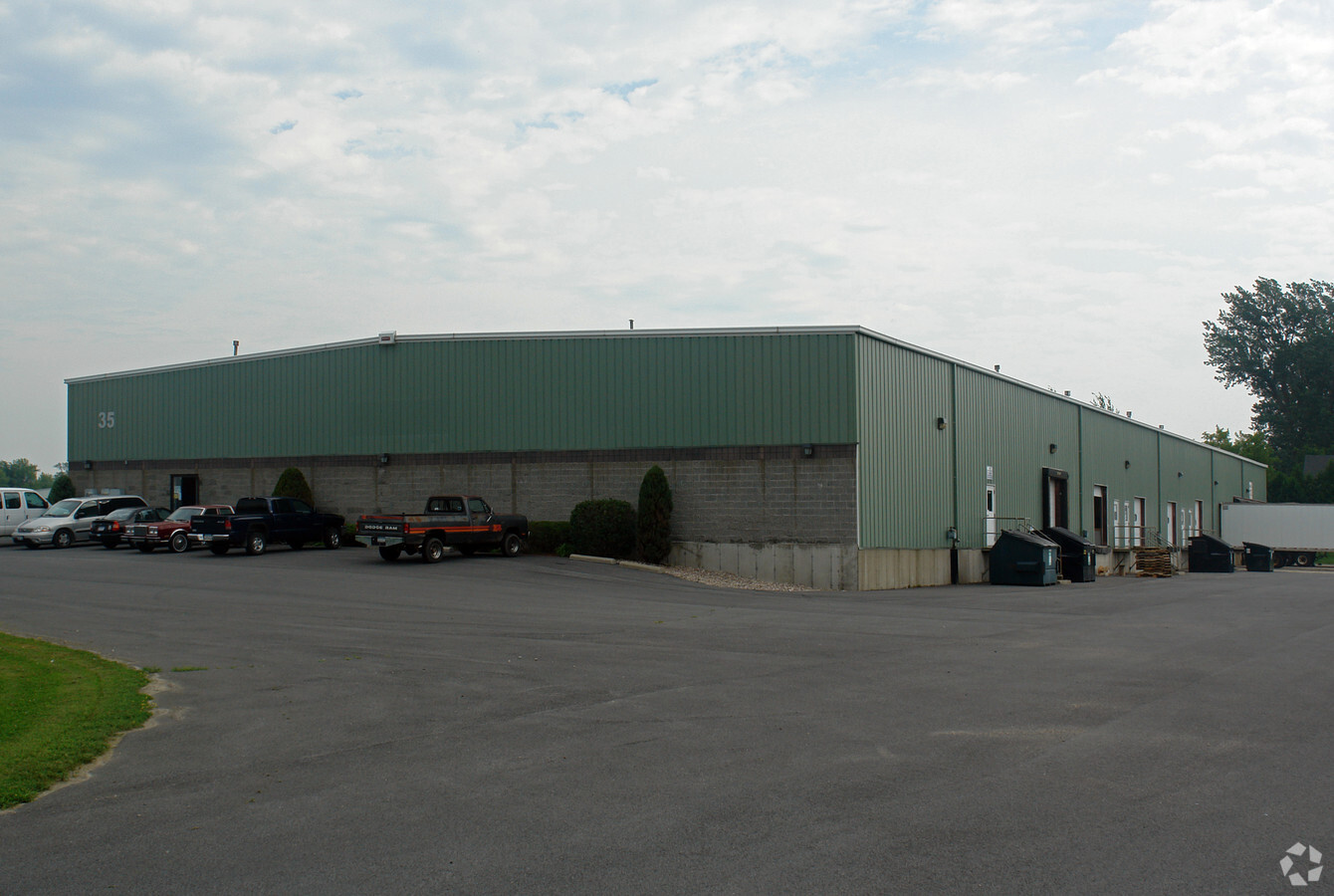
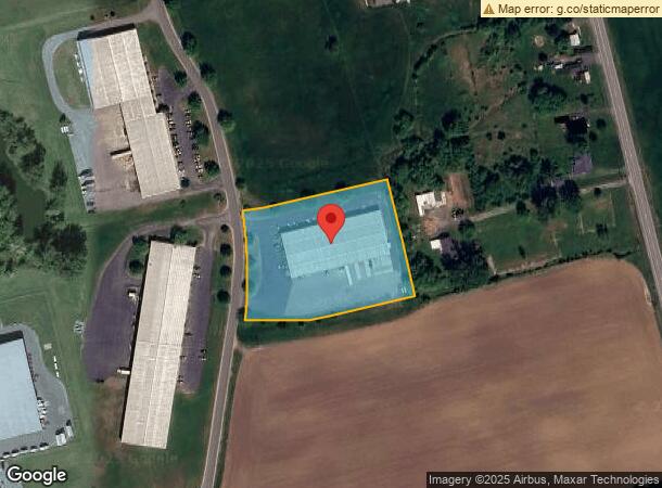
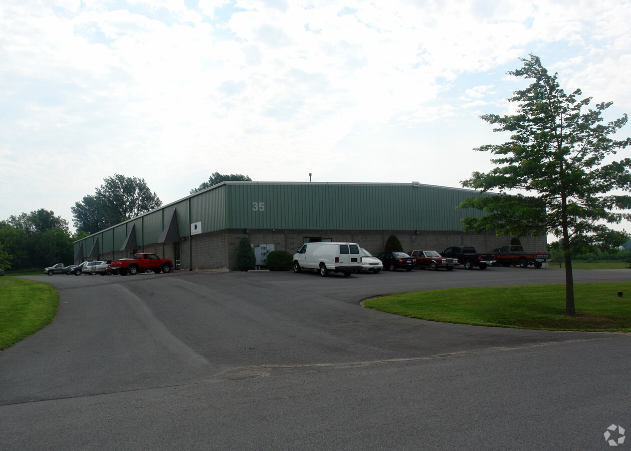
35 Gateway Dr
092400-167-000-0002-003-000-0000
SUB BK 21 PG 75 LOT 3
Warehouse
Clinton
X
New York
36019C0470E
3.000
2023
3.05 AC
2023
Upstate New York Area
100600
Other Market Areas
29,900 SF
Plattsburgh, NY
DEMOGRAPHICS near 35 Gateway Dr
1 Mile
3 Mile
5 Mile
2024 Total Population
186
1,937
8,348
2029 Population
186
1,927
8,338
Pop Growth 2024-2029
0.00%
(0.52%)
(0.12%)
Average Age
46
45
44
2024 Total Households
85
847
3,596
HH Growth 2024-2029
0.00%
(0.47%)
(0.11%)
Median Household Inc
$83,593
$80,113
$75,667
Avg Household Size
2.10
2.20
2.20
2024 Avg HH Vehicles
2.00
2.00
2.00
Median Home Value
$254,545
$217,742
$166,850
Median Year Built
1971
1975
1976
Nearby Places
- Restaurants
- Banks
- Shops
- Fitness
- Groceries
PUBLIC TRANSPORTATION
COMMUTER RAIL
Plattsburgh Amtrak Station (Adirondack - Amtrak)
DRIVE
WALK
Distance
Plattsburgh Amtrak Station (Adirondack - Amtrak)
12 min
7.2 mi
AIRPORT
Plattsburgh International
DRIVE
WALK
Distance
Plattsburgh International
17 min
10.6 mi
Patrick Leahy Burlington International
DRIVE
WALK
Distance
Patrick Leahy Burlington International
70 min
33.3 mi
Freight Ports
Montreal
DRIVE
WALK
Distance
Montreal
79 min
59.1 mi
SALE & LEASE HISTORY
LISTING DATE
SALE/LEASE

Sep 24, 2016
For Sale
Nearby Properties
Address
Land Use
TOTAL SIZE
Lot Size
Zoning
Address
Land Use
TOTAL SIZE
Lot Size
Zoning
30,964 SF
7.36 AC
Address
Land Use
TOTAL SIZE
Lot Size
Zoning
1,729 SF
390.40 AC
Address
Land Use
TOTAL SIZE
Lot Size
Zoning
2,709 SF
15.11 AC
Address
Land Use
TOTAL SIZE
Lot Size
Zoning
3,968 SF
156.60 AC
Address
Land Use
TOTAL SIZE
Lot Size
Zoning
6,175 SF
50.30 AC
Address
Land Use
TOTAL SIZE
Lot Size
Zoning
59,800 SF
3.42 AC
Address
Land Use
TOTAL SIZE
Lot Size
Zoning
42,162 SF
7.93 AC
Address
Land Use
TOTAL SIZE
Lot Size
Zoning
100.40 AC
Address
Land Use
TOTAL SIZE
Lot Size
Zoning
255.30 AC
Address
Land Use
TOTAL SIZE
Lot Size
Zoning
952 SF
54.85 AC
Address
Land Use
TOTAL SIZE
Lot Size
Zoning
160.90 AC
Address
Land Use
TOTAL SIZE
Lot Size
Zoning
27.30 AC
Address
Land Use
TOTAL SIZE
Lot Size
Zoning
24,150 SF
2.47 AC
Address
Land Use
TOTAL SIZE
Lot Size
Zoning
6,306 SF
12.70 AC
Address
Land Use
TOTAL SIZE
Lot Size
Zoning
118.70 AC
01 - NOT Z
Address
Land Use
TOTAL SIZE
Lot Size
Zoning
116.10 AC
Address
Land Use
TOTAL SIZE
Lot Size
Zoning
15,142 SF
4.50 AC
C
Address
Land Use
TOTAL SIZE
Lot Size
Zoning
20,000 SF
2.86 AC
Address
Land Use
TOTAL SIZE
Lot Size
Zoning
129.70 AC
Address
Land Use
TOTAL SIZE
Lot Size
Zoning
1.10 AC
SC
Address
Land Use
TOTAL SIZE
Lot Size
Zoning
101.40 AC
Address
Land Use
TOTAL SIZE
Lot Size
Zoning
107 AC
Address
Land Use
TOTAL SIZE
Lot Size
Zoning
98.30 AC
Address
Land Use
TOTAL SIZE
Lot Size
Zoning
173.60 AC
Address
Land Use
TOTAL SIZE
Lot Size
Zoning
1,309 SF
184.30 AC
Address
Land Use
TOTAL SIZE
Lot Size
Zoning
4,800 SF
5.17 AC
R-2
Address
Land Use
TOTAL SIZE
Lot Size
Zoning
16,086 SF
5.70 AC
Address
Land Use
TOTAL SIZE
Lot Size
Zoning
8,625 SF
11.56 AC
Address
Land Use
TOTAL SIZE
Lot Size
Zoning
98.50 AC
The World's #1 Commercial Real Estate Marketplace
Connect with us
© 2025 CoStar Group
The information above has been obtained from sources believed reliable. While we do not doubt its accuracy we have not verified it and make no guarantee, warranty or representation about it. It is your responsibility to independently confirm its accuracy and completeness. Any projections, opinions, assumptions, or estimates used are for example only and do not represent the current or future performance of the property. The value of this transaction to you depends on tax and other factors which should be evaluated by your tax, financial, and legal advisors. You and your advisors should conduct a careful, independent investigation of the property to determine to your satisfaction the suitability of the property for your needs.