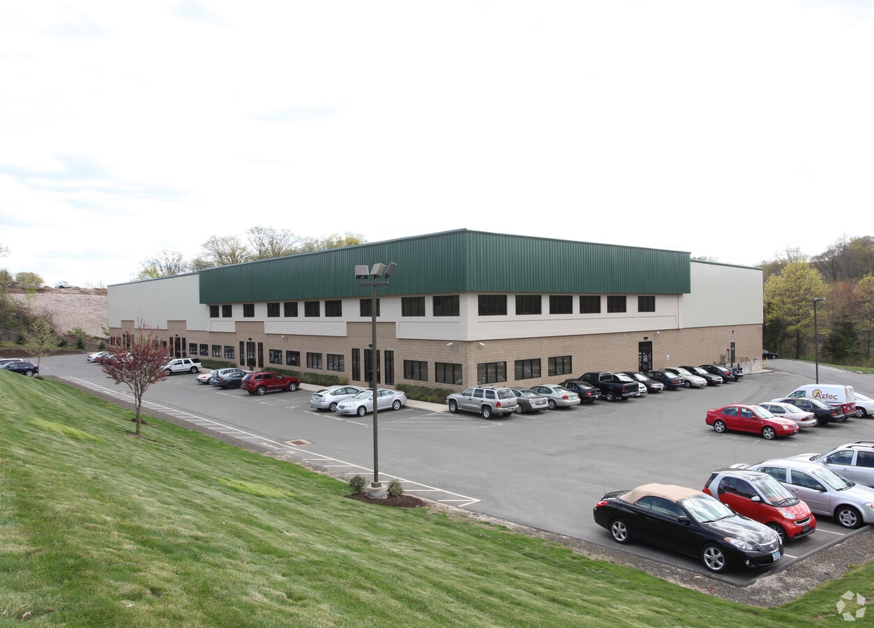
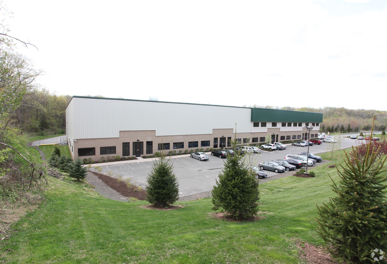
Property Record
35 Phil Mack Dr, Middletown, CT 06457

Current Lease Availabilities
NEARBY LISTINGS FOR SALE OR LEASE
Property Detail
35 Phil Mack Dr
MTWN-000001-000000-000068
Middlesex
Industrialgeneral
Connecticut
X
68
09003C0650F
13.62 AC
2024
NW Middlesex/Mid'town
2024
Hartford
541401
Hartford-West Hartford-East Hartford, CT
45,000 SF
DEMOGRAPHICS near 35 Phil Mack Dr
1 Mile
3 Mile
5 Mile
2024 Total Population
2,100
29,425
103,980
2029 Population
2,093
29,315
103,360
Pop Growth 2024-2029
(0.33%)
(0.37%)
(0.60%)
Average Age
40
42
41
2024 Total Households
1,068
12,845
43,183
HH Growth 2024-2029
(0.37%)
(0.47%)
(0.57%)
Median Household Inc
$88,477
$94,943
$82,799
Avg Household Size
1.90
2.20
2.30
2024 Avg HH Vehicles
2.00
2.00
2.00
Median Home Value
$313,333
$291,329
$266,620
Median Year Built
1985
1982
1973
Nearby Places
- Restaurants
- Banks
- Shops
- Fitness
- Groceries
PUBLIC TRANSPORTATION
AIRPORT
Bradley International
DRIVE
WALK
Distance
Bradley International
34 min
28.5 mi
Freight Ports
Port of Davisville, RI
DRIVE
WALK
Distance
Port of Davisville, RI
1 min
67.9 mi
Nearby Properties
Address
Land Use
TOTAL SIZE
Lot Size
Zoning
Address
Land Use
TOTAL SIZE
Lot Size
Zoning
17.38 AC
PRD
Address
Land Use
TOTAL SIZE
Lot Size
Zoning
29.45 AC
R-15
Address
Land Use
TOTAL SIZE
Lot Size
Zoning
241,225 SF
25.64 AC
R-11
Address
Land Use
TOTAL SIZE
Lot Size
Zoning
15.10 AC
PRD
Address
Land Use
TOTAL SIZE
Lot Size
Zoning
19.49 AC
PRD
Address
Land Use
TOTAL SIZE
Lot Size
Zoning
11.80 AC
PRD
Address
Land Use
TOTAL SIZE
Lot Size
Zoning
8.75 AC
R-25
Address
Land Use
TOTAL SIZE
Lot Size
Zoning
129,626 SF
22.36 AC
IT
Address
Land Use
TOTAL SIZE
Lot Size
Zoning
24.45 AC
HB
Address
Land Use
TOTAL SIZE
Lot Size
Zoning
13.28 AC
PRD
Address
Land Use
TOTAL SIZE
Lot Size
Zoning
83,241 SF
52.65 AC
R-15
Address
Land Use
TOTAL SIZE
Lot Size
Zoning
41.78 AC
IT
Address
Land Use
TOTAL SIZE
Lot Size
Zoning
15.50 AC
PRD
Address
Land Use
TOTAL SIZE
Lot Size
Zoning
91,663 SF
22.20 AC
R-21
Address
Land Use
TOTAL SIZE
Lot Size
Zoning
13.02 AC
HB
Address
Land Use
TOTAL SIZE
Lot Size
Zoning
5.65 AC
HB
Address
Land Use
TOTAL SIZE
Lot Size
Zoning
197,680 SF
26.91 AC
IT
Address
Land Use
TOTAL SIZE
Lot Size
Zoning
80,627 SF
10.54 AC
HB
Address
Land Use
TOTAL SIZE
Lot Size
Zoning
156,397 SF
28 AC
HB
Address
Land Use
TOTAL SIZE
Lot Size
Zoning
67,050 SF
20.36 AC
R-15
Address
Land Use
TOTAL SIZE
Lot Size
Zoning
122,735 SF
16.85 AC
HB
Address
Land Use
TOTAL SIZE
Lot Size
Zoning
50,533 SF
33 AC
R-30
Address
Land Use
TOTAL SIZE
Lot Size
Zoning
6.09 AC
PRD
Address
Land Use
TOTAL SIZE
Lot Size
Zoning
72,920 SF
4.10 AC
HB
Address
Land Use
TOTAL SIZE
Lot Size
Zoning
49,228 SF
164.74 AC
R-1
Address
Land Use
TOTAL SIZE
Lot Size
Zoning
228,928 SF
16.24 AC
IT
Address
Land Use
TOTAL SIZE
Lot Size
Zoning
38,096 SF
8.26 AC
PS-A
Address
Land Use
TOTAL SIZE
Lot Size
Zoning
61,047 SF
9.12 AC
CCD-2
Address
Land Use
TOTAL SIZE
Lot Size
Zoning
96,874 SF
6.40 AC
IOP
Address
Land Use
TOTAL SIZE
Lot Size
Zoning
236,666 SF
32.60 AC
R-21
The World's #1 Commercial Real Estate Marketplace
Connect with us
© 2025 CoStar Group
The information above has been obtained from sources believed reliable. While we do not doubt its accuracy we have not verified it and make no guarantee, warranty or representation about it. It is your responsibility to independently confirm its accuracy and completeness. Any projections, opinions, assumptions, or estimates used are for example only and do not represent the current or future performance of the property. The value of this transaction to you depends on tax and other factors which should be evaluated by your tax, financial, and legal advisors. You and your advisors should conduct a careful, independent investigation of the property to determine to your satisfaction the suitability of the property for your needs.