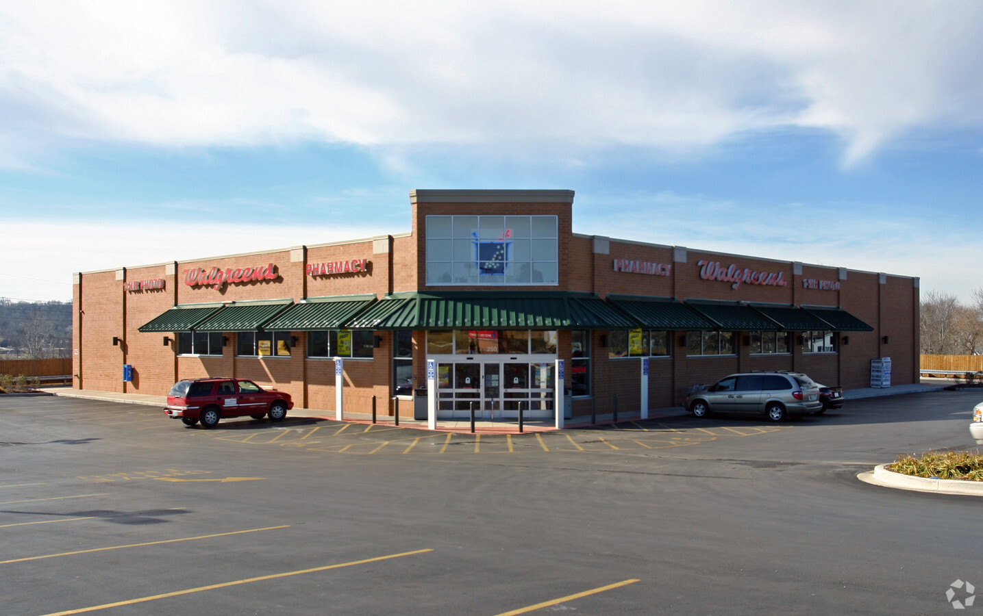
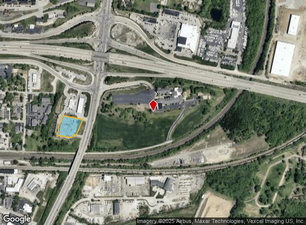
Property Record
350 E 4Th St, Eureka, MO 63025
NEARBY LISTINGS FOR SALE OR LEASE
Property Detail
350 E 4Th St
St. Louis
Eureka Acquisition Llc & Padco L L C
St. Louis, MO-IL
EUREKA ACQUISITION LLC & PADCO L L C PARCELS A & B BDY ADJ PARCEL A RESUB LOT 3A
29V-34-0540
St. Louis
Storebuilding
Missouri
2023
3a
2023
1.31 AC
221503
Outer St Louis County
14,475 SF
DEMOGRAPHICS near 350 E 4Th St
1 Mile
3 Mile
5 Mile
2024 Total Population
4,942
17,975
31,234
2029 Population
4,873
18,212
31,456
Pop Growth 2024-2029
(1.40%)
+ 1.32%
+ 0.71%
Average Age
40
39
40
2024 Total Households
1,642
5,933
10,807
HH Growth 2024-2029
(1.52%)
+ 1.23%
+ 0.69%
Median Household Inc
$95,603
$130,258
$122,442
Avg Household Size
2.60
2.80
2.70
2024 Avg HH Vehicles
2.00
2.00
2.00
Median Home Value
$303,594
$348,134
$352,305
Median Year Built
1990
1998
1995
Nearby Places
- Restaurants
- Banks
- Shops
- Fitness
- Groceries
PUBLIC TRANSPORTATION
AIRPORT
St Louis Lambert International
DRIVE
WALK
Distance
St Louis Lambert International
43 min
30.4 mi
Freight Ports
Tulsa Port of Inola
DRIVE
WALK
Distance
Tulsa Port of Inola
391 min
357.8 mi
Nearby Properties
Address
Land Use
TOTAL SIZE
Lot Size
Zoning
Address
Land Use
TOTAL SIZE
Lot Size
Zoning
20,594 SF
1,905.12 AC
NU
Address
Land Use
TOTAL SIZE
Lot Size
Zoning
12,274 SF
86.91 AC
R1
Address
Land Use
TOTAL SIZE
Lot Size
Zoning
13.12 AC
Address
Land Use
TOTAL SIZE
Lot Size
Zoning
207,499 SF
10.11 AC
98R-5
Address
Land Use
TOTAL SIZE
Lot Size
Zoning
39.97 AC
98PI
Address
Land Use
TOTAL SIZE
Lot Size
Zoning
153,647 SF
22.80 AC
98C
Address
Land Use
TOTAL SIZE
Lot Size
Zoning
250,959 SF
22.13 AC
98M-1
Address
Land Use
TOTAL SIZE
Lot Size
Zoning
85,759 SF
8.25 AC
H
Address
Land Use
TOTAL SIZE
Lot Size
Zoning
203,960 SF
12.88 AC
NU
Address
Land Use
TOTAL SIZE
Lot Size
Zoning
7.48 AC
R4
Address
Land Use
TOTAL SIZE
Lot Size
Zoning
8.30 AC
Address
Land Use
TOTAL SIZE
Lot Size
Zoning
7.50 AC
98R-1
Address
Land Use
TOTAL SIZE
Lot Size
Zoning
48,797 SF
23.28 AC
R1
Address
Land Use
TOTAL SIZE
Lot Size
Zoning
29,960 SF
14.54 AC
NU
Address
Land Use
TOTAL SIZE
Lot Size
Zoning
46,777 SF
71 AC
107NU
Address
Land Use
TOTAL SIZE
Lot Size
Zoning
7.26 AC
R3
Address
Land Use
TOTAL SIZE
Lot Size
Zoning
899 SF
1.41 AC
R3
Address
Land Use
TOTAL SIZE
Lot Size
Zoning
36,184 SF
13.15 AC
98R-5
Address
Land Use
TOTAL SIZE
Lot Size
Zoning
2,870 SF
245 AC
NU
Address
Land Use
TOTAL SIZE
Lot Size
Zoning
27,588 SF
11.07 AC
H
Address
Land Use
TOTAL SIZE
Lot Size
Zoning
26,024 SF
2.65 AC
98PC
Address
Land Use
TOTAL SIZE
Lot Size
Zoning
69,225 SF
2.45 AC
98C
Address
Land Use
TOTAL SIZE
Lot Size
Zoning
43,052 SF
112.19 AC
107NU
Address
Land Use
TOTAL SIZE
Lot Size
Zoning
60,655 SF
2.95 AC
R-5
Address
Land Use
TOTAL SIZE
Lot Size
Zoning
28,200 SF
2.94 AC
98PC
Address
Land Use
TOTAL SIZE
Lot Size
Zoning
46,615 SF
6.91 AC
98C
Address
Land Use
TOTAL SIZE
Lot Size
Zoning
9.10 AC
98R-1
Address
Land Use
TOTAL SIZE
Lot Size
Zoning
50,040 SF
3.57 AC
98R-5C
Address
Land Use
TOTAL SIZE
Lot Size
Zoning
8,074 SF
17.04 AC
98M-1
Address
Land Use
TOTAL SIZE
Lot Size
Zoning
21.37 AC
R1
The World's #1 Commercial Real Estate Marketplace
Connect with us
© 2025 CoStar Group
The information above has been obtained from sources believed reliable. While we do not doubt its accuracy we have not verified it and make no guarantee, warranty or representation about it. It is your responsibility to independently confirm its accuracy and completeness. Any projections, opinions, assumptions, or estimates used are for example only and do not represent the current or future performance of the property. The value of this transaction to you depends on tax and other factors which should be evaluated by your tax, financial, and legal advisors. You and your advisors should conduct a careful, independent investigation of the property to determine to your satisfaction the suitability of the property for your needs.