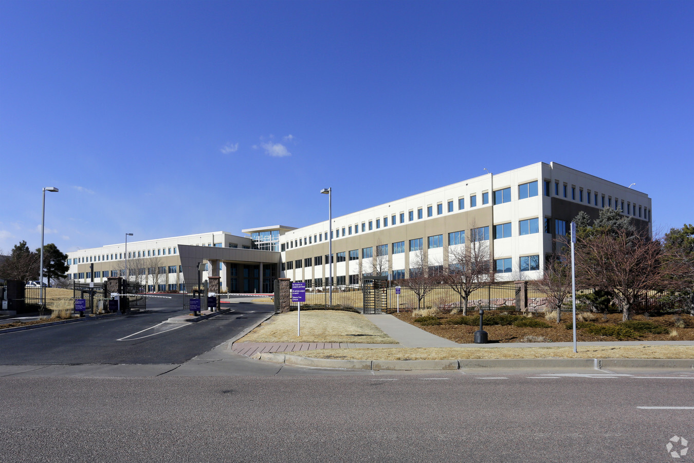
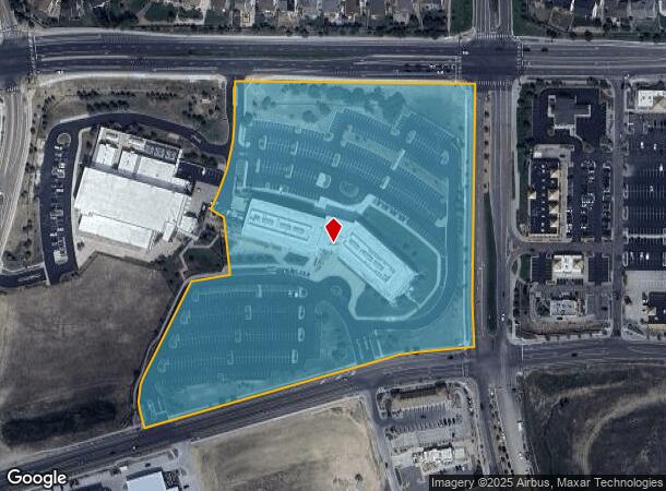
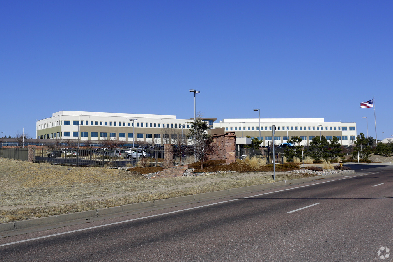
Property Record
350 Spectrum Loop, Colorado Springs, CO 80921

NEARBY LISTINGS FOR SALE OR LEASE
Property Detail
350 Spectrum Loop
Colorado Springs, CO
Northgate Campus Fil No 1
62071-08-005
LOT 1 NORTHGATE CAMPUS FIL NO 1, EX THAT PT CONV TO CITY FOR R/W BY REC # 208056013
Officebuilding
El Paso
X
Colorado
08041C0290G
1
2023
14.29 AC
2024
Northeast
007205
Colorado Springs
154,703 SF
DEMOGRAPHICS near 350 Spectrum Loop
1 Mile
3 Mile
5 Mile
2024 Total Population
6,374
30,026
59,495
2029 Population
6,699
31,613
62,768
Pop Growth 2024-2029
+ 5.10%
+ 5.29%
+ 5.50%
Average Age
38
40
39
2024 Total Households
2,255
10,775
20,508
HH Growth 2024-2029
+ 5.32%
+ 5.52%
+ 5.82%
Median Household Inc
$121,836
$133,613
$133,126
Avg Household Size
2.80
2.80
2.80
2024 Avg HH Vehicles
2.00
2.00
2.00
Median Home Value
$613,584
$599,215
$626,483
Median Year Built
2006
2006
2005
Nearby Places
- Restaurants
- Banks
- Shops
- Fitness
- Groceries
PUBLIC TRANSPORTATION
AIRPORT
City of Colorado Springs Municipal
DRIVE
WALK
Distance
City of Colorado Springs Municipal
34 min
20.1 mi
Freight Ports
Tulsa Port Of Catoosa
DRIVE
WALK
Distance
Tulsa Port Of Catoosa
743 min
695.1 mi
SALE & LEASE HISTORY
LISTING DATE
SALE/LEASE

Apr 11, 2023
For Sale
Apr 11, 2023
For Lease
Nearby Properties
Address
Land Use
TOTAL SIZE
Lot Size
Zoning
Address
Land Use
TOTAL SIZE
Lot Size
Zoning
562,942 SF
27.13 AC
PUD
Address
Land Use
TOTAL SIZE
Lot Size
Zoning
278,951 SF
32.43 AC
PIP1/CR HR
Address
Land Use
TOTAL SIZE
Lot Size
Zoning
257,140 SF
30.17 AC
PBC OC/CR
Address
Land Use
TOTAL SIZE
Lot Size
Zoning
316,105 SF
19.73 AC
PUD
Address
Land Use
TOTAL SIZE
Lot Size
Zoning
323,646 SF
31.30 AC
PIP1 A PIP
Address
Land Use
TOTAL SIZE
Lot Size
Zoning
57.81 AC
PUD HR
Address
Land Use
TOTAL SIZE
Lot Size
Zoning
188,626 SF
22.34 AC
PIP1/CR HR
Address
Land Use
TOTAL SIZE
Lot Size
Zoning
132,854 SF
10 AC
PIP1/CR HR
Address
Land Use
TOTAL SIZE
Lot Size
Zoning
411,465 SF
22.54 AC
PUD
Address
Land Use
TOTAL SIZE
Lot Size
Zoning
322,150 SF
19 AC
PUD HR
Address
Land Use
TOTAL SIZE
Lot Size
Zoning
95,337 SF
49.29 AC
PIP1
Address
Land Use
TOTAL SIZE
Lot Size
Zoning
151,287 SF
9.40 AC
PUD HR
Address
Land Use
TOTAL SIZE
Lot Size
Zoning
82,671 SF
21.90 AC
PUD
Address
Land Use
TOTAL SIZE
Lot Size
Zoning
109,437 SF
1.08 AC
PUD
Address
Land Use
TOTAL SIZE
Lot Size
Zoning
266,793 SF
15.68 AC
PUD
Address
Land Use
TOTAL SIZE
Lot Size
Zoning
346,674 SF
17.96 AC
PUD
Address
Land Use
TOTAL SIZE
Lot Size
Zoning
347,470 SF
15.42 AC
PUD HR
Address
Land Use
TOTAL SIZE
Lot Size
Zoning
349,673 SF
12.25 AC
PUD
Address
Land Use
TOTAL SIZE
Lot Size
Zoning
154,816 SF
17.75 AC
PIP1 HR
Address
Land Use
TOTAL SIZE
Lot Size
Zoning
154,641 SF
15.05 AC
OC/CR PIP1
Address
Land Use
TOTAL SIZE
Lot Size
Zoning
222,866 SF
14.40 AC
RM-30
Address
Land Use
TOTAL SIZE
Lot Size
Zoning
206,674 SF
3.86 AC
PUD
Address
Land Use
TOTAL SIZE
Lot Size
Zoning
87,290 SF
7 AC
PIP1 HR
Address
Land Use
TOTAL SIZE
Lot Size
Zoning
98,428 SF
16.92 AC
PUD
Address
Land Use
TOTAL SIZE
Lot Size
Zoning
355,799 SF
10.51 AC
PUD HR
Address
Land Use
TOTAL SIZE
Lot Size
Zoning
86,779 SF
10.62 AC
PCD
Address
Land Use
TOTAL SIZE
Lot Size
Zoning
119,596 SF
19.25 AC
PUD HR
Address
Land Use
TOTAL SIZE
Lot Size
Zoning
238,843 SF
9.46 AC
PUD
Address
Land Use
TOTAL SIZE
Lot Size
Zoning
75,787 SF
2.84 AC
A PUD
The World's #1 Commercial Real Estate Marketplace
Connect with us
© 2025 CoStar Group
The information above has been obtained from sources believed reliable. While we do not doubt its accuracy we have not verified it and make no guarantee, warranty or representation about it. It is your responsibility to independently confirm its accuracy and completeness. Any projections, opinions, assumptions, or estimates used are for example only and do not represent the current or future performance of the property. The value of this transaction to you depends on tax and other factors which should be evaluated by your tax, financial, and legal advisors. You and your advisors should conduct a careful, independent investigation of the property to determine to your satisfaction the suitability of the property for your needs.