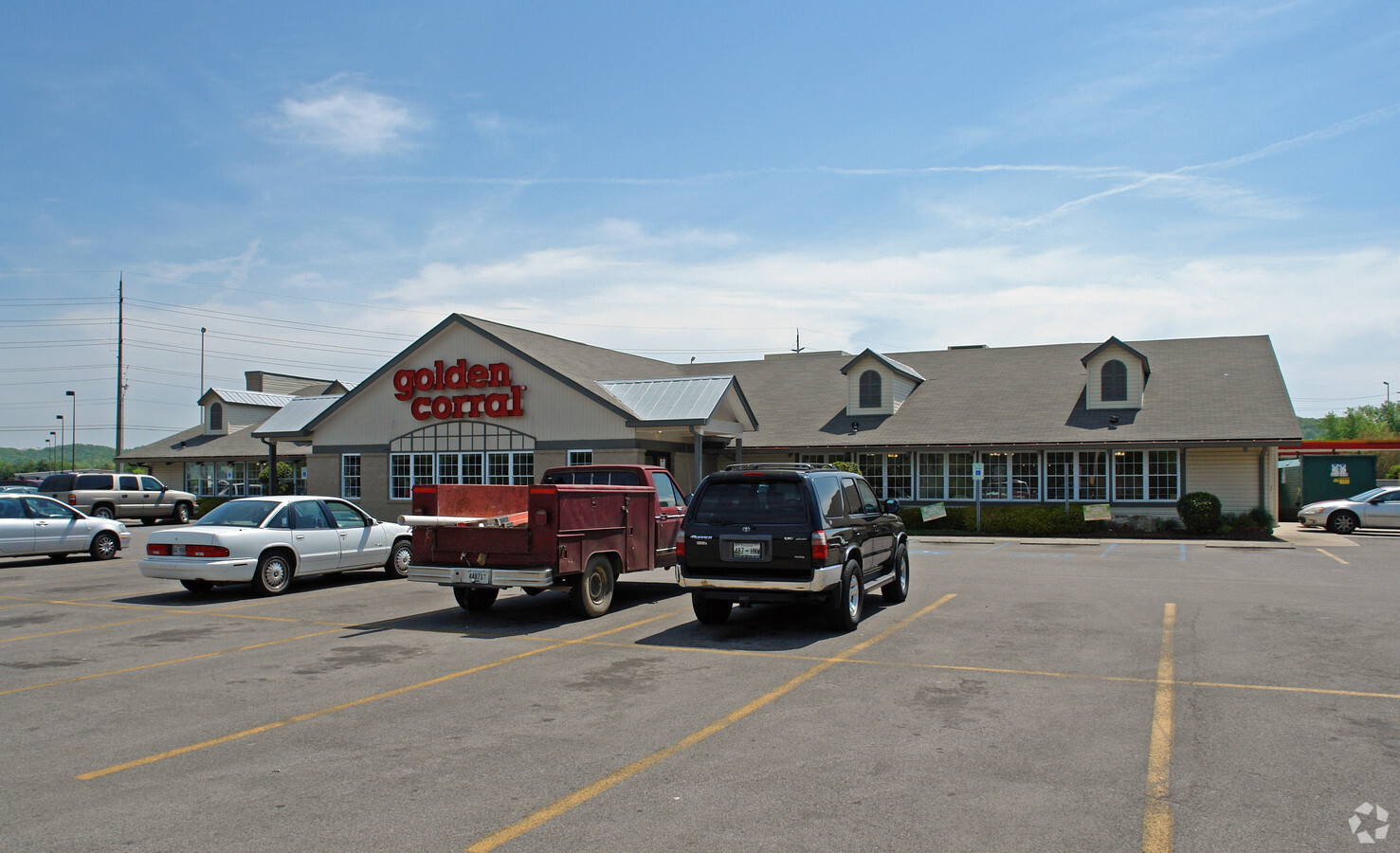
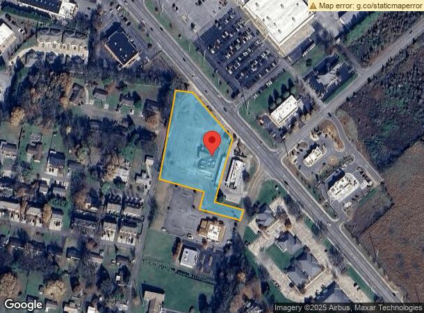
Property Record
350 Stuart Rd Ne, Cleveland, TN 37312

NEARBY LISTINGS FOR SALE OR LEASE
Property Detail
350 Stuart Rd Ne
042G-J-001.02
Hopkins Surveying Group Inc
Commercialnec
DISTRICT: 4
X
Bradley
47011C0129E
Tennessee
2024
2.61 AC
2024
Tennessee East Area
010201
Other Market Areas
10,144 SF
Cleveland, TN
DEMOGRAPHICS near 350 Stuart Rd Ne
1 Mile
3 Mile
5 Mile
2024 Total Population
3,701
40,919
71,596
2029 Population
3,904
43,145
75,540
Pop Growth 2024-2029
+ 5.49%
+ 5.44%
+ 5.51%
Average Age
40
40
40
2024 Total Households
1,503
15,991
27,869
HH Growth 2024-2029
+ 5.66%
+ 5.68%
+ 5.69%
Median Household Inc
$57,045
$55,752
$55,111
Avg Household Size
2.40
2.40
2.50
2024 Avg HH Vehicles
2.00
2.00
2.00
Median Home Value
$220,136
$225,988
$224,550
Median Year Built
1982
1985
1985
Nearby Places
- Restaurants
- Banks
- Shops
- Fitness
- Groceries
PUBLIC TRANSPORTATION
AIRPORT
Lovell Field
DRIVE
WALK
Distance
Lovell Field
39 min
28.0 mi
Freight Ports
Georgia Ports - Savannah
DRIVE
WALK
Distance
Georgia Ports - Savannah
427 min
370.7 mi
SALE & LEASE HISTORY
LISTING DATE
SALE/LEASE

Mar 09, 2021
For Sale
Nearby Properties
Address
Land Use
TOTAL SIZE
Lot Size
Zoning
Address
Land Use
TOTAL SIZE
Lot Size
Zoning
400,000 SF
123.44 AC
IH
Address
Land Use
TOTAL SIZE
Lot Size
Zoning
267,460 SF
8.30 AC
IL
Address
Land Use
TOTAL SIZE
Lot Size
Zoning
400,562 SF
15.26 AC
PI
Address
Land Use
TOTAL SIZE
Lot Size
Zoning
8,680 SF
355.73 AC
IL
Address
Land Use
TOTAL SIZE
Lot Size
Zoning
118,230 SF
37 AC
FAR
Address
Land Use
TOTAL SIZE
Lot Size
Zoning
88,644 SF
51.19 AC
R1
Address
Land Use
TOTAL SIZE
Lot Size
Zoning
68,425 SF
76.31 AC
MU
Address
Land Use
TOTAL SIZE
Lot Size
Zoning
68,785 SF
8.70 AC
R1
Address
Land Use
TOTAL SIZE
Lot Size
Zoning
356,920 SF
26.42 AC
IL
Address
Land Use
TOTAL SIZE
Lot Size
Zoning
93,264 SF
17.60 AC
CH
Address
Land Use
TOTAL SIZE
Lot Size
Zoning
74,392 SF
17.39 AC
MU
Address
Land Use
TOTAL SIZE
Lot Size
Zoning
620,857 SF
34.28 AC
IH
Address
Land Use
TOTAL SIZE
Lot Size
Zoning
170,518 SF
4.96 AC
CH
Address
Land Use
TOTAL SIZE
Lot Size
Zoning
423,535 SF
56.59 AC
IH
Address
Land Use
TOTAL SIZE
Lot Size
Zoning
153,044 SF
16.85 AC
PUD
Address
Land Use
TOTAL SIZE
Lot Size
Zoning
530,452 SF
30 AC
IL
Address
Land Use
TOTAL SIZE
Lot Size
Zoning
66,331 SF
10.87 AC
IL
Address
Land Use
TOTAL SIZE
Lot Size
Zoning
213,240 SF
19.10 AC
R3
Address
Land Use
TOTAL SIZE
Lot Size
Zoning
782,652 SF
43.40 AC
C-1
Address
Land Use
TOTAL SIZE
Lot Size
Zoning
203,778 SF
13.46 AC
R3
Address
Land Use
TOTAL SIZE
Lot Size
Zoning
416,503 SF
61.92 AC
CH
Address
Land Use
TOTAL SIZE
Lot Size
Zoning
96,527 SF
5.15 AC
CH
Address
Land Use
TOTAL SIZE
Lot Size
Zoning
203,751 SF
19.34 AC
CH
Address
Land Use
TOTAL SIZE
Lot Size
Zoning
132,758 SF
12.30 AC
PUD
Address
Land Use
TOTAL SIZE
Lot Size
Zoning
28,351 SF
0.50 AC
I1
Address
Land Use
TOTAL SIZE
Lot Size
Zoning
56,725 SF
13.06 AC
R1
Address
Land Use
TOTAL SIZE
Lot Size
Zoning
265,226 SF
25.90 AC
CH
Address
Land Use
TOTAL SIZE
Lot Size
Zoning
36.78 AC
PI
Address
Land Use
TOTAL SIZE
Lot Size
Zoning
141,489 SF
10.40 AC
R3
Address
Land Use
TOTAL SIZE
Lot Size
Zoning
86,435 SF
7.68 AC
CH
The World's #1 Commercial Real Estate Marketplace
Connect with us
© 2025 CoStar Group
The information above has been obtained from sources believed reliable. While we do not doubt its accuracy we have not verified it and make no guarantee, warranty or representation about it. It is your responsibility to independently confirm its accuracy and completeness. Any projections, opinions, assumptions, or estimates used are for example only and do not represent the current or future performance of the property. The value of this transaction to you depends on tax and other factors which should be evaluated by your tax, financial, and legal advisors. You and your advisors should conduct a careful, independent investigation of the property to determine to your satisfaction the suitability of the property for your needs.