Property Record
3500 Daniells Bridge Rd, Athens, GA 30606
NEARBY LISTINGS FOR SALE OR LEASE
-
-
View all Athens listings for sale on LoopNet.com
Property Detail
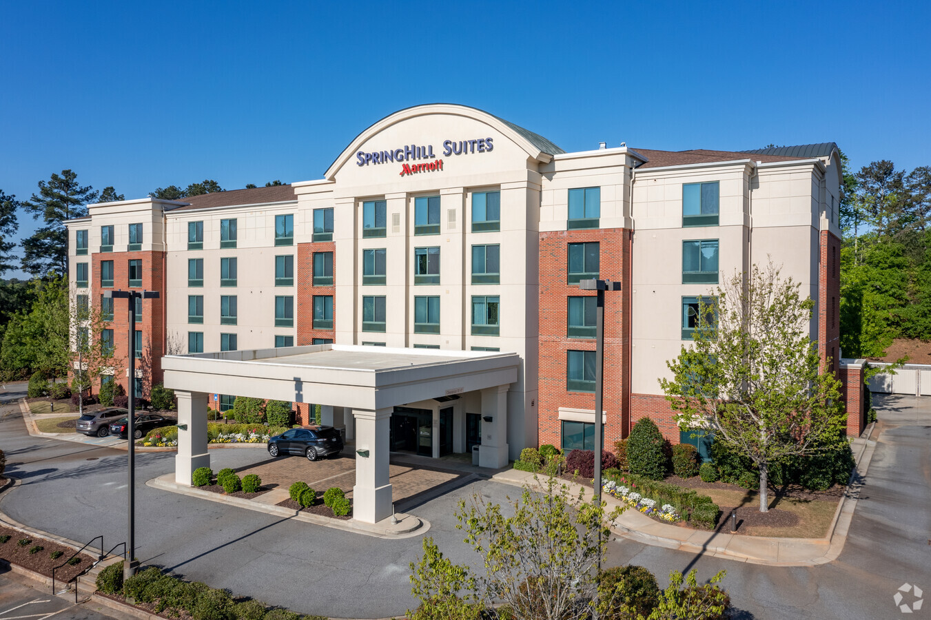
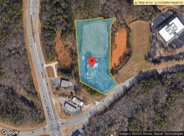
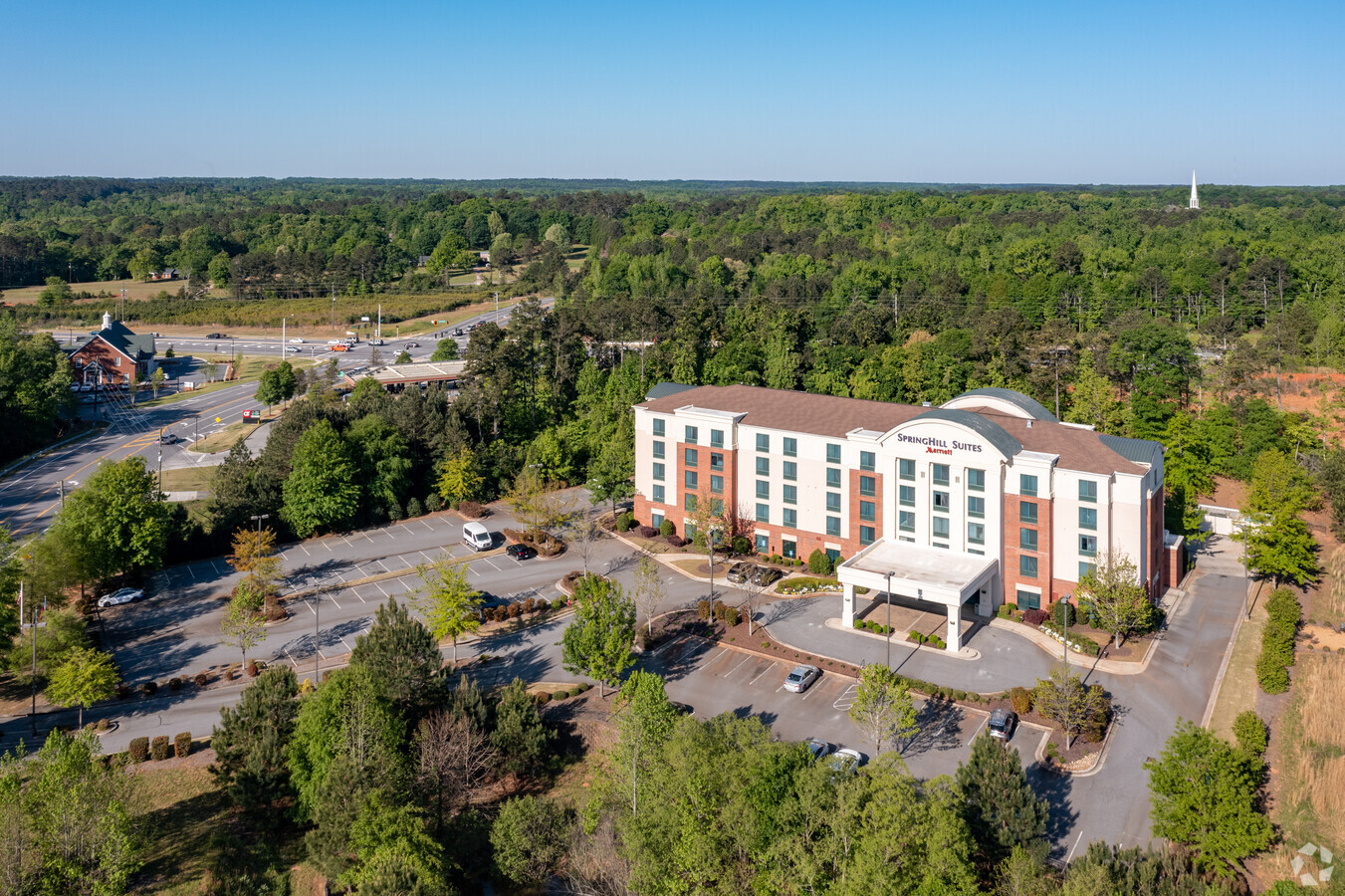
3500 Daniells Bridge Rd
Athens-Clarke County, GA
University Pkwy Office & Technology Park
B04-M0-04A
1410/298 345/351 - 37/9
Hotel
Oconee
X
Georgia
13059C0032E
4
2024
6.30 AC
2024
Athens/Gainesville
030202
Other Market Areas
62,635 SF
DEMOGRAPHICS near 3500 Daniells Bridge Rd
1 Mile
3 Mile
5 Mile
2024 Total Population
2,076
25,614
67,331
2029 Population
2,348
27,537
70,800
Pop Growth 2024-2029
+ 13.10%
+ 7.51%
+ 5.15%
Average Age
39
39
38
2024 Total Households
699
10,112
26,857
HH Growth 2024-2029
+ 13.16%
+ 6.69%
+ 4.50%
Median Household Inc
$92,856
$80,927
$71,536
Avg Household Size
3.00
2.50
2.40
2024 Avg HH Vehicles
2.00
2.00
2.00
Median Home Value
$364,161
$329,285
$330,692
Median Year Built
1990
1996
1990
Nearby Places
- Restaurants
- Banks
- Shops
- Fitness
- Groceries
Nearby Properties
Address
Land Use
TOTAL SIZE
Lot Size
Zoning
Address
Land Use
TOTAL SIZE
Lot Size
Zoning
212,919 SF
37.92 AC
RM-1
Address
Land Use
TOTAL SIZE
Lot Size
Zoning
87,066 SF
36.66 AC
RM-2
Address
Land Use
TOTAL SIZE
Lot Size
Zoning
81,792 SF
30.99 AC
RM-1
Address
Land Use
TOTAL SIZE
Lot Size
Zoning
98,402 SF
8.11 AC
B-2
Address
Land Use
TOTAL SIZE
Lot Size
Zoning
317,646 SF
55.19 AC
AG
Address
Land Use
TOTAL SIZE
Lot Size
Zoning
108,668 SF
37.79 AC
001
Address
Land Use
TOTAL SIZE
Lot Size
Zoning
2,505 SF
25.03 AC
RM-1
Address
Land Use
TOTAL SIZE
Lot Size
Zoning
17,388 SF
21.49 AC
RM-1
Address
Land Use
TOTAL SIZE
Lot Size
Zoning
4,907 SF
28.35 AC
RM-2
Address
Land Use
TOTAL SIZE
Lot Size
Zoning
1,511 SF
17.01 AC
RM-1
Address
Land Use
TOTAL SIZE
Lot Size
Zoning
1,020 SF
27.72 AC
RM-1
Address
Land Use
TOTAL SIZE
Lot Size
Zoning
113,787 SF
32.92 AC
C-G
Address
Land Use
TOTAL SIZE
Lot Size
Zoning
Address
Land Use
TOTAL SIZE
Lot Size
Zoning
4,373 SF
25.41 AC
RM-1
Address
Land Use
TOTAL SIZE
Lot Size
Zoning
107,030 SF
34.62 AC
AR
Address
Land Use
TOTAL SIZE
Lot Size
Zoning
154,270 SF
23.19 AC
Address
Land Use
TOTAL SIZE
Lot Size
Zoning
22,716 SF
66.62 AC
R-3
Address
Land Use
TOTAL SIZE
Lot Size
Zoning
17,356 SF
10.66 AC
B-2
Address
Land Use
TOTAL SIZE
Lot Size
Zoning
70,000 SF
5.40 AC
O-B-P
Address
Land Use
TOTAL SIZE
Lot Size
Zoning
178,150 SF
18.59 AC
C-G
Address
Land Use
TOTAL SIZE
Lot Size
Zoning
118,596 SF
44.98 AC
C-G
Address
Land Use
TOTAL SIZE
Lot Size
Zoning
90,670 SF
11.86 AC
B-2
Address
Land Use
TOTAL SIZE
Lot Size
Zoning
132,941 SF
13.40 AC
C-G
Address
Land Use
TOTAL SIZE
Lot Size
Zoning
68,931 SF
5.56 AC
O-B-P
Address
Land Use
TOTAL SIZE
Lot Size
Zoning
4.86 AC
B-1
Address
Land Use
TOTAL SIZE
Lot Size
Zoning
10.43 AC
G
Address
Land Use
TOTAL SIZE
Lot Size
Zoning
29,376 SF
197.43 AC
AG
Address
Land Use
TOTAL SIZE
Lot Size
Zoning
58,725 SF
3.14 AC
B-2
Address
Land Use
TOTAL SIZE
Lot Size
Zoning
44,563 SF
18.32 AC
C-G
Address
Land Use
TOTAL SIZE
Lot Size
Zoning
24,826 SF
4.80 AC
B-2
The World's #1 Commercial Real Estate Marketplace
Connect with us
© 2025 CoStar Group
The information above has been obtained from sources believed reliable. While we do not doubt its accuracy we have not verified it and make no guarantee, warranty or representation about it. It is your responsibility to independently confirm its accuracy and completeness. Any projections, opinions, assumptions, or estimates used are for example only and do not represent the current or future performance of the property. The value of this transaction to you depends on tax and other factors which should be evaluated by your tax, financial, and legal advisors. You and your advisors should conduct a careful, independent investigation of the property to determine to your satisfaction the suitability of the property for your needs.