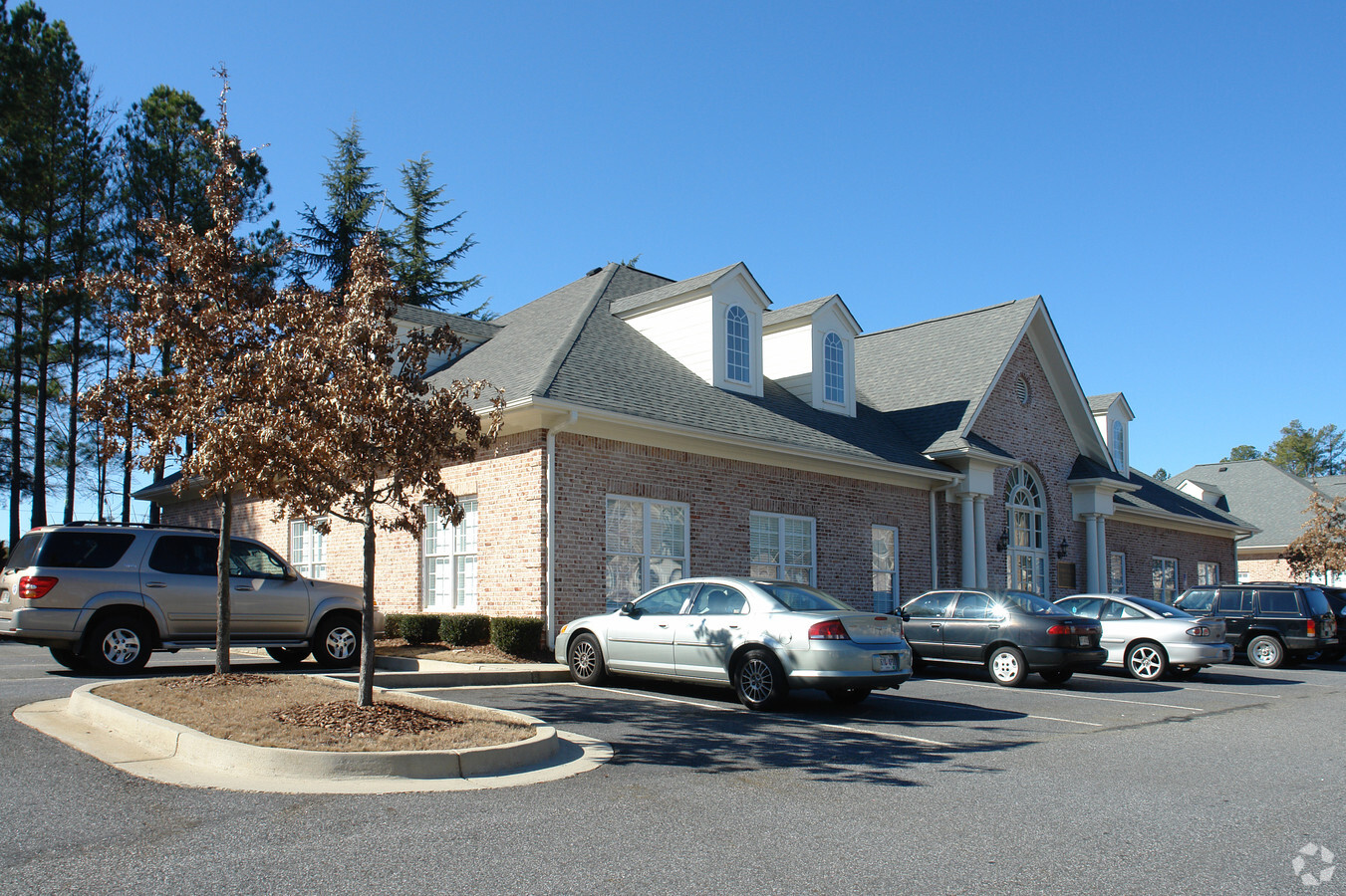
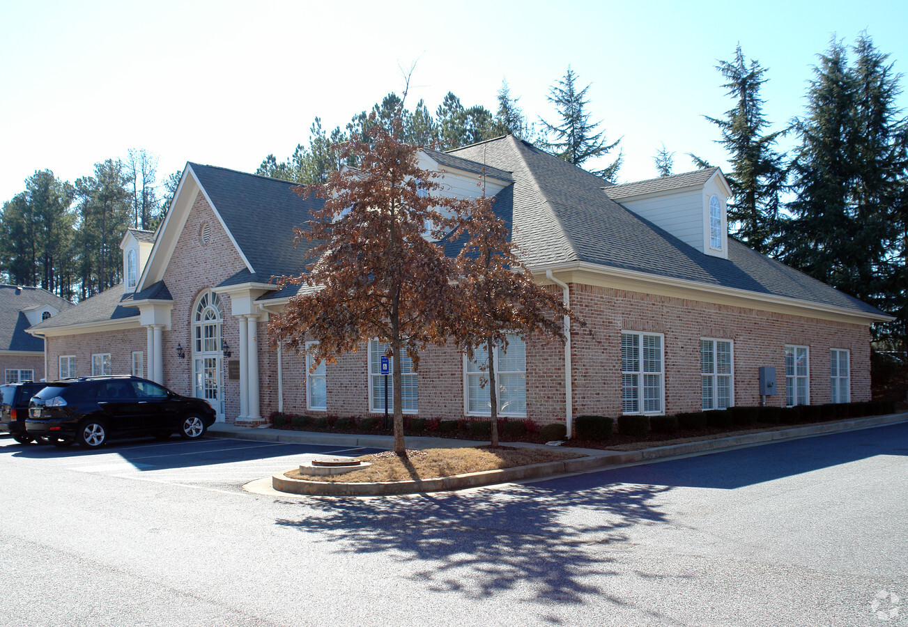
Property Record
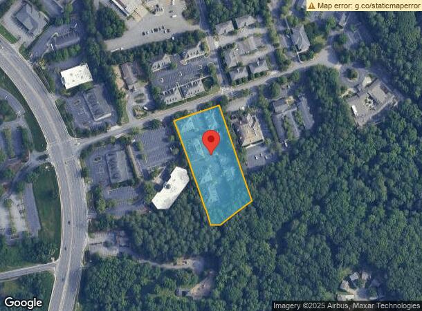
3500 Duluth Park Ln, Duluth, GA 30096

NEARBY LISTINGS FOR SALE OR LEASE
Property Detail
3500 Duluth Park Ln
Atlanta-Sandy Springs-Roswell, GA
Common Area Park
6-295-065
COMMON AREA PARKSIDE PROF CENTER
Commercialcondominium
Gwinnett
X
Georgia
13121C0093G
3
2024
2.55 AC
2023
Duluth/Suwanee/Buford
050219
Atlanta
DEMOGRAPHICS near 3500 Duluth Park Ln
1 Mile
3 Mile
5 Mile
2024 Total Population
13,643
68,590
199,357
2029 Population
14,256
71,393
207,404
Pop Growth 2024-2029
+ 4.49%
+ 4.09%
+ 4.04%
Average Age
38
39
38
2024 Total Households
5,575
25,250
72,644
HH Growth 2024-2029
+ 4.57%
+ 4.17%
+ 4.09%
Median Household Inc
$71,804
$87,858
$81,143
Avg Household Size
2.40
2.70
2.70
2024 Avg HH Vehicles
2.00
2.00
2.00
Median Home Value
$293,856
$374,739
$407,030
Median Year Built
1991
1993
1994
Nearby Places
- Restaurants
- Banks
- Shops
- Fitness
- Groceries
PUBLIC TRANSPORTATION
AIRPORT
Hartsfield - Jackson Atlanta International
DRIVE
WALK
Distance
Hartsfield - Jackson Atlanta International
50 min
35.6 mi
Freight Ports
Georgia Ports - Savannah
DRIVE
WALK
Distance
Georgia Ports - Savannah
306 min
270.5 mi
Nearby Properties
Address
Land Use
TOTAL SIZE
Lot Size
Zoning
Address
Land Use
TOTAL SIZE
Lot Size
Zoning
652,108 SF
78.64 AC
PUD
Address
Land Use
TOTAL SIZE
Lot Size
Zoning
491,482 SF
41.72 AC
C1
Address
Land Use
TOTAL SIZE
Lot Size
Zoning
20,896 SF
38.74 AC
RM13-MULTI
Address
Land Use
TOTAL SIZE
Lot Size
Zoning
329,029 SF
21.16 AC
C1
Address
Land Use
TOTAL SIZE
Lot Size
Zoning
421,088 SF
40.47 AC
RM
Address
Land Use
TOTAL SIZE
Lot Size
Zoning
450,095 SF
45.79 AC
RM10
Address
Land Use
TOTAL SIZE
Lot Size
Zoning
300,735 SF
21.95 AC
PUD
Address
Land Use
TOTAL SIZE
Lot Size
Zoning
324,001 SF
11.64 AC
PUD
Address
Land Use
TOTAL SIZE
Lot Size
Zoning
357,430 SF
47.93 AC
RM
Address
Land Use
TOTAL SIZE
Lot Size
Zoning
323,846 SF
24.89 AC
PUD
Address
Land Use
TOTAL SIZE
Lot Size
Zoning
304,001 SF
32 AC
PUD
Address
Land Use
TOTAL SIZE
Lot Size
Zoning
237,864 SF
5.09 AC
PUD
Address
Land Use
TOTAL SIZE
Lot Size
Zoning
88.90 AC
AG1
Address
Land Use
TOTAL SIZE
Lot Size
Zoning
341,506 SF
36.69 AC
C1
Address
Land Use
TOTAL SIZE
Lot Size
Zoning
180,572 SF
14.77 AC
C1
Address
Land Use
TOTAL SIZE
Lot Size
Zoning
217,080 SF
49.32 AC
M1
Address
Land Use
TOTAL SIZE
Lot Size
Zoning
254,048 SF
28.59 AC
RM
Address
Land Use
TOTAL SIZE
Lot Size
Zoning
1,650 SF
74.37 AC
AG1
Address
Land Use
TOTAL SIZE
Lot Size
Zoning
347,940 SF
46.73 AC
OI
Address
Land Use
TOTAL SIZE
Lot Size
Zoning
287,824 SF
31.59 AC
RM
Address
Land Use
TOTAL SIZE
Lot Size
Zoning
201,795 SF
22.03 AC
RM
Address
Land Use
TOTAL SIZE
Lot Size
Zoning
202,674 SF
8.42 AC
PUD-PLANNE
Address
Land Use
TOTAL SIZE
Lot Size
Zoning
43.34 AC
R4A
Address
Land Use
TOTAL SIZE
Lot Size
Zoning
251,611 SF
22.50 AC
RM
Address
Land Use
TOTAL SIZE
Lot Size
Zoning
2.94 AC
M1
Address
Land Use
TOTAL SIZE
Lot Size
Zoning
232,473 SF
16.21 AC
PUD
Address
Land Use
TOTAL SIZE
Lot Size
Zoning
251,998 SF
9.44 AC
PUD
Address
Land Use
TOTAL SIZE
Lot Size
Zoning
168,882 SF
20 AC
R75
Address
Land Use
TOTAL SIZE
Lot Size
Zoning
247,198 SF
14.88 AC
C2
Address
Land Use
TOTAL SIZE
Lot Size
Zoning
158,224 SF
16.93 AC
PUD
The World's #1 Commercial Real Estate Marketplace
Connect with us
© 2025 CoStar Group
The information above has been obtained from sources believed reliable. While we do not doubt its accuracy we have not verified it and make no guarantee, warranty or representation about it. It is your responsibility to independently confirm its accuracy and completeness. Any projections, opinions, assumptions, or estimates used are for example only and do not represent the current or future performance of the property. The value of this transaction to you depends on tax and other factors which should be evaluated by your tax, financial, and legal advisors. You and your advisors should conduct a careful, independent investigation of the property to determine to your satisfaction the suitability of the property for your needs.