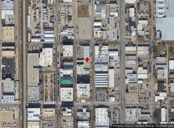
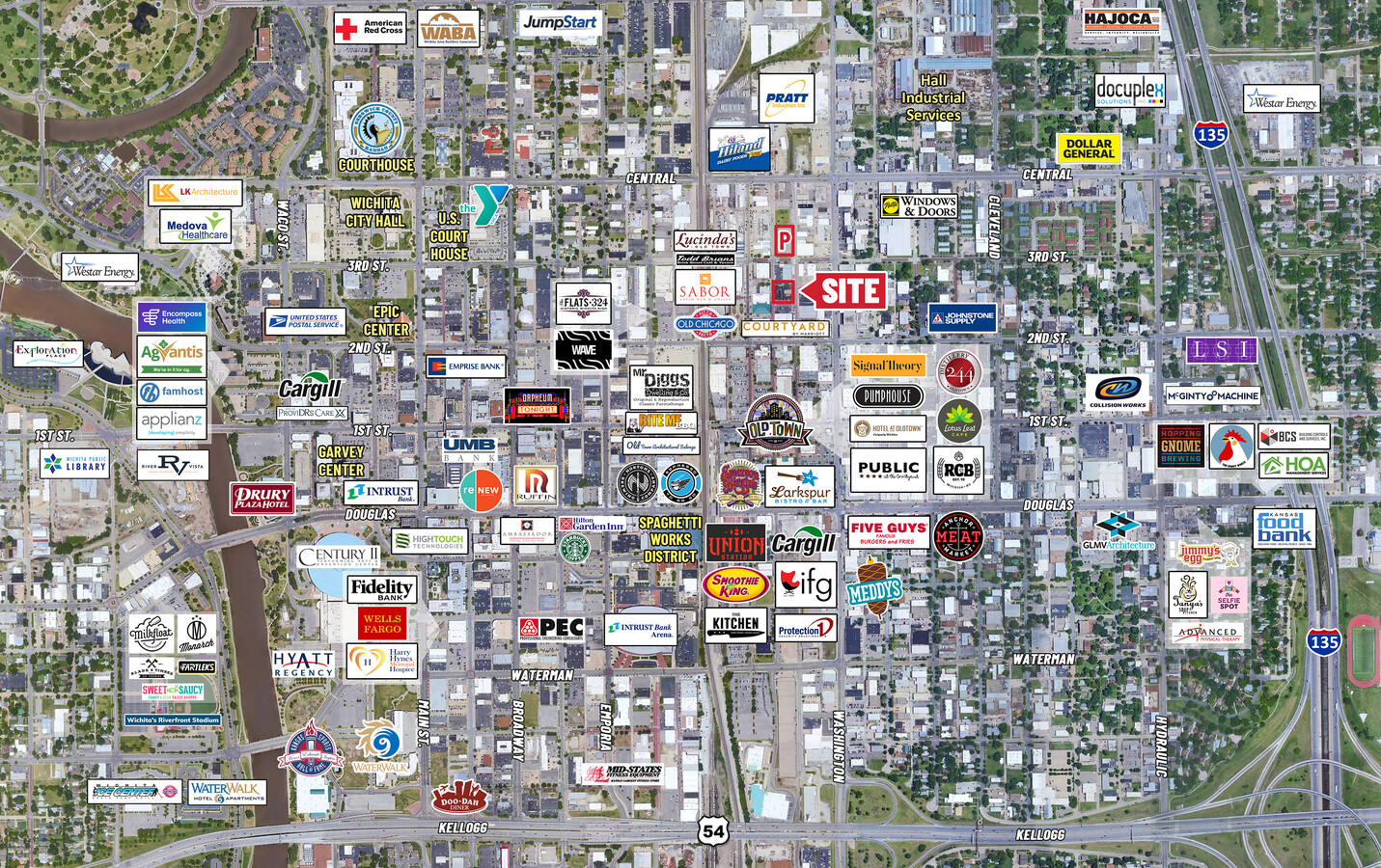
Property Record
351 N Mosley St, Wichita, KS 67202
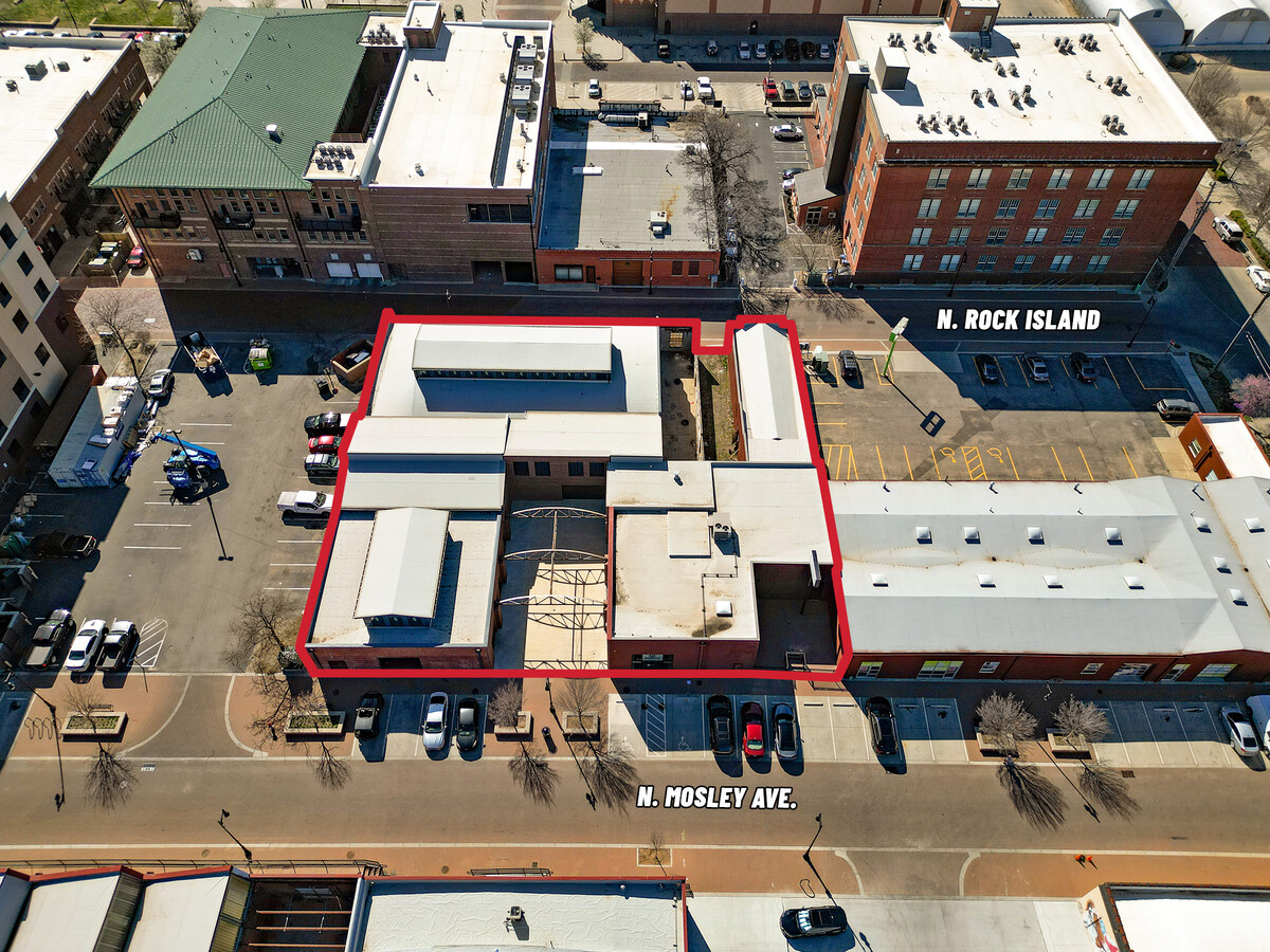
This Property Is For Sale
NEARBY LISTINGS FOR SALE OR LEASE
Property Detail
351 N Mosley St
Wichita, KS
H L & A M Taylor Add
125-21-0-21-08-001.02
TH PT LOTS 15-16-17 BEG 10 FT E & 151.40 FT S NE COR LOT 13 TH S 66.83 FT W 64.40 FT N 67.12 FT E 64.40 FT TO BEG BLOCK A H L & A M TAYLOR ADDITION
Warehouse
Sedgwick
X
Kansas
20173C0354G
13
2023
0.10 AC
2023
Downtown
004301
Wichita
3,795 SF
DEMOGRAPHICS near 351 N Mosley St
1 Mile
3 Mile
5 Mile
2024 Total Population
10,857
116,687
233,682
2029 Population
11,369
120,796
240,055
Pop Growth 2024-2029
+ 4.72%
+ 3.52%
+ 2.73%
Average Age
37
37
37
2024 Total Households
4,515
47,684
95,828
HH Growth 2024-2029
+ 5.63%
+ 3.59%
+ 2.73%
Median Household Inc
$34,468
$42,062
$45,098
Avg Household Size
1.80
2.20
2.30
2024 Avg HH Vehicles
1.00
2.00
2.00
Median Home Value
$84,932
$86,531
$109,833
Median Year Built
1958
1953
1958
Nearby Places
- Restaurants
- Banks
- Shops
- Fitness
- Groceries
PUBLIC TRANSPORTATION
AIRPORT
Wichita Dwight D Eisenhower Ntl
DRIVE
WALK
Distance
Wichita Dwight D Eisenhower Ntl
13 min
8.2 mi
Freight Ports
Tulsa Port Of Catoosa
DRIVE
WALK
Distance
Tulsa Port Of Catoosa
207 min
193.4 mi
Nearby Properties
Address
Land Use
TOTAL SIZE
Lot Size
Zoning
Address
Land Use
TOTAL SIZE
Lot Size
Zoning
468,755 SF
10.41 AC
CBD,LI
Address
Land Use
TOTAL SIZE
Lot Size
Zoning
499,239 SF
18.70 AC
GO
Address
Land Use
TOTAL SIZE
Lot Size
Zoning
515,640 SF
14.49 AC
CBD
Address
Land Use
TOTAL SIZE
Lot Size
Zoning
481,160 SF
63.37 AC
SF-5
Address
Land Use
TOTAL SIZE
Lot Size
Zoning
154,716 SF
12.67 AC
LC
Address
Land Use
TOTAL SIZE
Lot Size
Zoning
430,593 SF
11.89 AC
GO,LC
Address
Land Use
TOTAL SIZE
Lot Size
Zoning
386,803 SF
13.33 AC
CBD
Address
Land Use
TOTAL SIZE
Lot Size
Zoning
346,728 SF
15.91 AC
SF-5
Address
Land Use
TOTAL SIZE
Lot Size
Zoning
574,959 SF
53.70 AC
B,LC
Address
Land Use
TOTAL SIZE
Lot Size
Zoning
197,464 SF
4.05 AC
CBD
Address
Land Use
TOTAL SIZE
Lot Size
Zoning
227,462 SF
17.80 AC
TF-3
Address
Land Use
TOTAL SIZE
Lot Size
Zoning
237,087 SF
48.33 AC
B
Address
Land Use
TOTAL SIZE
Lot Size
Zoning
109,743 SF
6.10 AC
CBD
Address
Land Use
TOTAL SIZE
Lot Size
Zoning
328,487 SF
25.95 AC
MF-29
Address
Land Use
TOTAL SIZE
Lot Size
Zoning
84,757 SF
1.44 AC
GC
Address
Land Use
TOTAL SIZE
Lot Size
Zoning
148,617 SF
17.27 AC
SF-5
Address
Land Use
TOTAL SIZE
Lot Size
Zoning
104,331 SF
SF-5
Address
Land Use
TOTAL SIZE
Lot Size
Zoning
103,261 SF
5.49 AC
B
Address
Land Use
TOTAL SIZE
Lot Size
Zoning
180,527 SF
1.93 AC
LI
Address
Land Use
TOTAL SIZE
Lot Size
Zoning
143,110 SF
1.57 AC
LI
Address
Land Use
TOTAL SIZE
Lot Size
Zoning
186,902 SF
5.24 AC
SF-5
Address
Land Use
TOTAL SIZE
Lot Size
Zoning
79,041 SF
19.51 AC
LC
Address
Land Use
TOTAL SIZE
Lot Size
Zoning
110,839 SF
0.81 AC
CBD
Address
Land Use
TOTAL SIZE
Lot Size
Zoning
945,203 SF
9.53 AC
GO
Address
Land Use
TOTAL SIZE
Lot Size
Zoning
154,741 SF
14.61 AC
U
Address
Land Use
TOTAL SIZE
Lot Size
Zoning
73,314 SF
3.18 AC
SF-5
Address
Land Use
TOTAL SIZE
Lot Size
Zoning
98,677 SF
5.62 AC
TF-3
Address
Land Use
TOTAL SIZE
Lot Size
Zoning
113,980 SF
20.09 AC
SF-5
Address
Land Use
TOTAL SIZE
Lot Size
Zoning
92,973 SF
5.52 AC
PUD
Address
Land Use
TOTAL SIZE
Lot Size
Zoning
167,315 SF
2 AC
LC,SF-5
The World's #1 Commercial Real Estate Marketplace
Connect with us
© 2025 CoStar Group
The information above has been obtained from sources believed reliable. While we do not doubt its accuracy we have not verified it and make no guarantee, warranty or representation about it. It is your responsibility to independently confirm its accuracy and completeness. Any projections, opinions, assumptions, or estimates used are for example only and do not represent the current or future performance of the property. The value of this transaction to you depends on tax and other factors which should be evaluated by your tax, financial, and legal advisors. You and your advisors should conduct a careful, independent investigation of the property to determine to your satisfaction the suitability of the property for your needs.