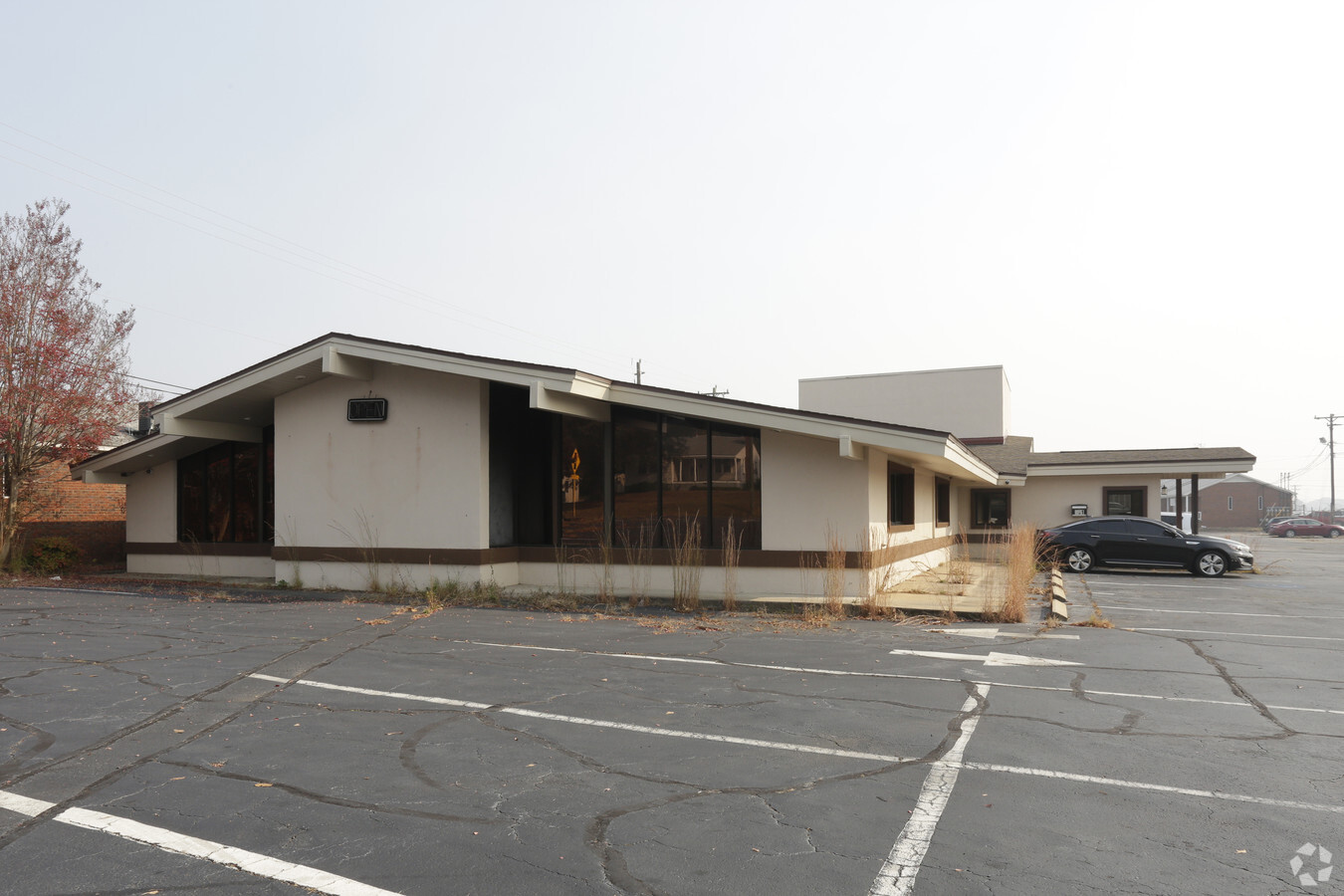
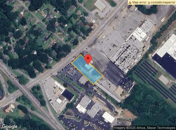
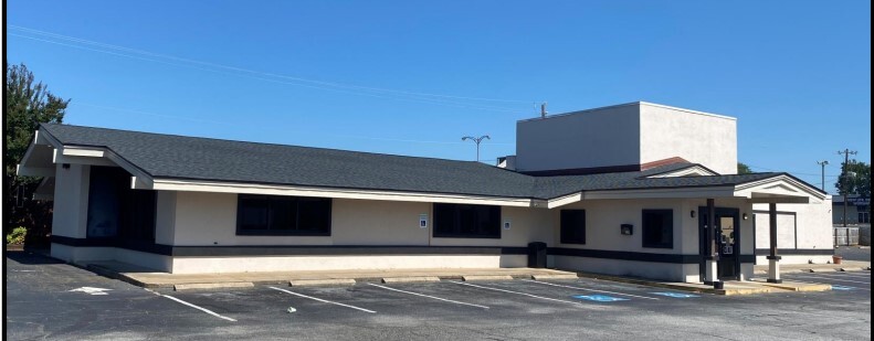
Property Record
351 Whitney Rd, Spartanburg, SC 29303
NEARBY LISTINGS FOR SALE OR LEASE
Property Detail
351 Whitney Rd
7-08-10-012.02
Property Of King Motor Center
Restaurantbuilding
S SIDE U S 221 & N OF PINE ST DB 96H-756
X
Spartanburg
45083C0256D
South Carolina
2024
1.12 AC
2023
East Side
021500
Greenville/Spartanburg
6,644 SF
Spartanburg, SC
DEMOGRAPHICS near 351 Whitney Rd
1 Mile
3 Mile
5 Mile
2024 Total Population
6,500
47,314
106,007
2029 Population
7,286
53,775
120,003
Pop Growth 2024-2029
+ 12.09%
+ 13.66%
+ 13.20%
Average Age
37
37
38
2024 Total Households
2,271
18,563
42,065
HH Growth 2024-2029
+ 14.44%
+ 14.40%
+ 13.68%
Median Household Inc
$34,390
$40,836
$47,763
Avg Household Size
2.20
2.20
2.30
2024 Avg HH Vehicles
1.00
2.00
2.00
Median Home Value
$123,266
$138,948
$160,746
Median Year Built
1971
1972
1977
Nearby Places
- Restaurants
- Banks
- Shops
- Fitness
- Groceries
PUBLIC TRANSPORTATION
COMMUTER RAIL
Spartanburg Amtrak Station (Crescent - Amtrak)
Drive
Walk
Distance
Spartanburg Amtrak Station (Crescent - Amtrak)
4 min
1.7 mi
AIRPORT
Greenville Spartanburg International
Drive
Walk
Distance
Greenville Spartanburg International
30 min
20.8 mi
Freight Ports
North Charleston Terminal
Drive
Walk
Distance
North Charleston Terminal
225 min
197.5 mi
SALE & LEASE HISTORY
LISTING DATE
SALE/LEASE

Sep 22, 2022
For Lease
Sep 22, 2022
For Sale
Oct 07, 2016
For Sale
May 20, 2019
For Sale
Jul 23, 2018
For Lease
Feb 28, 2019
For Sale
Nearby Properties
Address
Land Use
TOTAL SIZE
Lot Size
Zoning
Address
Land Use
TOTAL SIZE
Lot Size
Zoning
9,080 SF
9.06 AC
Address
Land Use
TOTAL SIZE
Lot Size
Zoning
27,491 SF
2.95 AC
Address
Land Use
TOTAL SIZE
Lot Size
Zoning
15,108 SF
16.27 AC
Address
Land Use
TOTAL SIZE
Lot Size
Zoning
17,744 SF
3.41 AC
Address
Land Use
TOTAL SIZE
Lot Size
Zoning
2,100 SF
10.12 AC
Address
Land Use
TOTAL SIZE
Lot Size
Zoning
19,876 SF
0.02 AC
Address
Land Use
TOTAL SIZE
Lot Size
Zoning
2,637 SF
21.41 AC
Address
Land Use
TOTAL SIZE
Lot Size
Zoning
4,598 SF
6.68 AC
Address
Land Use
TOTAL SIZE
Lot Size
Zoning
12,069 SF
0.02 AC
Address
Land Use
TOTAL SIZE
Lot Size
Zoning
42,915 SF
7.47 AC
Address
Land Use
TOTAL SIZE
Lot Size
Zoning
122,626 SF
7.70 AC
Address
Land Use
TOTAL SIZE
Lot Size
Zoning
6,959 SF
51.62 AC
Address
Land Use
TOTAL SIZE
Lot Size
Zoning
8,872 SF
0.02 AC
Address
Land Use
TOTAL SIZE
Lot Size
Zoning
1,782 SF
3.50 AC
Address
Land Use
TOTAL SIZE
Lot Size
Zoning
5,242 SF
6.01 AC
Address
Land Use
TOTAL SIZE
Lot Size
Zoning
6,462 SF
31.44 AC
Address
Land Use
TOTAL SIZE
Lot Size
Zoning
82,270 SF
18.14 AC
Address
Land Use
TOTAL SIZE
Lot Size
Zoning
36,480 SF
15.39 AC
Address
Land Use
TOTAL SIZE
Lot Size
Zoning
89,435 SF
5.33 AC
Address
Land Use
TOTAL SIZE
Lot Size
Zoning
16,512 SF
23.72 AC
Address
Land Use
TOTAL SIZE
Lot Size
Zoning
91,780 SF
2.30 AC
Address
Land Use
TOTAL SIZE
Lot Size
Zoning
2,154 SF
16.99 AC
Address
Land Use
TOTAL SIZE
Lot Size
Zoning
5,872 SF
14.16 AC
Address
Land Use
TOTAL SIZE
Lot Size
Zoning
16.45 AC
Address
Land Use
TOTAL SIZE
Lot Size
Zoning
44,199 SF
5.02 AC
Address
Land Use
TOTAL SIZE
Lot Size
Zoning
5,693 SF
0.02 AC
Address
Land Use
TOTAL SIZE
Lot Size
Zoning
2,134 SF
27.72 AC
Address
Land Use
TOTAL SIZE
Lot Size
Zoning
2,288 SF
8.10 AC
Address
Land Use
TOTAL SIZE
Lot Size
Zoning
25,951 SF
17.61 AC
Address
Land Use
TOTAL SIZE
Lot Size
Zoning
27,136 SF
2.17 AC
Start a new search to find other properties for sale or lease
Connect with us
© 2025 CoStar Group
The information above has been obtained from sources believed reliable. While we do not doubt its accuracy we have not verified it and make no guarantee, warranty or representation about it. It is your responsibility to independently confirm its accuracy and completeness. Any projections, opinions, assumptions, or estimates used are for example only and do not represent the current or future performance of the property. The value of this transaction to you depends on tax and other factors which should be evaluated by your tax, financial, and legal advisors. You and your advisors should conduct a careful, independent investigation of the property to determine to your satisfaction the suitability of the property for your needs.