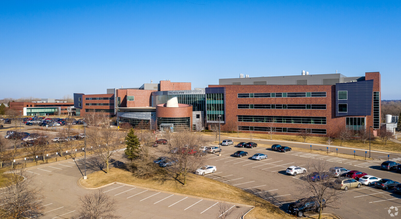
Property Record
3510 Hopkins Pl N, Saint Paul, MN 55128

Current Lease Availabilities
NEARBY LISTINGS FOR SALE OR LEASE
Property Detail
3510 Hopkins Pl N
Minneapolis-St. Paul-Bloomington, MN-WI
Oakdale Farm 2Nd Add
17-029-21-14-0005
SUBDIVISIONNAME OAKDALE FARM 2ND ADD LOT 4 BLOCK 1 SUBDIVISIONCD 58172
Commercialnec
Washington
X
Minnesota
27123C0065G
4
2024
22.81 AC
2023
East
070906
Minneapolis/St Paul
388,596 SF
DEMOGRAPHICS near 3510 Hopkins Pl N
1 Mile
3 Mile
5 Mile
2024 Total Population
4,428
45,871
154,871
2029 Population
4,841
47,970
158,090
Pop Growth 2024-2029
+ 9.33%
+ 4.58%
+ 2.08%
Average Age
39
40
39
2024 Total Households
1,512
17,932
58,139
HH Growth 2024-2029
+ 9.13%
+ 4.54%
+ 2.21%
Median Household Inc
$110,447
$83,369
$79,598
Avg Household Size
2.70
2.50
2.60
2024 Avg HH Vehicles
2.00
2.00
2.00
Median Home Value
$331,101
$295,297
$284,778
Median Year Built
1991
1984
1978
Nearby Places
- Restaurants
- Banks
- Shops
- Fitness
- Groceries
PUBLIC TRANSPORTATION
AIRPORT
Minneapolis-St Paul International/Wold-Chamberlain
DRIVE
WALK
Distance
Minneapolis-St Paul International/Wold-Chamberlain
31 min
20.3 mi
Freight Ports
Port Milwaukee
DRIVE
WALK
Distance
Port Milwaukee
360 min
326.7 mi
Nearby Properties
Address
Land Use
TOTAL SIZE
Lot Size
Zoning
Address
Land Use
TOTAL SIZE
Lot Size
Zoning
272,720 SF
Address
Land Use
TOTAL SIZE
Lot Size
Zoning
228,036 SF
31.11 AC
Address
Land Use
TOTAL SIZE
Lot Size
Zoning
143,922 SF
23.12 AC
Address
Land Use
TOTAL SIZE
Lot Size
Zoning
335,452 SF
35.96 AC
Address
Land Use
TOTAL SIZE
Lot Size
Zoning
206,658 SF
8.21 AC
Address
Land Use
TOTAL SIZE
Lot Size
Zoning
3.91 AC
Address
Land Use
TOTAL SIZE
Lot Size
Zoning
256,440 SF
27.44 AC
Address
Land Use
TOTAL SIZE
Lot Size
Zoning
96,587 SF
17.42 AC
Address
Land Use
TOTAL SIZE
Lot Size
Zoning
222,374 SF
43.99 AC
Address
Land Use
TOTAL SIZE
Lot Size
Zoning
191,844 SF
10.75 AC
Address
Land Use
TOTAL SIZE
Lot Size
Zoning
213,440 SF
11.42 AC
Address
Land Use
TOTAL SIZE
Lot Size
Zoning
111,528 SF
20.30 AC
Address
Land Use
TOTAL SIZE
Lot Size
Zoning
94,080 SF
8.24 AC
Address
Land Use
TOTAL SIZE
Lot Size
Zoning
188,160 SF
7.53 AC
Address
Land Use
TOTAL SIZE
Lot Size
Zoning
165,404 SF
12.09 AC
Address
Land Use
TOTAL SIZE
Lot Size
Zoning
1.90 AC
Address
Land Use
TOTAL SIZE
Lot Size
Zoning
88,119 SF
7.34 AC
Address
Land Use
TOTAL SIZE
Lot Size
Zoning
190,208 SF
17.98 AC
Address
Land Use
TOTAL SIZE
Lot Size
Zoning
152,900 SF
2.16 AC
Address
Land Use
TOTAL SIZE
Lot Size
Zoning
492,112 SF
4.46 AC
Address
Land Use
TOTAL SIZE
Lot Size
Zoning
309,440 SF
49.74 AC
Address
Land Use
TOTAL SIZE
Lot Size
Zoning
66,366 SF
3.06 AC
Address
Land Use
TOTAL SIZE
Lot Size
Zoning
27.92 AC
Address
Land Use
TOTAL SIZE
Lot Size
Zoning
99,612 SF
3.11 AC
Address
Land Use
TOTAL SIZE
Lot Size
Zoning
103,500 SF
3.57 AC
Address
Land Use
TOTAL SIZE
Lot Size
Zoning
137,934 SF
8.52 AC
Address
Land Use
TOTAL SIZE
Lot Size
Zoning
145,320 SF
4.61 AC
Address
Land Use
TOTAL SIZE
Lot Size
Zoning
92,538 SF
8.64 AC
Address
Land Use
TOTAL SIZE
Lot Size
Zoning
20,800 SF
9.01 AC
The World's #1 Commercial Real Estate Marketplace
Connect with us
© 2025 CoStar Group
The information above has been obtained from sources believed reliable. While we do not doubt its accuracy we have not verified it and make no guarantee, warranty or representation about it. It is your responsibility to independently confirm its accuracy and completeness. Any projections, opinions, assumptions, or estimates used are for example only and do not represent the current or future performance of the property. The value of this transaction to you depends on tax and other factors which should be evaluated by your tax, financial, and legal advisors. You and your advisors should conduct a careful, independent investigation of the property to determine to your satisfaction the suitability of the property for your needs.