Property Record
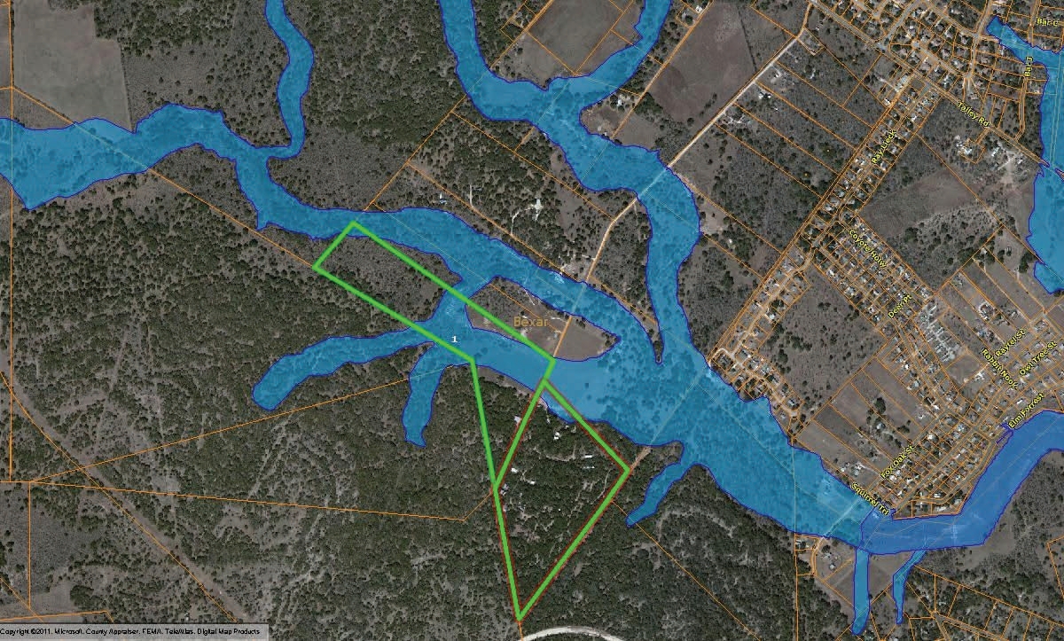
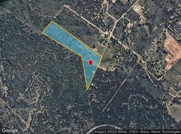
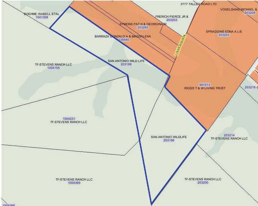
3511 Talley Rd, San Antonio, TX 78253
NEARBY LISTINGS FOR SALE OR LEASE
Property Detail
3511 Talley Rd
San Antonio-New Braunfels, TX
Conv A/S Code
04381-000-0023
CB 4381 PT OF P-2 ABS 887, CB 4382 PT OF P-2 ABS 1118 & CB 4401 PT OF P-17
Farms
Bexar
A
Texas
48325C0400D
23
2023
51 AC
2023
Far West
172006
San Antonio
DEMOGRAPHICS near 3511 Talley Rd
1 Mile
3 Mile
5 Mile
2024 Total Population
898
42,852
128,813
2029 Population
1,011
47,489
141,600
Pop Growth 2024-2029
+ 12.58%
+ 10.82%
+ 9.93%
Average Age
35
35
34
2024 Total Households
279
13,419
41,078
HH Growth 2024-2029
+ 12.90%
+ 11.06%
+ 10.07%
Median Household Inc
$115,760
$109,711
$108,447
Avg Household Size
3.20
3.20
3.10
2024 Avg HH Vehicles
3.00
2.00
2.00
Median Home Value
$343,103
$298,684
$289,220
Median Year Built
2010
2010
2010
Nearby Places
- Restaurants
- Banks
- Shops
- Fitness
- Groceries
PUBLIC TRANSPORTATION
AIRPORT
San Antonio International
DRIVE
WALK
Distance
San Antonio International
34 min
23.0 mi
Freight Ports
Port of Corpus Christi
DRIVE
WALK
Distance
Port of Corpus Christi
174 min
161.8 mi
Nearby Properties
Address
Land Use
TOTAL SIZE
Lot Size
Zoning
Address
Land Use
TOTAL SIZE
Lot Size
Zoning
238,098 SF
13.92 AC
Address
Land Use
TOTAL SIZE
Lot Size
Zoning
294,979 SF
18.70 AC
Address
Land Use
TOTAL SIZE
Lot Size
Zoning
497,319 SF
60 AC
Address
Land Use
TOTAL SIZE
Lot Size
Zoning
257,067 SF
13.25 AC
Address
Land Use
TOTAL SIZE
Lot Size
Zoning
100,706 SF
10.90 AC
Address
Land Use
TOTAL SIZE
Lot Size
Zoning
15,315 SF
586 AC
Address
Land Use
TOTAL SIZE
Lot Size
Zoning
654.58 AC
Address
Land Use
TOTAL SIZE
Lot Size
Zoning
71,170 SF
7.52 AC
Address
Land Use
TOTAL SIZE
Lot Size
Zoning
332,145 SF
17.03 AC
Address
Land Use
TOTAL SIZE
Lot Size
Zoning
242.77 AC
Address
Land Use
TOTAL SIZE
Lot Size
Zoning
136.12 AC
Address
Land Use
TOTAL SIZE
Lot Size
Zoning
99.80 AC
Address
Land Use
TOTAL SIZE
Lot Size
Zoning
442.05 AC
Address
Land Use
TOTAL SIZE
Lot Size
Zoning
231.51 AC
Address
Land Use
TOTAL SIZE
Lot Size
Zoning
100.09 AC
Address
Land Use
TOTAL SIZE
Lot Size
Zoning
98,827 SF
3.23 AC
Address
Land Use
TOTAL SIZE
Lot Size
Zoning
189.14 AC
Address
Land Use
TOTAL SIZE
Lot Size
Zoning
79,567 SF
17.86 AC
Address
Land Use
TOTAL SIZE
Lot Size
Zoning
33.96 AC
Address
Land Use
TOTAL SIZE
Lot Size
Zoning
94.43 AC
Address
Land Use
TOTAL SIZE
Lot Size
Zoning
16,486 SF
1.98 AC
Address
Land Use
TOTAL SIZE
Lot Size
Zoning
19,951 SF
2.48 AC
Address
Land Use
TOTAL SIZE
Lot Size
Zoning
3,839 SF
124.38 AC
Address
Land Use
TOTAL SIZE
Lot Size
Zoning
25,712 SF
5 AC
Address
Land Use
TOTAL SIZE
Lot Size
Zoning
38.28 AC
Address
Land Use
TOTAL SIZE
Lot Size
Zoning
48,570 SF
7.18 AC
Address
Land Use
TOTAL SIZE
Lot Size
Zoning
12,719 SF
1.62 AC
Address
Land Use
TOTAL SIZE
Lot Size
Zoning
11,560 SF
1.38 AC
Address
Land Use
TOTAL SIZE
Lot Size
Zoning
259.11 AC
Address
Land Use
TOTAL SIZE
Lot Size
Zoning
22,424 SF
3.66 AC
The World's #1 Commercial Real Estate Marketplace
Connect with us
© 2025 CoStar Group
The information above has been obtained from sources believed reliable. While we do not doubt its accuracy we have not verified it and make no guarantee, warranty or representation about it. It is your responsibility to independently confirm its accuracy and completeness. Any projections, opinions, assumptions, or estimates used are for example only and do not represent the current or future performance of the property. The value of this transaction to you depends on tax and other factors which should be evaluated by your tax, financial, and legal advisors. You and your advisors should conduct a careful, independent investigation of the property to determine to your satisfaction the suitability of the property for your needs.